Wedge Mountain (Half NE Arete)
Date: April 3-4, 2026
Distance: 24km
Elevation gain: 2160m
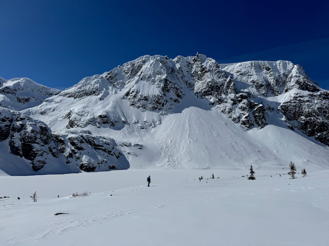
Wedge Mountain, the highest mountain in Garibaldi Provincial Park, dominates its corner of British Columbia. It is almost three kilometres tall and rises over two kilometres above the Sea-to-Sky Highway. From Wedgemount Lake, most parties will take the Northeast Arete route, a classic mountaineering line (AD-) involving glacier travel and a 45-degree snow climb with some exposure below the summit, or the half arete variation, in which the ridge is gained halfway up. We took the latter approach.
Paul and I were looking for a suitable mountaineering objective before my exams started. There was a perfect weather window over the Easter long weekend, placing Wedge Mountain on the table. It was the obvious choice. To shorten the climb on the summit day, we planned to hike up to the lake on Friday evening, camp at the campground, and get an alpine start.
I spent Friday morning scrambling to finish an assignment, met Paul in West Vancouver around 3pm, then drove north. The road to the Wedgemount Lake trailhead is unpaved and had one rutted section that was tricky but manageable in the Kona. We arrived at the parking lot to see that an Evo had somehow made it through…
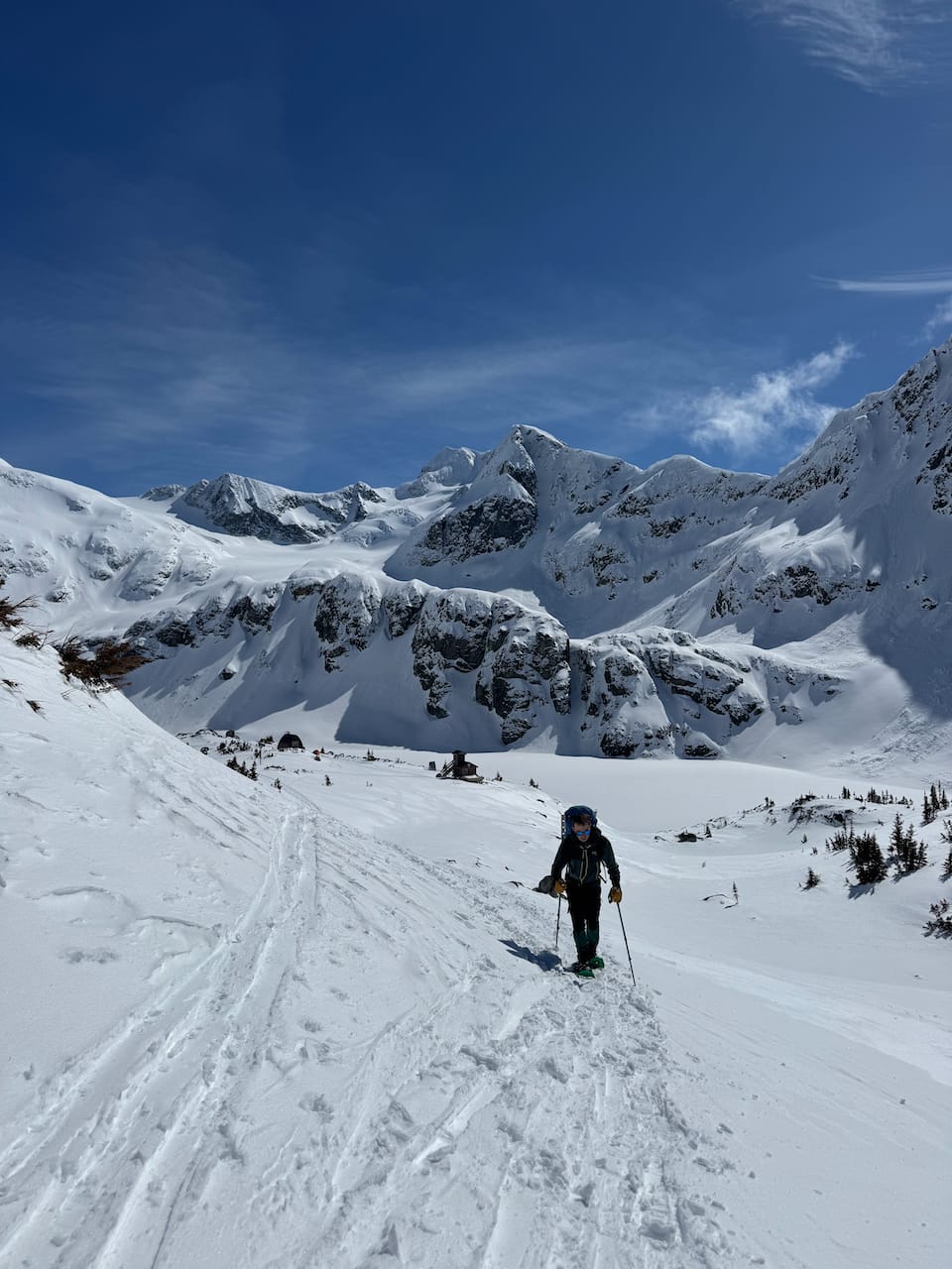
The Wedgemount Lake trail was icy in sections, but the grind went by quickly. As we gained elevation, the snow became deeper, and we followed a set of snowshoe tracks. Whoever set the tracks had bailed and found another route, but we were so close to the campground, we decided to continue up and over a small ridge.
We arrived at the campground just past sunset to find another SWBC Peakbaggers group and some familiar faces from the VOC already in the hut. We had a pleasant dinner, then an early night.
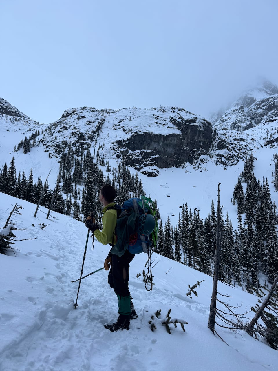
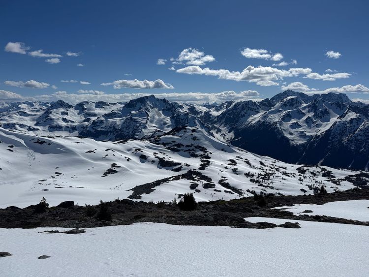
In the morning, some faffing took place, but we were off by 3:45am or so. We walked across the frozen Wedgemount Lake and continued onto the Wedgemount Glacier. We quickly passed the peakbagger group and started breaking trail. There was about 30 centimetres of powder, making trail-breaking a tedious task. Our target was a steep slope to our southeast, on the other side of the glacier, marking the access point to the arete.
The fog created a pitch-dark void. Visibility was zero and our headlamp beams did not travel far. We were relying on my GPS for navigation. The glacier began as a gentle slope, but then the route began to climb and the snowdrifts deepened. We soon found ourselves at the base of the icefall.
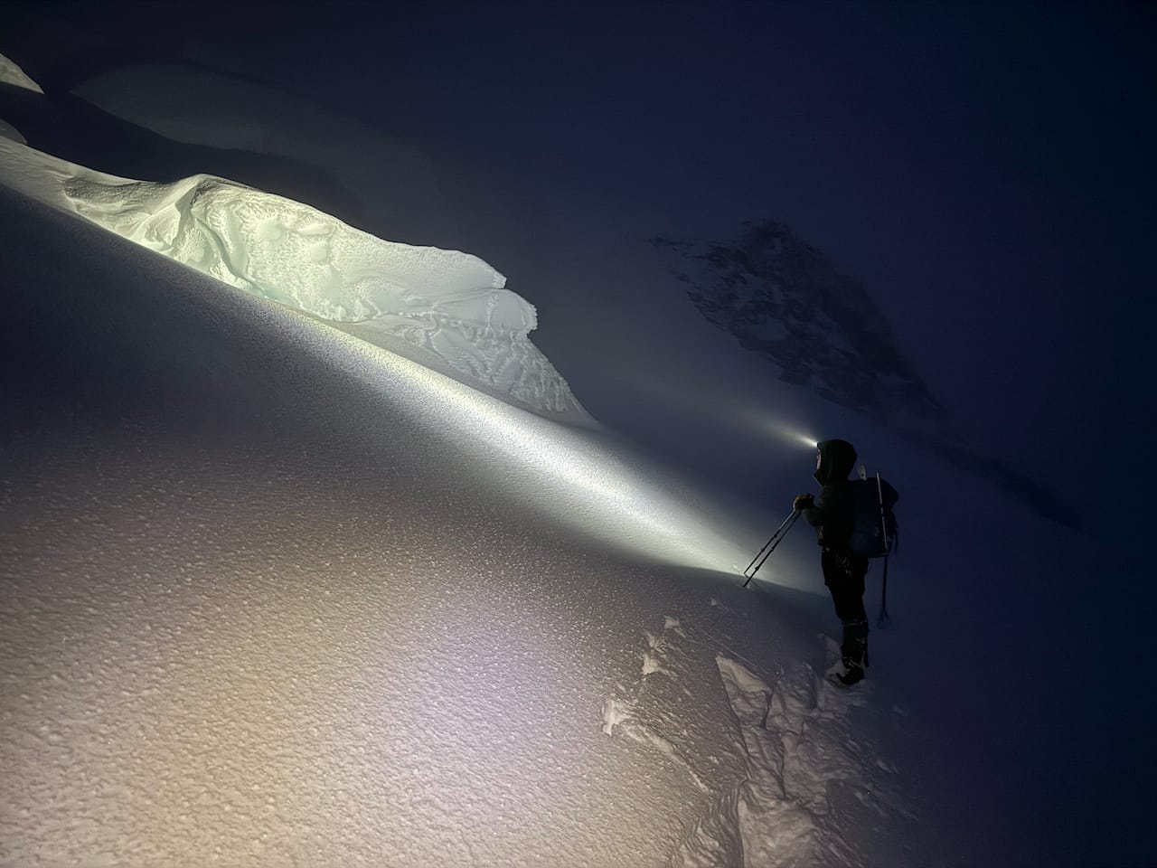
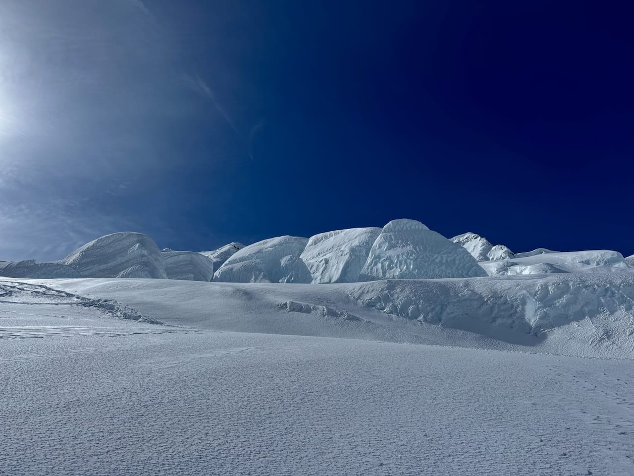
Our next task: finding a route through the massive, slightly unstable blocks of ice while avoiding sheer cliffs to climber’s right. This took some time. We tried a few routes that seemed feasible, but ice cliffs or massive open crevasses would always block our path. At one point we reached the top of a small rise, only to see a yawning crevasse ahead of us, forcing us to backtrack through the ice valleys.
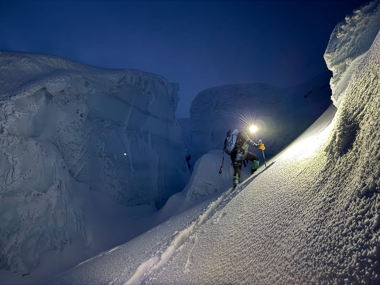
Eventually we found a route. Crampons came on for a short six-foot icy slope, but then we were above the icefall.
The sun was rising and some light shone through the fog. Another long plod followed. At times, the massive bulk of Wedge’s summit emerged from the mist, still so far above us.
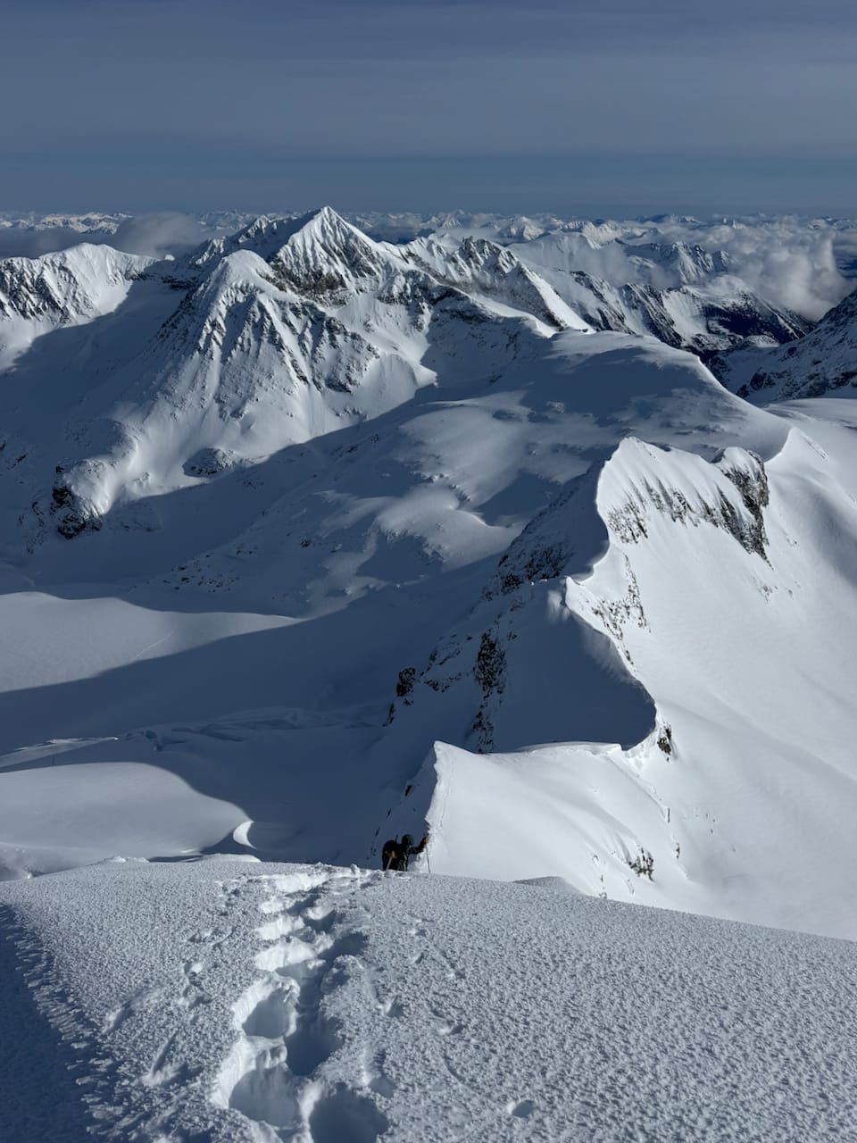
To reach the arete, we climbed one more slope. Far below us, the other VOC group was still navigating the icefall, following our initial tracks away from the correct route. Eventually they corrected their course.
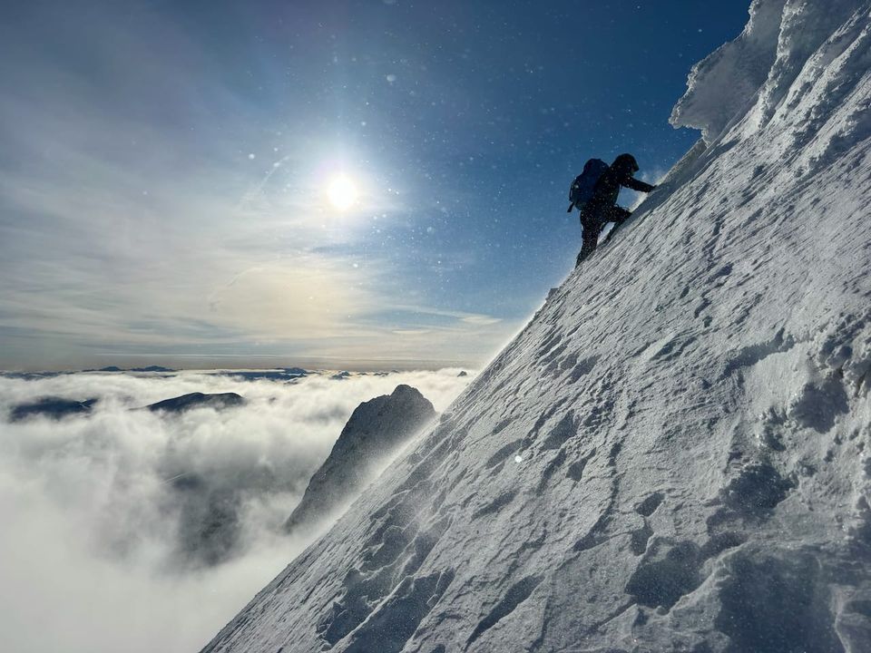
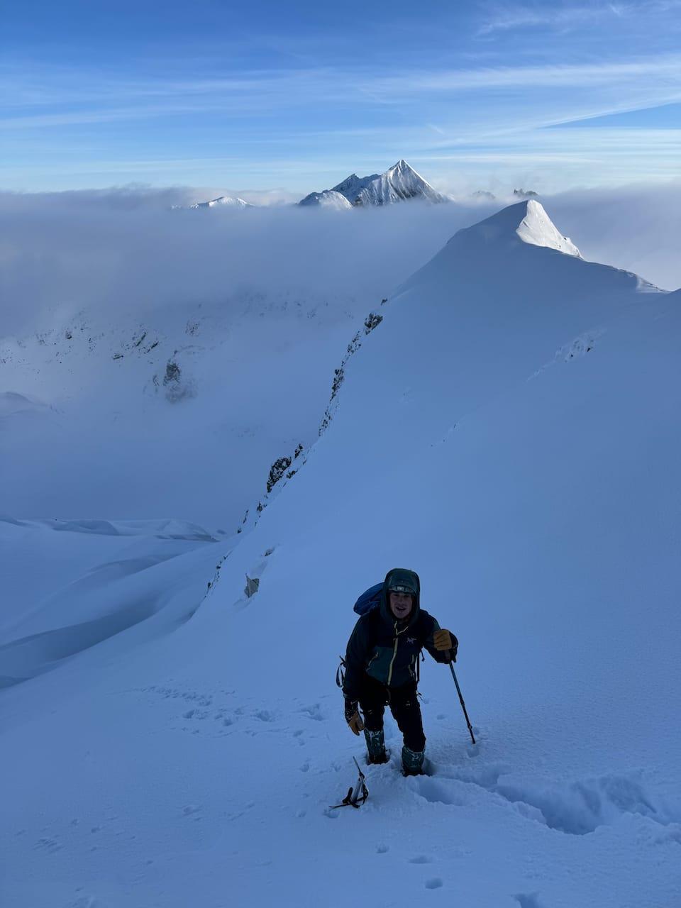
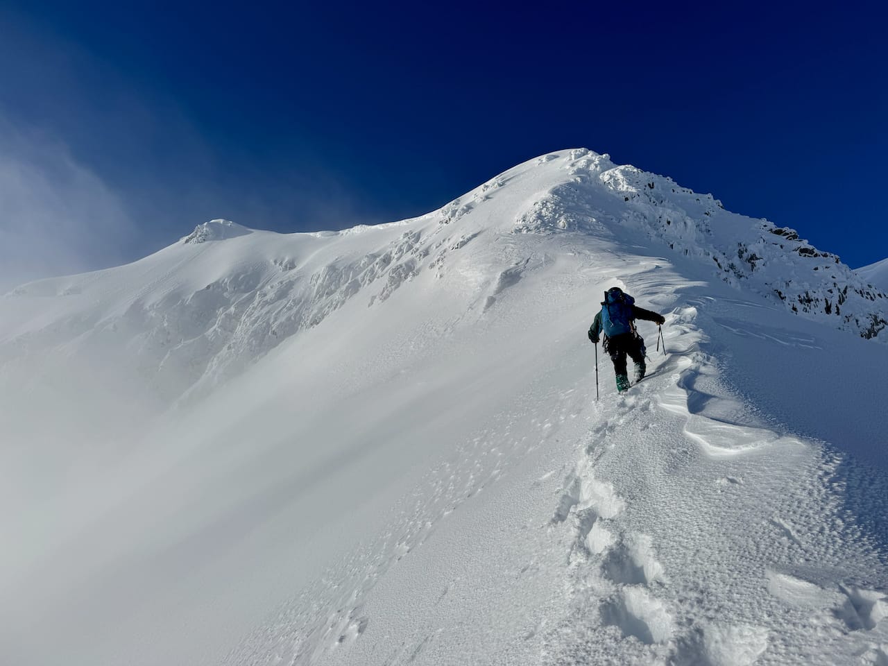
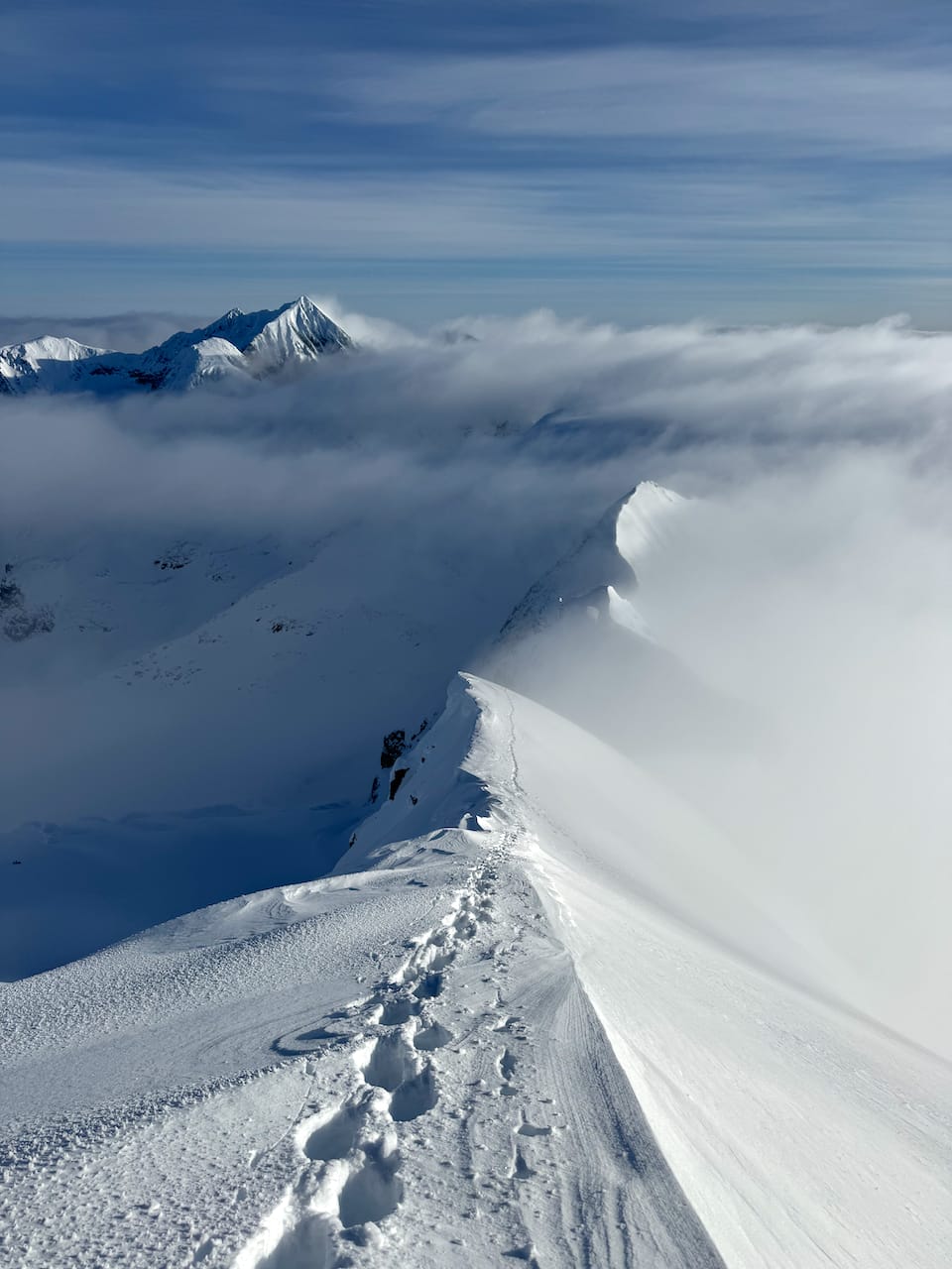
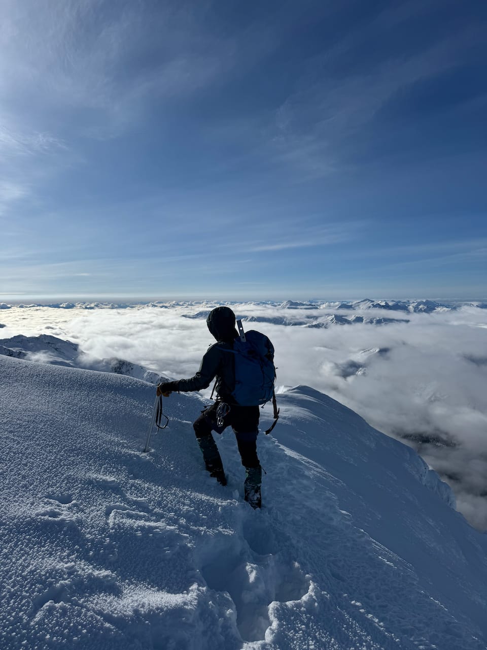
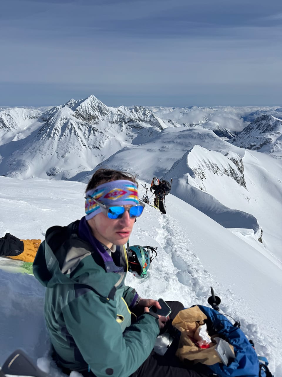
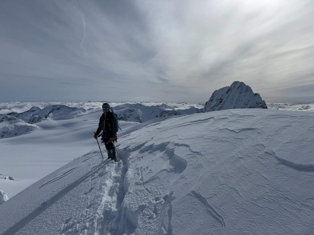
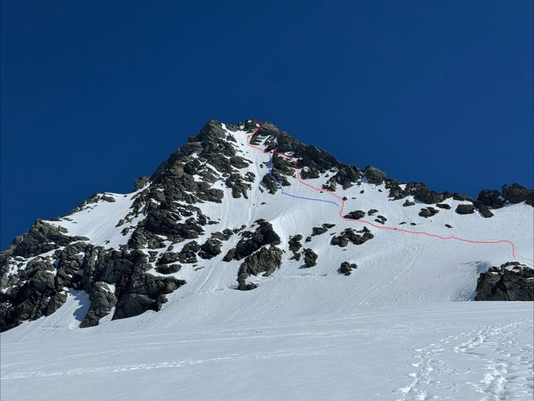
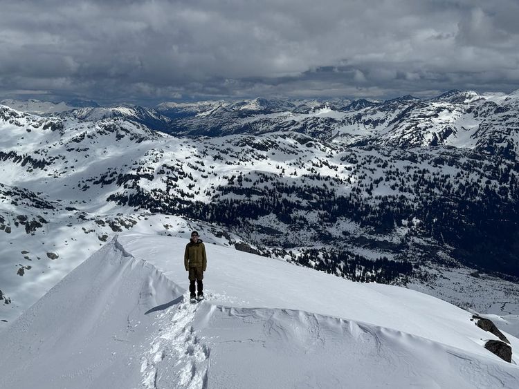
We set foot on the arete around 7:30am. This was a spectacular, razor-thin ridge with some steep and exposed sections, and cornices hanging over the eastern face. The weather was sunnier than forecasted, so the snow would soften more rapidly than expected, creating unstable conditions. On Joffre Peak almost exactly a year earlier, my group had taken too long to summit and narrowly avoided a cornice collapse. This memory was on the back of my mind as Paul and I navigated around the cornices. We’d hoped to arrive and leave very early, and we were still on schedule.
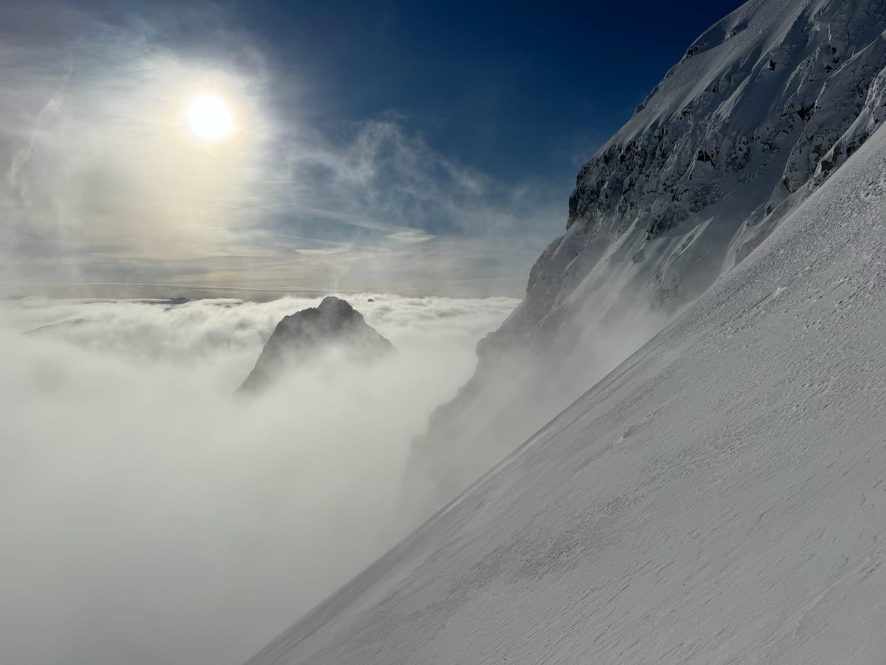
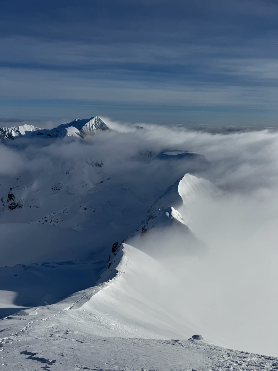
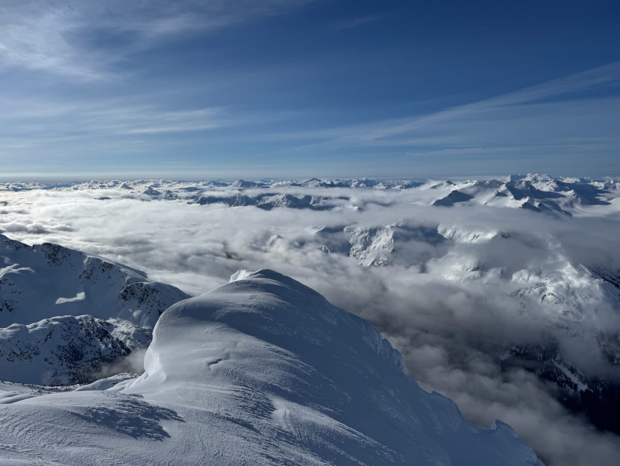
Mount Weart and Lesser Wedge were now visible. Most of the clouds remained, especially on the eastern side of the arete, masking the exposure on that face. A fall would send you into the void.
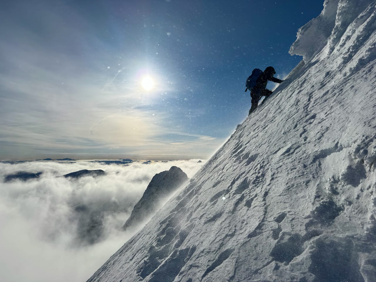
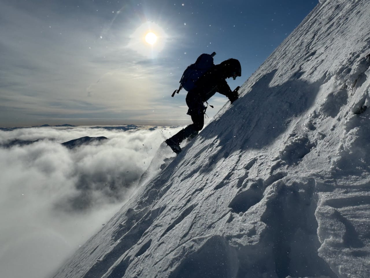
Things got steeper and steeper. Eventually a short traverse took us to the base of the crux of the trip, a sustained 45-degree slope.
We slowly but surely made our way up all 200 vertical metres of the slope, kicking steps into solid snow. As we rose above the ridge, the wind picked up, driving whirlwinds of snow off the peak. The clouds began to clear.
At the top of the steep section, I had to take a break to put some more layers on, a difficult task in these blustery conditions.
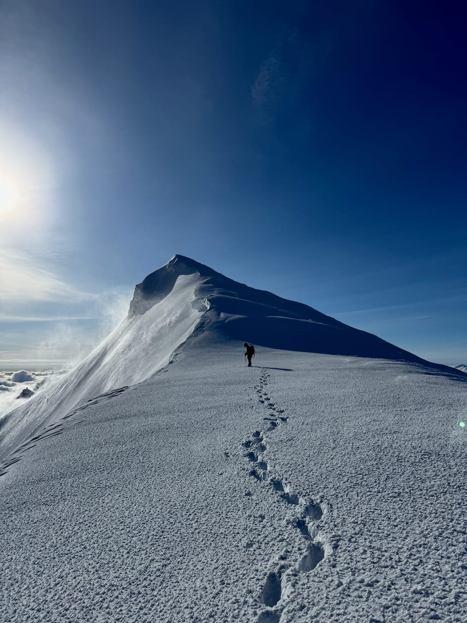
Once on the ridge, the wind kept me awake as Paul and I took the last few steps to the summit. Victory was ours on Wedge Mountain!
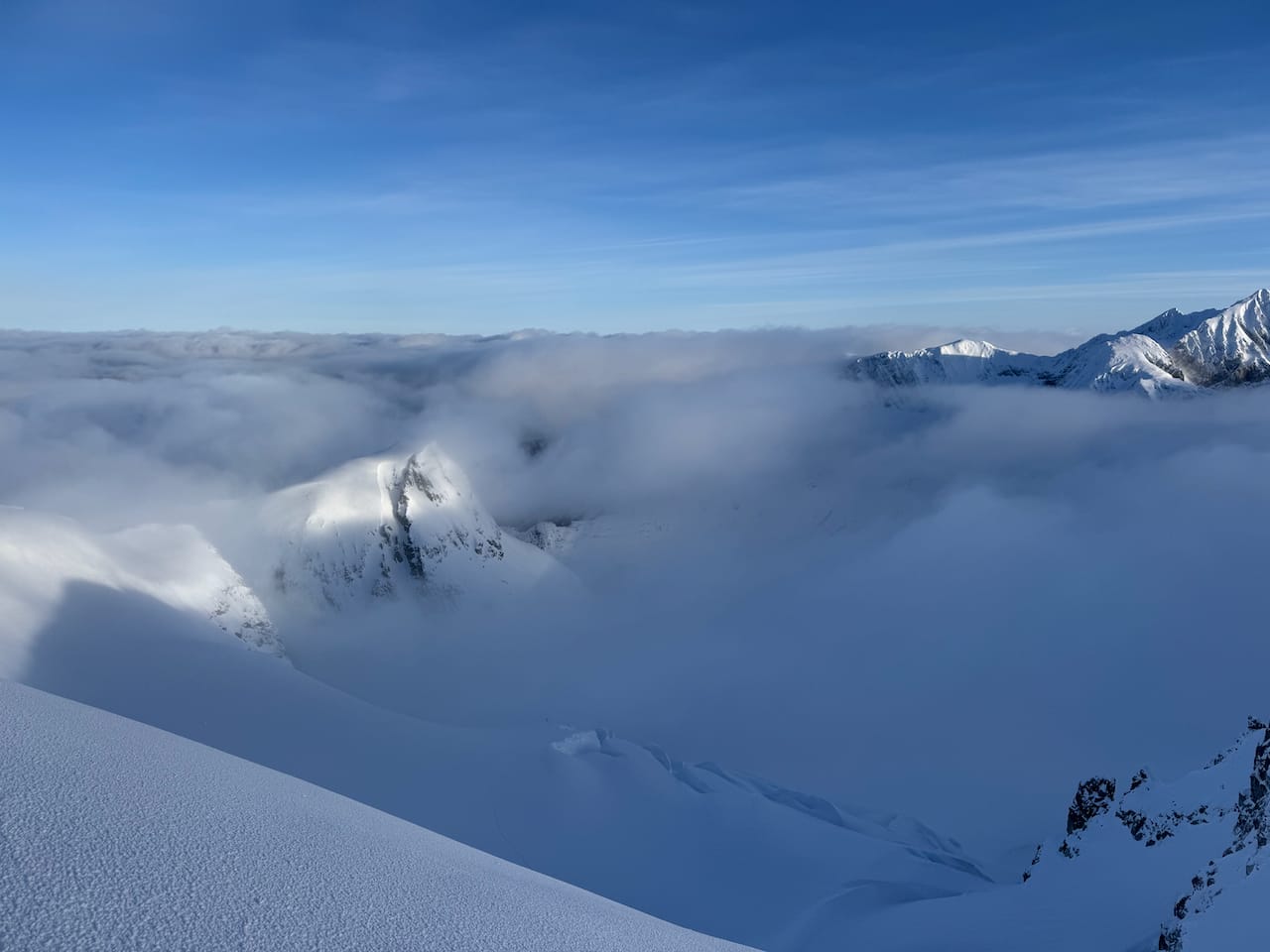
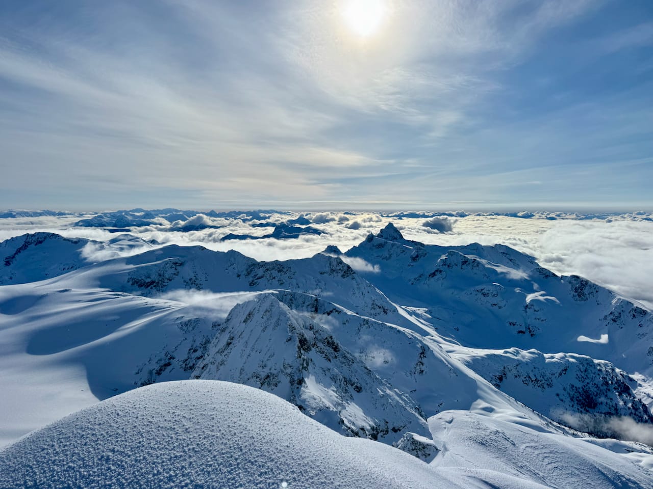
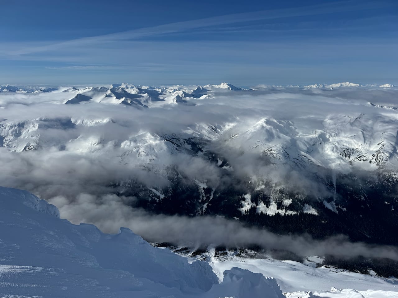
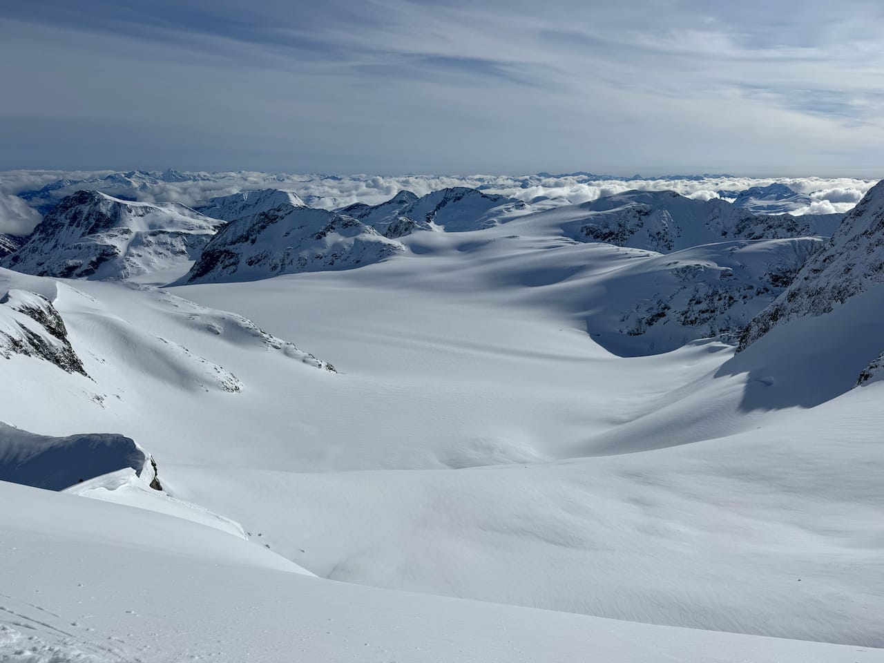
It was the most sublime view I have ever seen. Mountains emerged from the mist as the clouds faded; some which I have visited, bringing back memories of previous adventures, and many, many more that I have yet to climb. Our perch was higher than almost everything in sight. Windows opened in the lower clouds, giving us glimpses to faraway valleys. Somewhere out there was Vancouver. Closer to the peak, fog left Wedge Creek, almost two kilometres below us. The scale of the terrain was hard to comprehend. There was a cliff below the arete, I realized, and a fall would have been quite severe. Below and beyond it was the vastness of the Weart Glacier. Maybe it was the exhaustion, the biting cold, or the lack of sleep, but there was an almost spiritual quality to the experience. I kept thinking how damn lucky I was to be here!
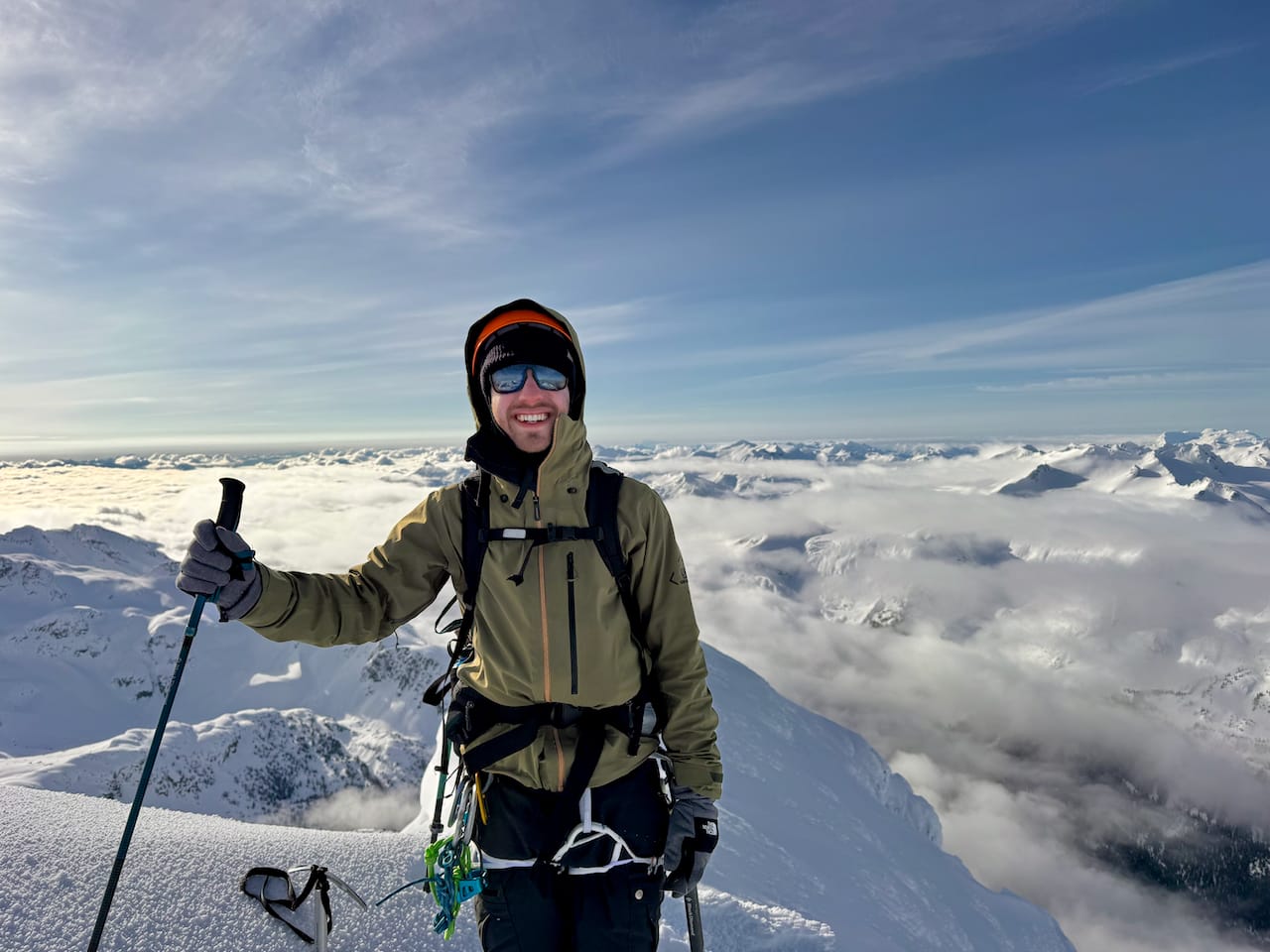
With the frigid conditions on the summit, we did not linger. After about ten minutes on the summit, it was time to leave.
The downclimb was long and tedious. As we gripped our ice axes for stability, the cold pierced through our gloves. Once we were back on the traverse, blood rushed back to our hands and feeling returned painfully. It got so bad that Paul started swearing in French. Somehow the massive cliffs, avalanche hazards, and giant icy blocks of doom were not the scariest thing on this mountain...
Just before 10am the SWBC group passed us, then the other VOC group trudged along. Everyone eventually reached the summit.
Once our hands thawed out, we began the long plod along the arete, through the icefall, down the valley, and back to the hut. Along the way we passed Steven Song and Mel who were going for Mount James Turner. Small world.
The temperature was quite warm by now, and we saw or heard small avalanches every few minutes. There was an especially large one on Rethel Mountain, across the lake, that shook the ground.
At the hut we enjoyed a very, very comfortable nap. The alarm clock was painful, but it was time to leave.
In the distance we saw the first group descending the glacier. For a while, there was no sign of the other VOC team. With the warm conditions and avalanche risk, we were quite concerned, especially when we heard helicopters in the distance! Eventually, as we were leaving, we saw the group reach the icefield. Two SAR helicopters flew over the trail, but it turned out that they were there for other reasons.
The descent was annoying. Snow stuck to my snowshoes, so I had to remove them, but this made the icy sections quite slippery.
Eventually we reached the car. I stopped at the first grocery store in Whistler, bought a carton of lemonade, and drank as much as I could in the parking lot, which revitalized me for the rest of the drive. We took another break in Squamish to eat samosas, then made our way back to Vancouver. On the drive, the weather was perfect and the snow-covered peaks across Howe Sound were stunning. I took a quick glance at the ocean: it already felt surreal that I’d started the day three thousand metres above it.
What a day!
Member discussion