Canoes, Cliffs, and Chaos: An Indian Arm Adventure (Peak 1388)("McPherson Peak")
Date: October 4-6, 2025
Distance: About 33km by canoe + 17.46km on foot
Elevation gain: 1733m
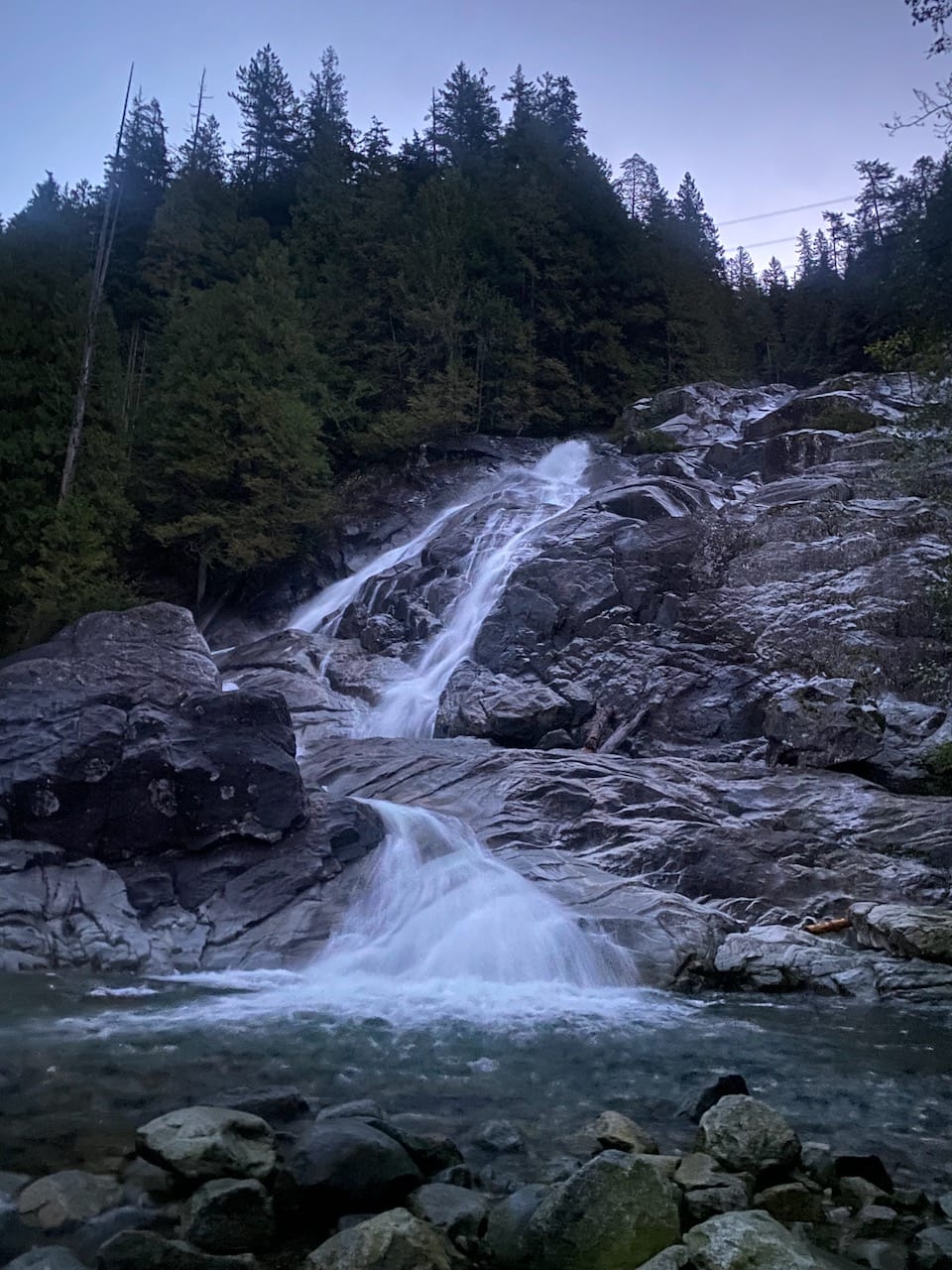
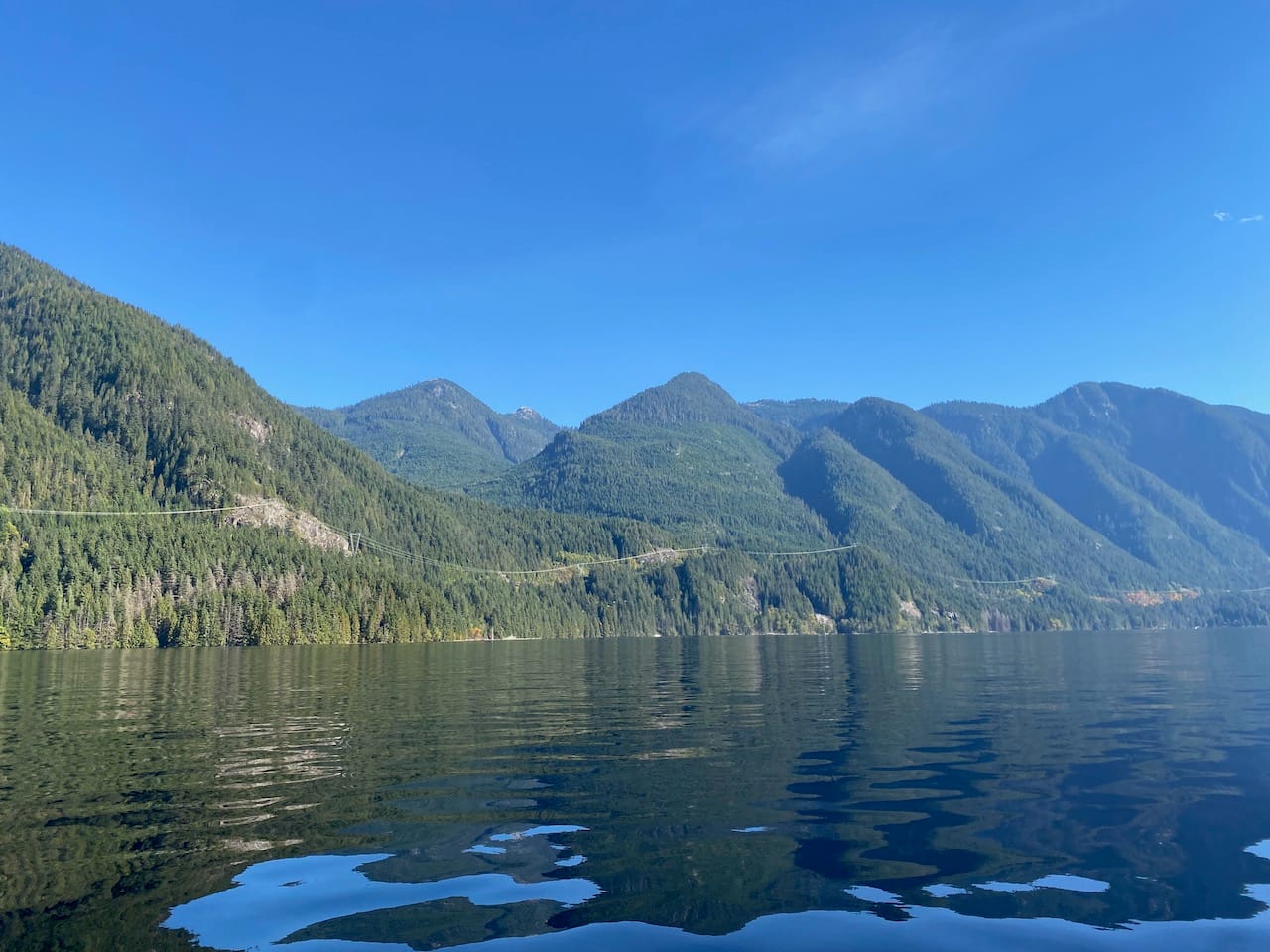
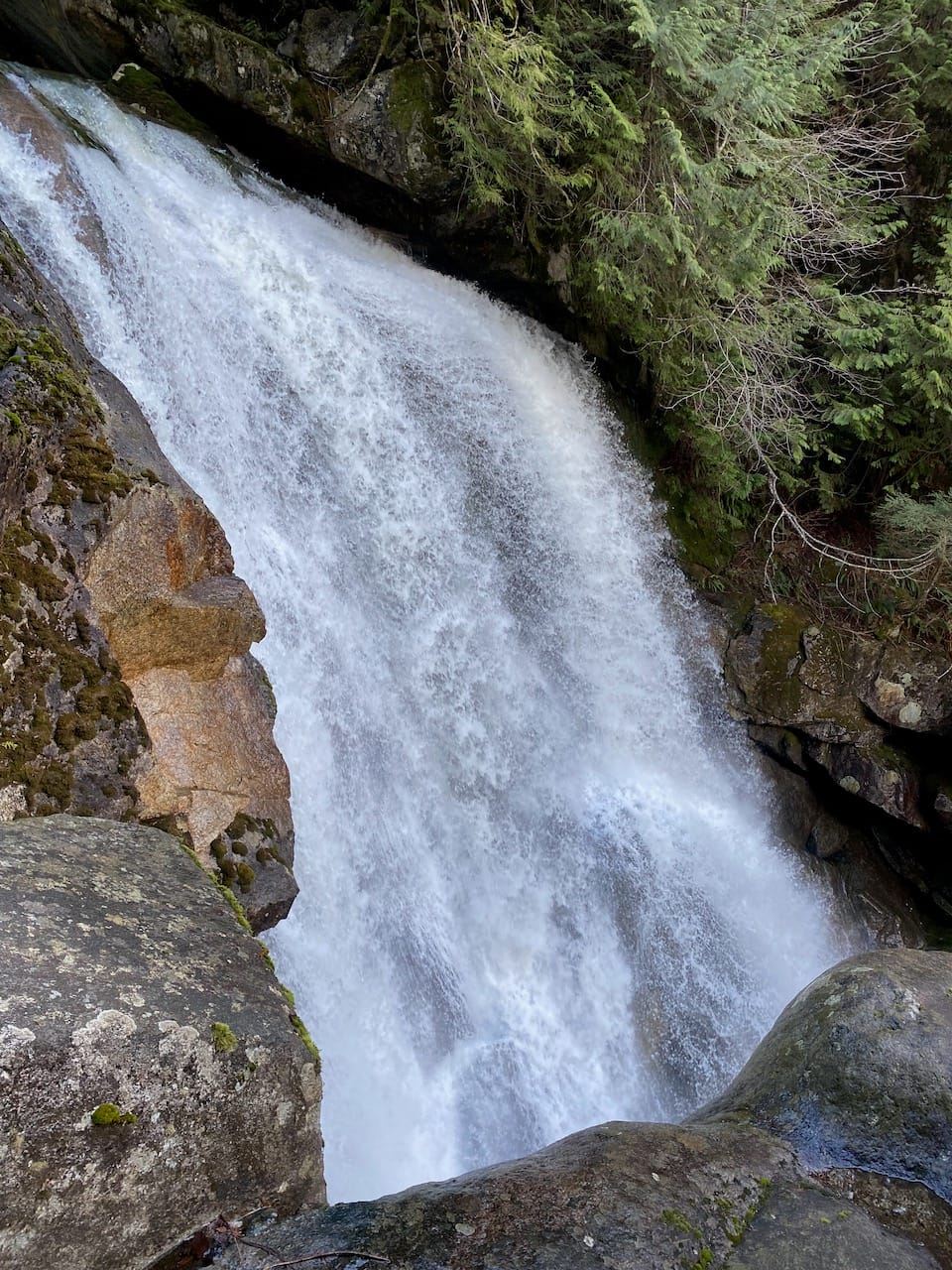
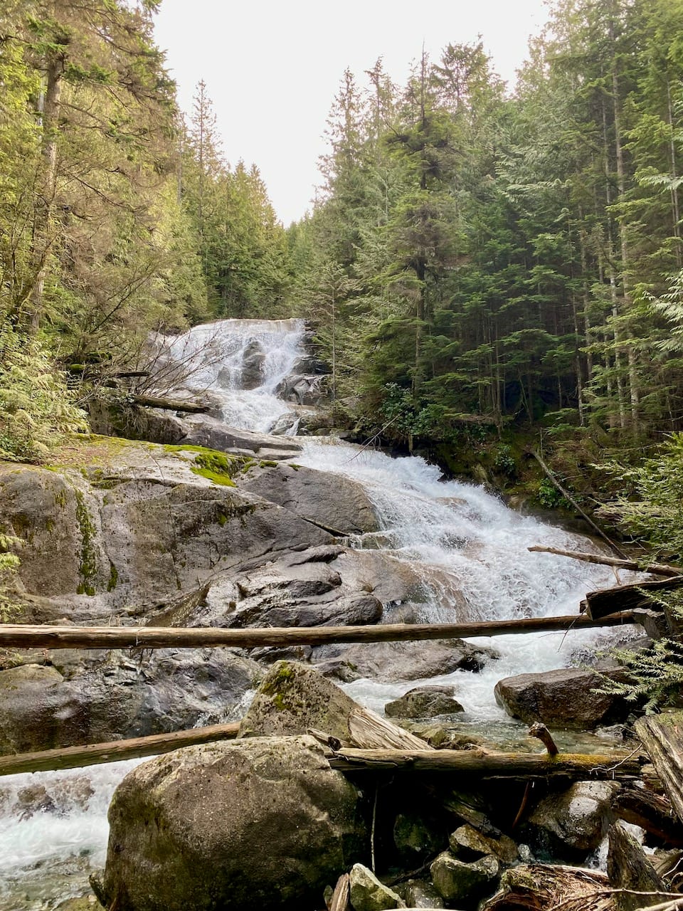
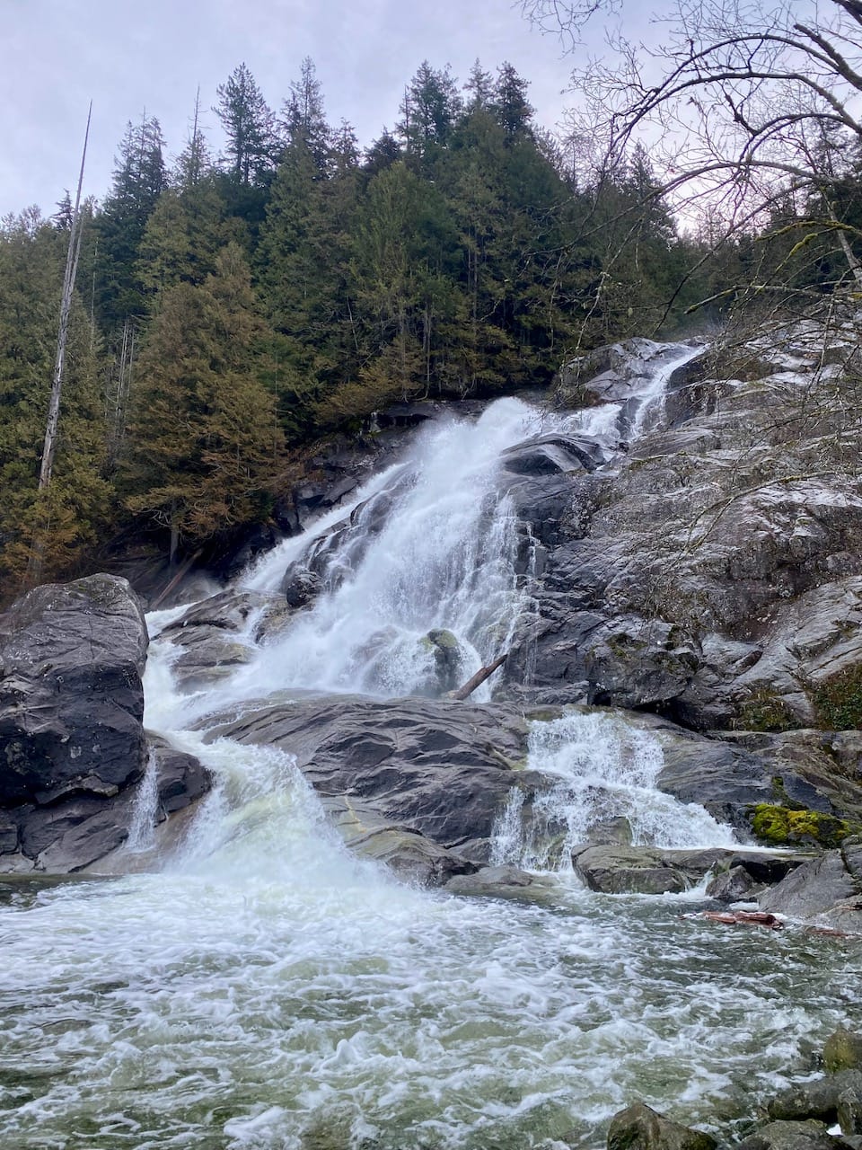
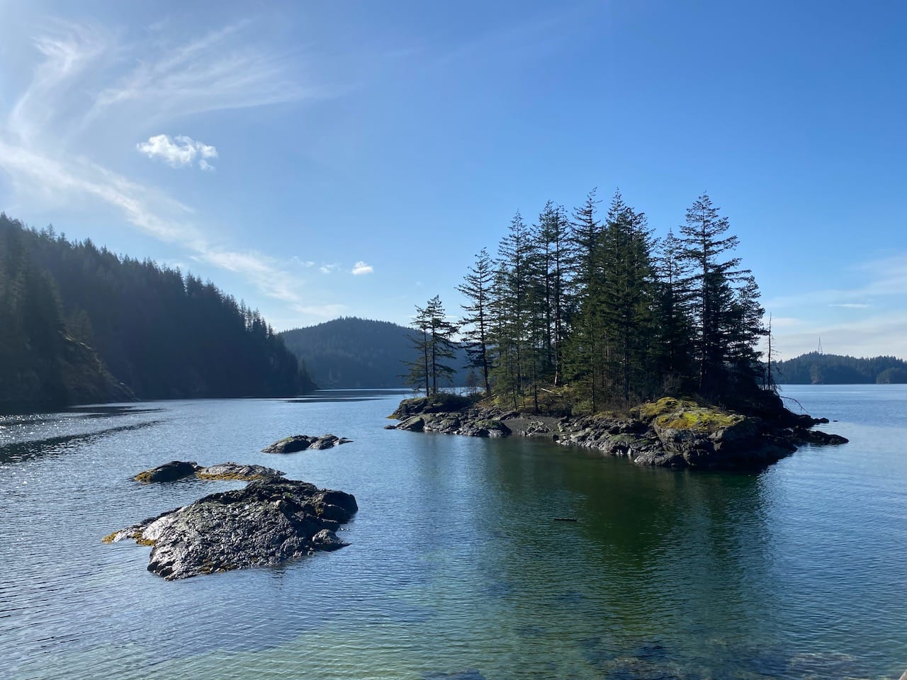
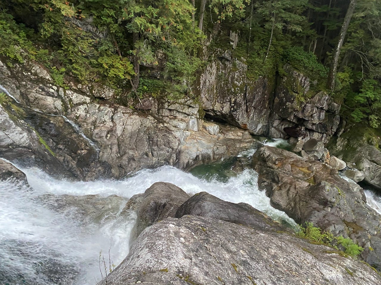
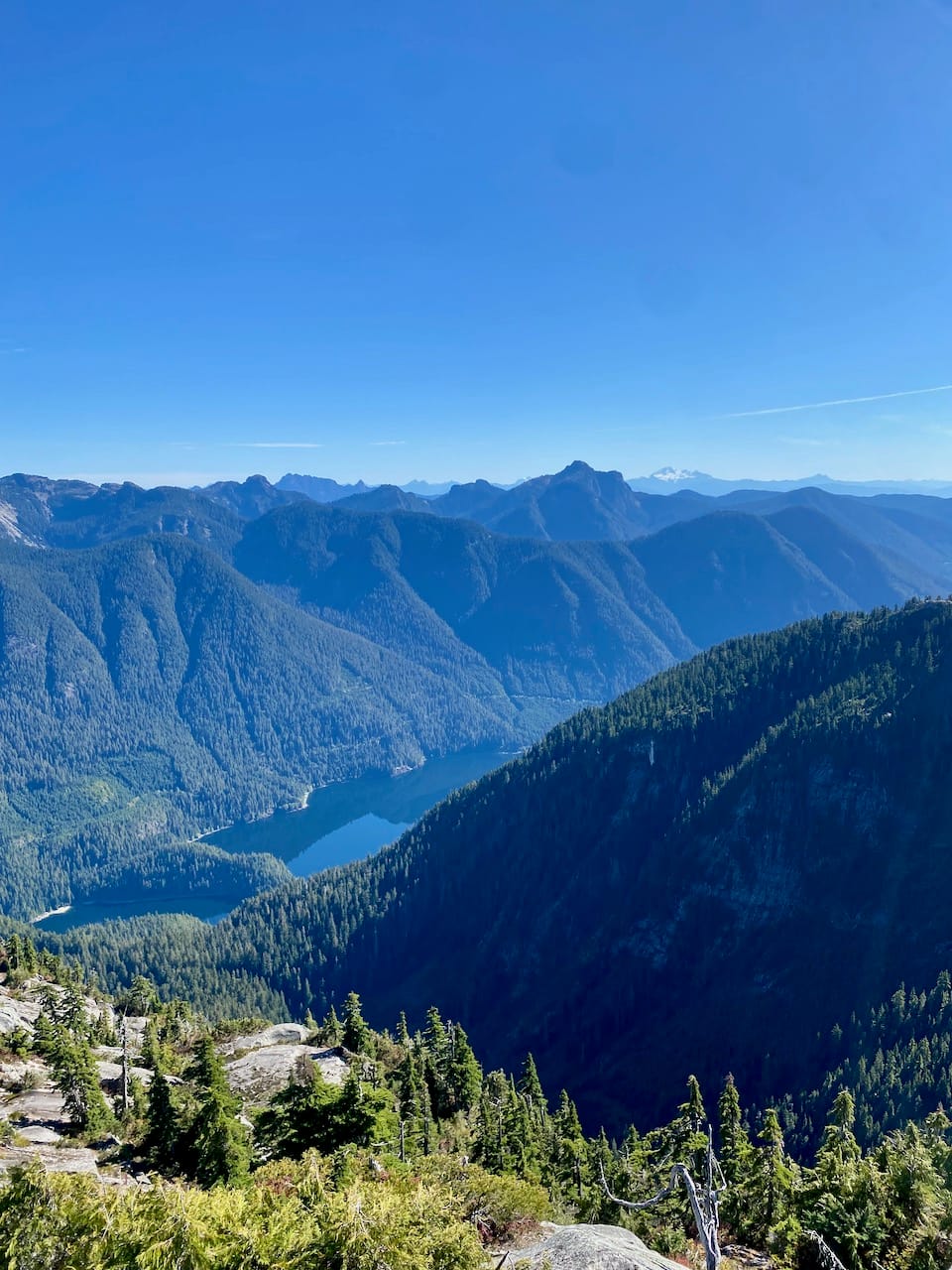
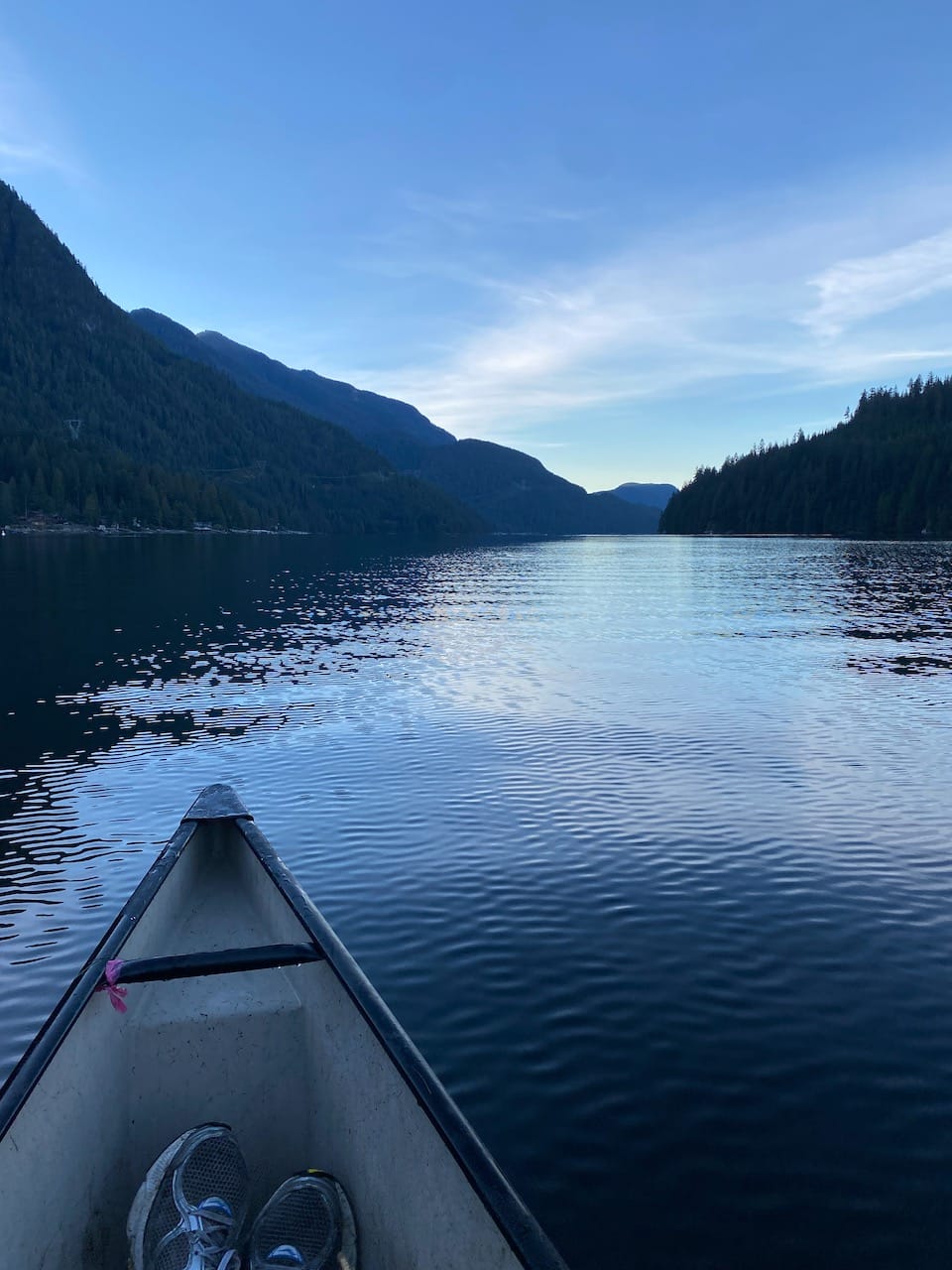
Every other year, my family and I canoe to the end of Say Nuth Khaw Yum/Indian Arm to see the salmon run. With its steep walls rising over a thousand metres, the scenery in this fjord rivals that of Norway or New Zealand, despite being an extension of Vancouver’s harbour. One highlight is Granite Falls, a cascade of water formed by Grand Creek as it tumbles over a cliff. Above the falls, the creek disappears from view. I wondered: What lies above the falls?
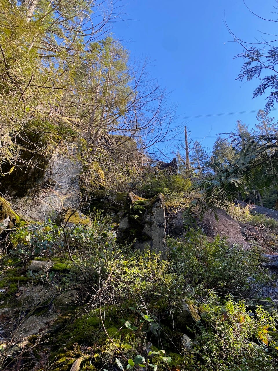
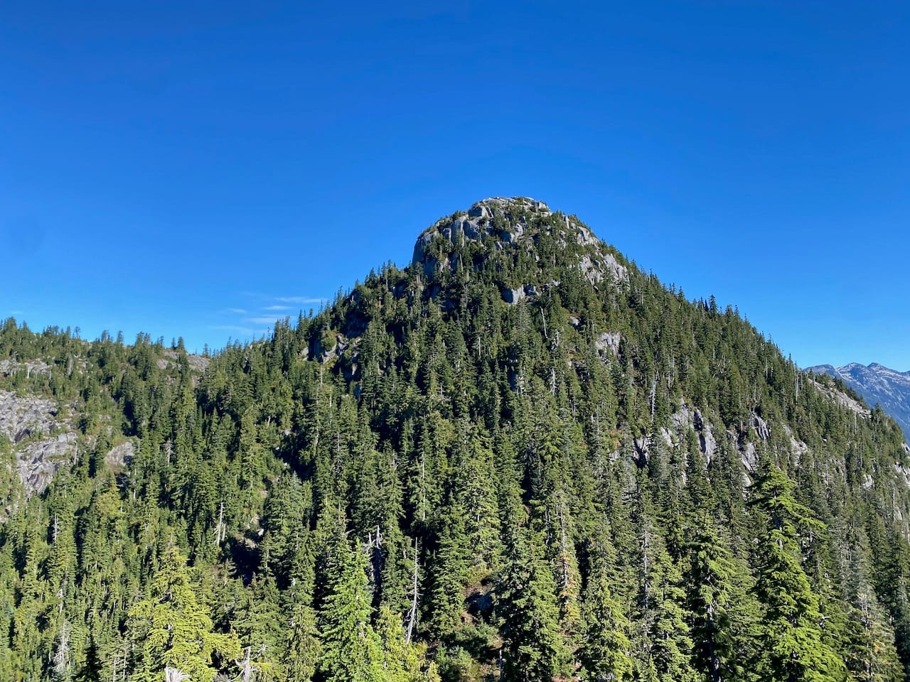
As you approach the head of the fjord, a hidden granite dome can briefly be glimpsed, towering above the Grand Creek valley. It marks the highest point of Eagle Ridge, which continues south to Coquitlam. While the Fannin Range on the other side of the fjord is well-documented, this peak remains very obscure. It has no official name. Despite its prominence and proximity to Vancouver, there’s remarkably little information out there, which piqued my interest.
I spent some time studying maps and pieced together a possible route to the summit. From Granite Falls, I could hopefully scramble up a cliff to reach the Indian Arm Trail, which circumnavigates the Arm. Built in the early 2000s by legendary trailbuilder Don McPherson (who also built the Grouse Grind), it was never made official, and today it’s rarely traveled and very overgrown. The route follows the western side of Grand Creek, crosses it, then climbs hundreds of metres up Grand Ridge. Trip reports mentioned bushwhacking, logging roads long reclaimed by the forest, and knife-edge ridgelines with steep drops into the valley. Once on Eagle Ridge, I could leave the IAT, follow the ridge north, traverse over one small bump, then reach the summit.
I found one IAT trip report which mentioned this section of the ridge, but none describing an ascent of the peak itself (of course, the peak has surely seen many ascents by the Tsleil-Waututh/loggers/prospectors/Don McPherson over the years, and had definitely been climbed at least once). On topographic maps and satellite images, the ridge looked straightforward enough; hopefully it wouldn't be too difficult. Right?
Note: Bivouac.com assigns this peak the name “Grand Peak”, but by their own standards, this is not a good name, since there is already a “Grand Ridge” next to the mountain. If it needs a name, I’d suggest “McPherson Peak”, after Don McPherson.
Attempt 1: May 2024
My first plan was to reach the peak from the Stawamus-Indian FSR, which had been recently improved in preparation for a major pipeline project. I arrived at the turnoff to find that the road had closed, literally the week before I arrived in Vancouver, so I hiked to Wesel and Clarion Peaks instead. The road will remain off-limits for the next few years. I would have to access the peak by water.
A few months later, I made plans to canoe to Granite Falls with my sisters and hike from there, but that trip fell through at the last minute.
Attempt 3: March 1-2, 2025
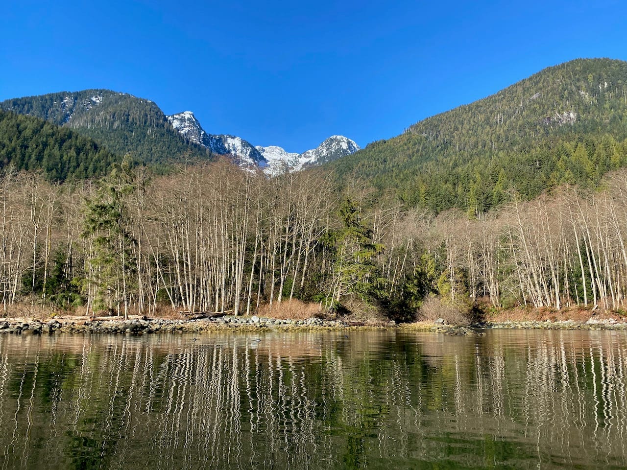
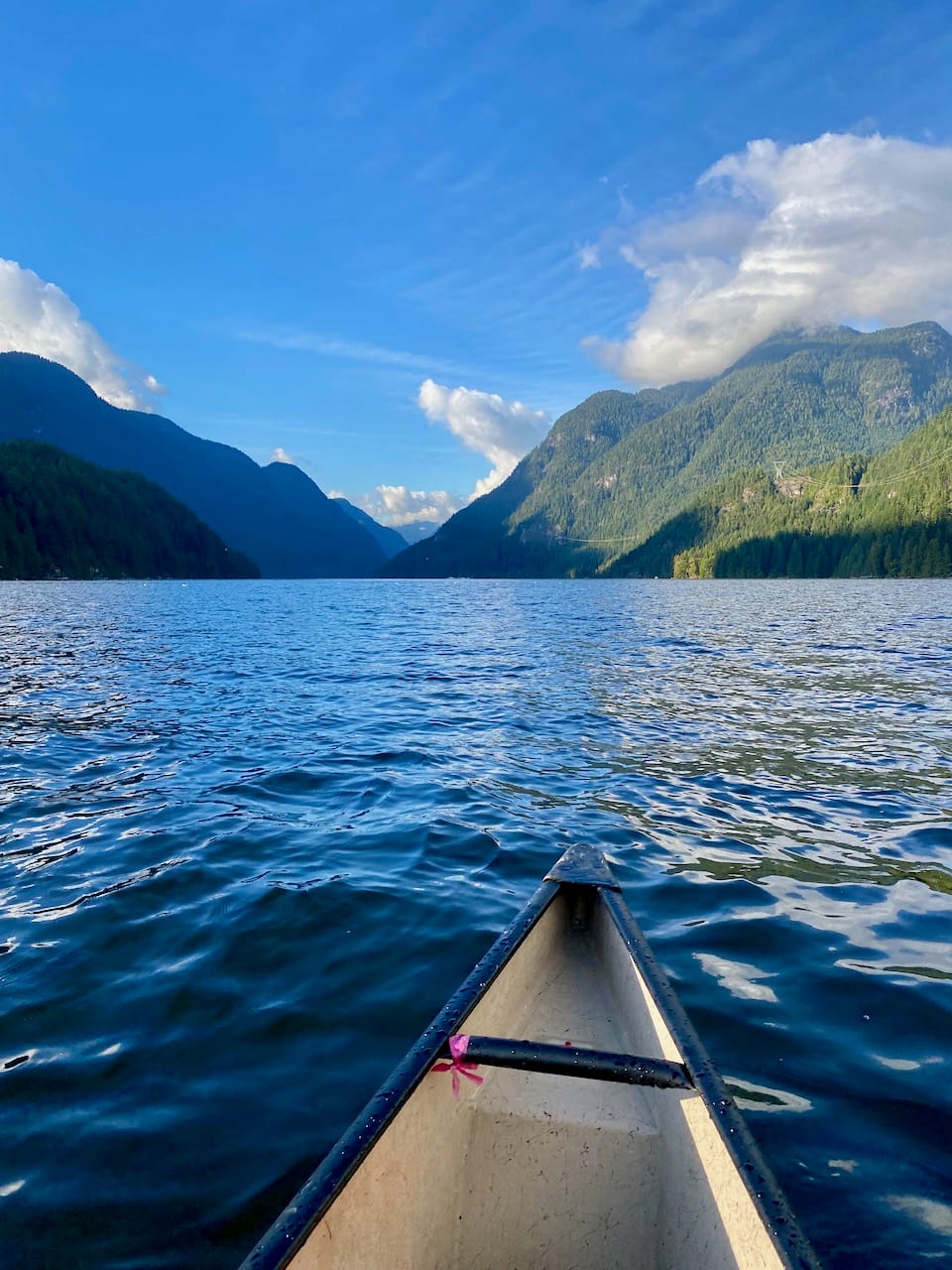
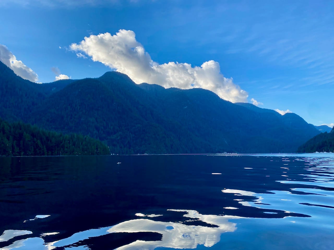
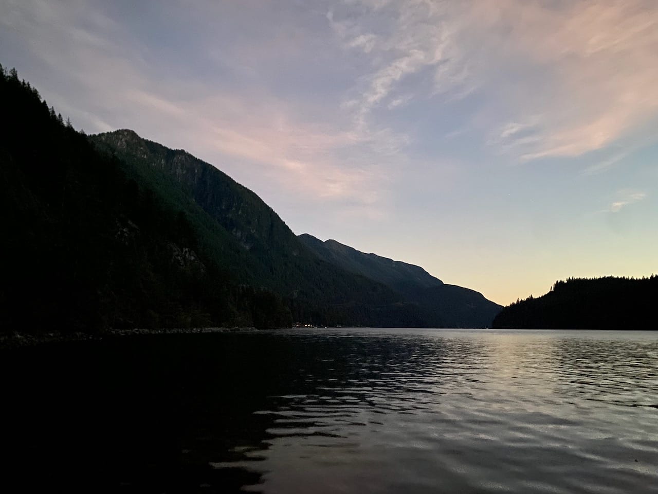
Paul and I left Deep Cove at sunrise and canoed north to Granite Falls. I’d been to Indian Arm many times, but never in spring. It was even more peaceful than in the fall, with snow blanketing the mountains and almost no other marine traffic. After a short stop at Berg’s Landing, we reached Granite Falls.
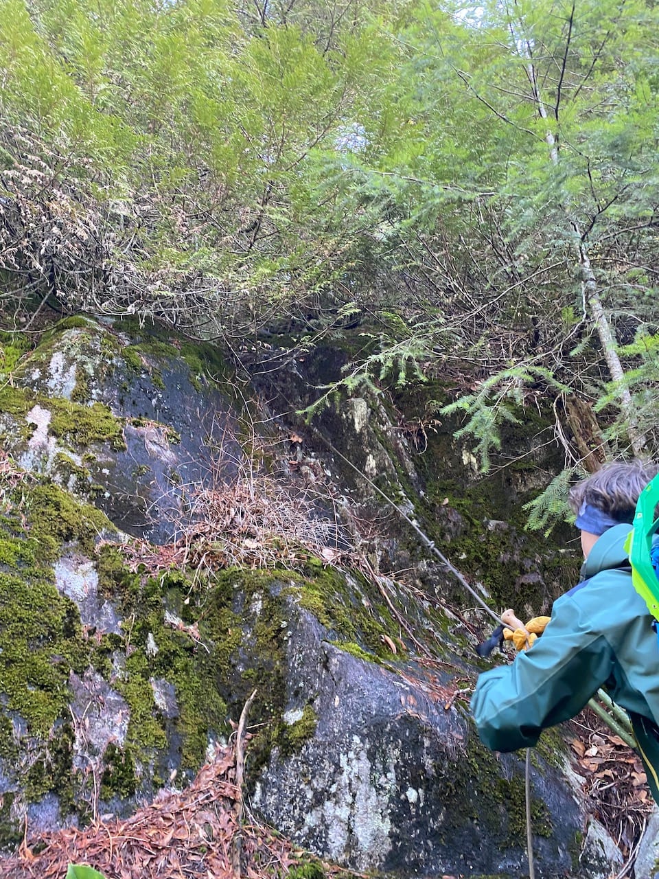
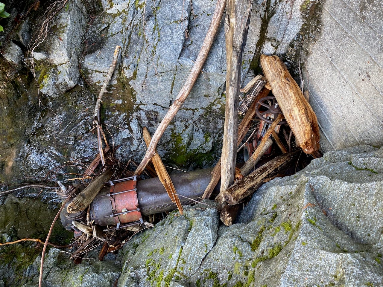
Our first task was to climb above the waterfall. From the 1880s to early 1960s, Granite Falls was the site of a quarry (see Ralph Drew’s website for a detailed history). The excavations made the natural topography even steeper, creating cliffs requiring some scrambling. I’d seen references to a “faint trail” on the north side of the falls, and we did find one, but it headed north and dead-ended at a flat area marked with rocks where structures had once stood. We bushwhacked closer to the falls and found another faint trail heading up the bluffs. There was one very slippery section with a fixed rope of uncertain quality. (There’s another trail a bit closer to the falls, with another sketchy slippery section and fixed rope. Be very careful on either trail).
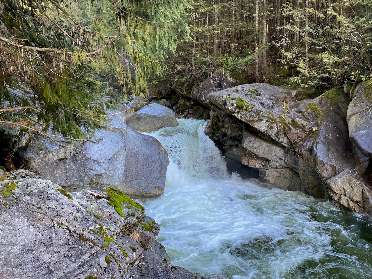
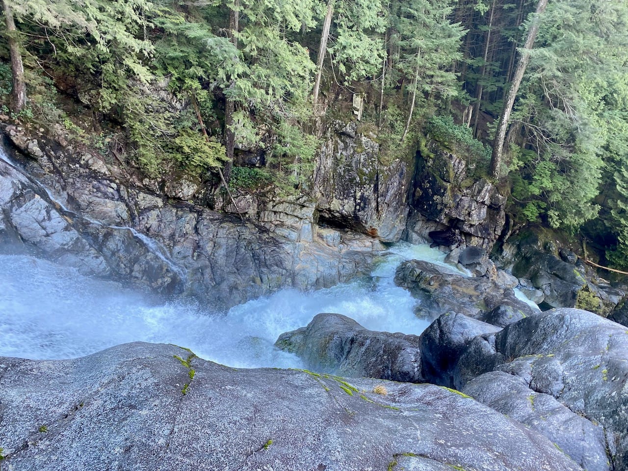
We hiked/scrambled upward, partly though the forest and partly over bare granite beside the creek. Granite Falls is just the final drop in a long series of beautiful cascades and pools carved into the granite by the water. The falls were the site of a resort in the 1960s, and some artifacts from that time remain. Eventually we reached the Indian Arm Trail, which initially follows a logging road.
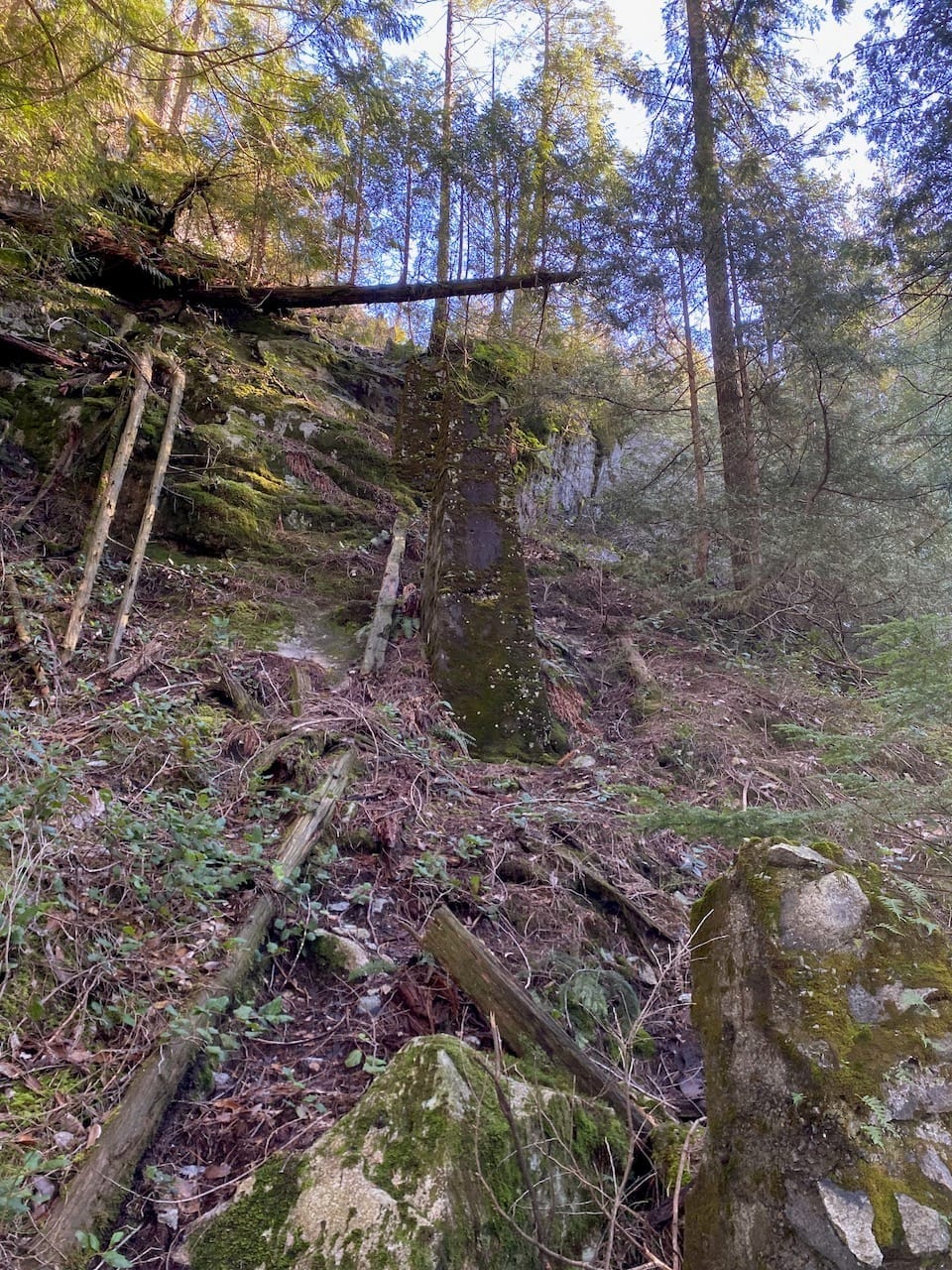
More forest navigation followed, interspersed with sections on an old FSR with some unexpected orange flagging. The bridge where the IAT crossed Grand Creek vanished years ago, but the crossing was knee deep at most.
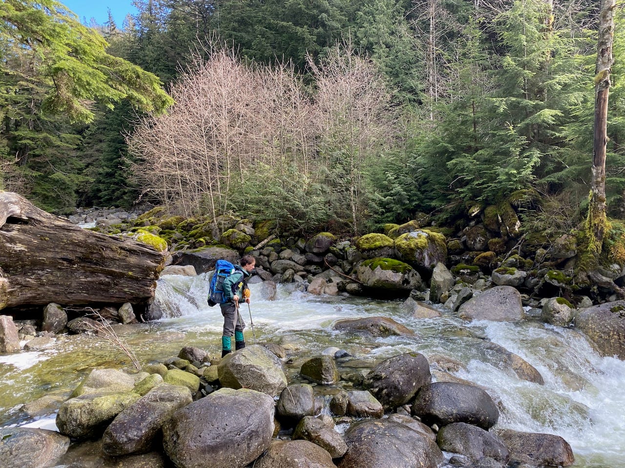
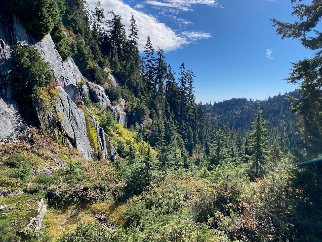
We headed uphill near Flume Creek, passing some more beautiful waterfalls before veering away from the creek through deadfall. In hindsight it would’ve been easier to follow the original IAT route more closely.
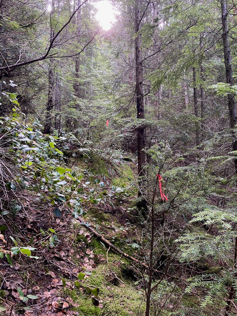
At 500m we reached another long-abandoned logging road which crosses Flume Creek. From here the IAT was surprisingly well-flagged! At eye level, there were flags every few metres in most places. Underfoot, since this trail sees so few visitors, it was hard to tell that anyone had walked here. It felt somewhat surreal.
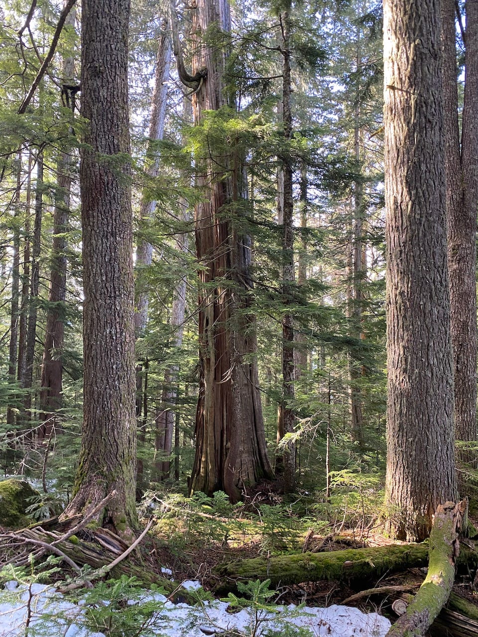
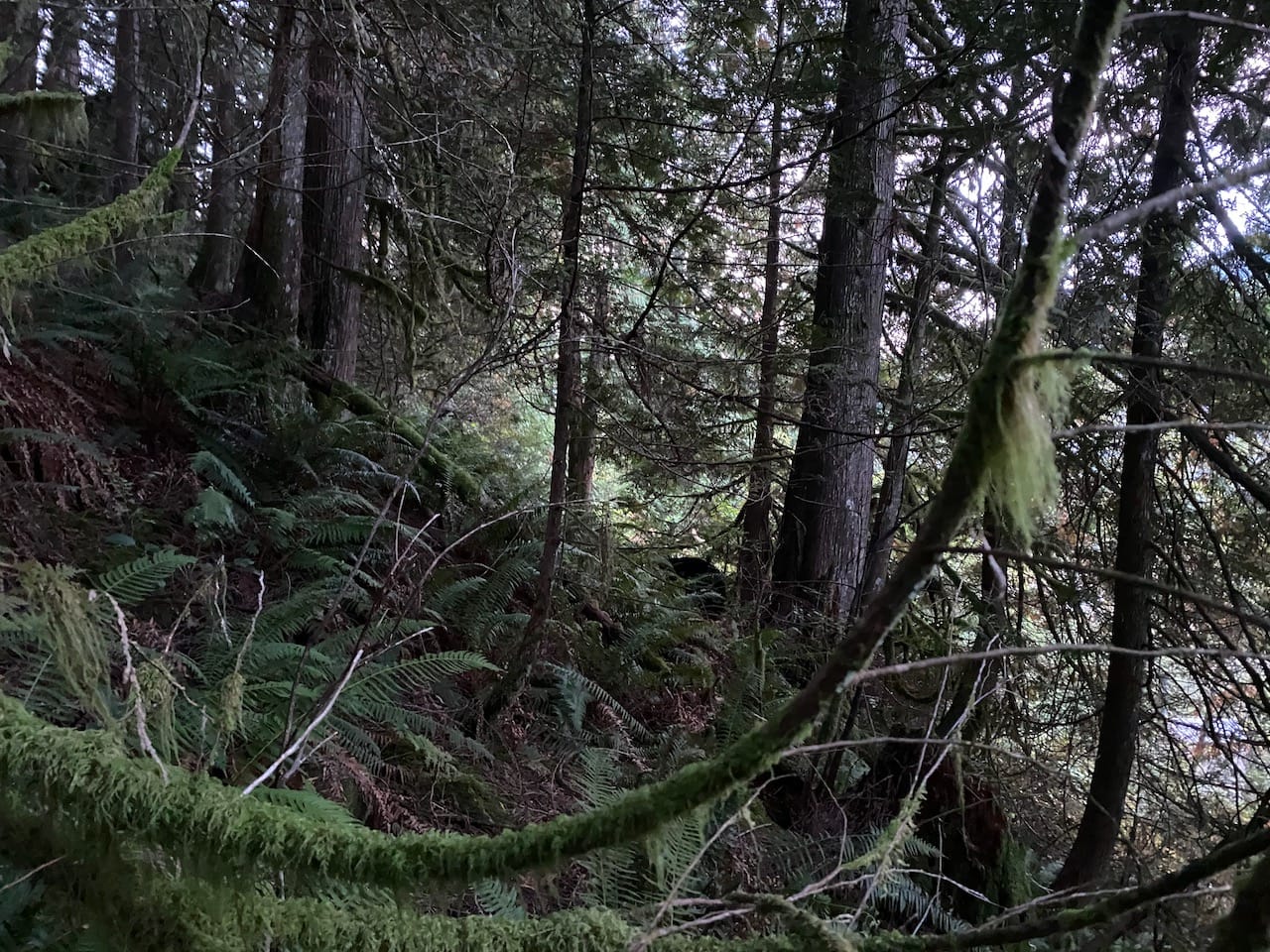
We reached the remains of the end of yet another abandoned FSR, now a minefield of deadfall. Snow made this section more treacherous and I often found myself postholing through dead wood. Around here, the snowshoes came on. Soon after this, the claustrophobic third-growth forest gave way to a much more open ancient forest with massive trees, much more pleasant to walk through.
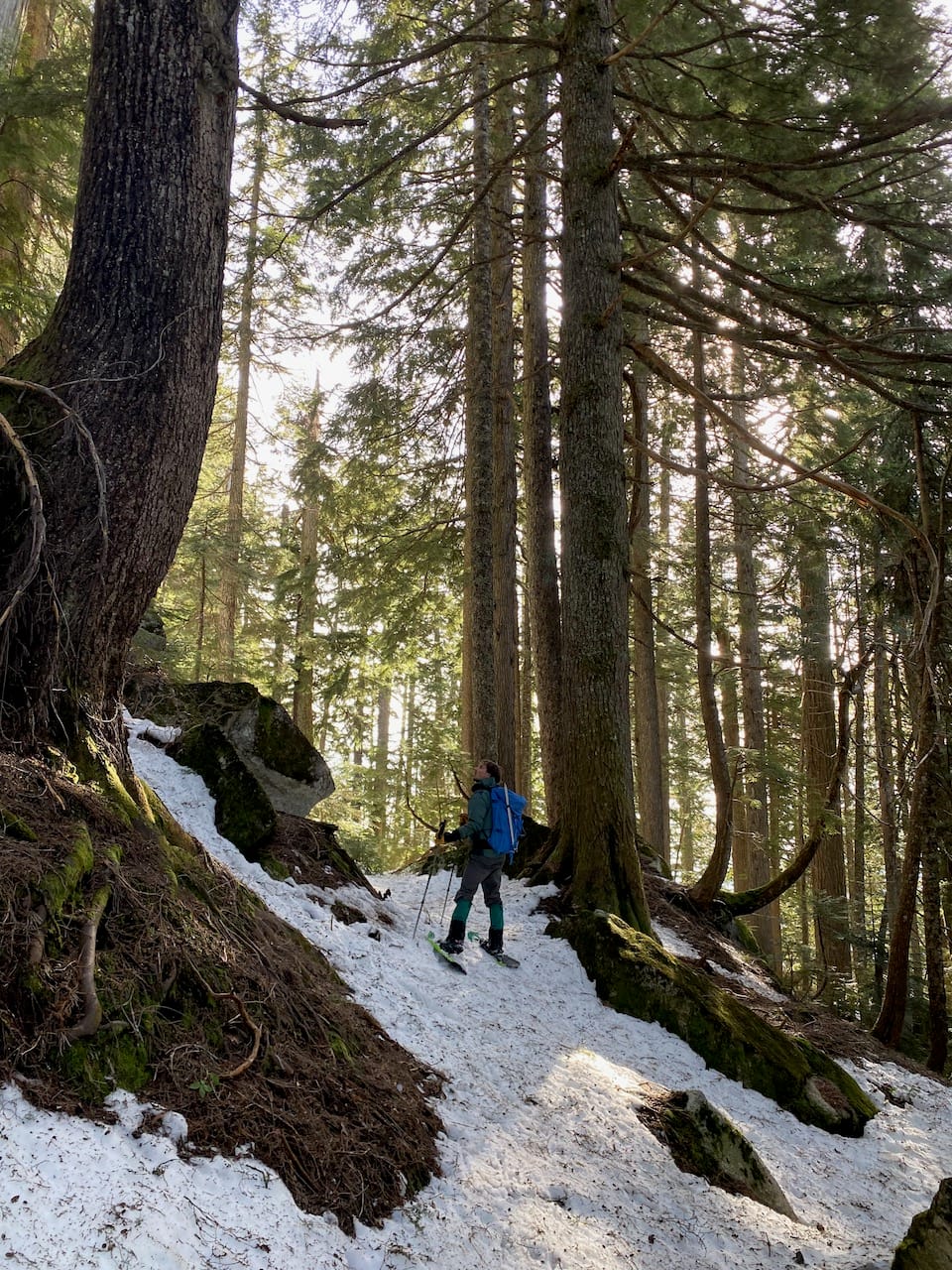
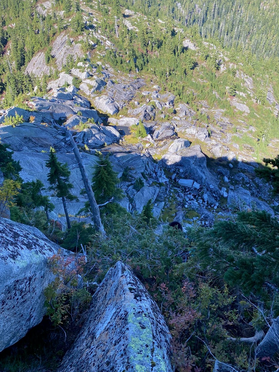
We continued up the ridge. At times, there were large cliffs blocking the way, but the flags pointed us to the best route.
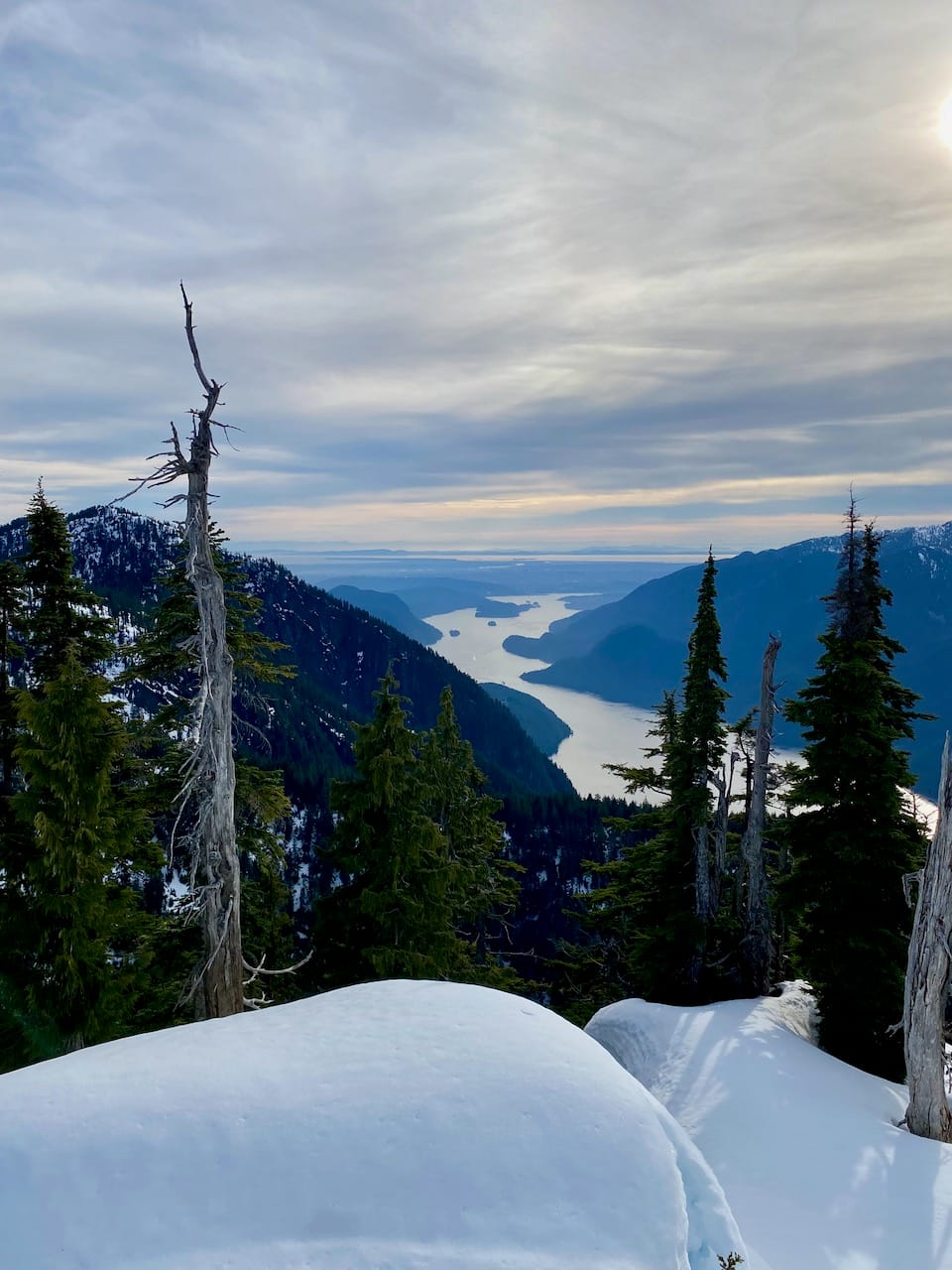
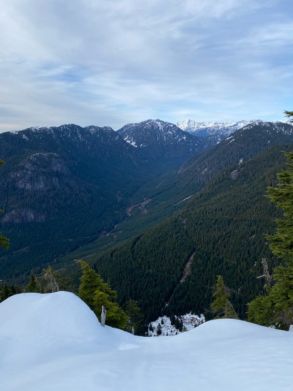
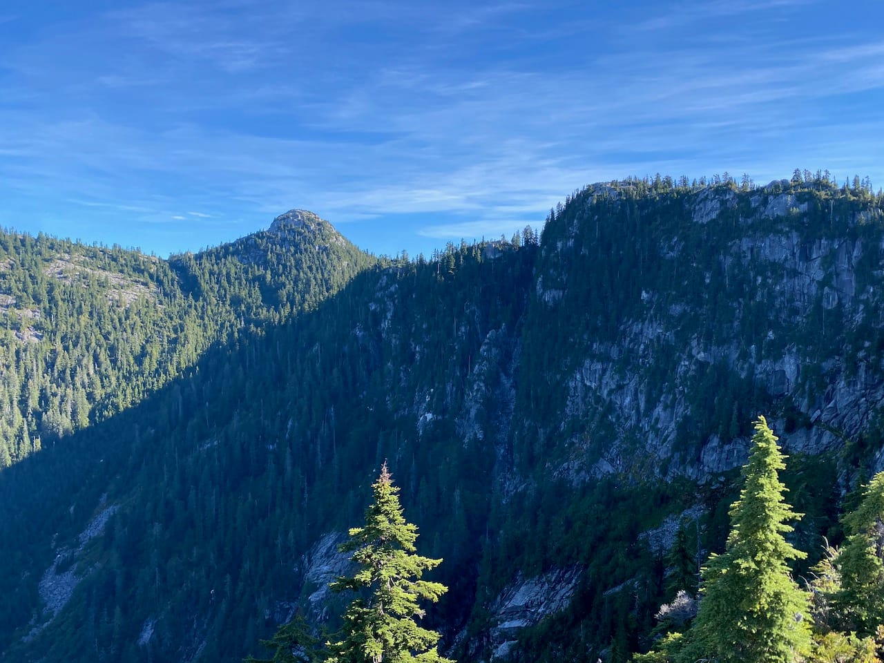
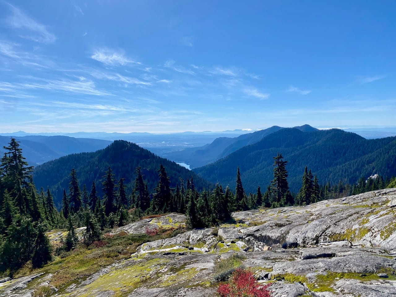
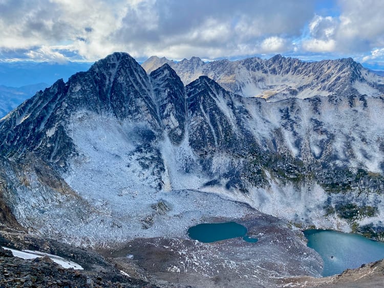
The trail emerged onto the summit of Grand Ridge, a snow-covered bluff with excellent views, especially down Indian Arm to Burnaby. We took a break here and admired the scenery. Our objective was finally in sight! We noticed that there were steeper slopes and more cliffs than we’d anticipated…

Immediately after leaving Grand Ridge, Paul’s snowshoe broke. We attempted to fix it with twine, which snapped. We then attempted a very janky repair using the ribbon from a balloon we’d found, but this also snapped. Our attempt would have to end here.
The steep snowy sections were tricky for Paul with one snowshoe, but somehow he managed it. We stayed closer to the IAT route on the descent, stumbling across a corduroy road and the remains of a logging camp. The sun set on our way down, and we left the IAT in total darkness. This made the scrambling sections more challenging. We ended up on another trail closer to the falls, descending one slippery section after another. After a short section of bushwhacking, we looked out onto a dark void. In our exhaustion, it took us a few seconds to realize that it was the ocean; we’d reached the north beach. We set up camp at the campsite, then canoed back to Deep Cove the next day.
In hindsight, there wasn’t enough time in the day to make it to the summit and back anyway, and even if there had been, we wouldn’t have been able to reach the summit in snowshoes.
Attempt 4: October 4-6, 2025
There was an unexpectedly nice weekend in October, and I decided it was time to finally finish this. I asked around, and Tom from the VOC was also interested in joining.
We made quick work of the paddle to Granite Falls and set up camp. I noticed that there were several signs about bear safety that weren’t there on my last visit, but I thought nothing of it… Coincidentally, the VOC was holding its “Intro to Kayaking” trip here, and we briefly chatted with some fellow VOCers before turning in for the night.
We left the campsite just before sunrise the next day. The ascent went smoothly and quickly, and Grand Ridge was reached without incident.
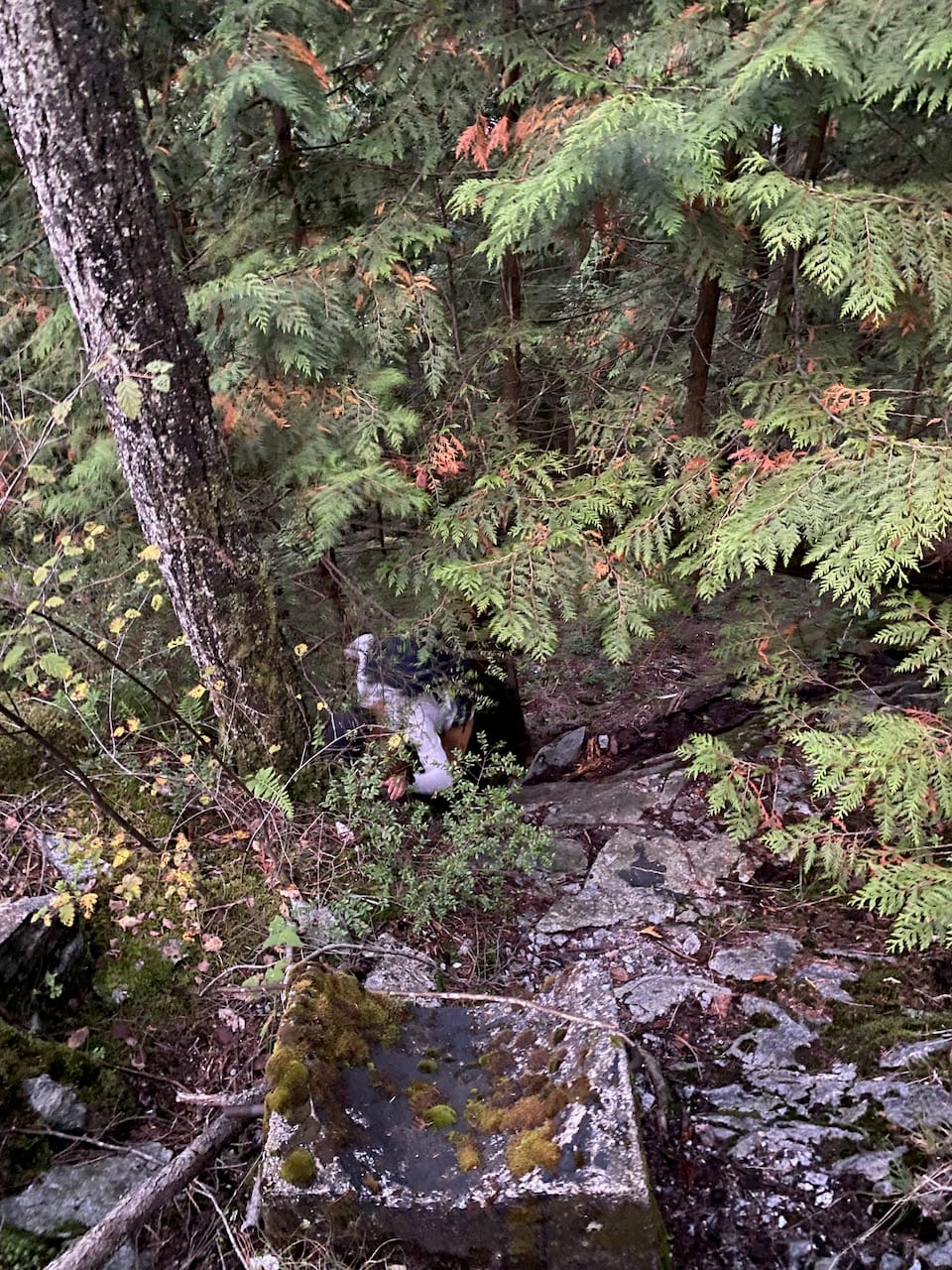
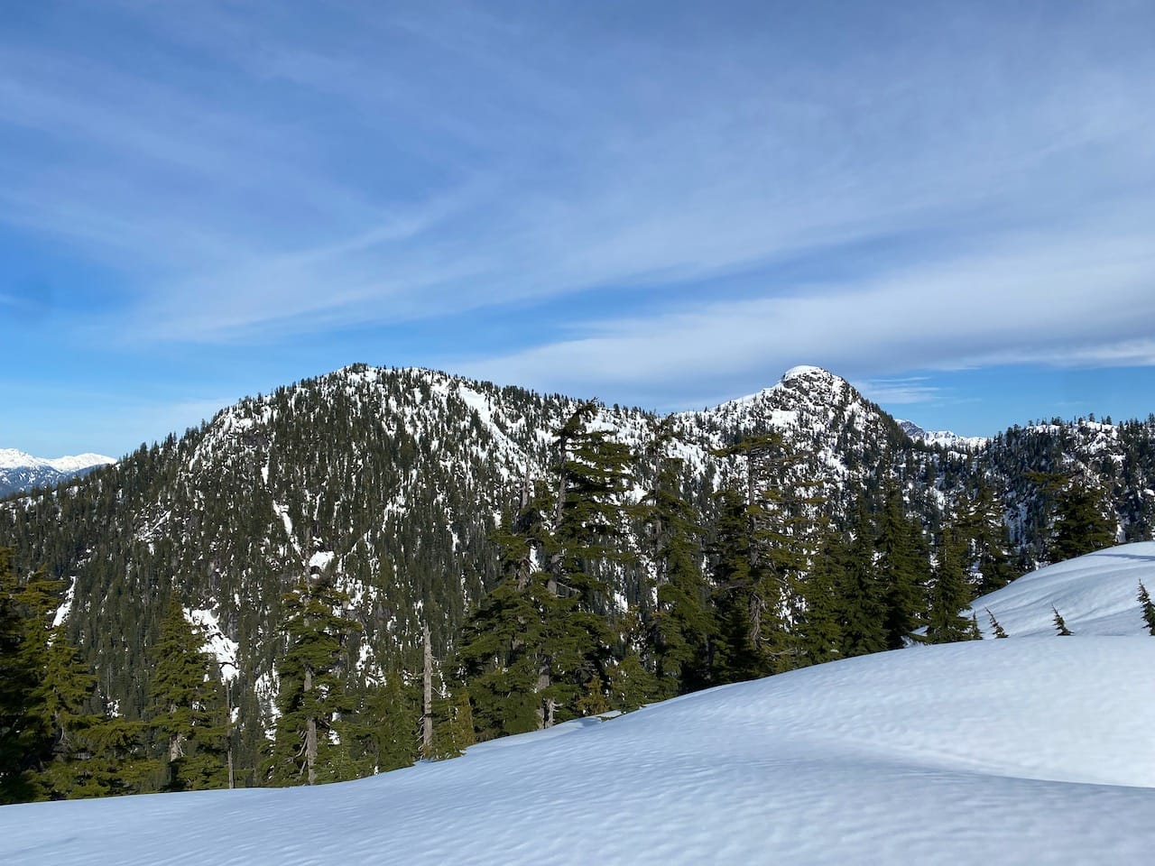
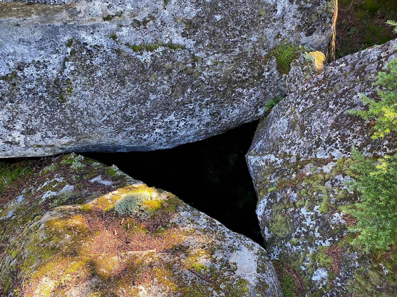
Beyond Grand Ridge, I was now in completely new territory. Here, the helpful flags almost completely vanished, something to be expected on such an obscure route, and we mostly relied on the GPS. At one point, the trail traversed the head of a gulley, less than a foot away from a massive drop into the Grand Creek valley. At another point - I think this was significantly off the route - boulders have fallen in such a way as to create a massive talus cave, several metres deep and wide enough to fit my car. We couldn’t see it until we were standing right above it.
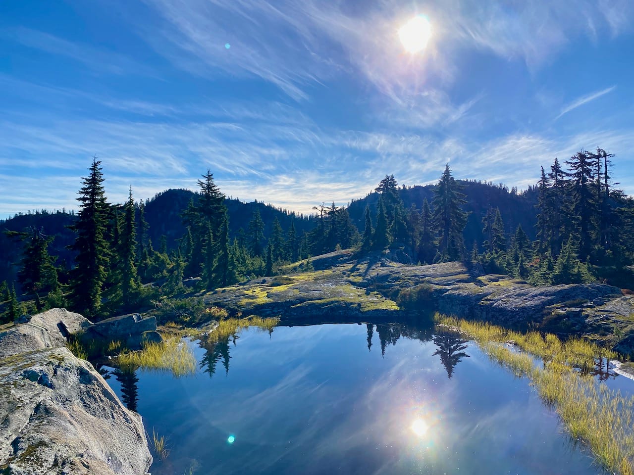
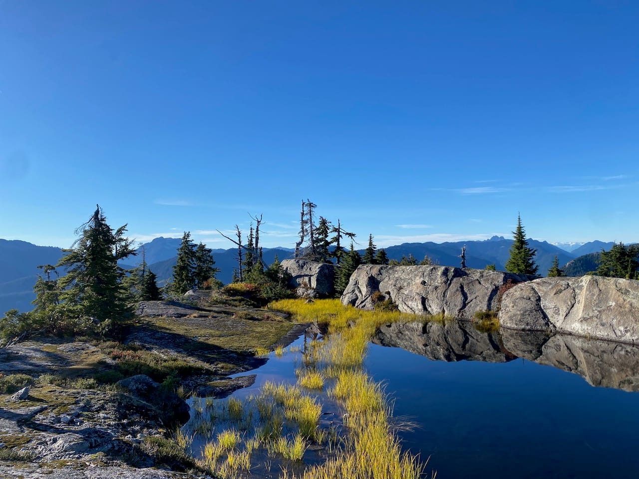
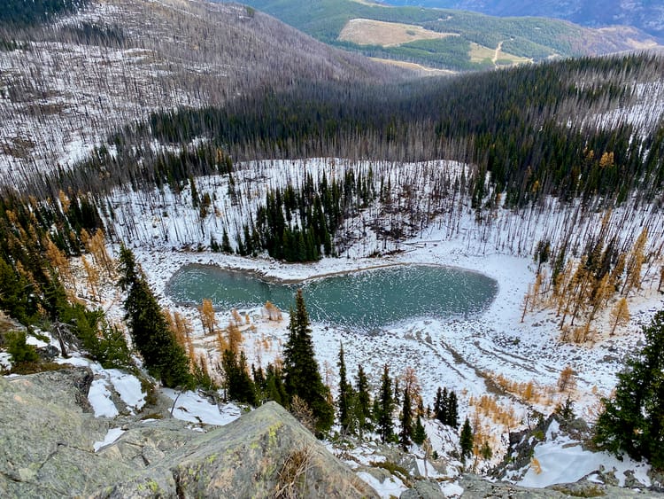
The trail leaves the ridge and enters a gully, where flagging briefly resumed, then emerges onto a small bump on Eagle Ridge, next to a deep tarn. At this point we left the Indian Arm Trail, continuing north along the ridge. Almost immediately, we found ourselves at the top of a large cliff with no obvious way down.
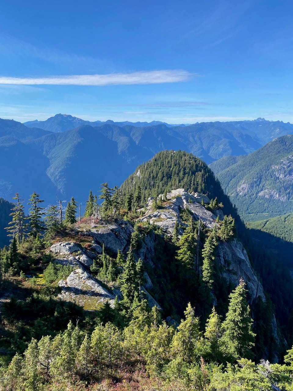
This was bypassed by descending a gully to the south. We continued up and over a smaller peak, scrambling and bushwhacking in sections, until we finally stood at the base of our objective.
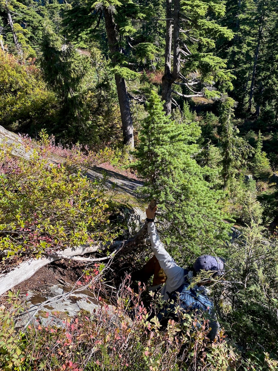
There was no obvious direct route to the summit. The south face was a series of steep slabs, so we headed to climber’s left to reach the ridge between our destination and the next. This involved some steep bushwhacking at first, but then I found a ramp which made things much easier, leading us to the ridge.
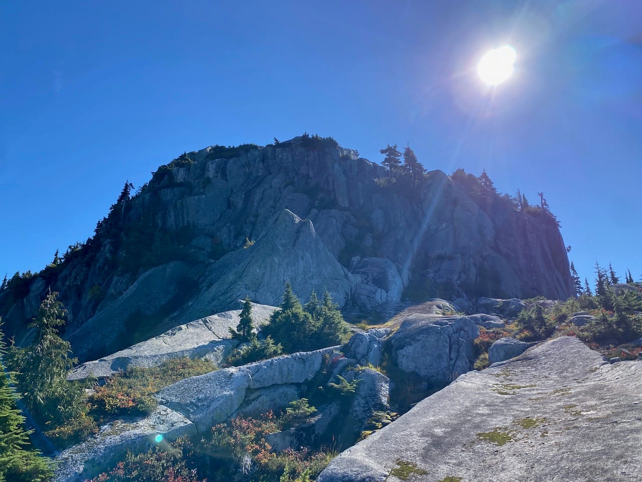
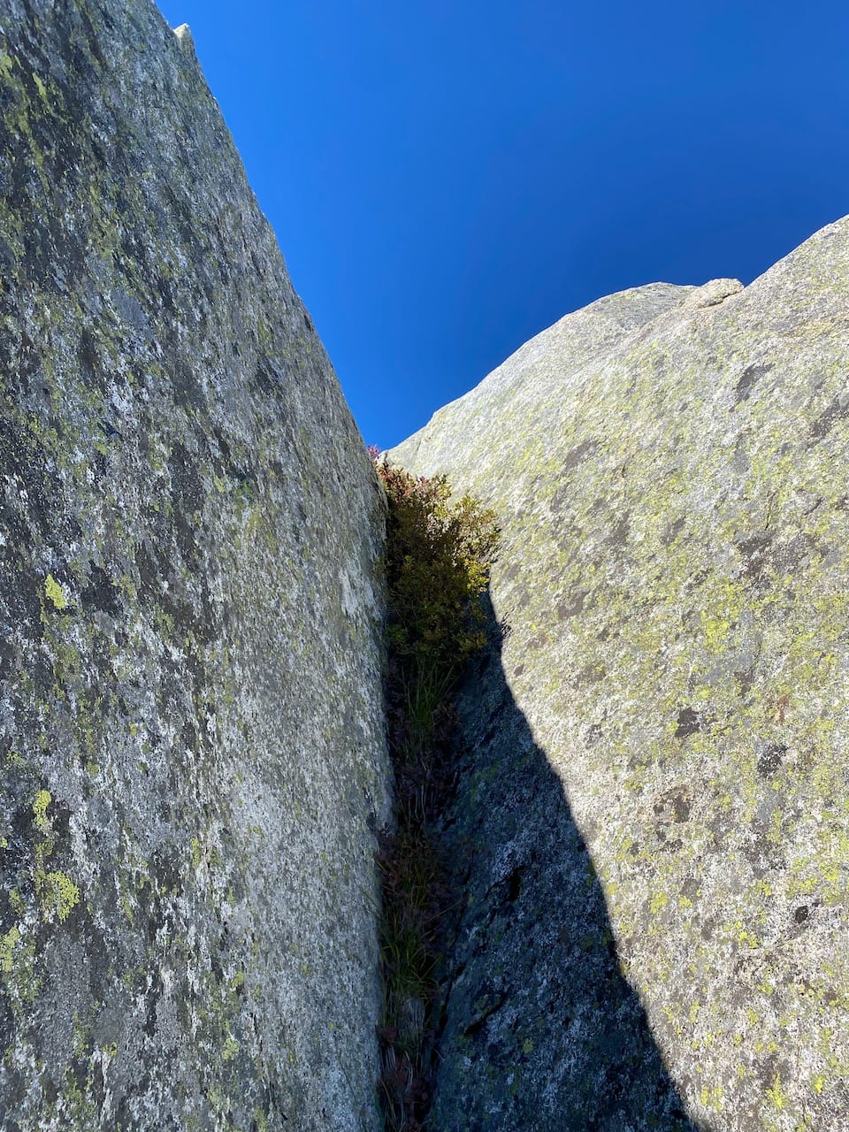
A large cliff guarded the summit. We tried several routes, each looking promising at first, but every one ended in steep exposure below the final cliff band. We spent some time searching for something that would go, but it seemed like we would have to bail here, so close to the summit.
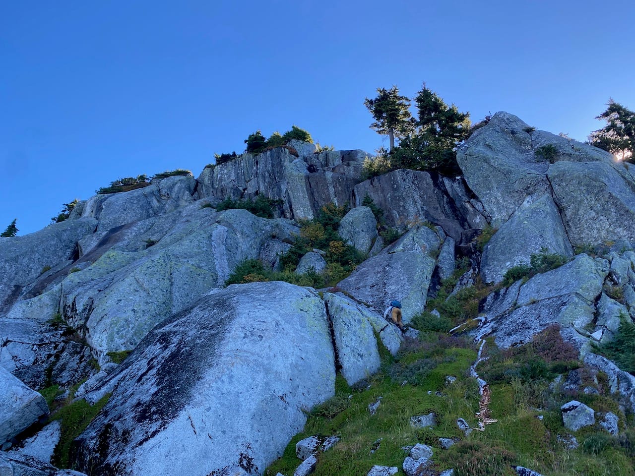
After some searching, we decided to make one last attempt by traversing left along a narrowing ledge. Where it ended, a tree and a few blueberry bushes offered just enough handholds to pull ourselves up another gully. This one involved some exposed class 4 moves, but it took us almost to the summit. A short chimney led the rest of the way.
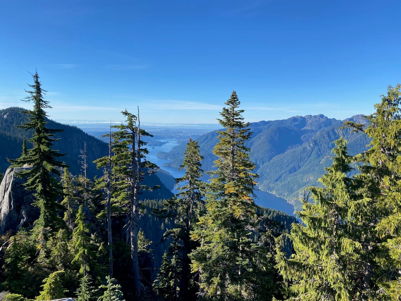
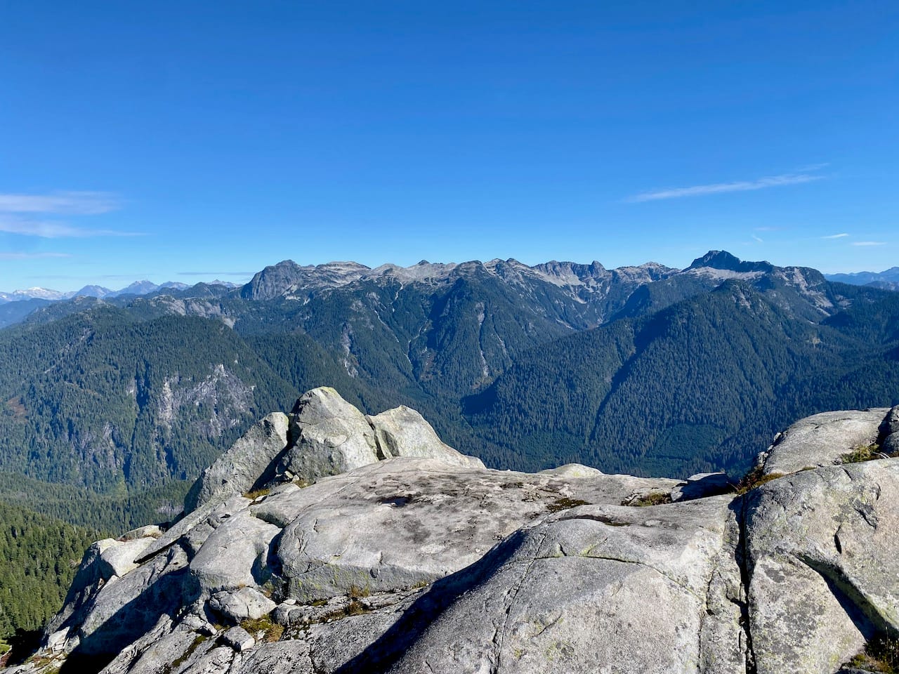
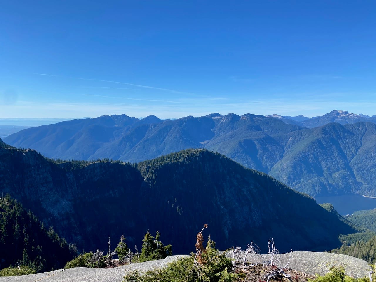
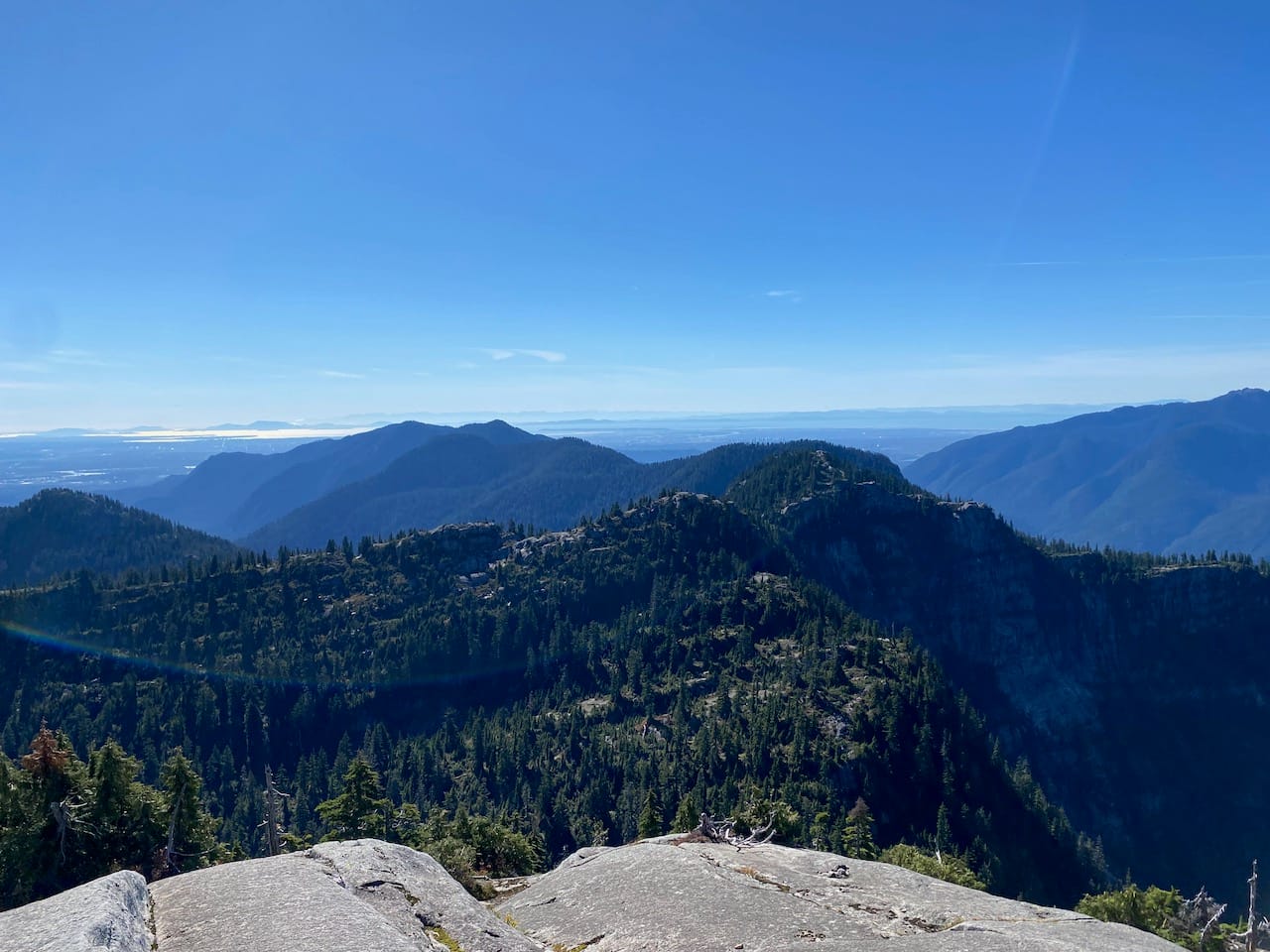
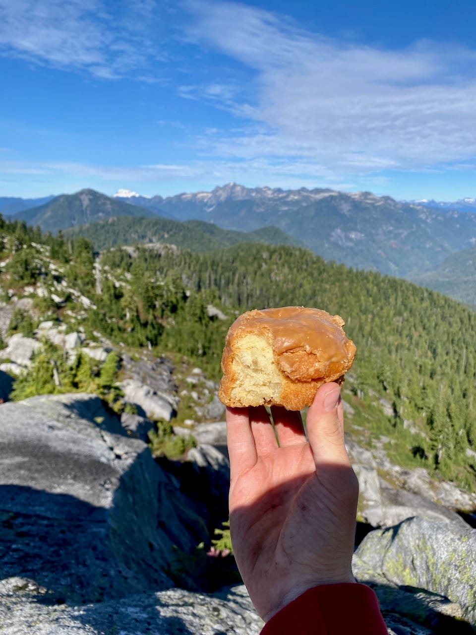
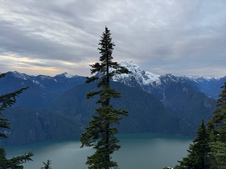
The view was spectacular. Meslilloet and Garibaldi to the north were highlights. Parts of Greater Vancouver could be seen to the south behind Eagle Ridge. To the east and west, cliffs guarded Grand Creek and the forbidden Coquitlam watershed. Interestingly, we could only see a small portion of Indian Arm itself. There was a collapsed cairn on the highest point, but no summit register.
We were running low on time at this point and didn’t linger. We descended, retrieved our packs, and had a quick lunch break on the ridge.
As we were talking, we heard voices in the distance! Who else was climbing this obscure peak? It turned out that the acoustics of the granite create the most perfect echo I’ve ever heard. It sounded like someone was right beside us. It was quite surreal.
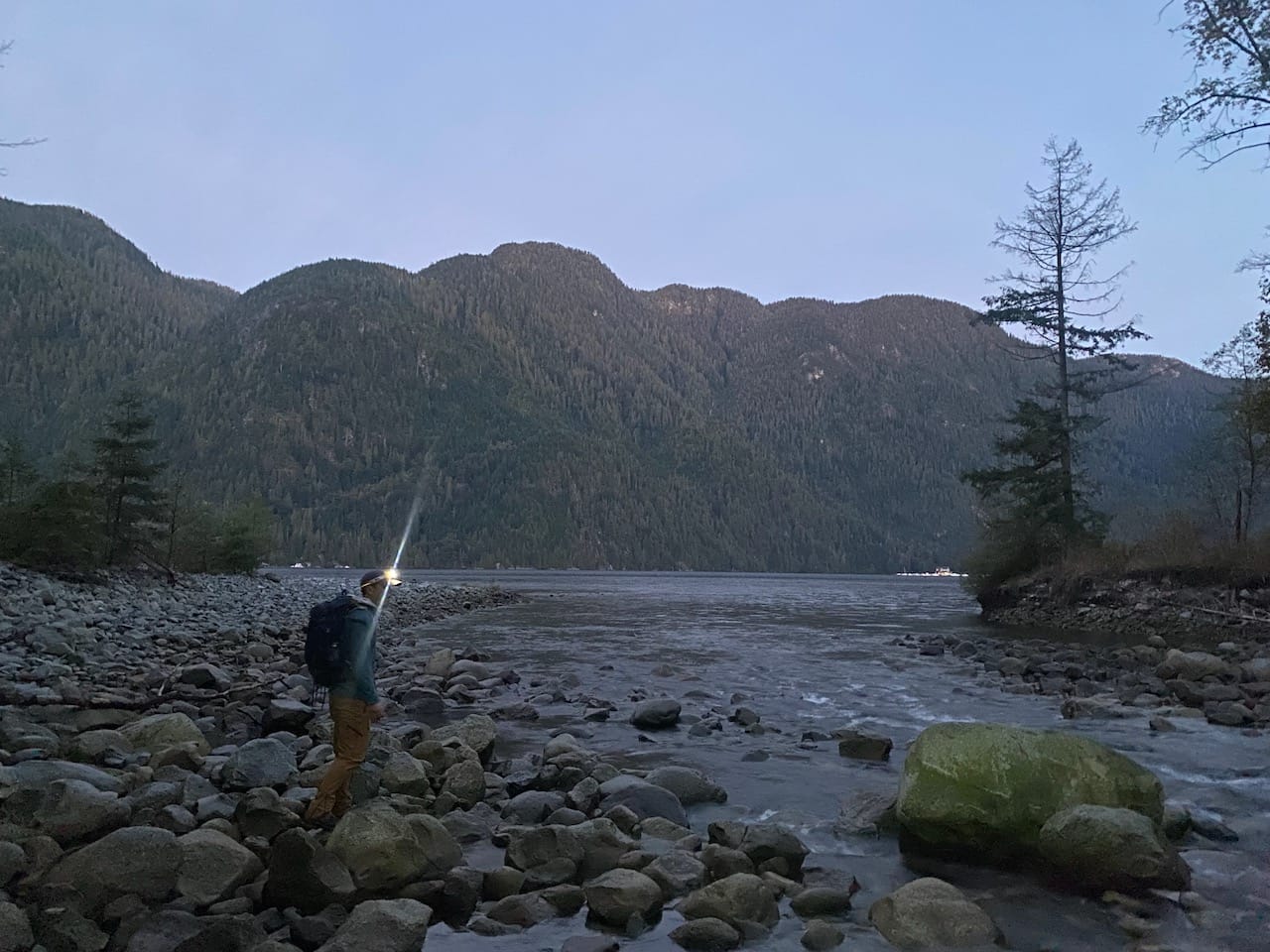
We returned to the Indian Arm Trail at a relatively rushed pace. At one point, we climbed down a tree to descend a cliff, and my phone fell out of my pocket. Luckily I retrieved it. The descent to Grand Creek went quickly.
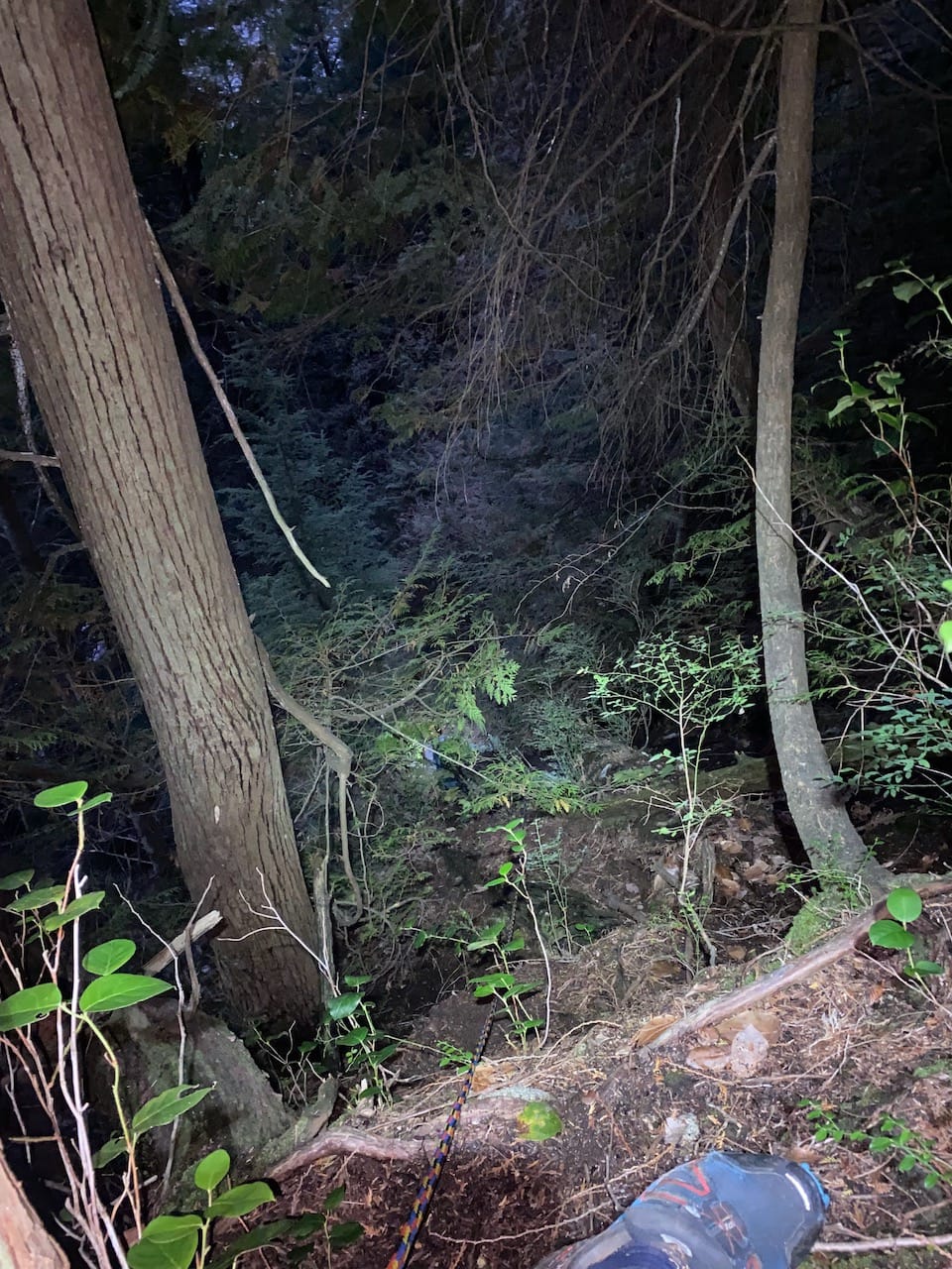
We reached the top of the final scramble just past sunset and still had enough usable light to get down safely. Unlike the previous night, we were the only ones at the campsite. As I set up camp, I heard rustling in the bushes nearby. We were exhausted and didn’t think much of it.
The full moon was bright and made it difficult to sleep. As I was drifting off, Tom woke me up. His backpack had disappeared!
We searched with our headlamps but found nothing and decided to wait for daylight. I fell asleep, but was woken up by a loud CLANG, as if a heavy object had fallen. I didn’t sleep well after that.
At sunrise we searched again. Drag marks in the dirt led in the direction of the forest. More alarmingly, something had knocked the bear cache over in an attempt to get at our food. Thankfully the container held.
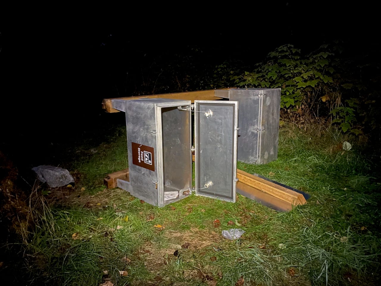
With bear spray in hand, we ventured into the woods to search for the lost backpack. Behind the bear cache, I found several piles of food wrappers accompanied by ripped dry bags. Something had been stealing campers’ bags, dragging them into the woods, and feasting on the contents. Unfortunately, there was still no sign of Tom’s pack.
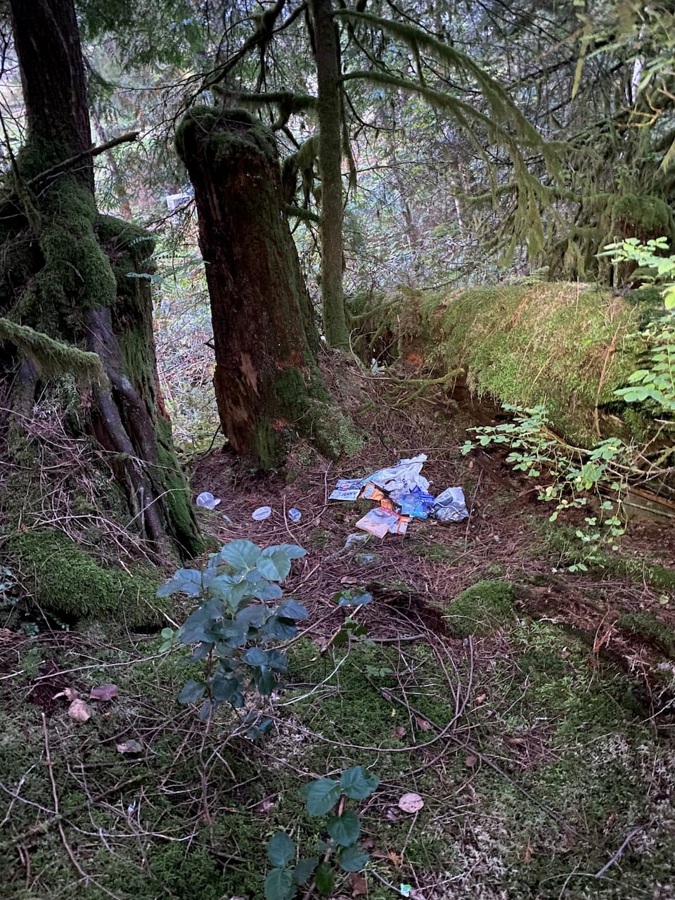
We debated whether to clean up the trash but we were concerned about angering the culprit. Just then, the largest bear I’ve ever seen waddled out of the forest!
We made our presence known, and after a tense moment, it took a few steps back. The search would have to end here. We retreated to our canoe and cast off, minus one backpack.
After four attempts, I’d finally reached the summit, at the cost of one snowshoe and one backpack filled with both expensive and sentimental gear. Thanks to Tom and Paul for joining me on these adventures. I loved exploring this rarely-seen corner of the province and discovering what Grand Creek has to offer - so close and yet so far from my hometown - but this summit won’t be seeing me again.
Member discussion