Chuwanten Mountain and Monument 83

Date: Oct 18, 2025
Distance: 18.70km (About 8km if only going to Chuwanten)
Elevation gain: 1099m (About 600m if only going to Chuwanten)
Chuwanten Mountain is located on the eastern edge of Manning Park. It sees few visitors, especially because of its distance from Vancouver. The standard route involves the often overgrown Monument 83 trail, but recent logging on the mountain’s eastern slopes has opened a much shorter and easier route.
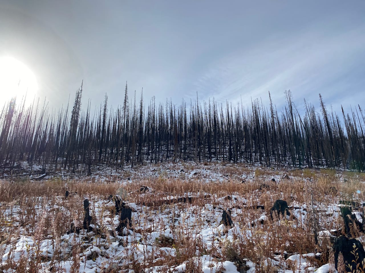
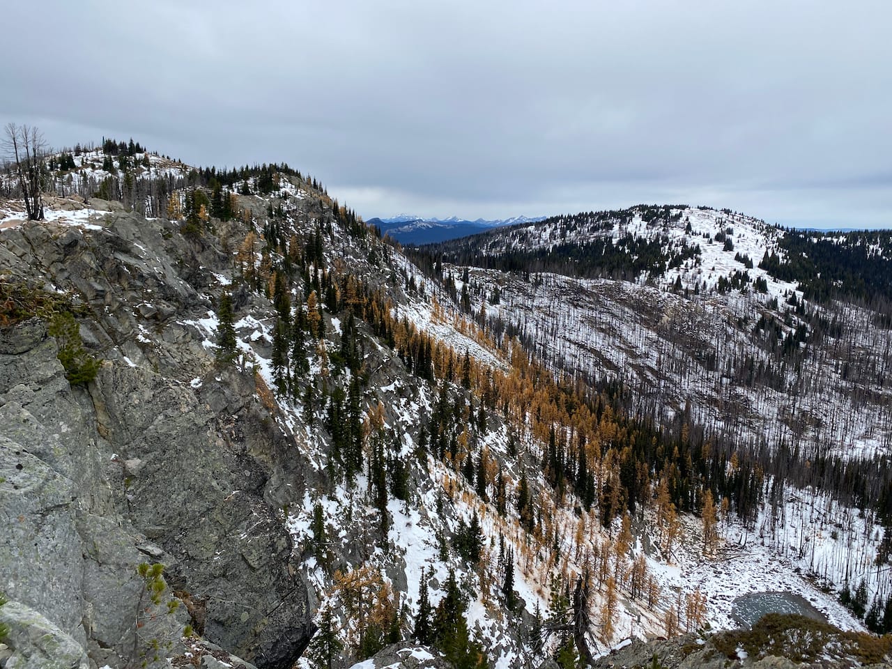
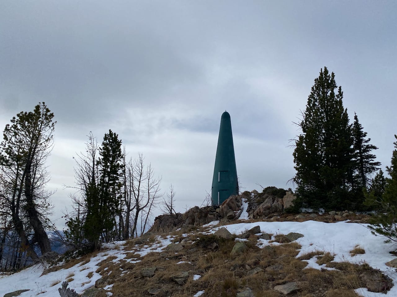
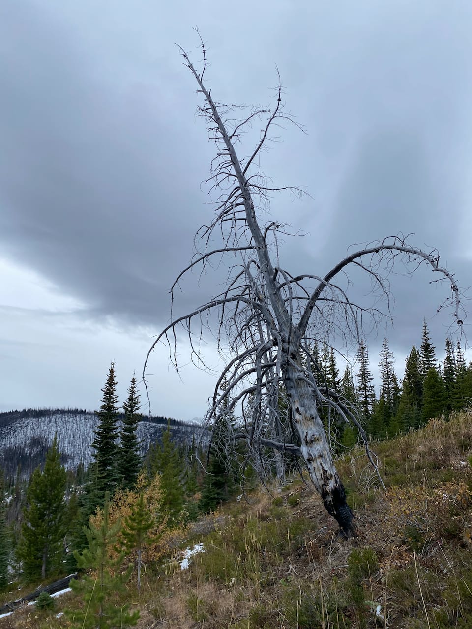
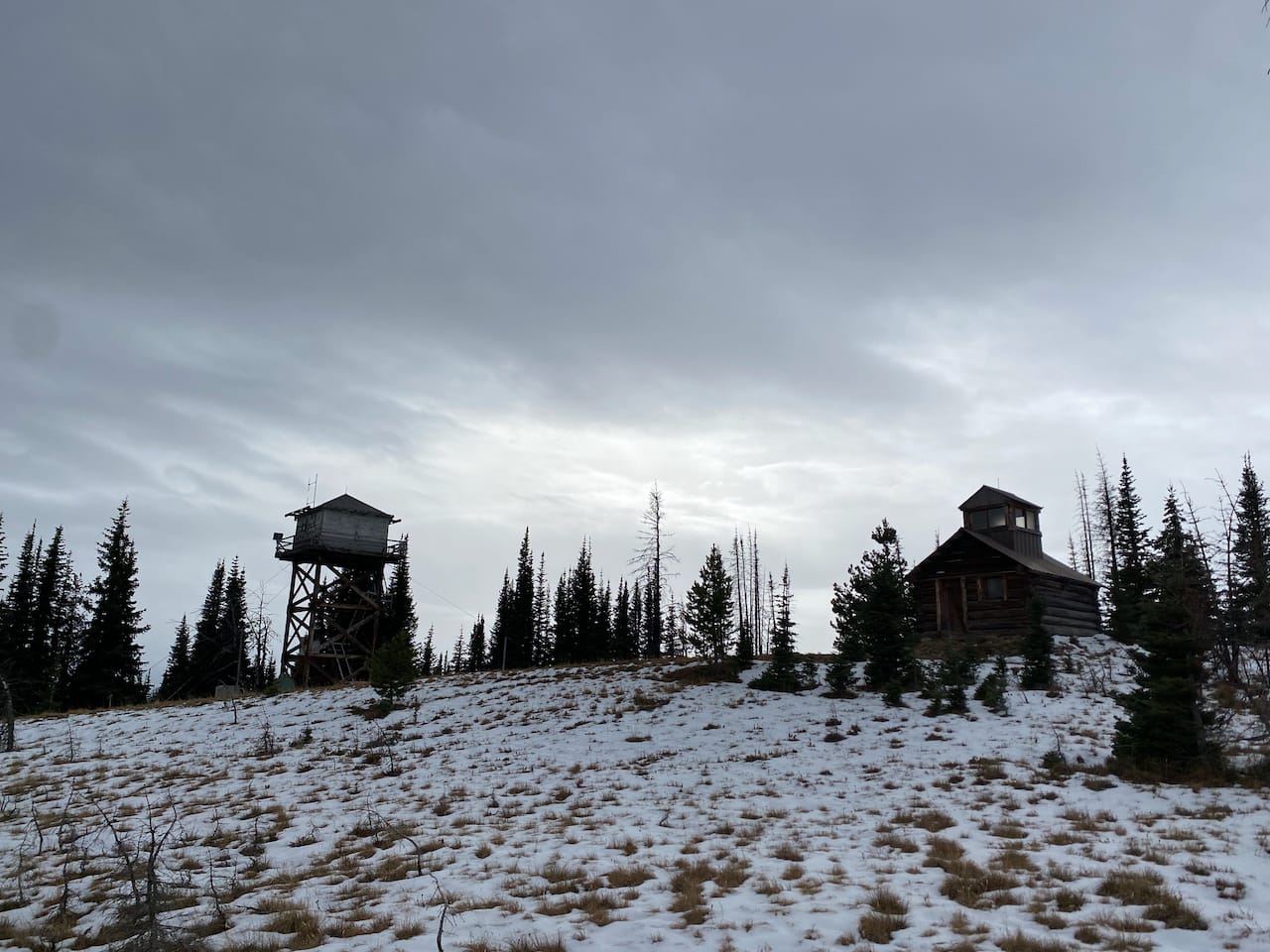
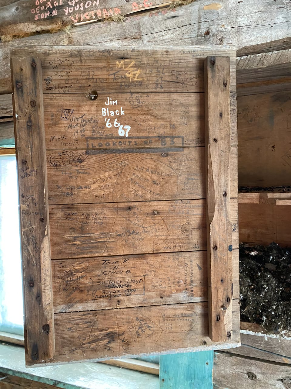
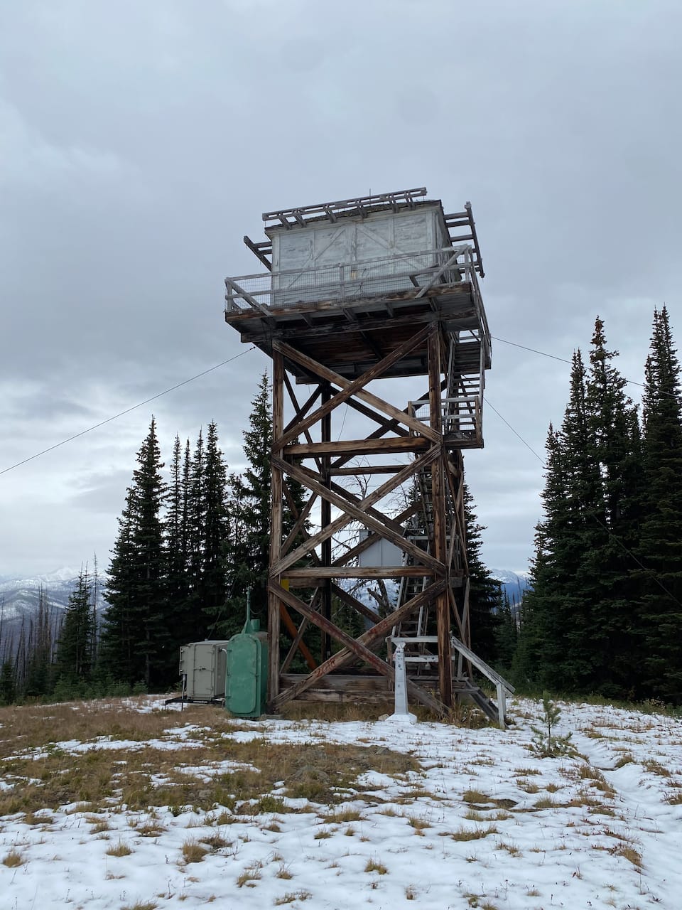
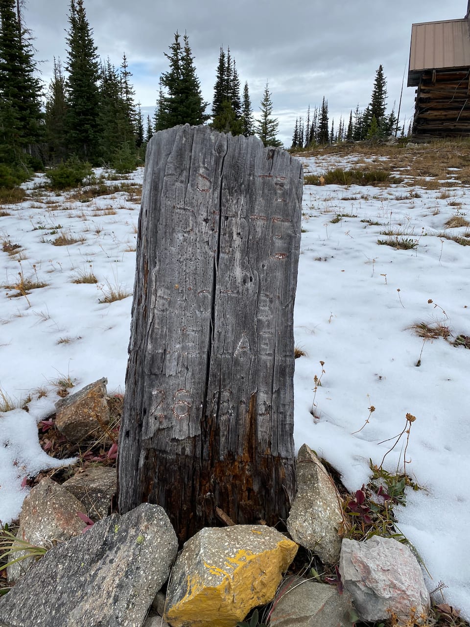
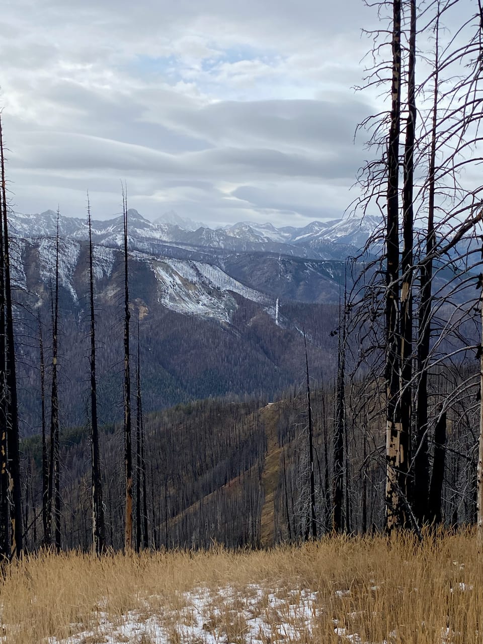
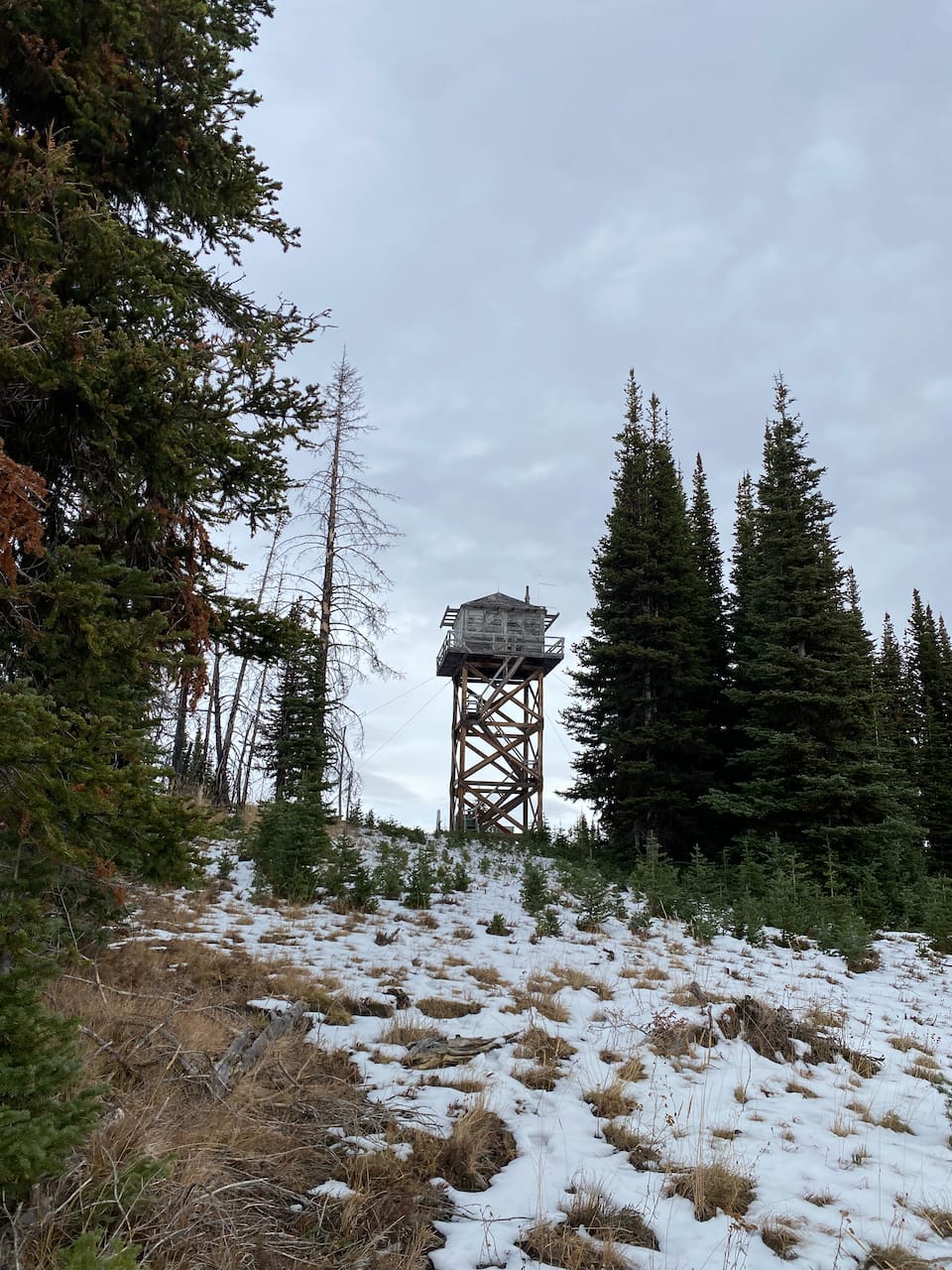
Further south is Monument 83 Peak, located on the U.S. - Canada border. It has not one but two fire lookout towers: in 1930, the US Forest Service built a tower on the highest point, but a later survey revealed it was actually in Canada, so they built another one on the American side in 1953 (source). Between the towers, there is a gravestone dating back to “61”, probably 1961. The ridge between the two peaks was recently burned, making it much easier to connect the two. With its abandoned lookout towers, burned trees, and overall eerie atmosphere, this would be a good Halloween destination.
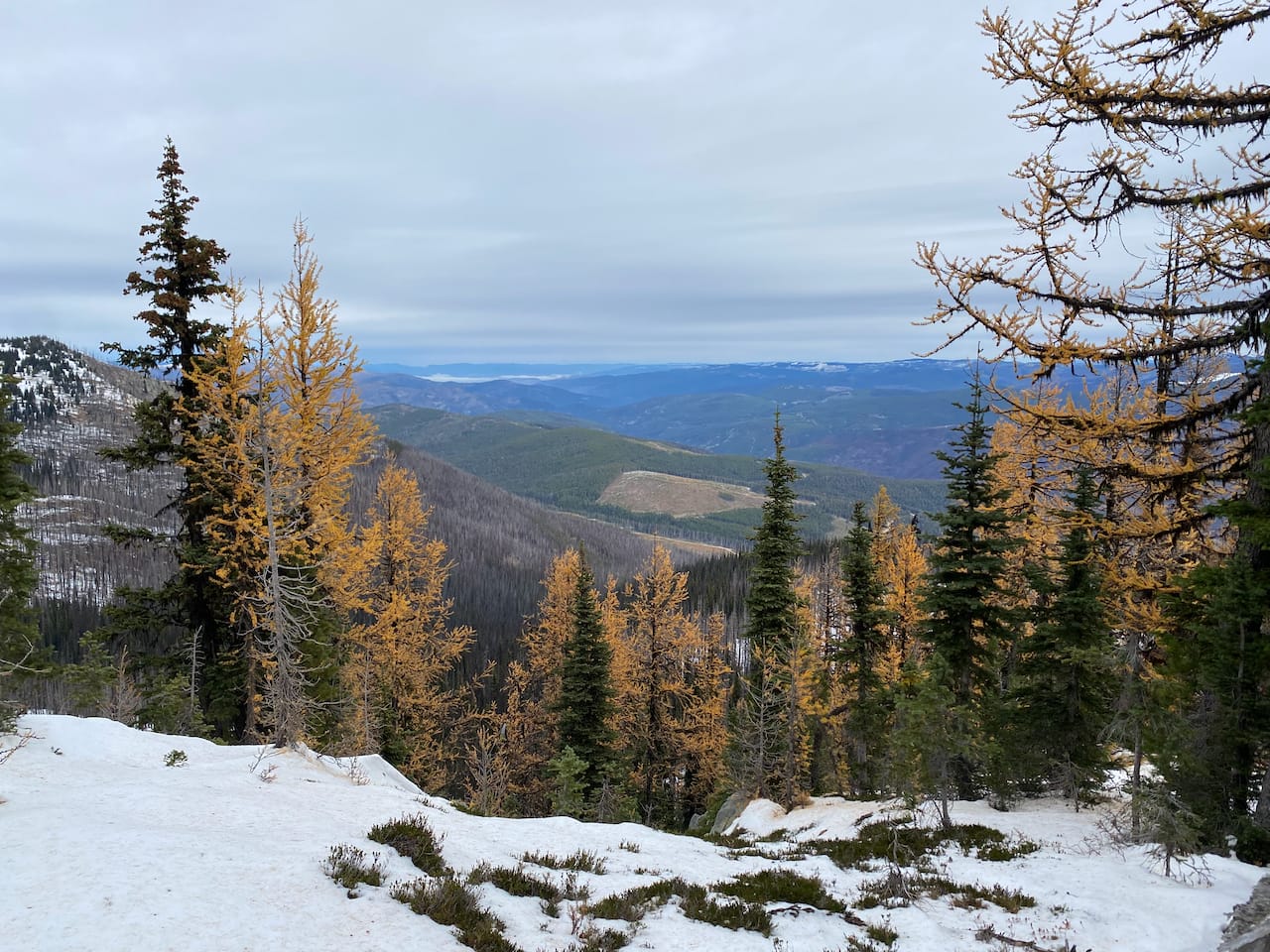
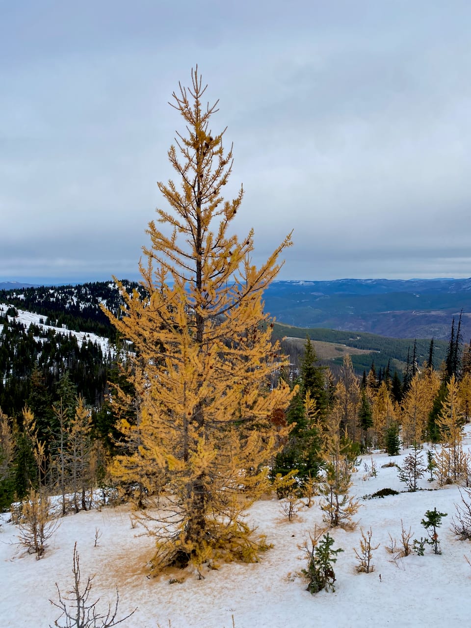
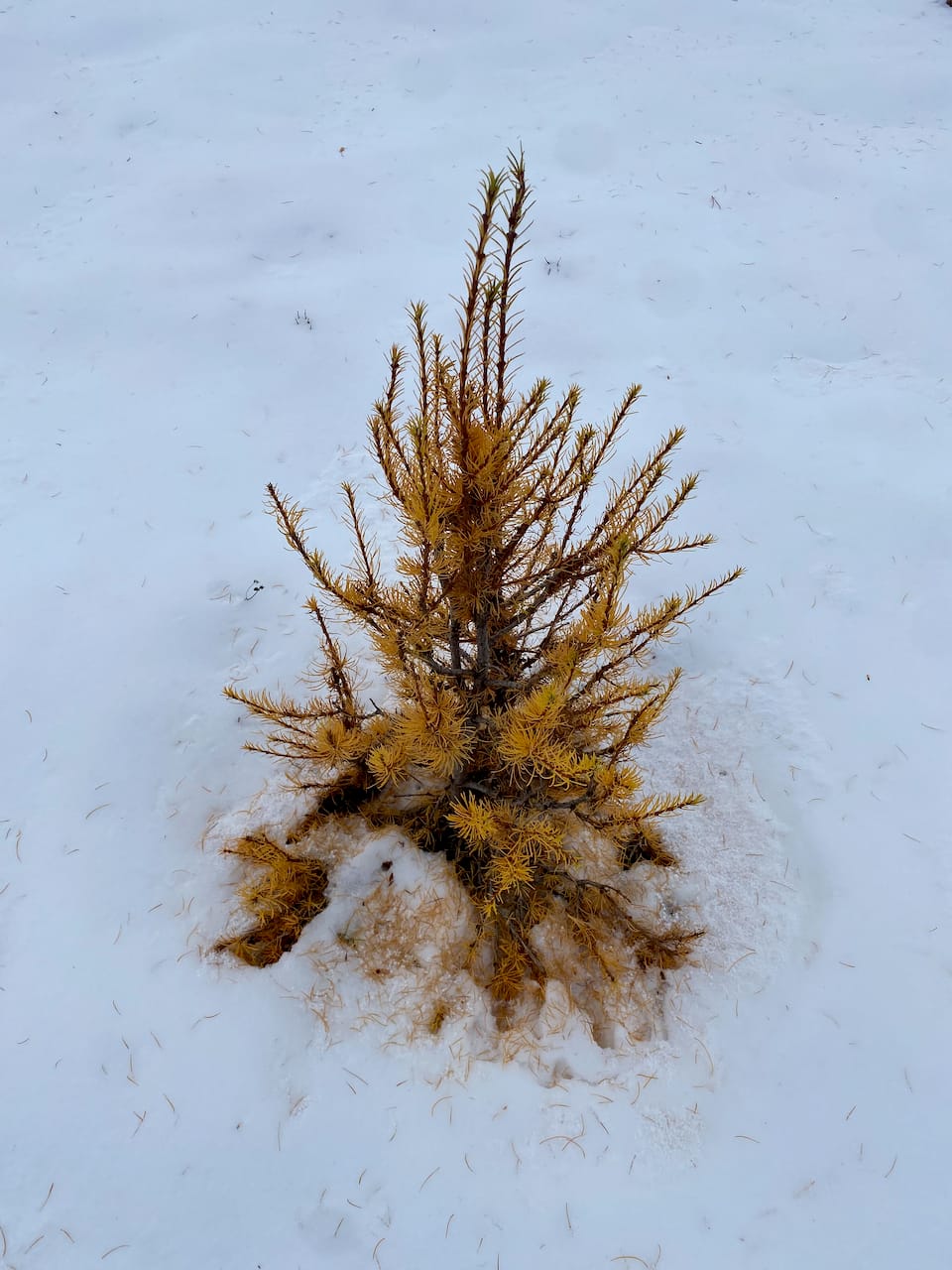
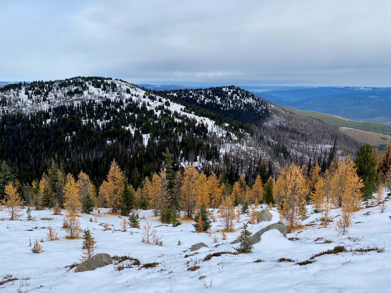
I was planning to ski to Chuwanten this winter, but then I saw a post on “SWBC Peakbaggers” with photos of golden larches below the peak. It's a similar altitude to the much better-known Frosty Mountain and provides some larch habitat. The ridge leading to Monument 83 is also partly at the right altitude, so I wanted to see if there were any larches there. (Spoiler alert: not many, almost all of them were lost in the wildfire.)
The forecast predicted good weather in the morning, but an atmospheric river was scheduled to hit the Lower Mainland mid-afternoon. I planned to start early and end early…
The drive was long (about three hours) and took me past every other Manning Park trailhead. The Pasayten River FSR and Manning spur were in excellent condition. A 2WD vehicle could make it most of the way, until some waterbars appear in the last 2–3 km. The spur climbs almost to 1700 m, and luckily there was no snow on the way in.
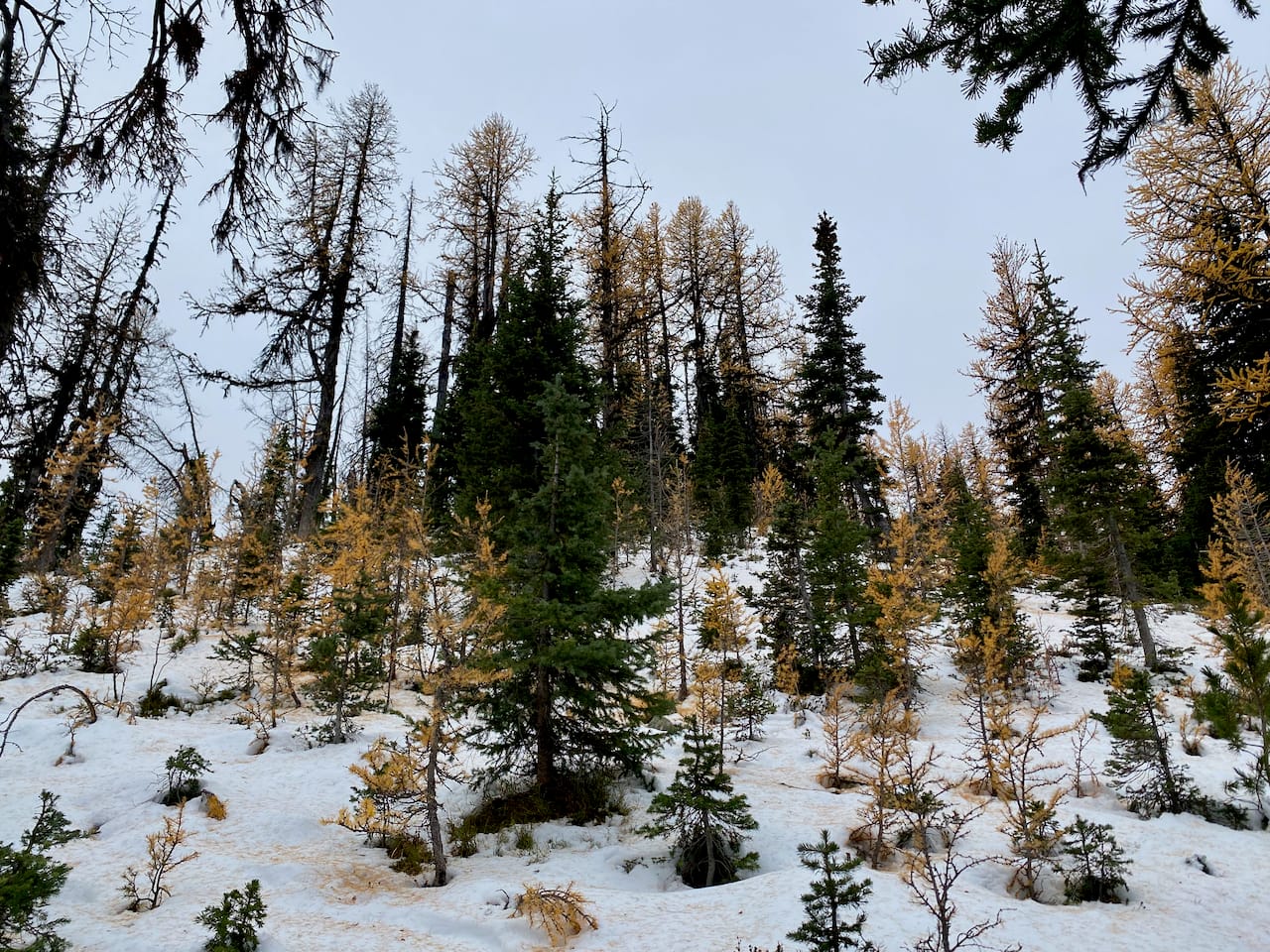
From the car, I walked southwest along a deactivated road, then a cut block, then burned forest. Travel here was very easy by BC standards. I walked across a plateau, then started the final climb to the ridge. The first larches made their appearance.
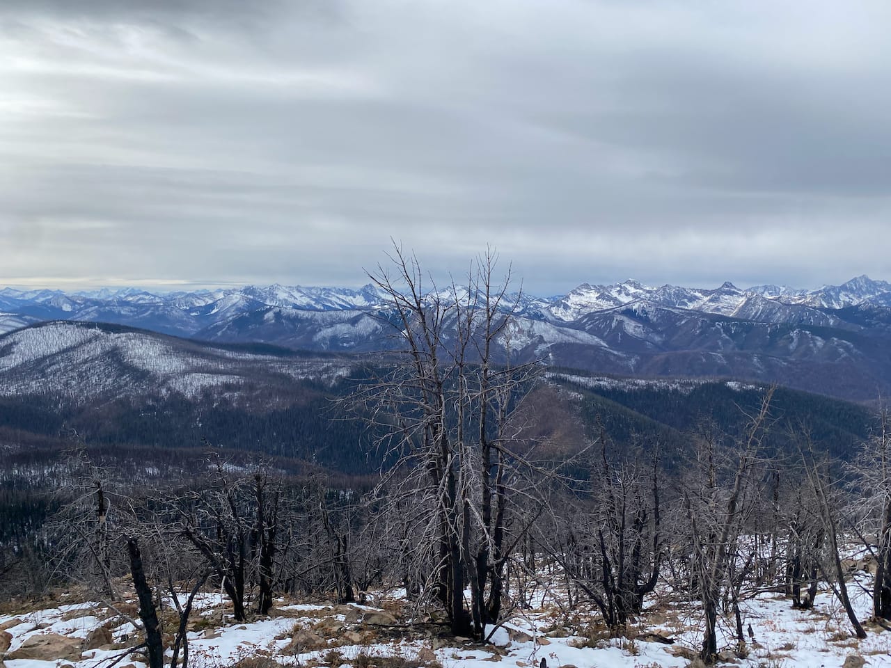
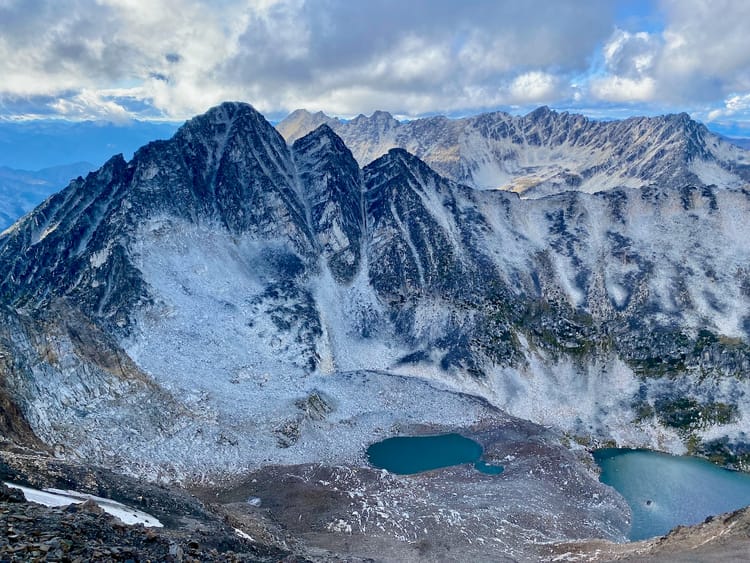
There are a few false summits; the true summit has a green radio repeater tower. I reached it quickly - less than 4km from the car. The summit is mostly treed, but the trees have burned, creating good views of Cathedral Park and the Pasayten wilderness.
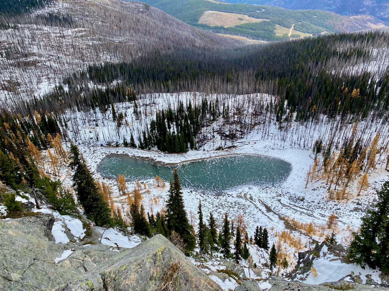
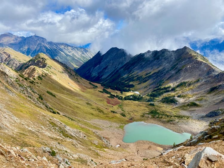
A small larch forest lies to the north of the peak, centred around a lake below. I didn't walk all the way down to the lake, instead exploring the larches on the ridge heading north from Chuwanten. They were past their prime but still scenic.
After admiring the views I headed south, traversing some small bumps on the ridge. This was mostly easy going through burned forest. Near the junction with the Pasayten River Trail, however, there was one annoying section with plenty of deadfall. There was one small grove of surviving larches on the largest bump on the ridge, but it was out of my way and the needles had mostly fallen so I didn't make the detour.
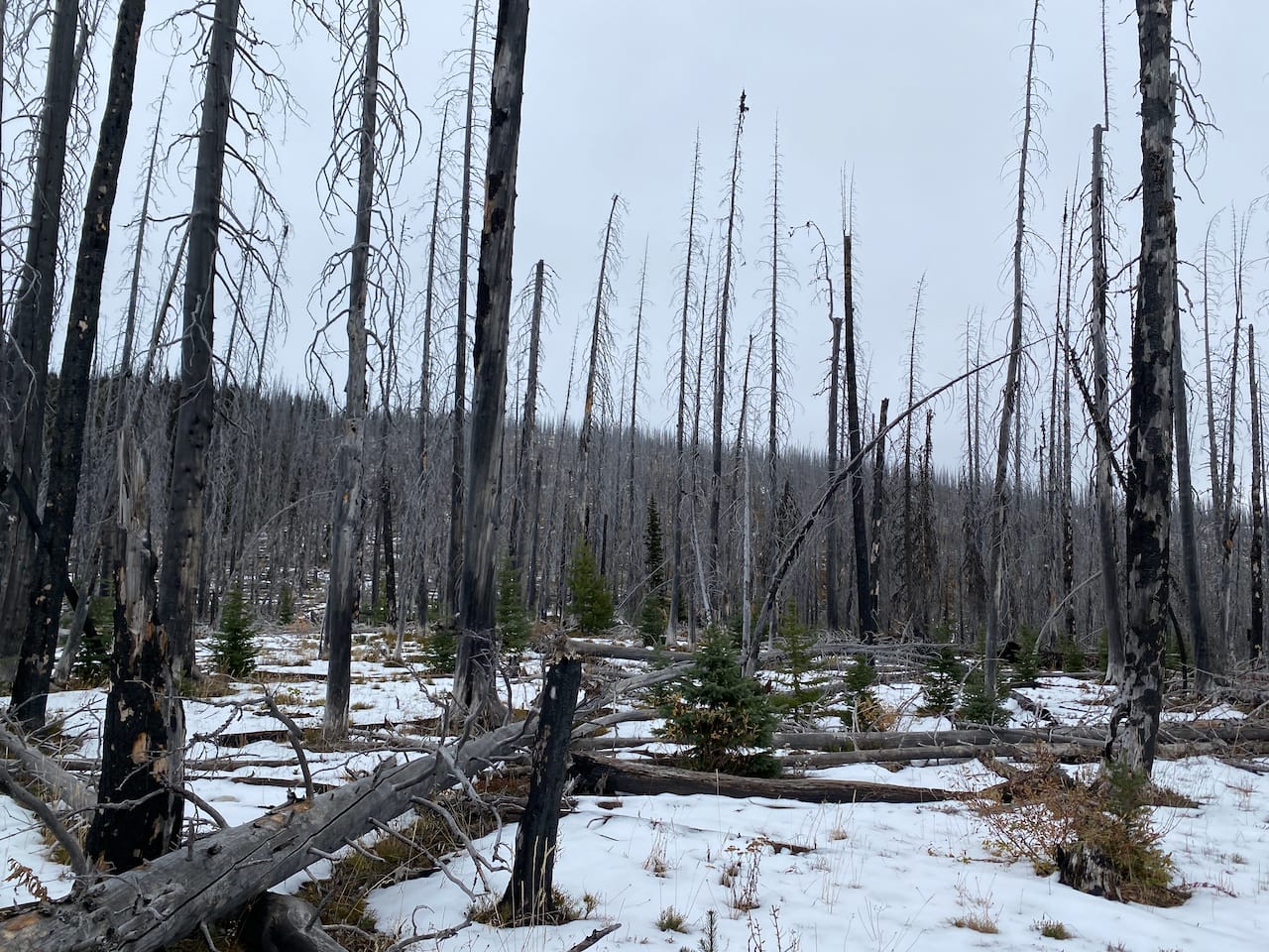
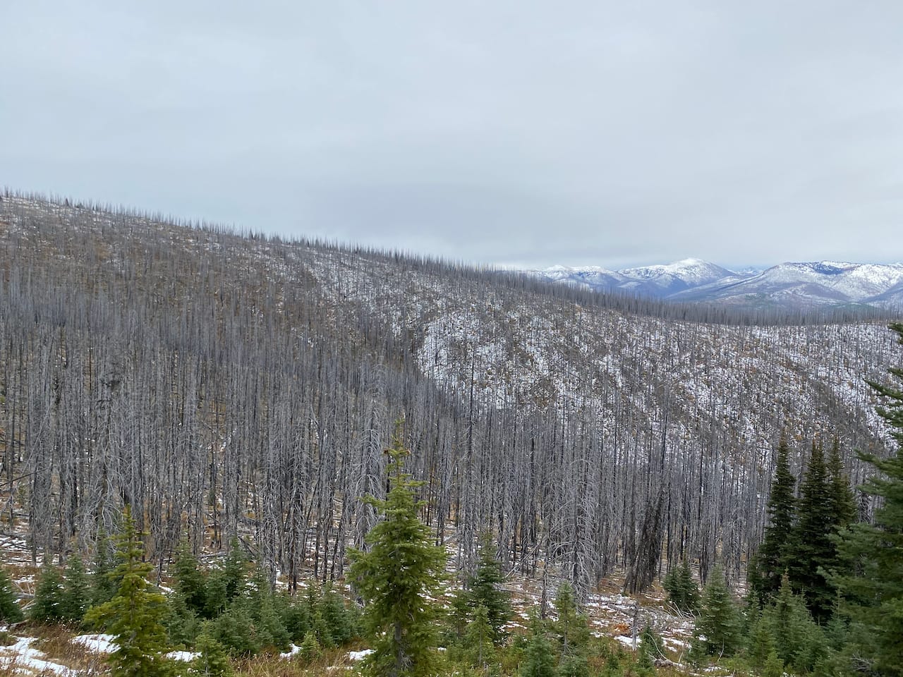
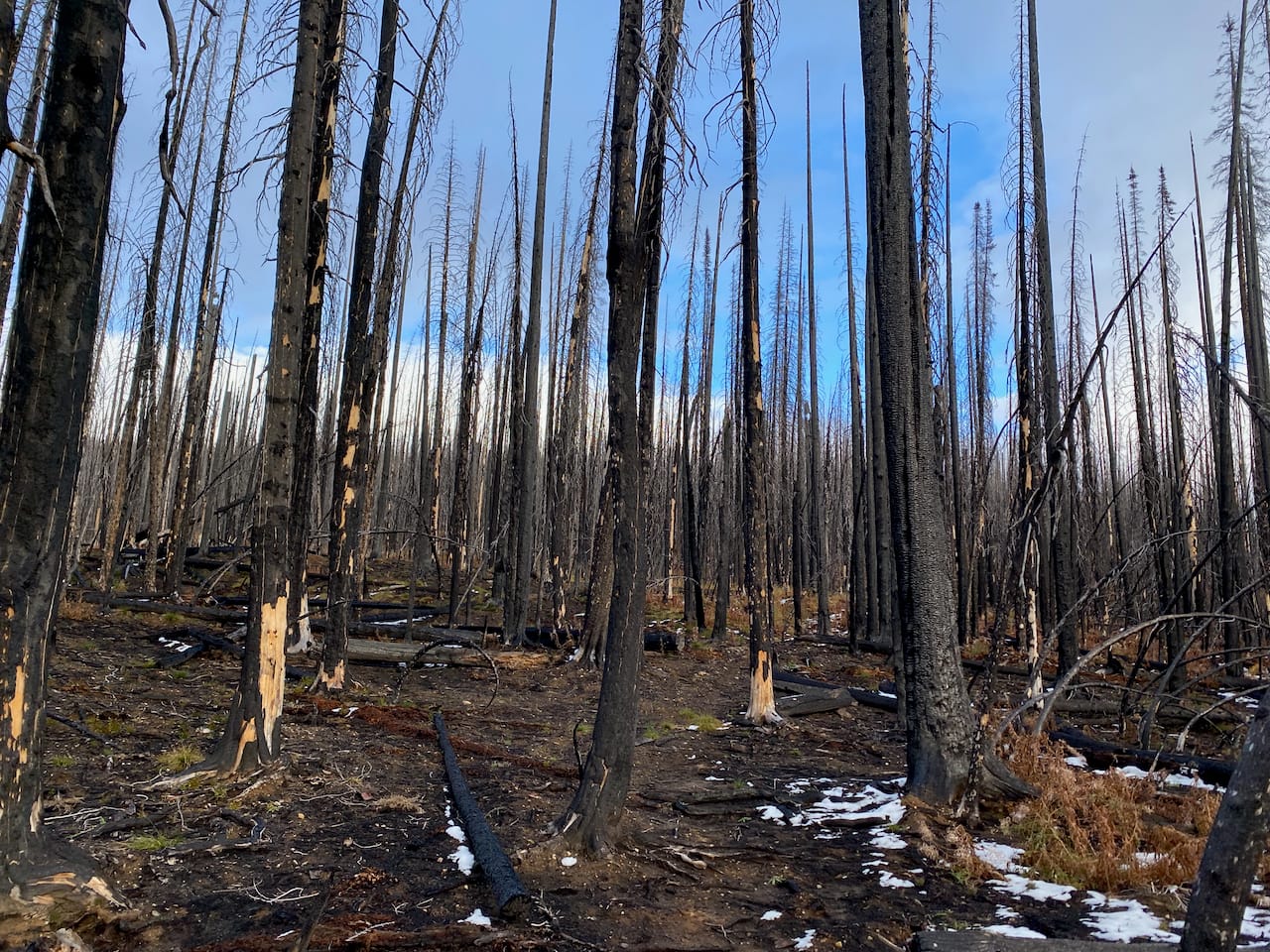
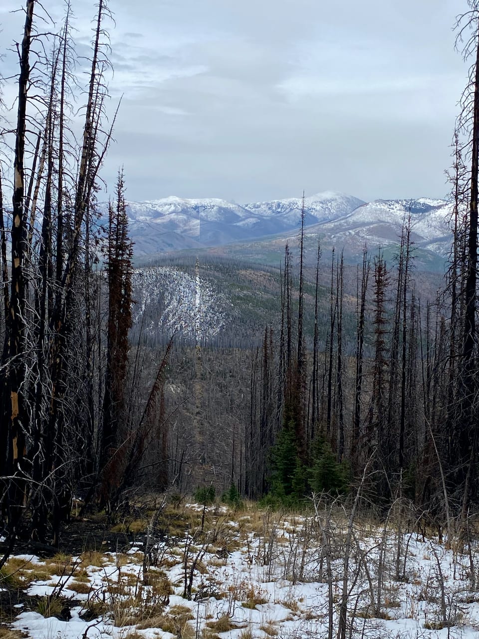
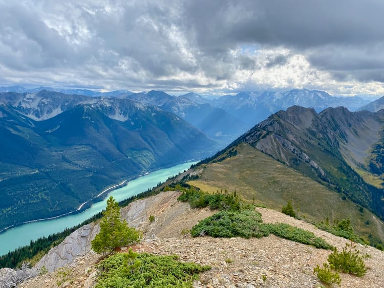
The Pasayten River Trail was easy to follow in places and unidentifiable in others. The forest was so open that walking was easy. Through the burned trees, Monument 83 Peak and larger peaks across the border came into view.
The summit of Monument 83 Peak was easily gained. The clouds briefly cleared, offering good views towards Cathedral Park and the Pasayten wilderness. The border swath was quite striking: a perfectly straight line maintained at all costs, even in such steep and remote terrain.

Storm clouds appeared on the horizon: my cue to get out of there. The wind picked up. As I reached the deadfall wasteland, the wind through the trees made eerie whistling noises that hadn’t been there before. Snow began when I was about 2km from the car, and soon my tracks were covered.
I needed to get out of there. I hurried down the cutblock with snow falling all around me and visibility dropping. The logging road had a thin layer of snow at the top, but I managed to descend before it got too deep. Then came a nerve-wracking drive through driving rain and snow along the Crowsnest. Eventually, I made it home safely.
Member discussion