Great Divide Trail Section G
Mount Robson Welcome Centre -> Surprise Pass (should’ve been Robson -> Kakwa Lake -> Bastille Creek trailhead)
August 22-28, 2025
154km
GDTA Link: https://greatdividetrail.com/go-hiking/section-hiking/section-g/
Side trips: Devout Peak, Jackpine Mountain
In many ways, Section G exemplifies what the GDT is all about. It is the wildest and most remote section of an already wild and remote trail. Hikers cross countless deep rivers, wrestle through seemingly endless fields of willows and mud, and sometimes spend days walking through bogs and floodplains. Some of the (bookable!) campsites don’t exist anymore or are mostly underwater. The reward is some of the most spectacular scenery the trail has to offer. In contrast to the southern sections, the mountains here are more worn down by the harsher climate, and after Mount Robson they never rose as high to begin with. As a result, the GDT spends more time on ridges and alpine plateaus than in previous sections, and numerous alternate routes lead to mountain summits, offering hikers stupendous views of peaks and valleys almost no one has visited.
The weather seemed to flip a switch, and I was treated to a full week of sunshine after the endless rain of earlier sections. Also, it must be said that the GDTA’s excellent work in this area has made the section less intimidating than in years past, with some of the worst bushwhacks now cleared. This section got off to a good start. Things fell apart when I injured my foot near the end of the trail, leading to an evacuation.
Logistics
Technically, section G starts at the junction of the North Boundary and Berg Lake trails, but this is 28km away from the nearest parking lot. Most hikers, myself included, will hike from the junction to the Mount Robson visitor centre along the Berg Lake trail, collect a resupply package, then return the same way.
The other endpoint, the Kakwa Lake cabin, is even harder to access. From the cabin, there are several ways to get back to civilization:
- Walk 100km along the Walker Creek FSR to the Yellowhead Highway, and hitch a ride from there.
- Arrange a pickup along the Walker Creek FSR. Conditions change yearly, as the road is no longer officially maintained. In 2025 the furthest drivable point was about 5km west of the Bastille Bridge trailhead, 33.5km away from the Kakwa cabin. Robson Backcountry Adventures runs a shuttle from here to McBride.
- Walk to Dome Creek, which adds a few extra kilometres to the road walk, and catch a train from there. See the Facebook group for more information.
- Injure yourself and get evacuated. I do not recommend this option.
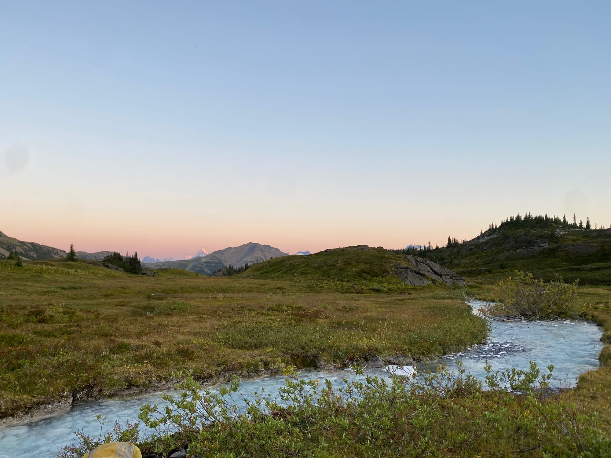
Berg Lake -> near Blueberry Lake
I found myself hiking along the Berg Lake trail at sunset, on my way to a pre-booked campsite at Kinney Lake, 8.6km from the visitor centre. Luckily, the trail’s popularity meant that even at night, it was busier than you’d expect for a trail in the middle of nowhere after dark. I passed several groups also hiking in the dark, and eventually made it to Kinney Lake without incident.
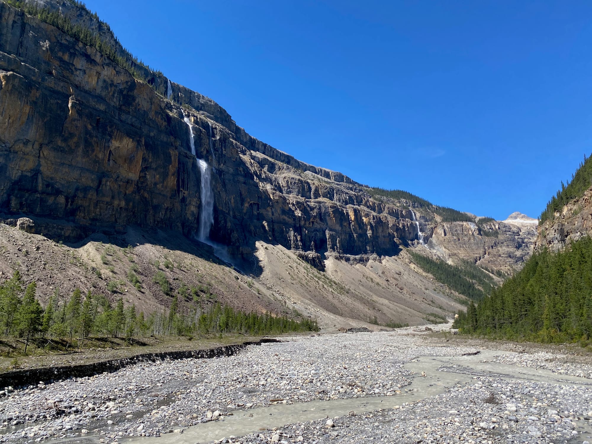
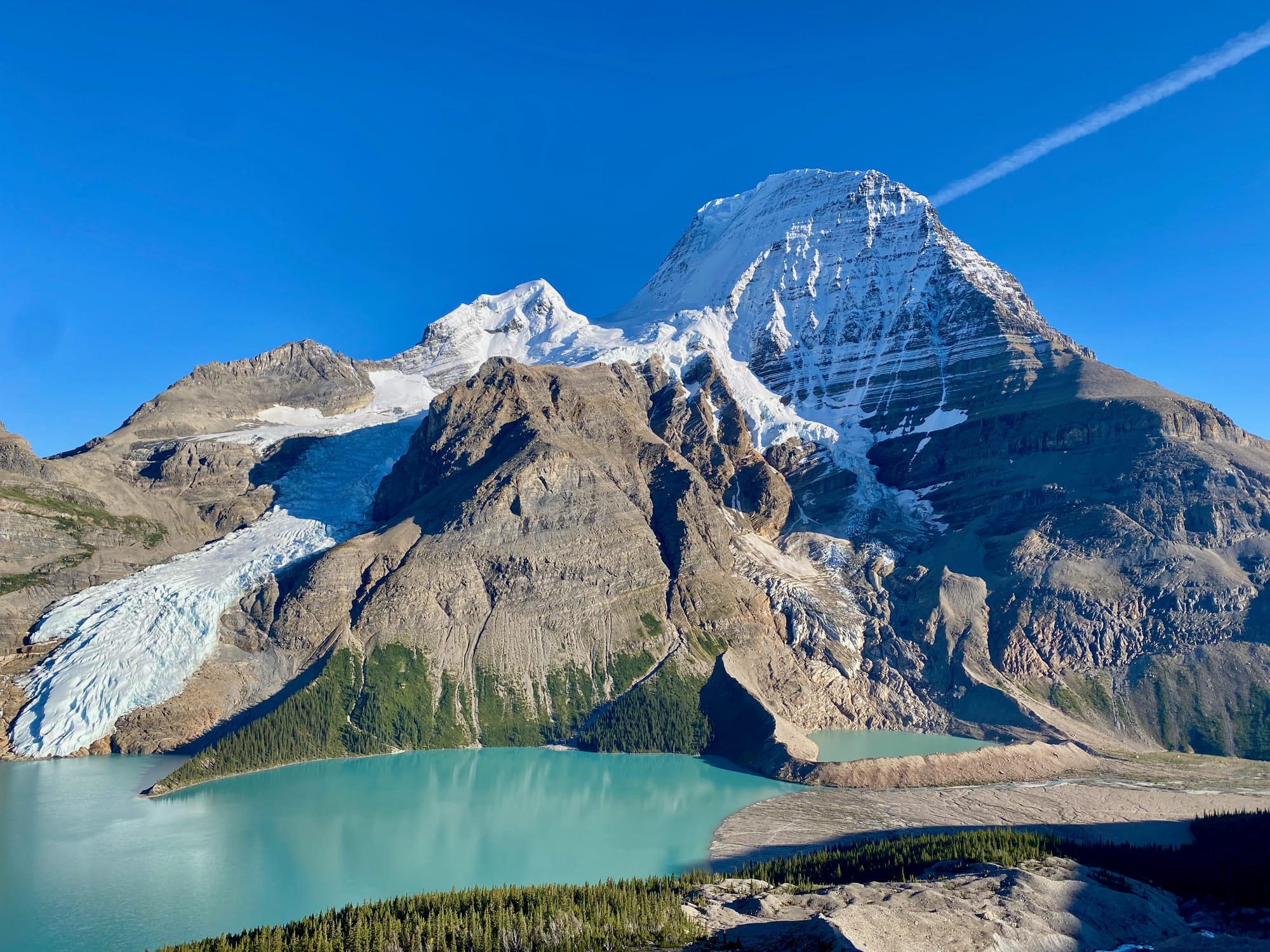
The next morning was, once again, sunny and clear, quite the contrast from the first few rainy weeks of this adventure. I enjoyed a relaxed morning at Kinney Lake, drying stuff, alarming day hikers, and soaking up the sun and the views. I eventually began the long grind up the Berg Lake trail. With 8 days’ worth of food on my back, this was more difficult than one would expect given how well-maintained the trail is. I got a few strange looks from hikers carrying much lighter packs with 1-2 days worth of food. On the way, I visited most of the waterfalls I’d missed on my rush to the visitor centre. Each one was stunning, especially Emperor Falls, with Robson towering above.
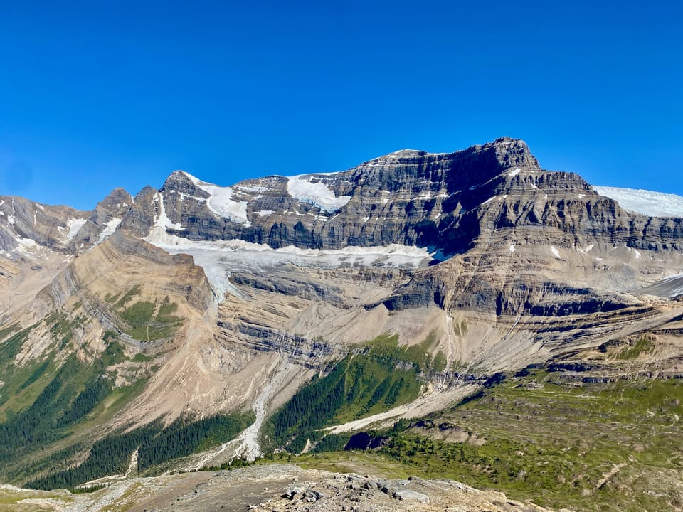
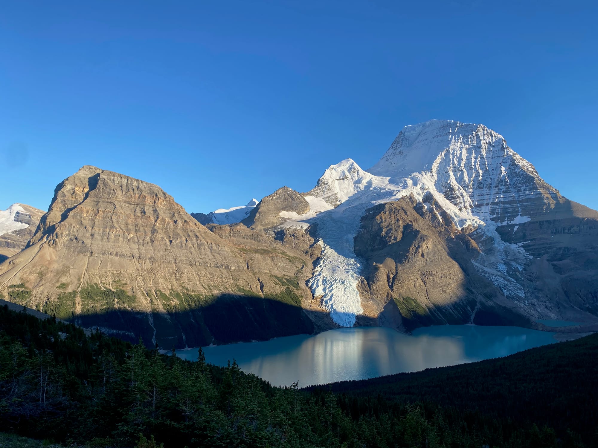
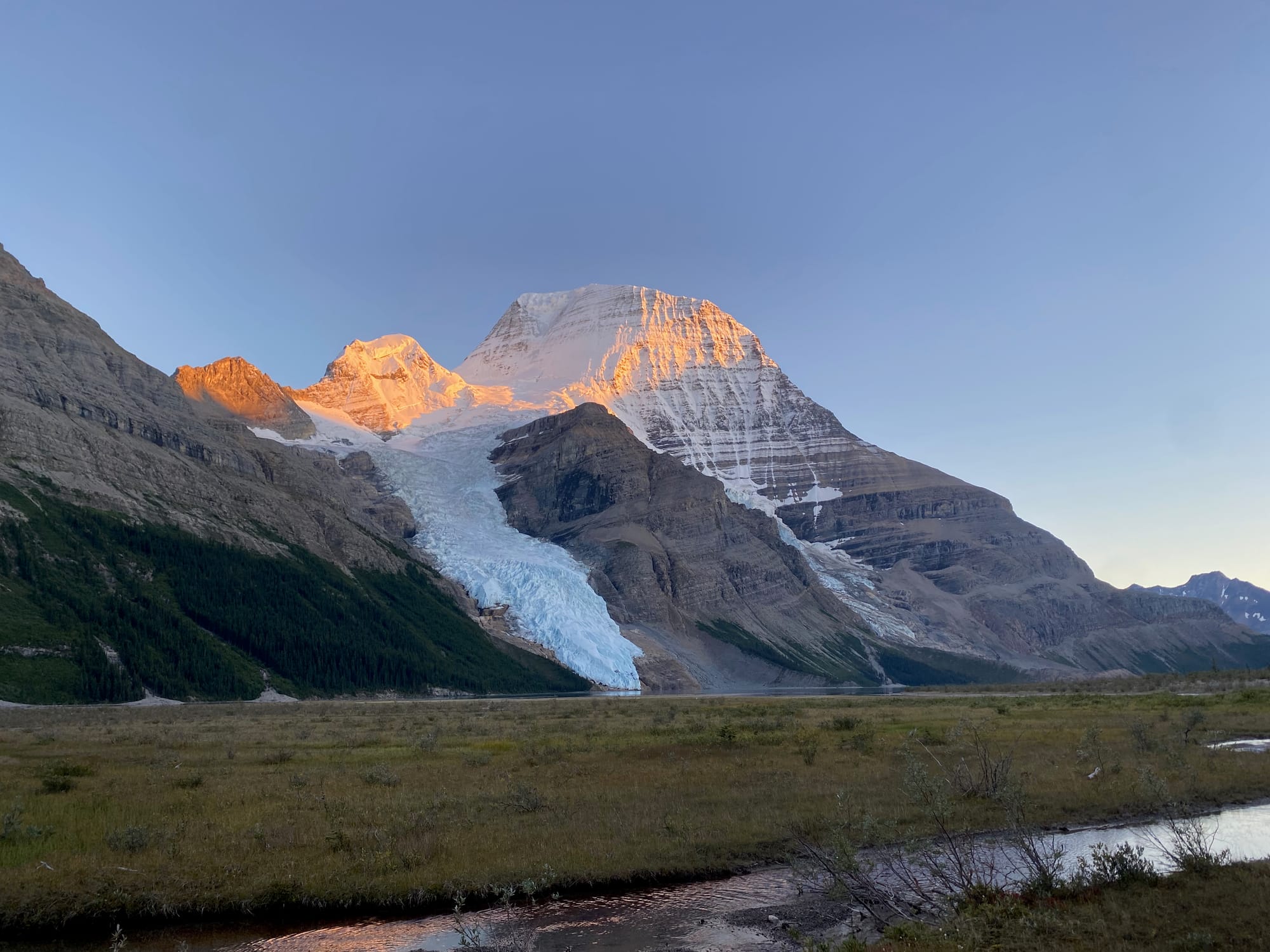
Once again, Robson stole the show. This time, there were no clouds hiding the summit, a very rare occurrence. I took the upper route via Hargreaves Lake to get a better perspective, returning to the main trail at the Berg Lake campsite. I exited the park at sunset, looking back every few minutes to see the changing light on Mt. Robson’s massive northern face.
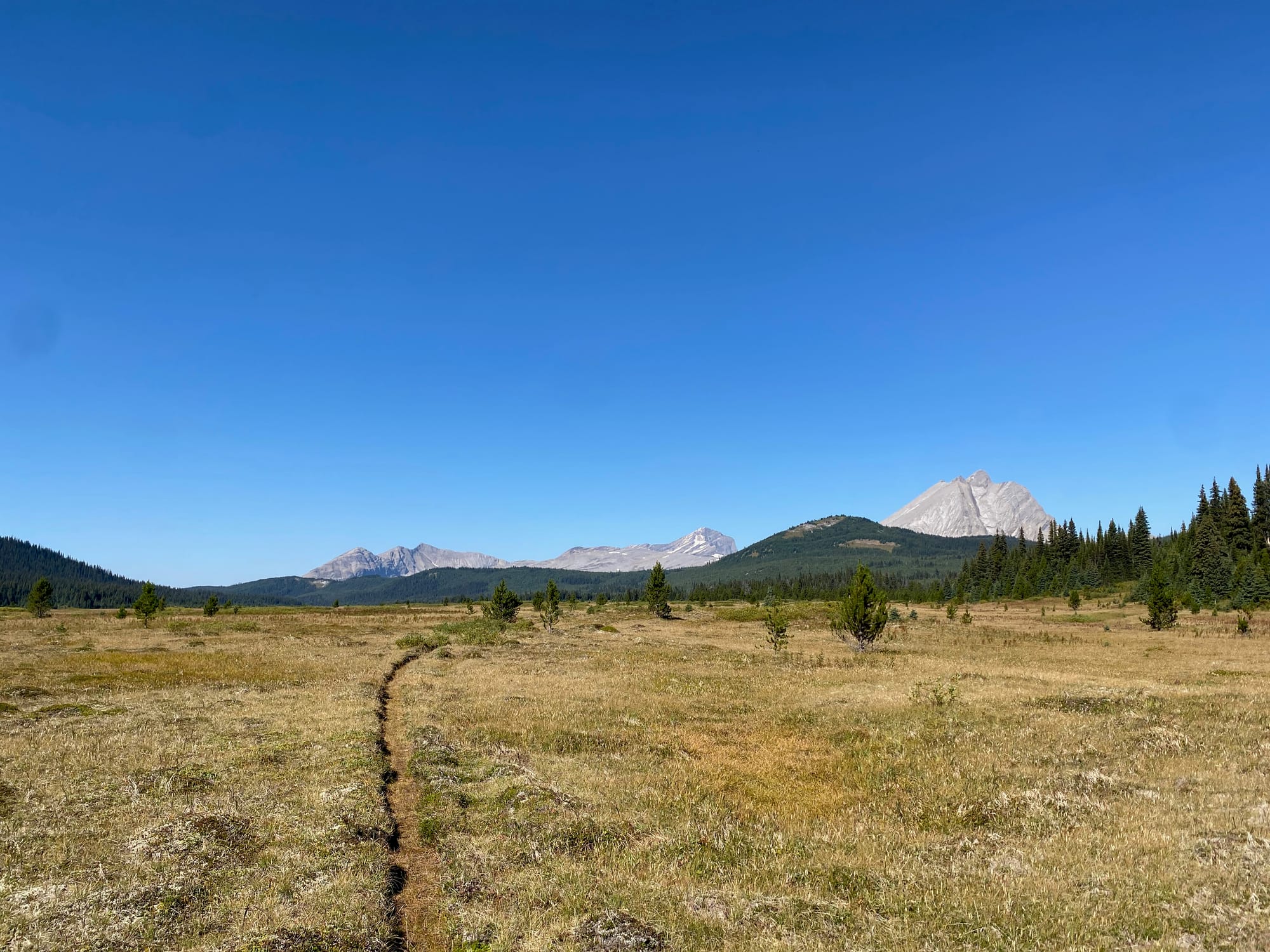
Past the park boundary, the well-maintained trail faded away as Mt. Robson receded behind me. I soon reached the junction marking the official start of Section G.
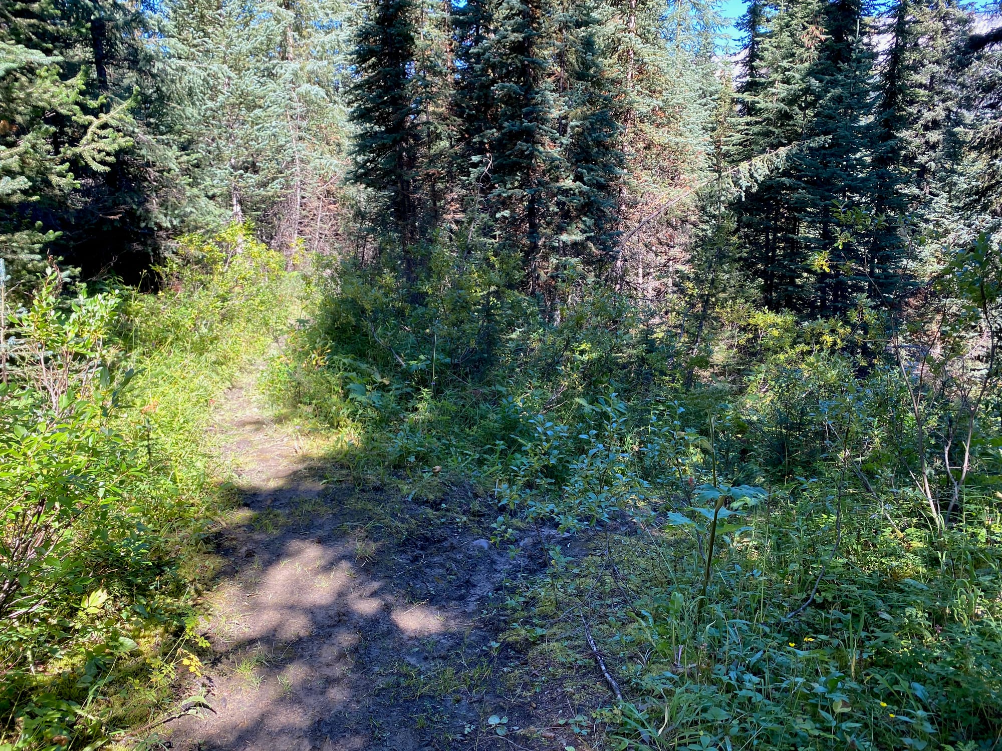
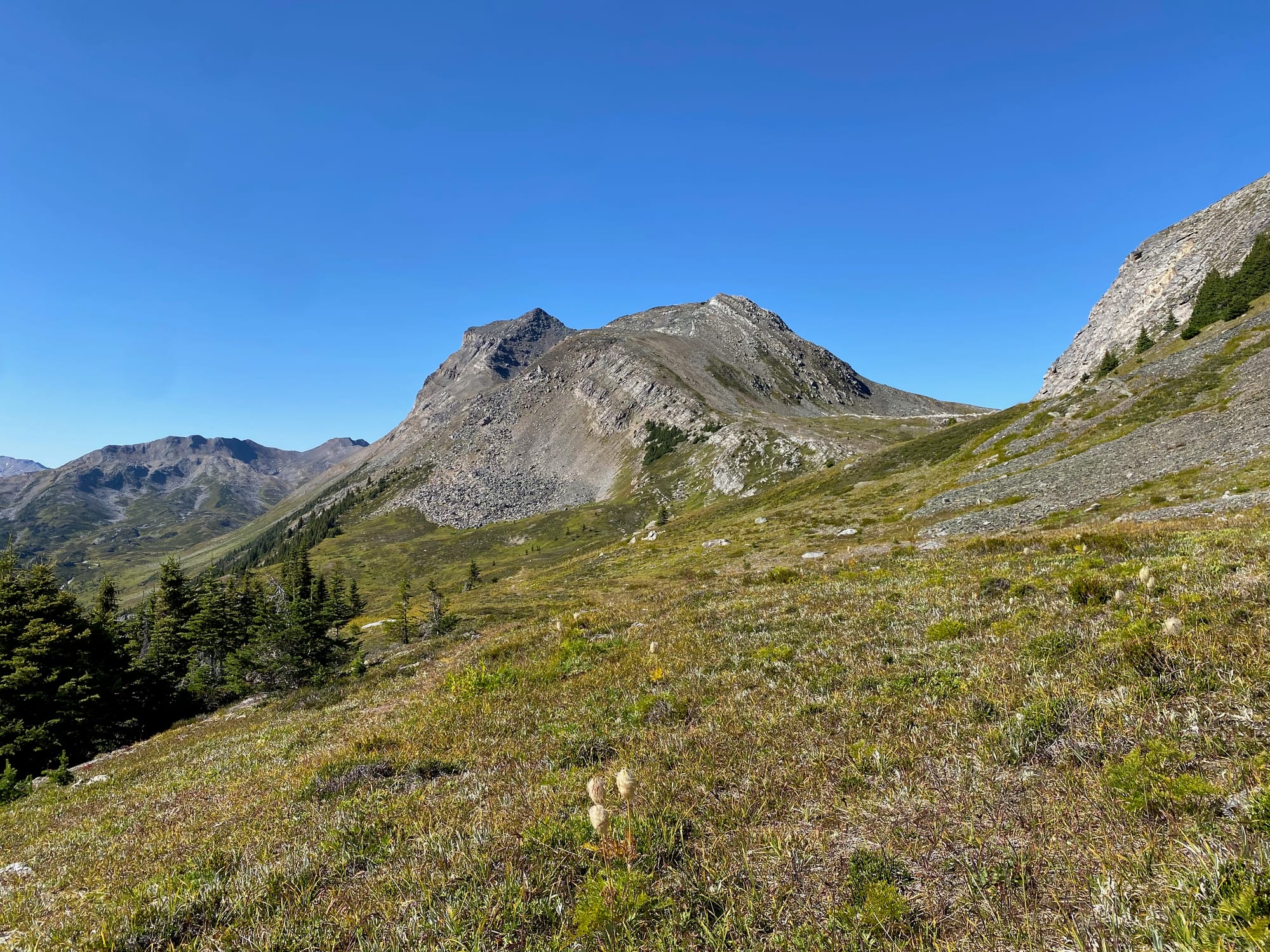
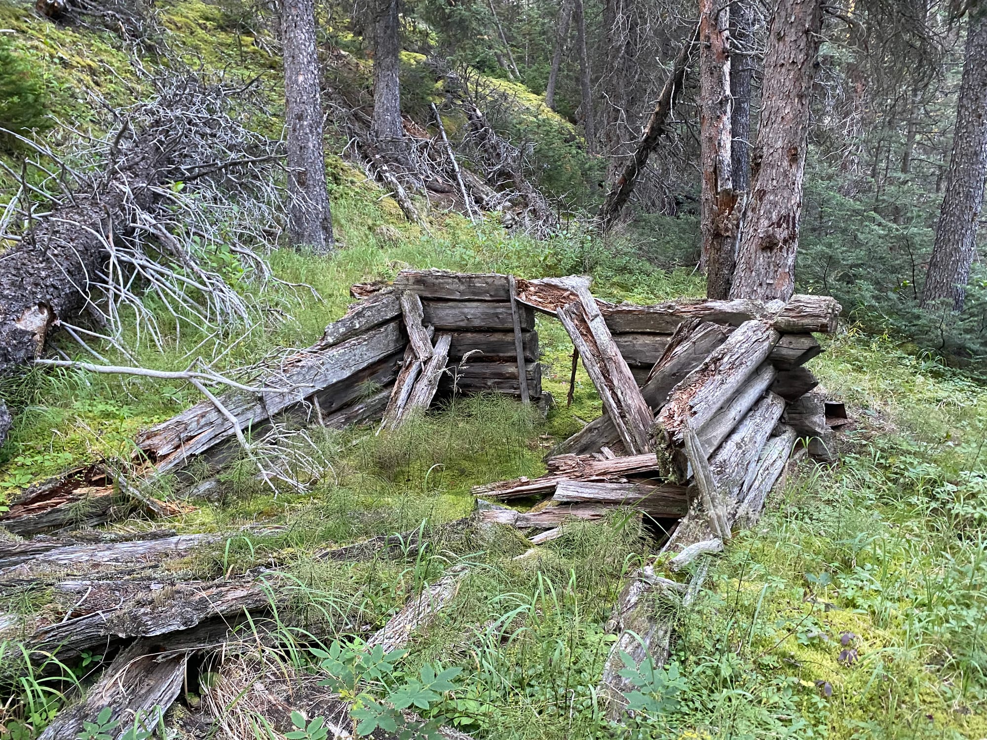
This section of the GDT follows the North Boundary Trail, which used to be a popular backpacking route, but is now officially decommissioned. I continued north on the Smoky River floodplain, crossing a few creeks which ended my longest streak of dry feet. I’d been warned about Carcajou Creek, which had stopped another hiker, but luckily I reached it early in the day and it was only waist-deep.
Past Carcajou Creek, I took a side trip to Peak 2689/“Devout Peak”, one of the mountains along the Smoky valley. Here, more than anywhere, I was getting into the middle of nowhere, with the GDT kilometres away and almost a vertical kilometre below me. I turned around before an especially technical section near the summit. On the way down, my Nalgene somehow broke after being dropped from hip height. They’re not supposed to do that…
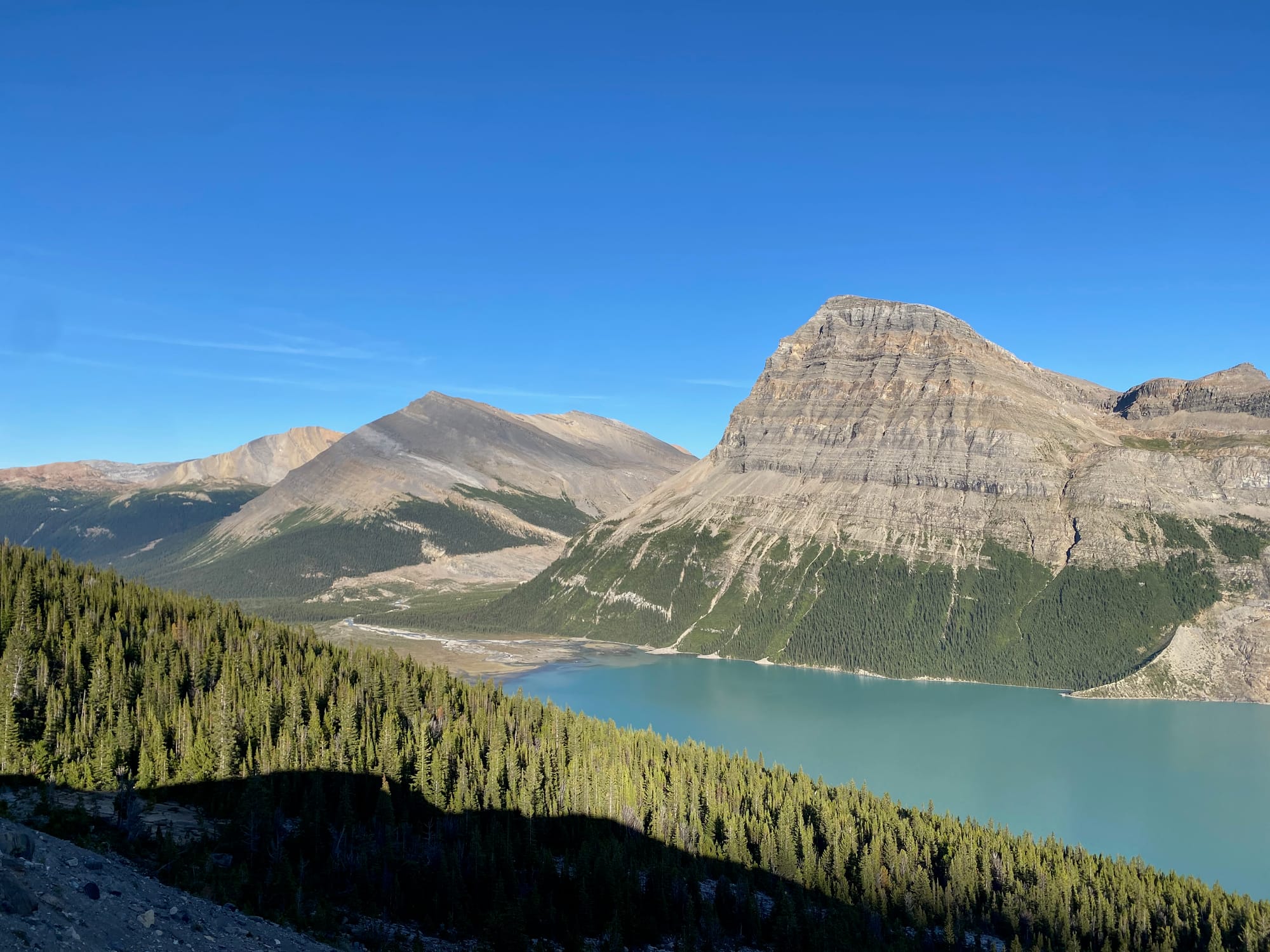
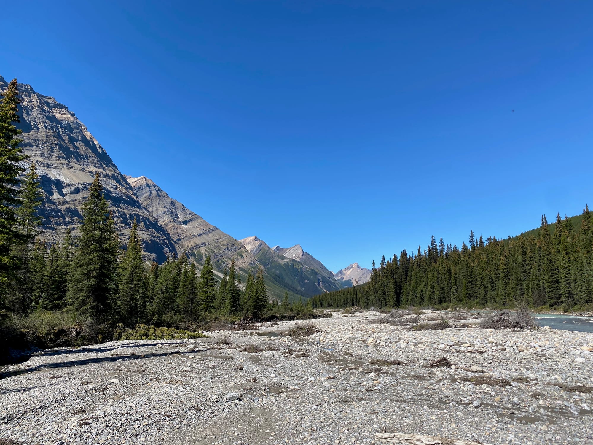
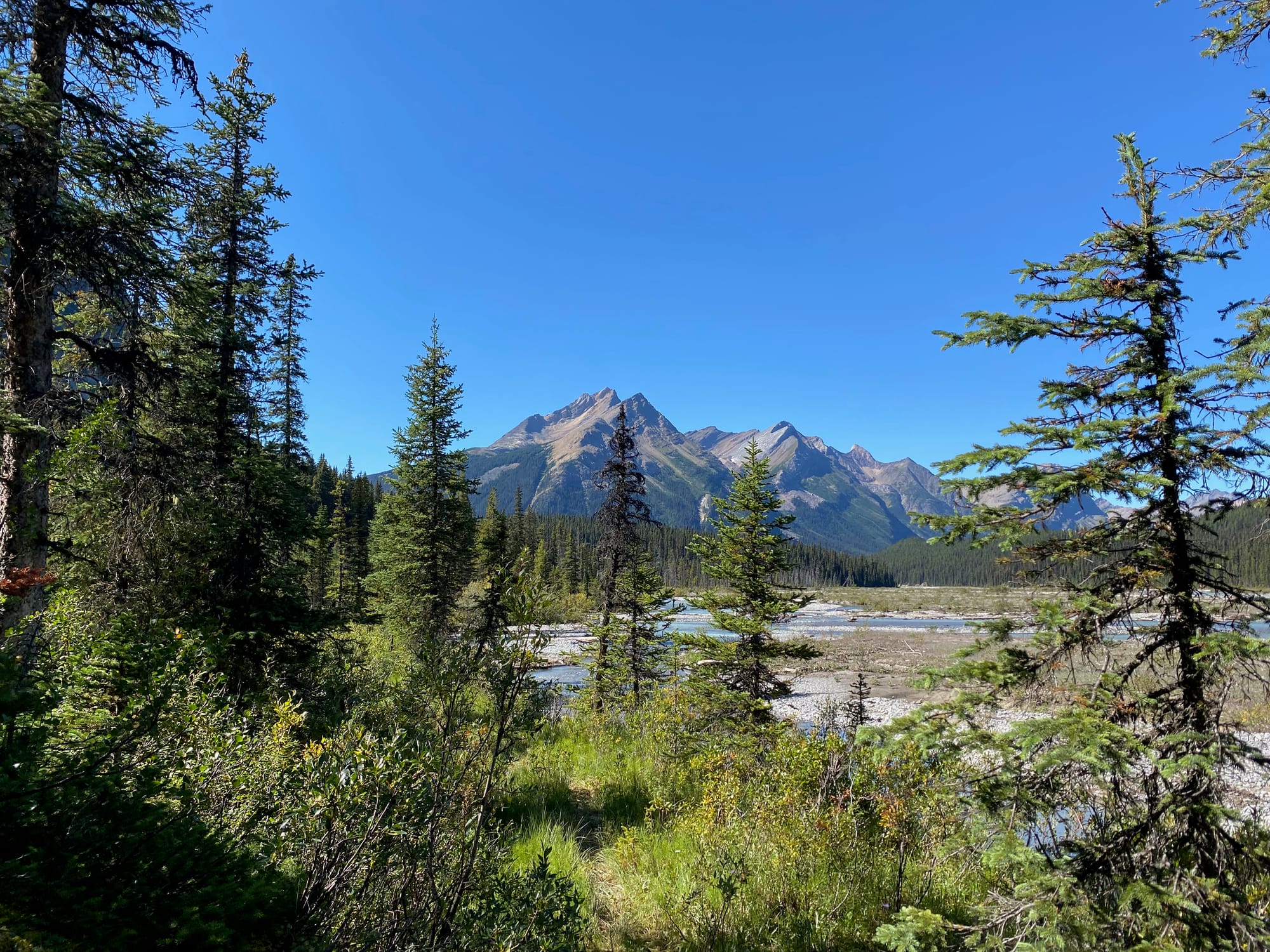
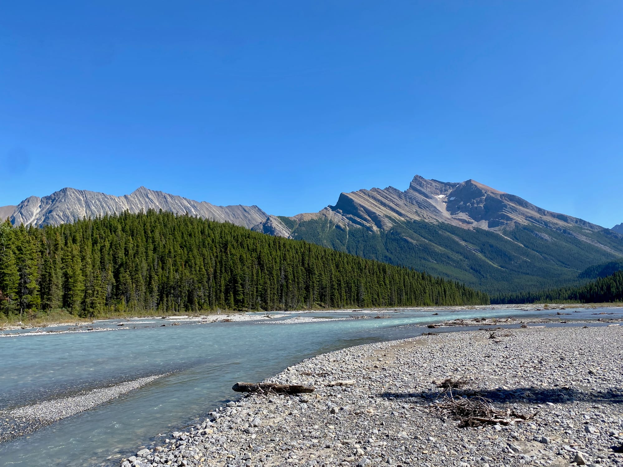
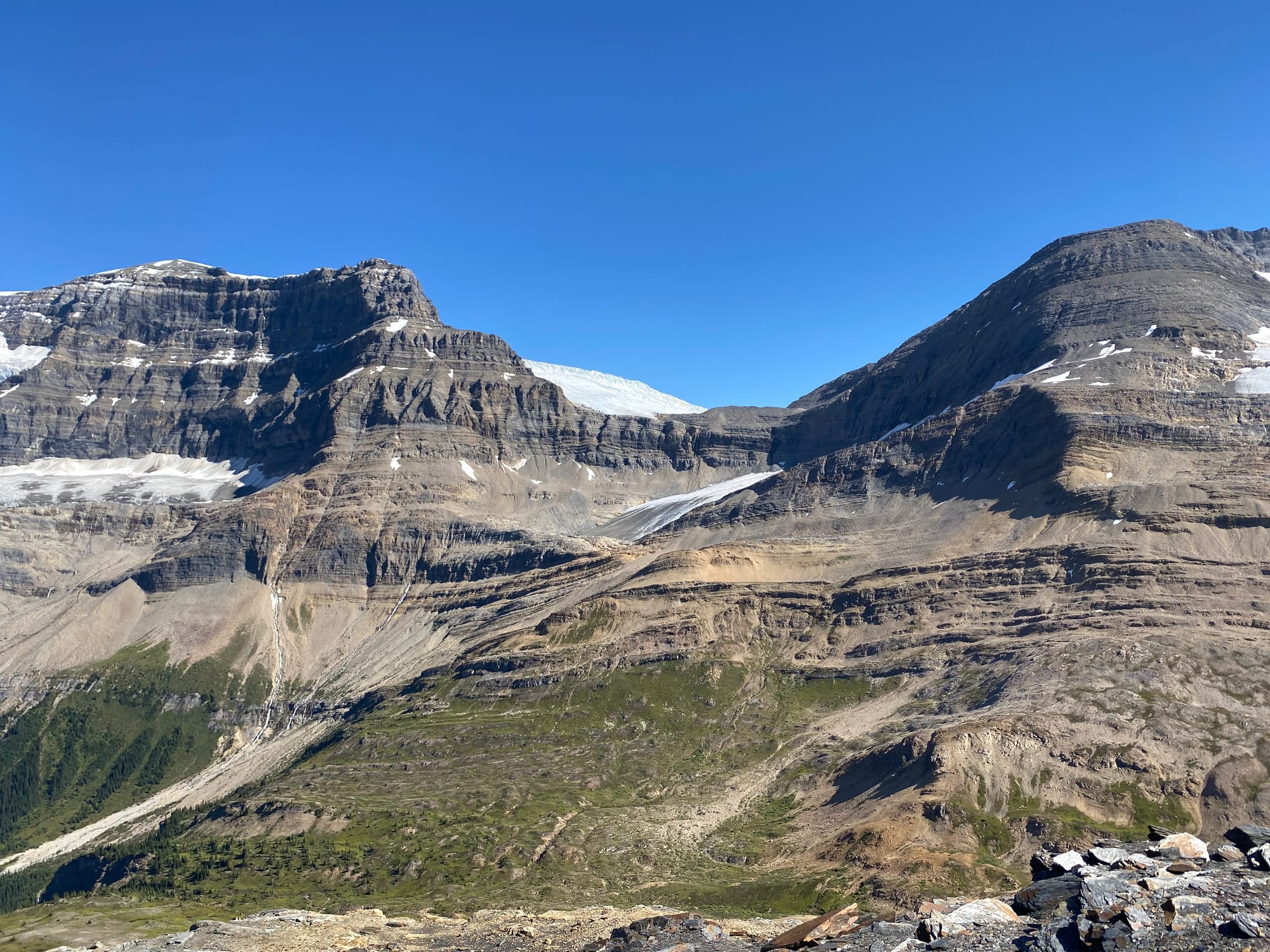
Back on the GDT, I continued along the Smoky floodplains, then to an especially precarious crossing of the Chown River followed by a walk along the creek. It was late in the day by that point, and Chown Creek was overflowing its banks, requiring a few traverses along cliffs and deadfall-strewn forests as I approached Bess Pass.
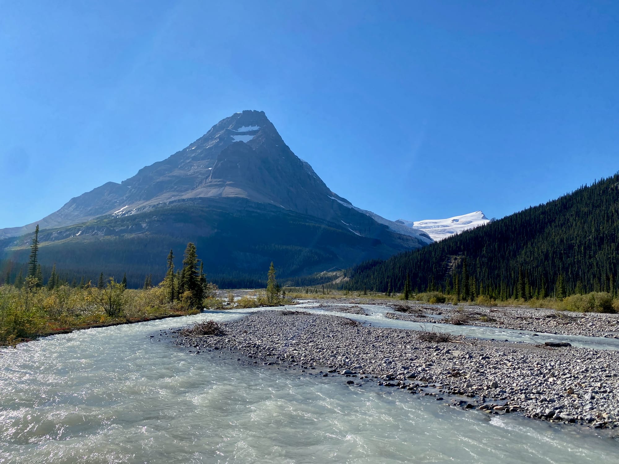
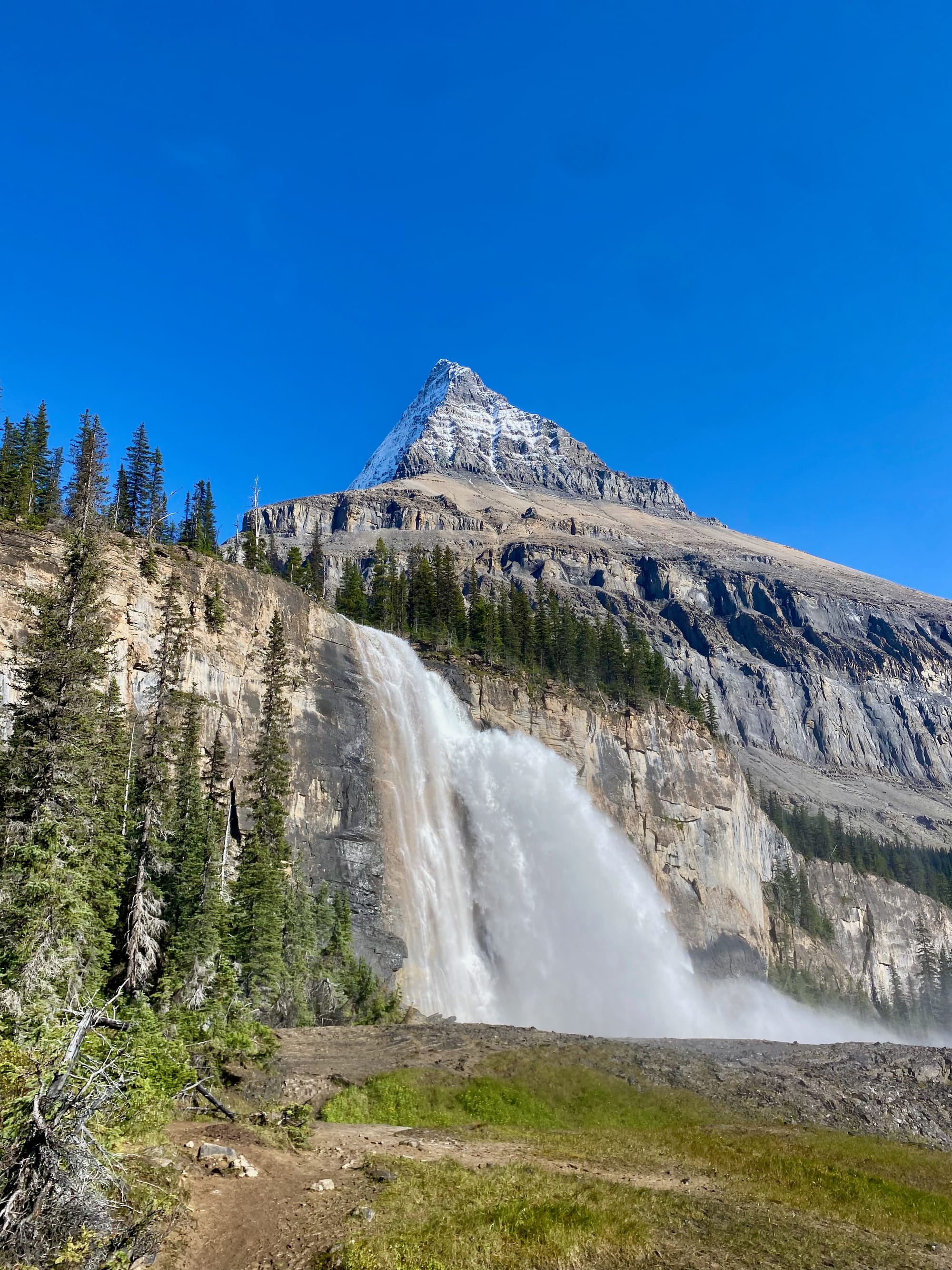
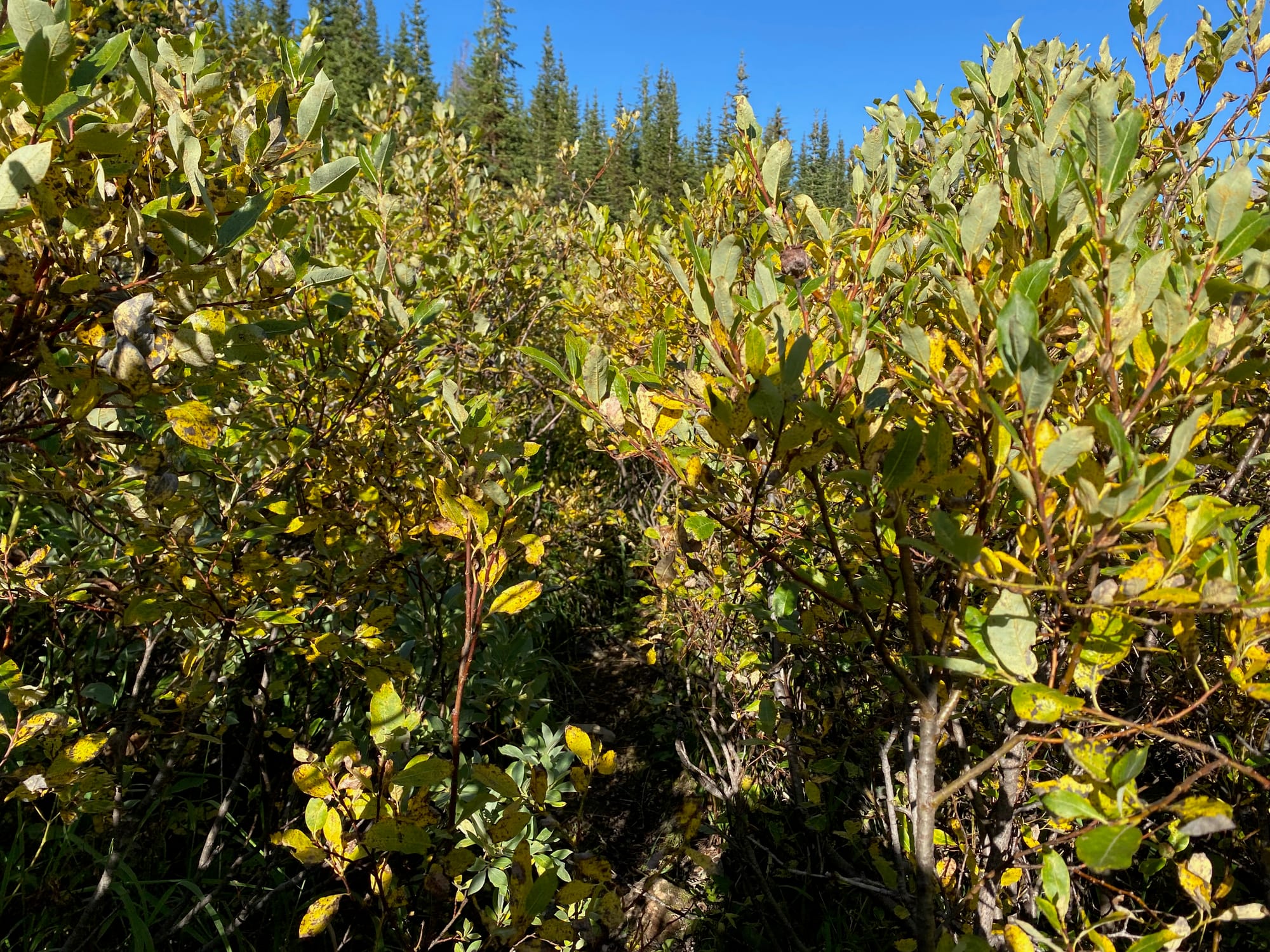
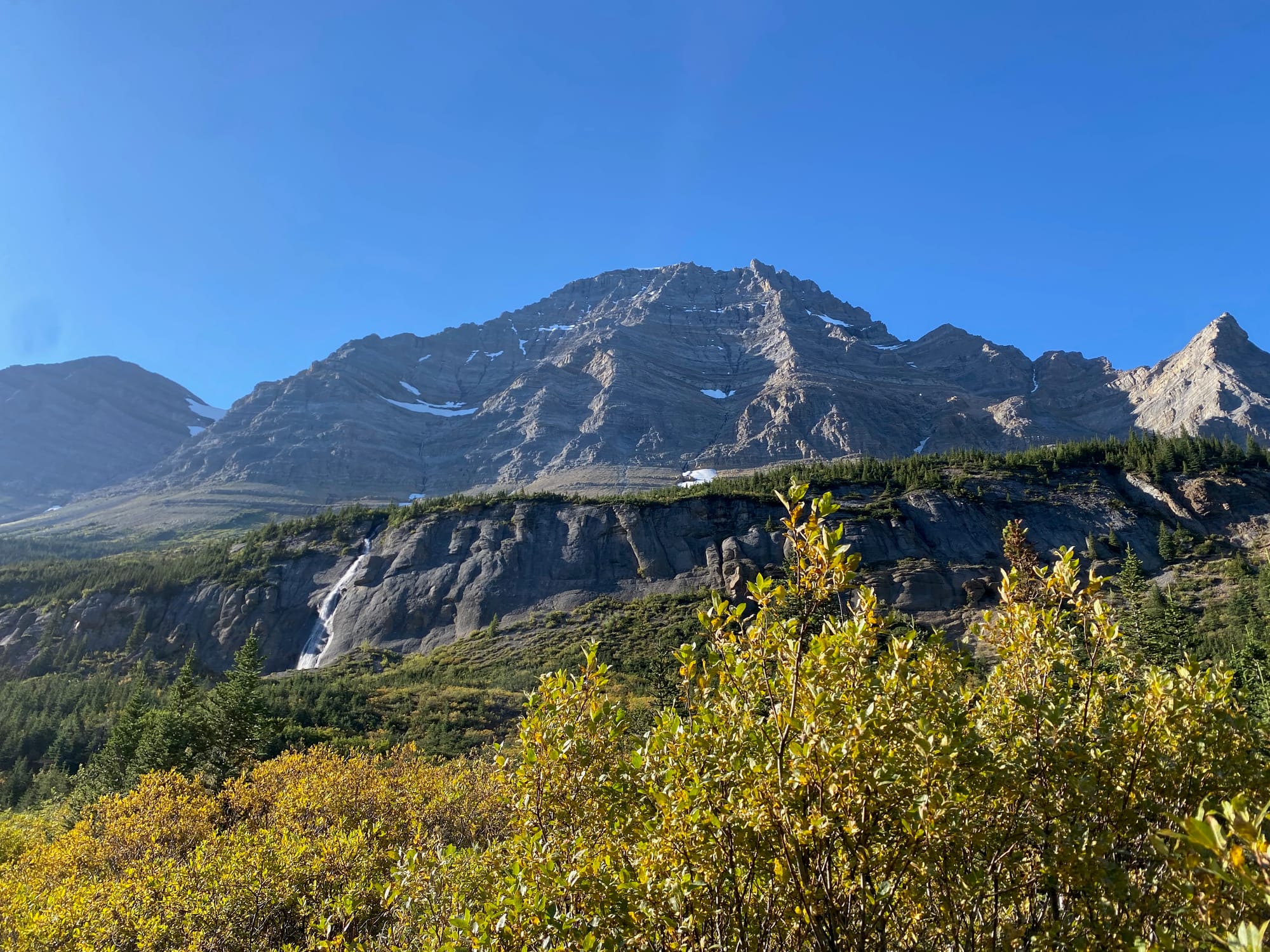
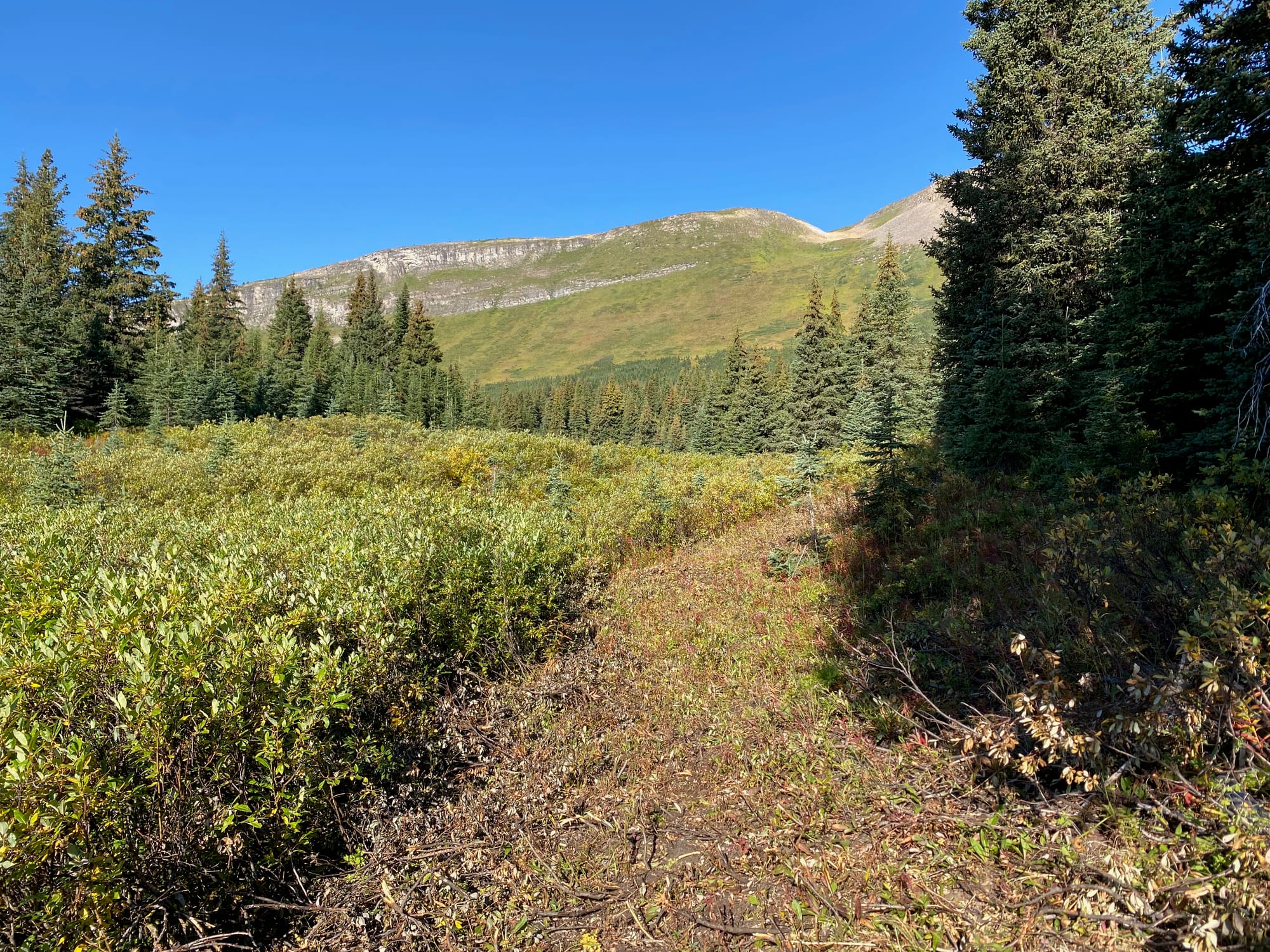
Bess Pass was the first annoying bushwhack in a while, with several kilometres of tangled willows above mud. For a while, a stream runs along the trail. This far north, the leaves were already starting to turn yellow. Past the pass, the trail traverses the side of Mount Bess; above the trail, meltwater from the icefield feeds several waterfalls, creating a surprisingly difficult creek crossing.
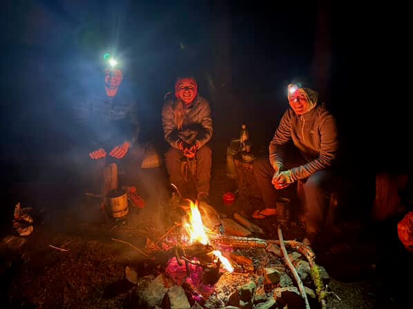
I arrived at the Jackpine horse camp. To my surprise, there was someone else there: V, a thru-hiker from the Czech Republic. It was nice to see another person again. He had some time after finishing his hike and was going back to Bess Pass to do some trail maintenance. He even offered to carry out some of my trash (thanks!). What an absolute legend.
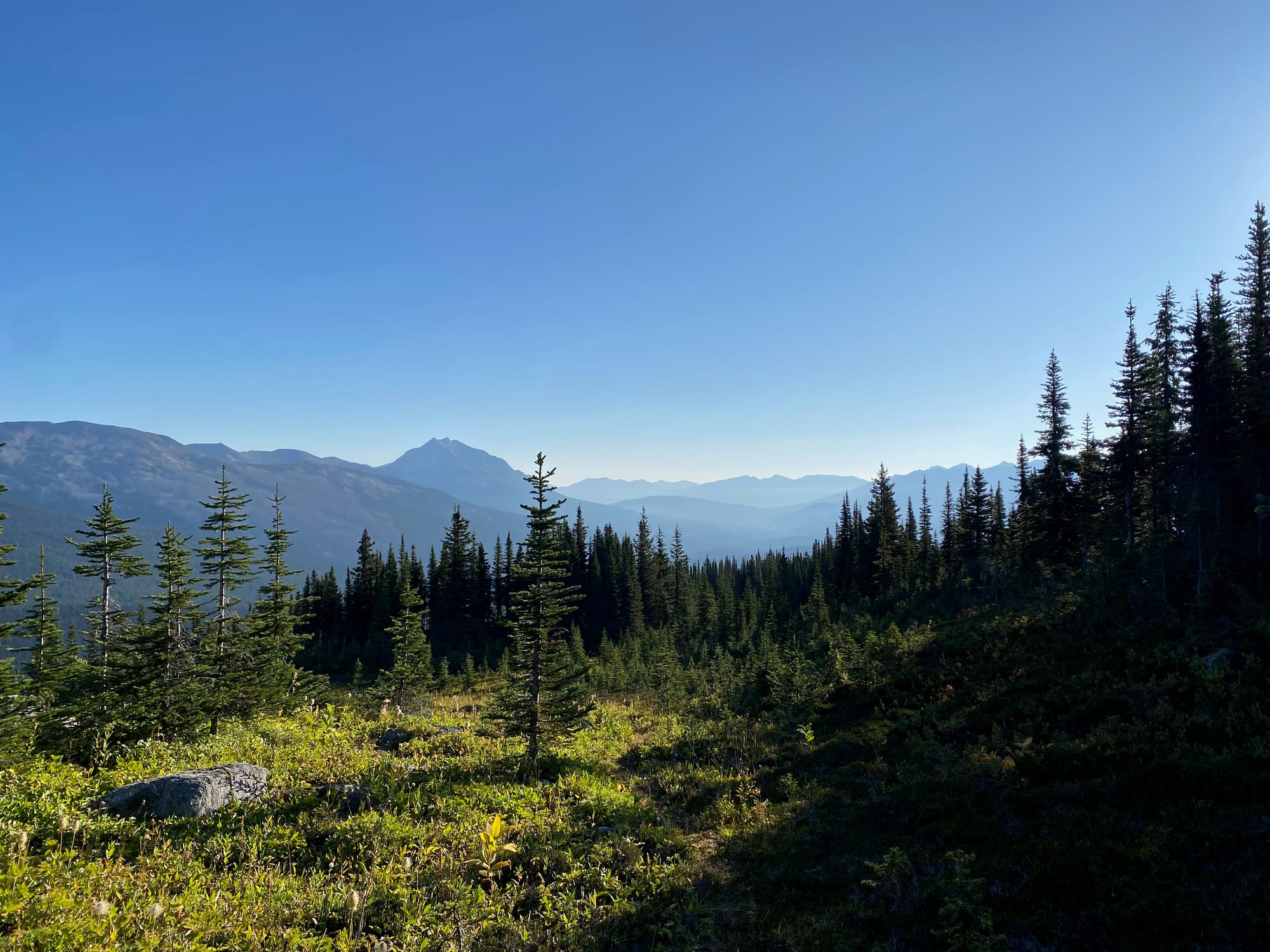
The next day’s route: the Jackpine High Route, one of the longest alpine stretches of the GDT. Wow.
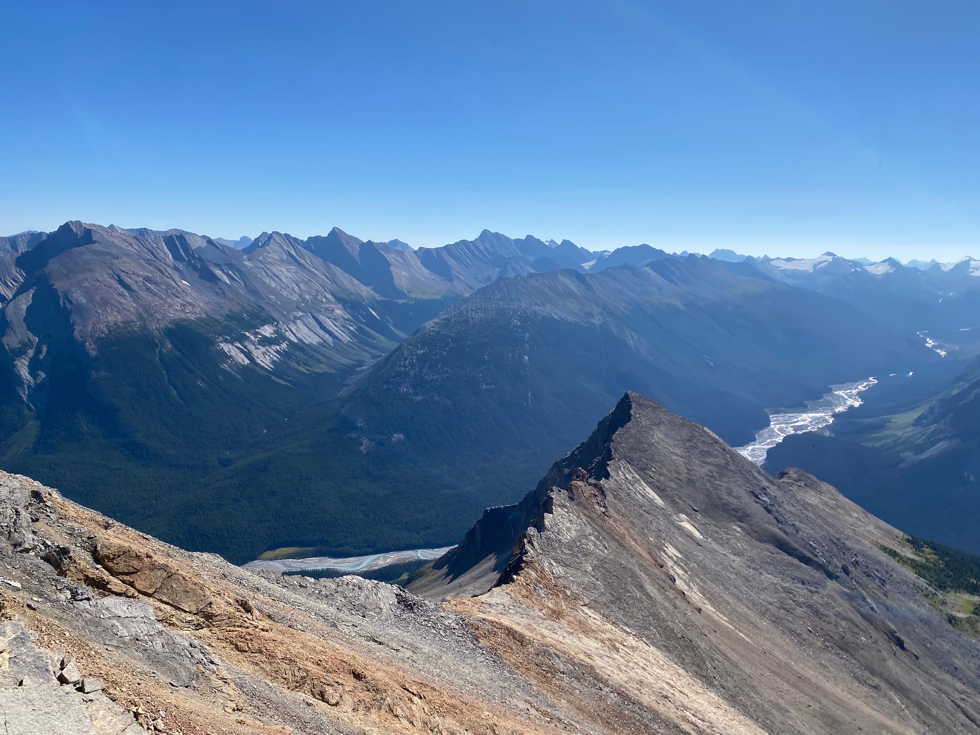
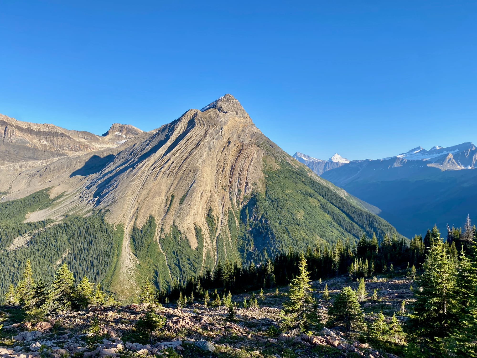
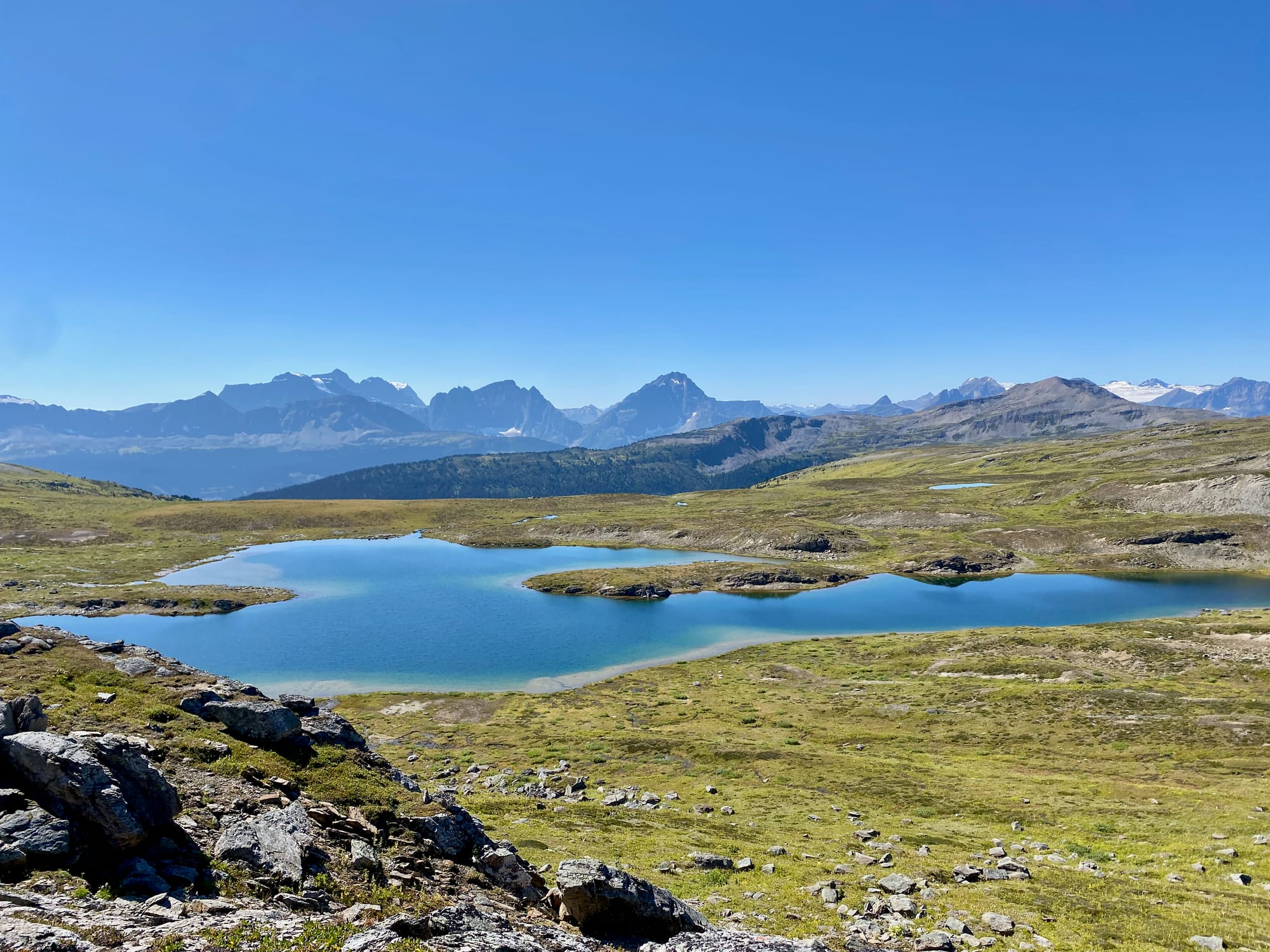
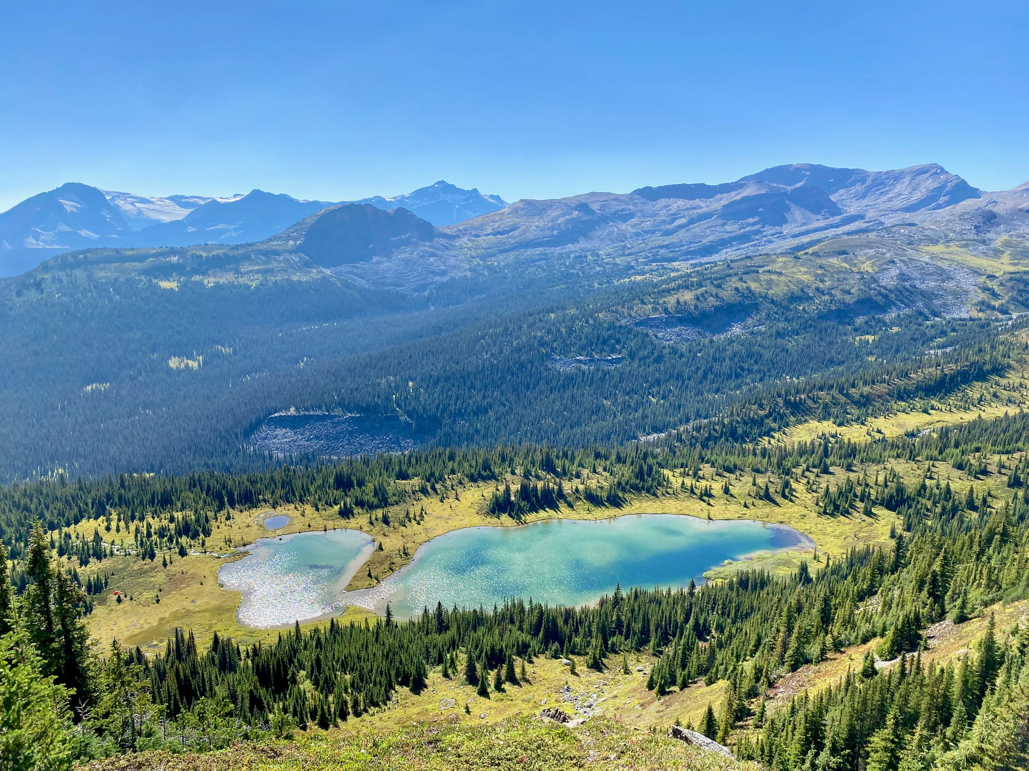
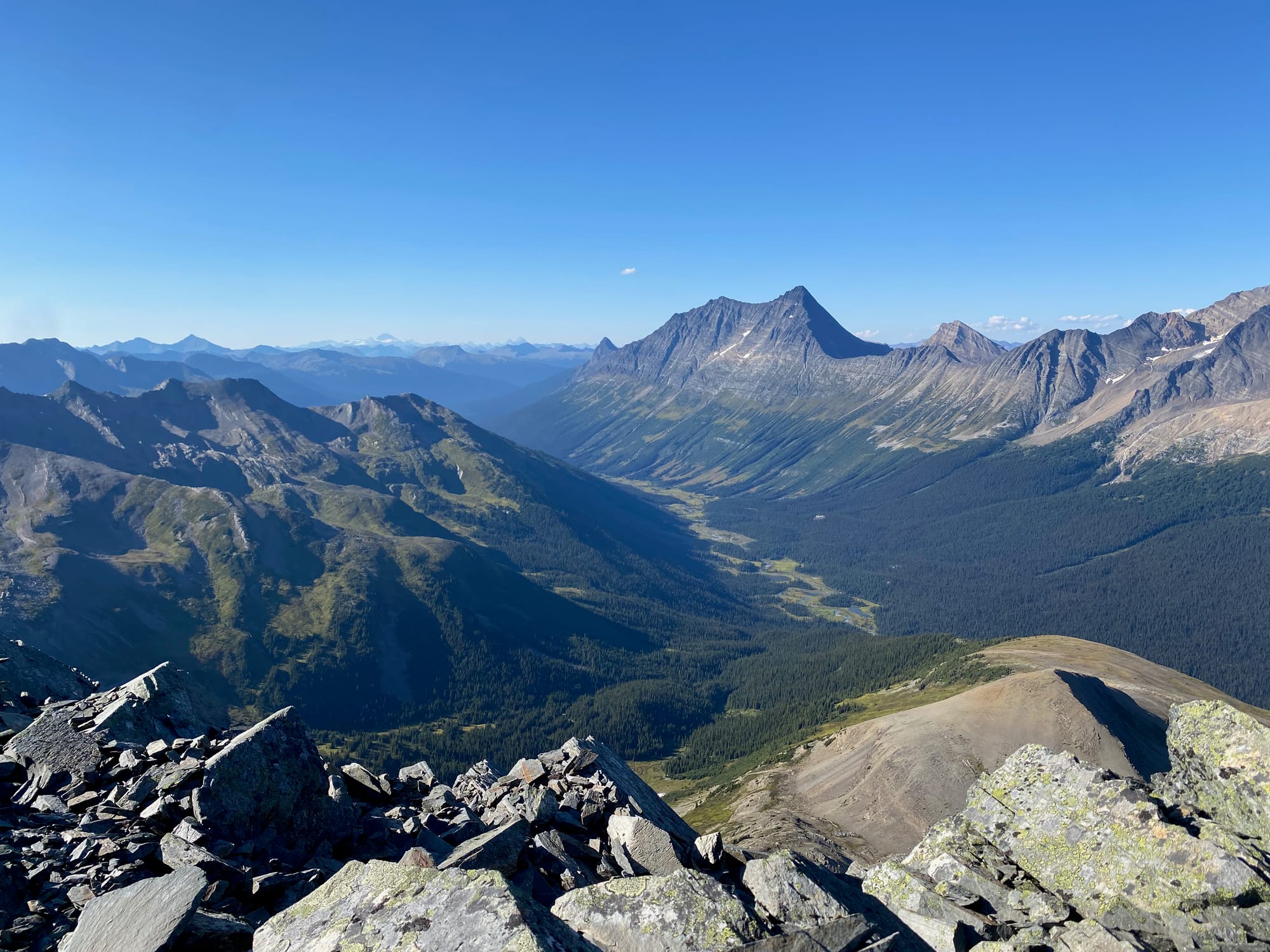
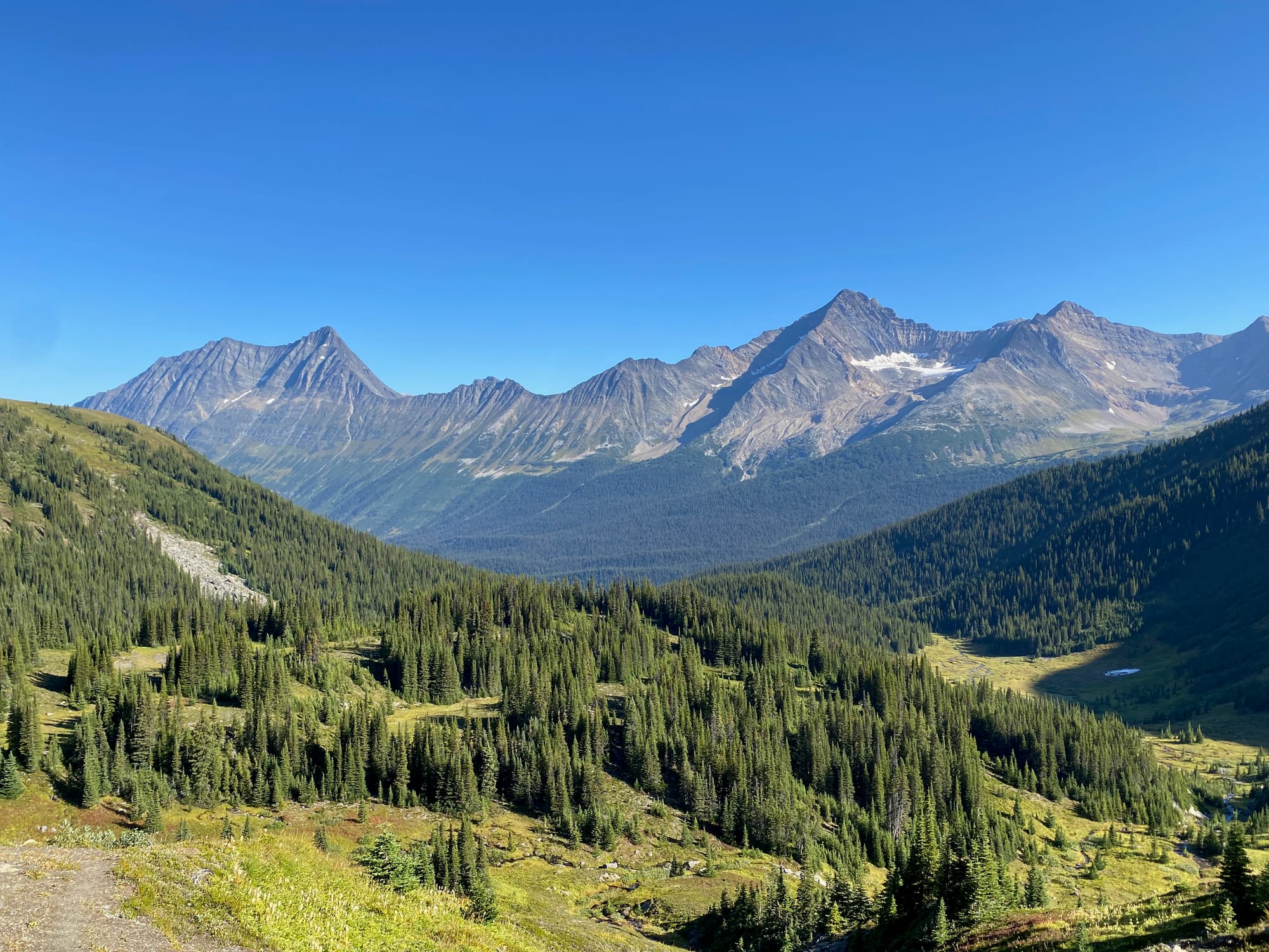
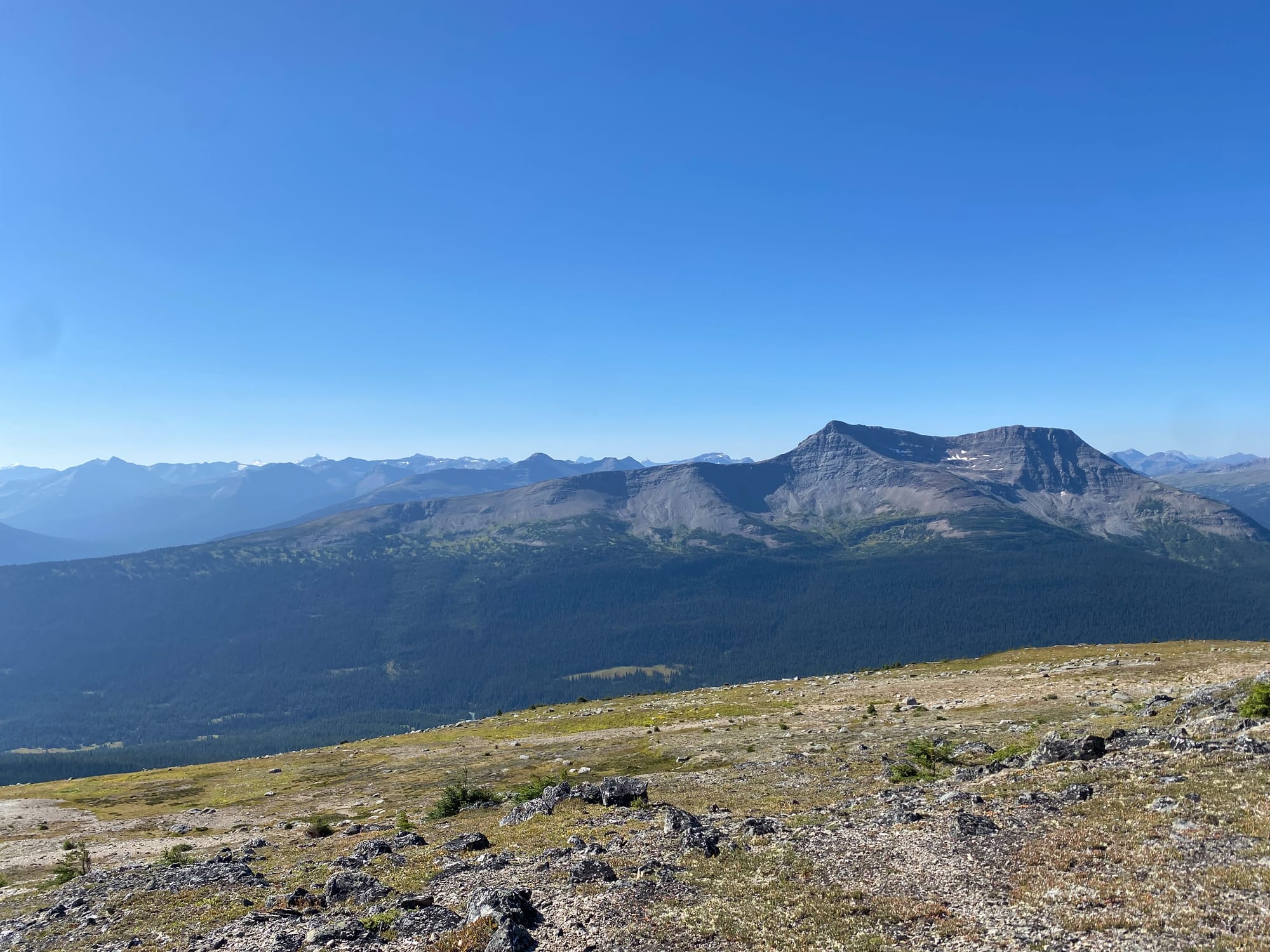
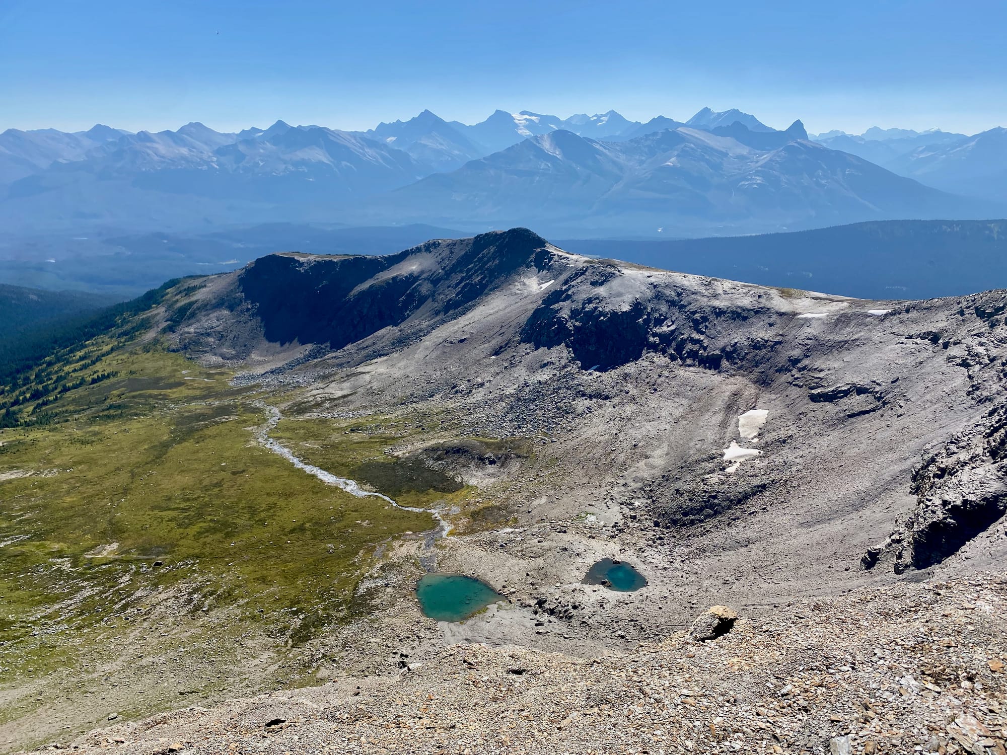
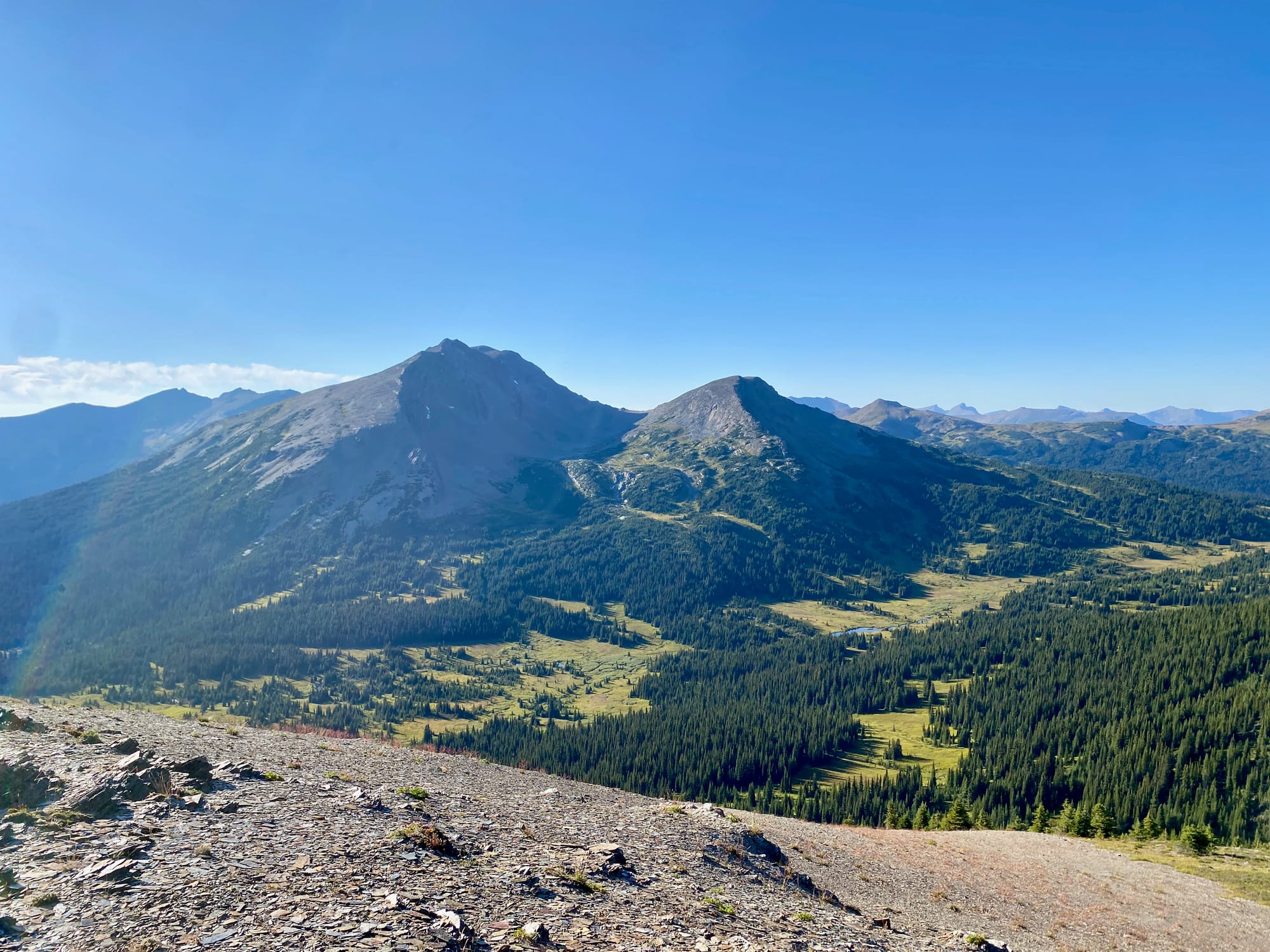
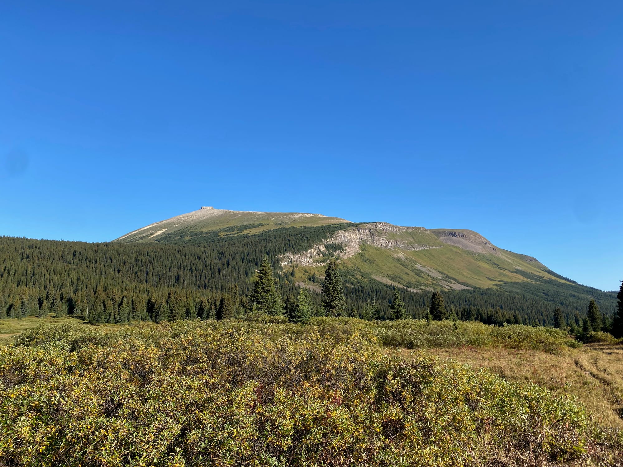
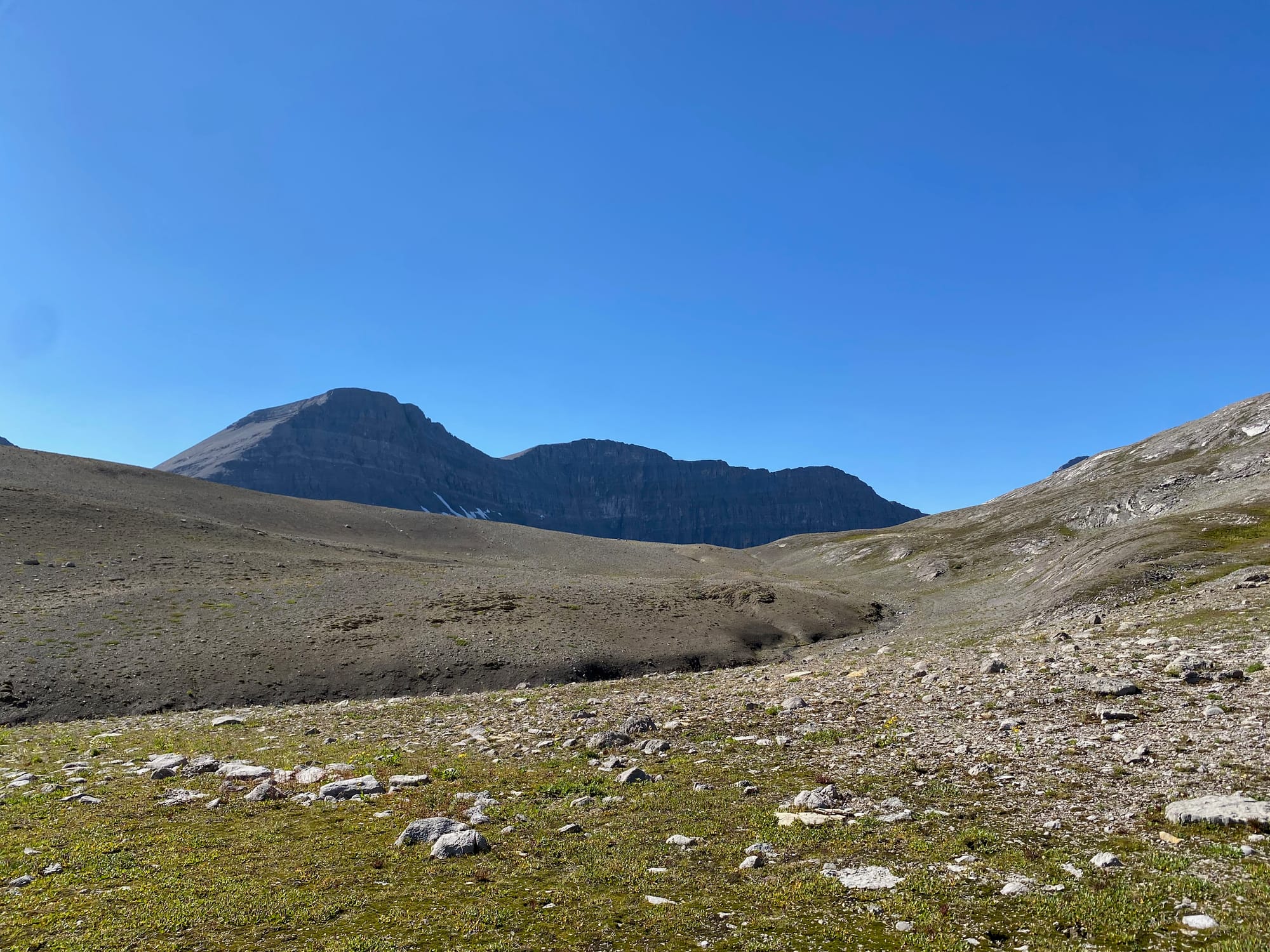
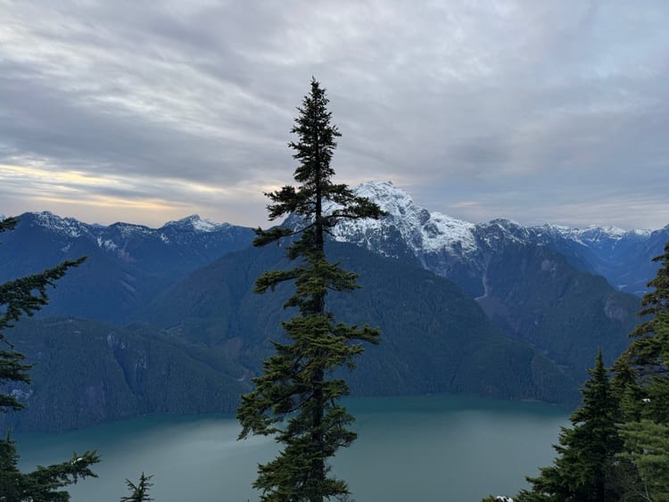
The main GDT meanders along an alpine plateau for several kilometres, past small hills and little tarns, with panoramic views. Mount Robson was visible in the distance to the south and the giants of Mt. Chown and Barricade Mountain dominated the view to the north. The highest point of the plateau (just north of the red line) was worth the detour. It occurred to me that very few people have seen this scenery in such hospitable conditions: summer is short here, and even in the summer, most Section G trip reports I’ve read mentioned some truly awful weather. I felt very lucky to be there when I was.

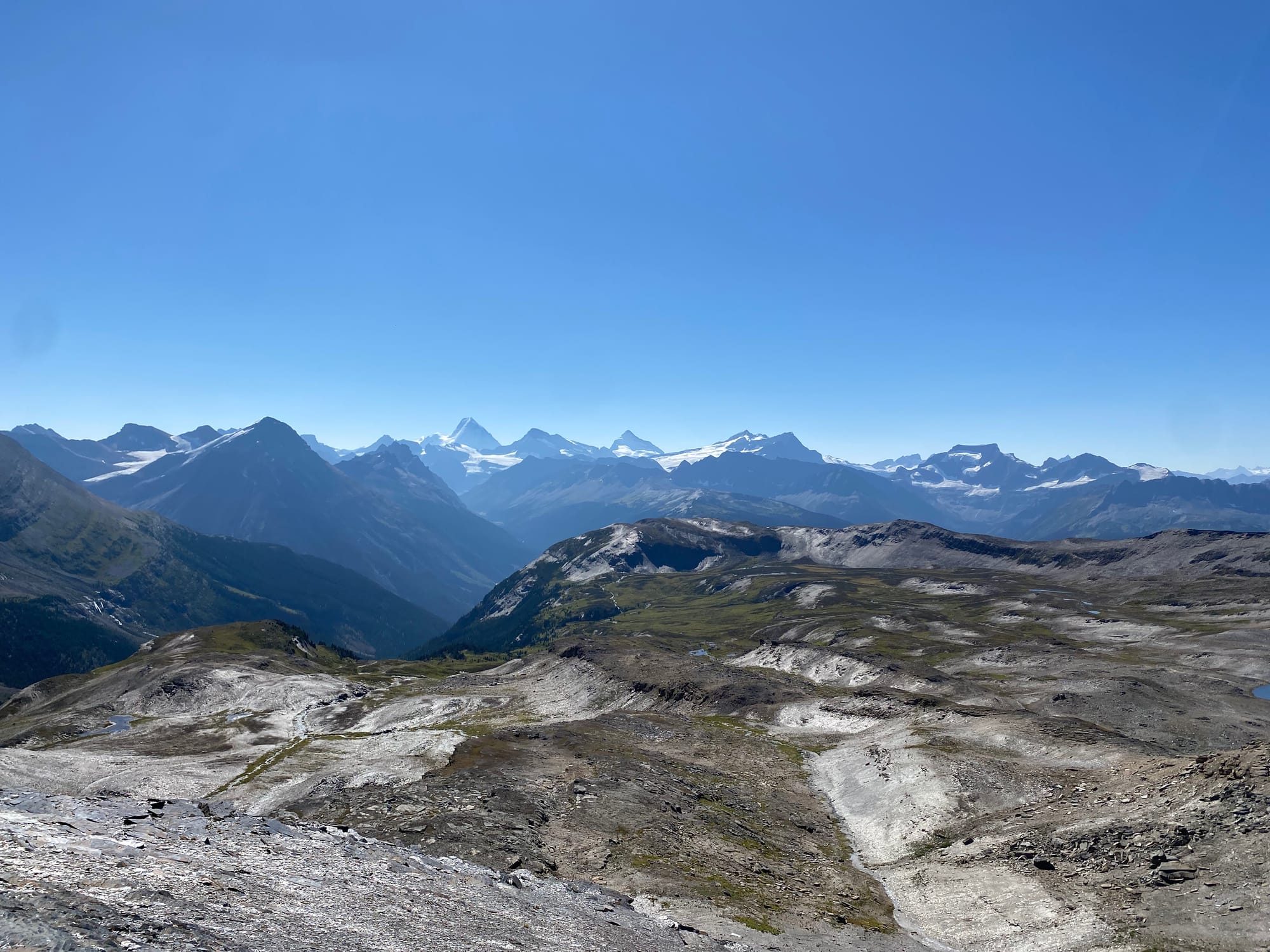
In the distance I saw two riders on horseback, making the scene look even more like Lord of the Rings than it already did. I never caught up to them.
Here, I made a decision that led to significant consequences. Jackpine Mountain had looked pretty intimidating from the alpine route, but as I got closer it seemed more manageable. I decided to take a detour to the summit.
Instead of descending to Blueberry Lake, I traversed the side of the mountain at the 2000 to 2050m elevation level (Warning! This really isn’t worth it unless you’re climbing Jackpine Mountain).
This was a flat bench at first, but soon I found myself traversing steep scree slopes and boulder fields before reaching the ridge. The ridge itself ended up being easier than expected: it was a class 2 scramble with some short, avoidable class 3 sections.
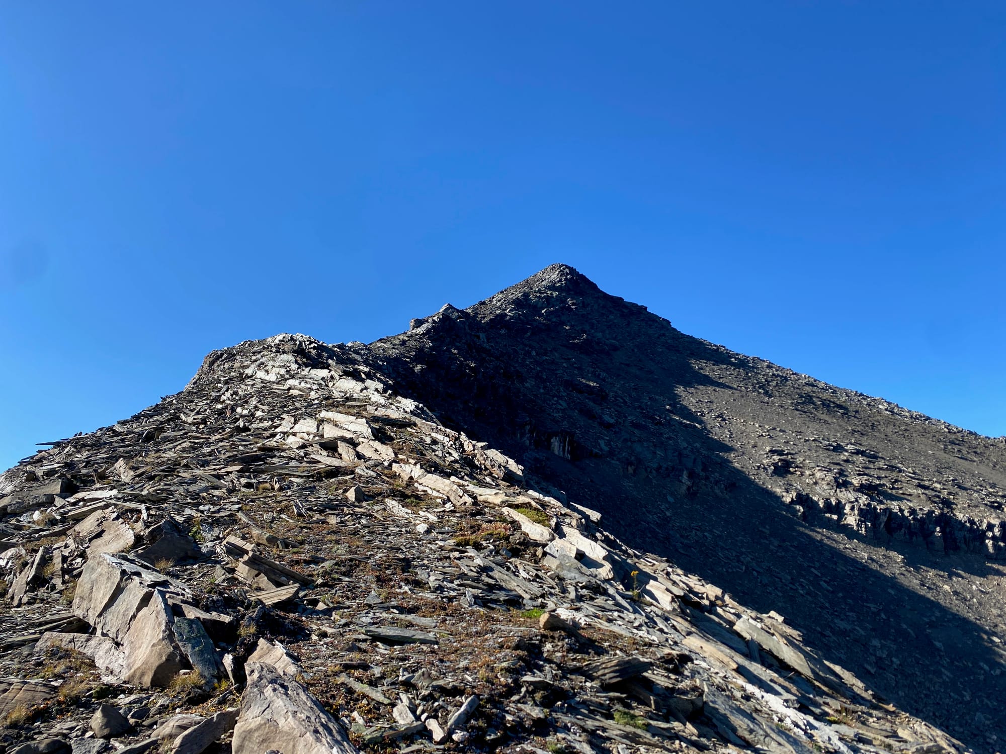
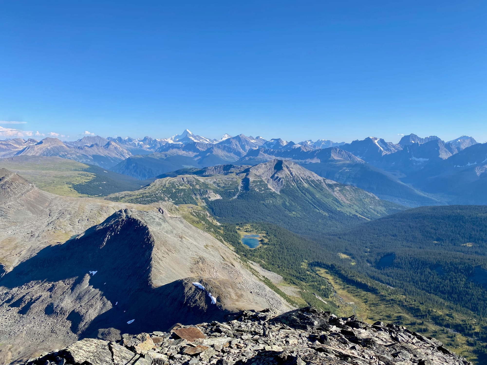
The summit had upgraded views from the Jackpine high route.
To get back to the main trail, I returned down the ridge, then I had to descend a very steep scree slope. This was quite tricky but I eventually made it past the steepest part. The slope flattened out, turning into a boulder field. About a hundred metres from the trail, I let my guard down and stepped on a loose rock, rolling my ankle.
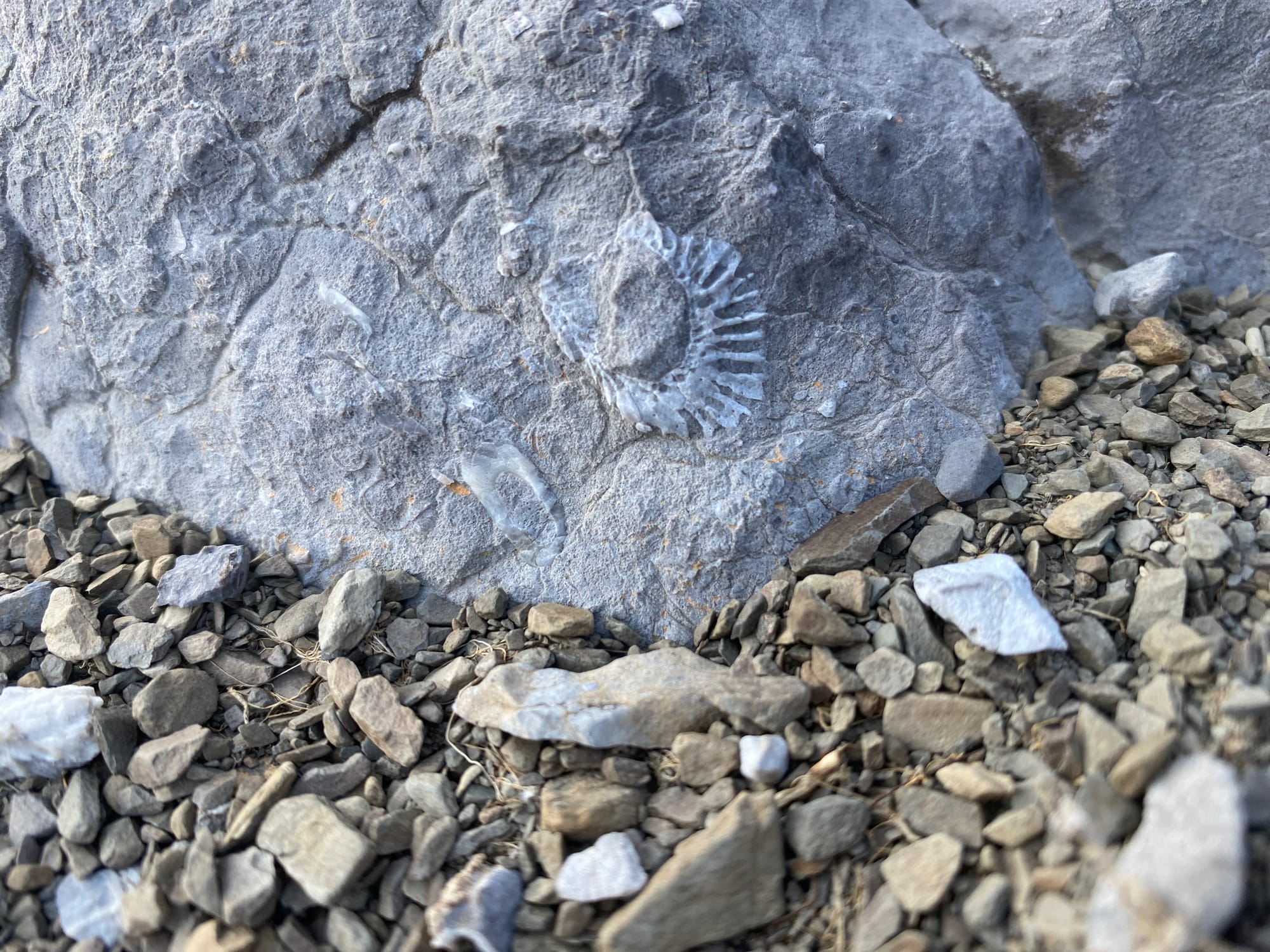
I limped to the trail, setting up camp at a small stream with weirdly bright water. I soaked my foot, and soon it was coated in white dust, either algae or geological in origin.
It looked like this would be the end of my adventure. From there, I could make my way to the Blueberry Lake trailhead and catch a ride back to town. It would be very disappointing to leave here, so close to the end and with such perfect conditions.
Yet the next morning, my foot somehow felt much, much better. I packed up camp and walked to my bear cache with little difficulty. It was still swollen but not especially painful, even while walking. I assessed the situation: I wasn’t far from the end, the weather forecast was perfect, I still had enough time to make it to the shuttle pickup spot on the Walker Creek FSR even at a slower pace, and I had recently done much more intense work with a worse ankle injury while treeplanting. I decided to continue.
I’ve spent a lot of time thinking about that decision. The ankle injury and associated delay reduced my margin of error, making any further incident far more consequential. I should not have continued. If I’d known what would happen next, I would not have continued.
That said, if I didn’t have some bad luck later on, I would have probably made it to Kakwa on schedule, and even if I hadn’t rolled my ankle, the other injury would probably have happened anyway.
Endgame
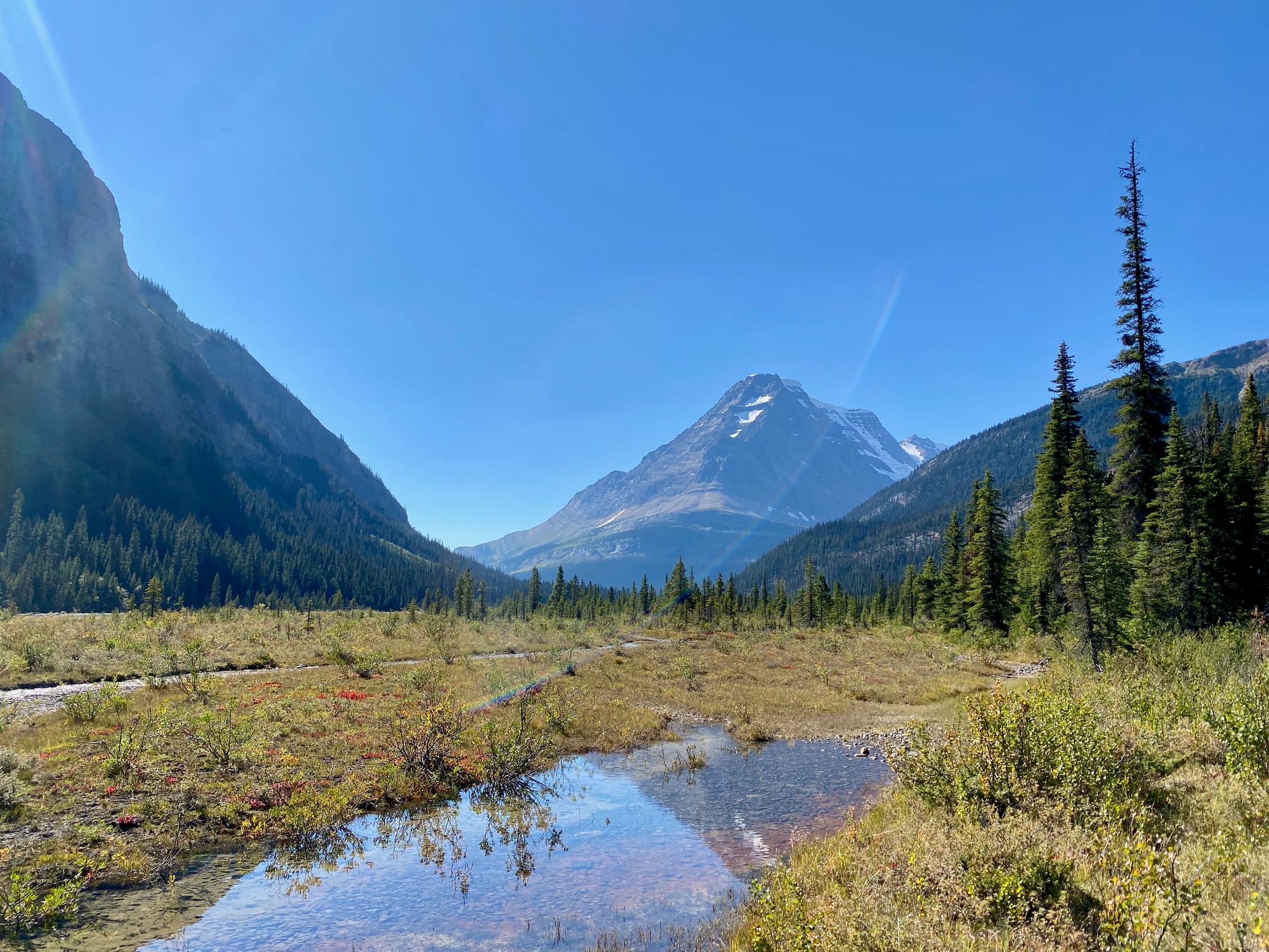
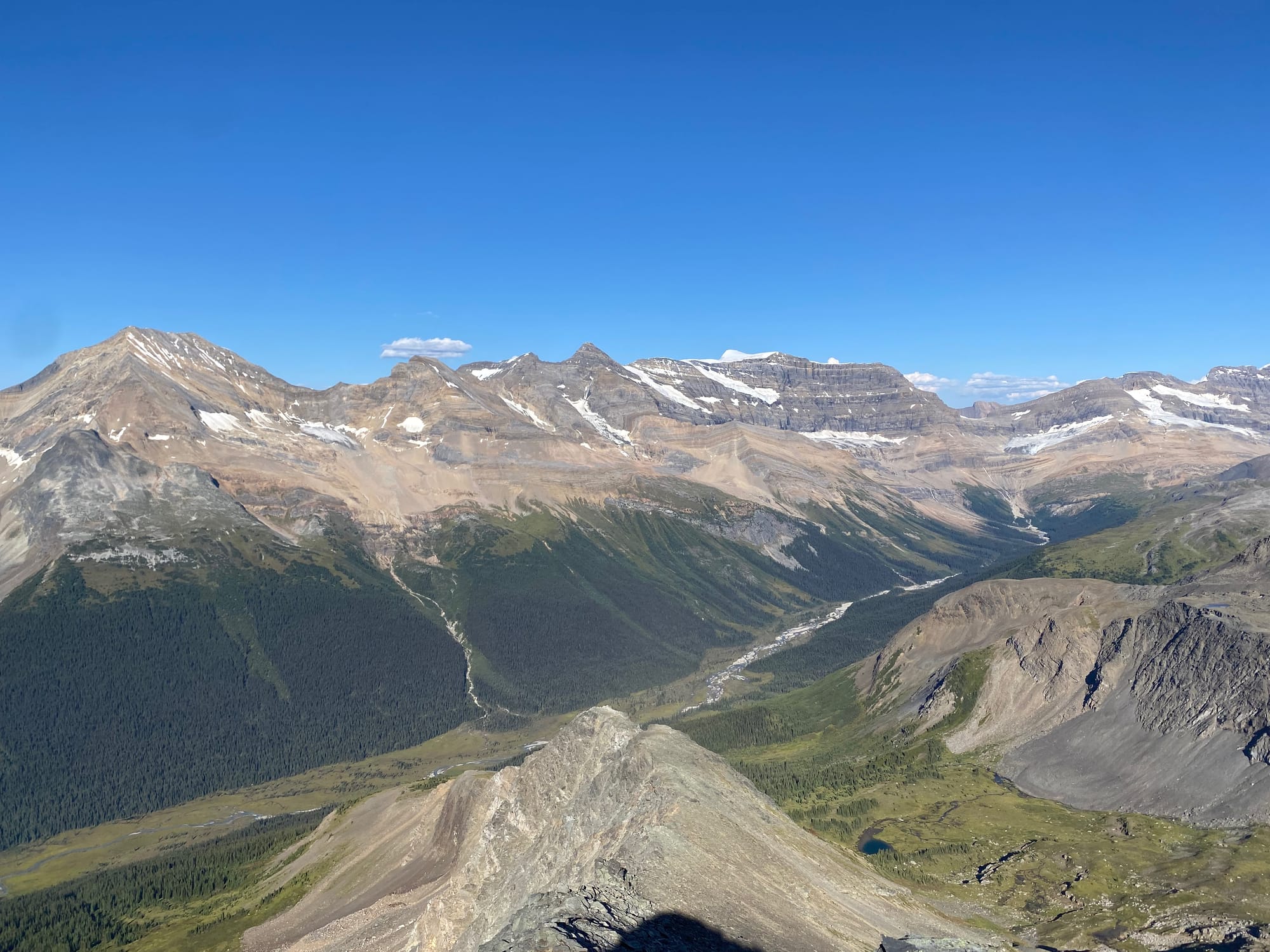
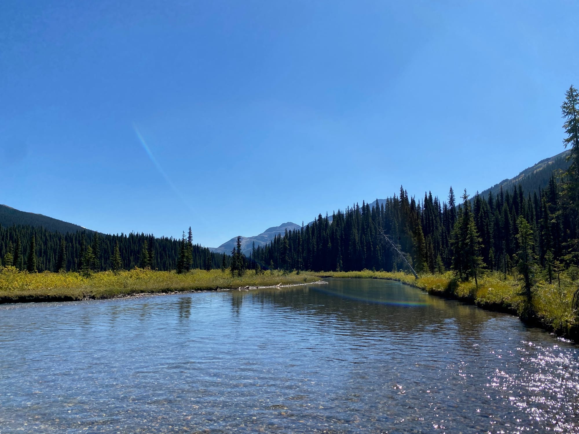
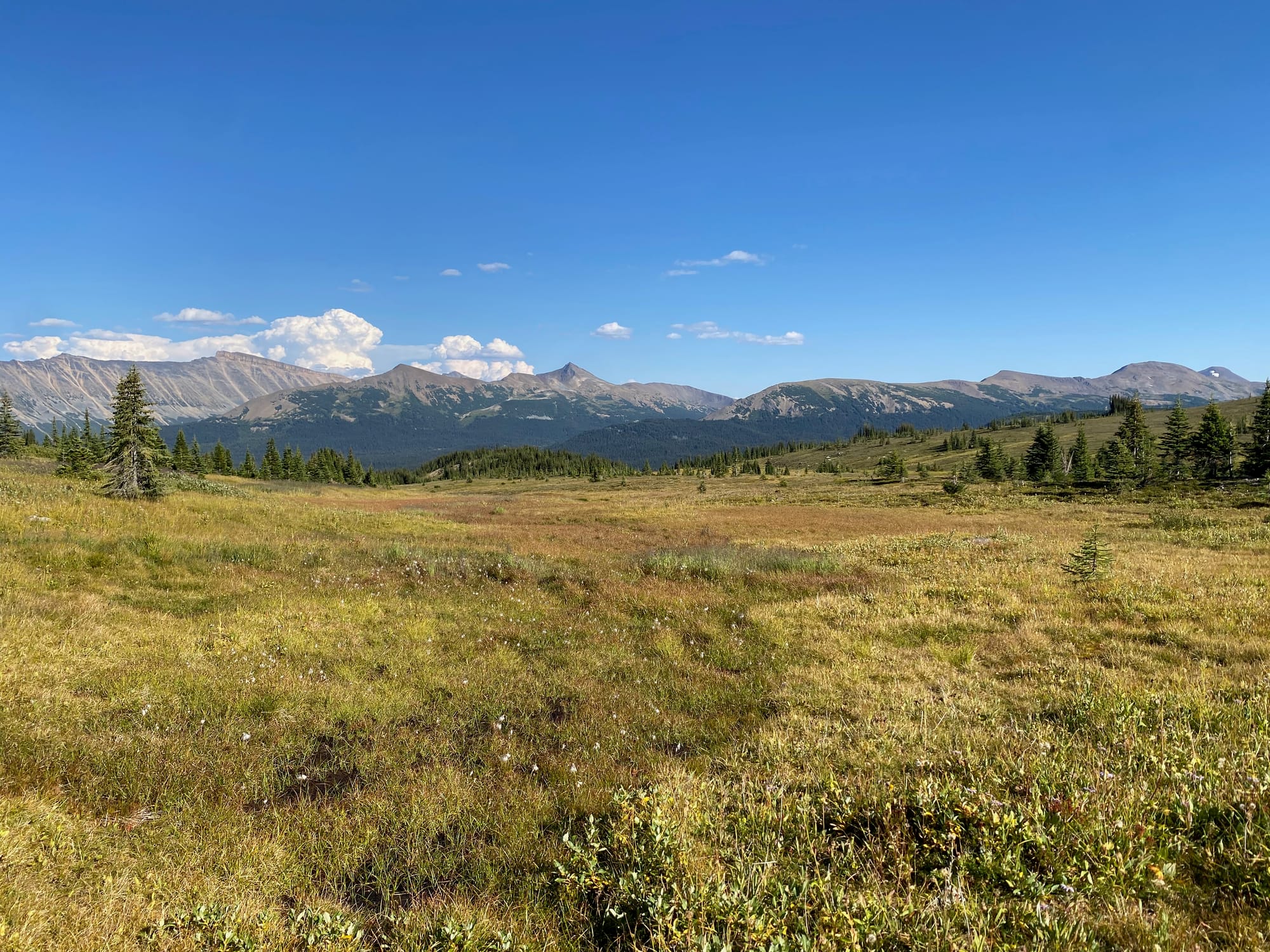
I’d hoped to do the Perseverance alternate, which follows a ridge with some scrambling, but I didn’t want to take that risk anymore. Ironically, after all my mountain-focused side trips, the stretch of the GDT with the most summits was now off-limits. Instead, I stayed on the main GDT, following the lower Jackpine river. This section was also incredibly pretty, with the river flowing through meadows and forests bounded by towering peaks. Like most of sections F and G, this was originally a horse trail, which meant fording the river every few metres. At one point the river formed a large pool and I enjoyed a relaxing swim. There were plenty of bogs as well, sometimes up to a metre immediately above the river. I spent most of the second half of the day trudging through deep mud.
The next day was going to be a long one, so I started very early. My goal was the Casket Creek campsite, 42km away over five hills. The first one, Little Shale Hill, went by quickly.
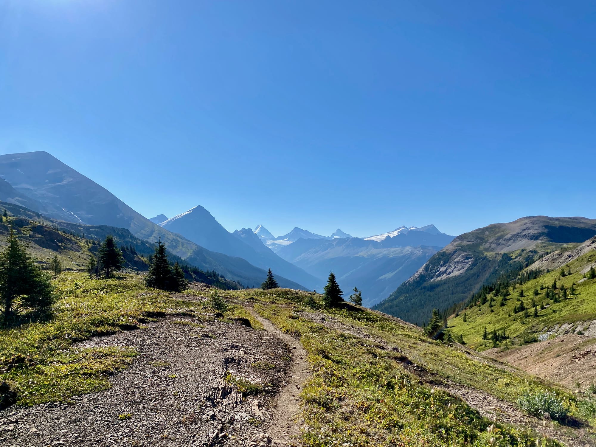
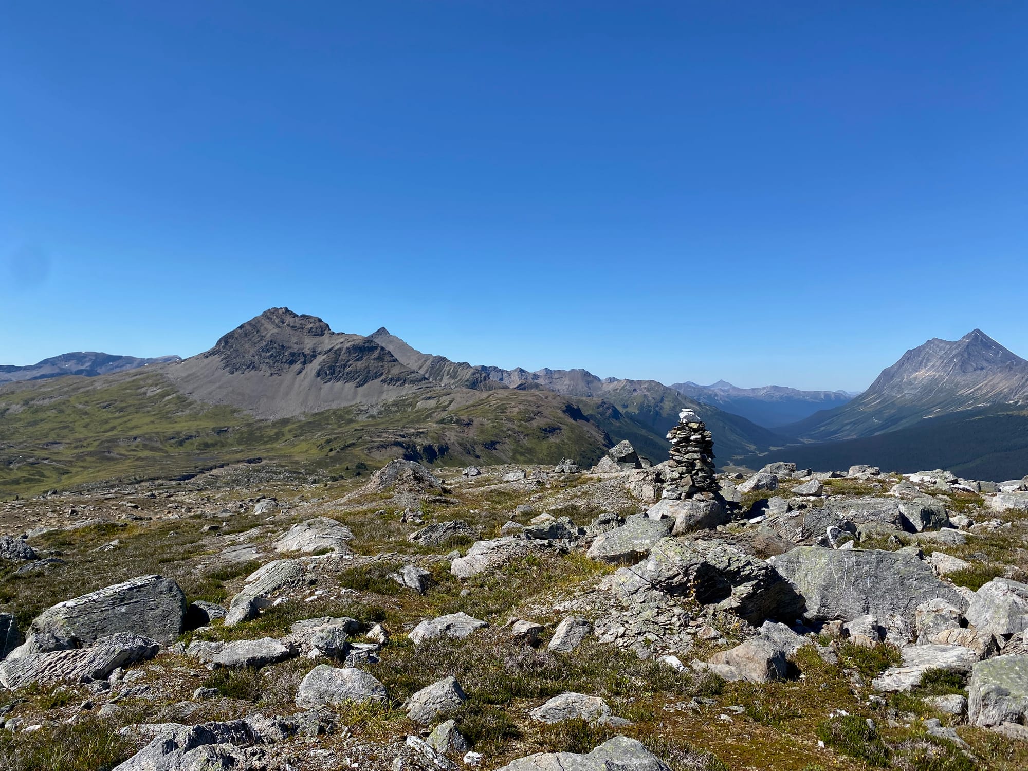
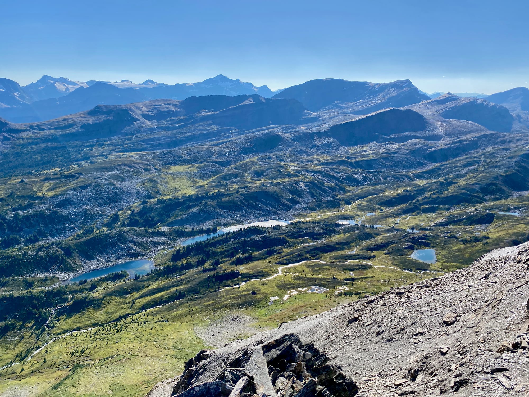
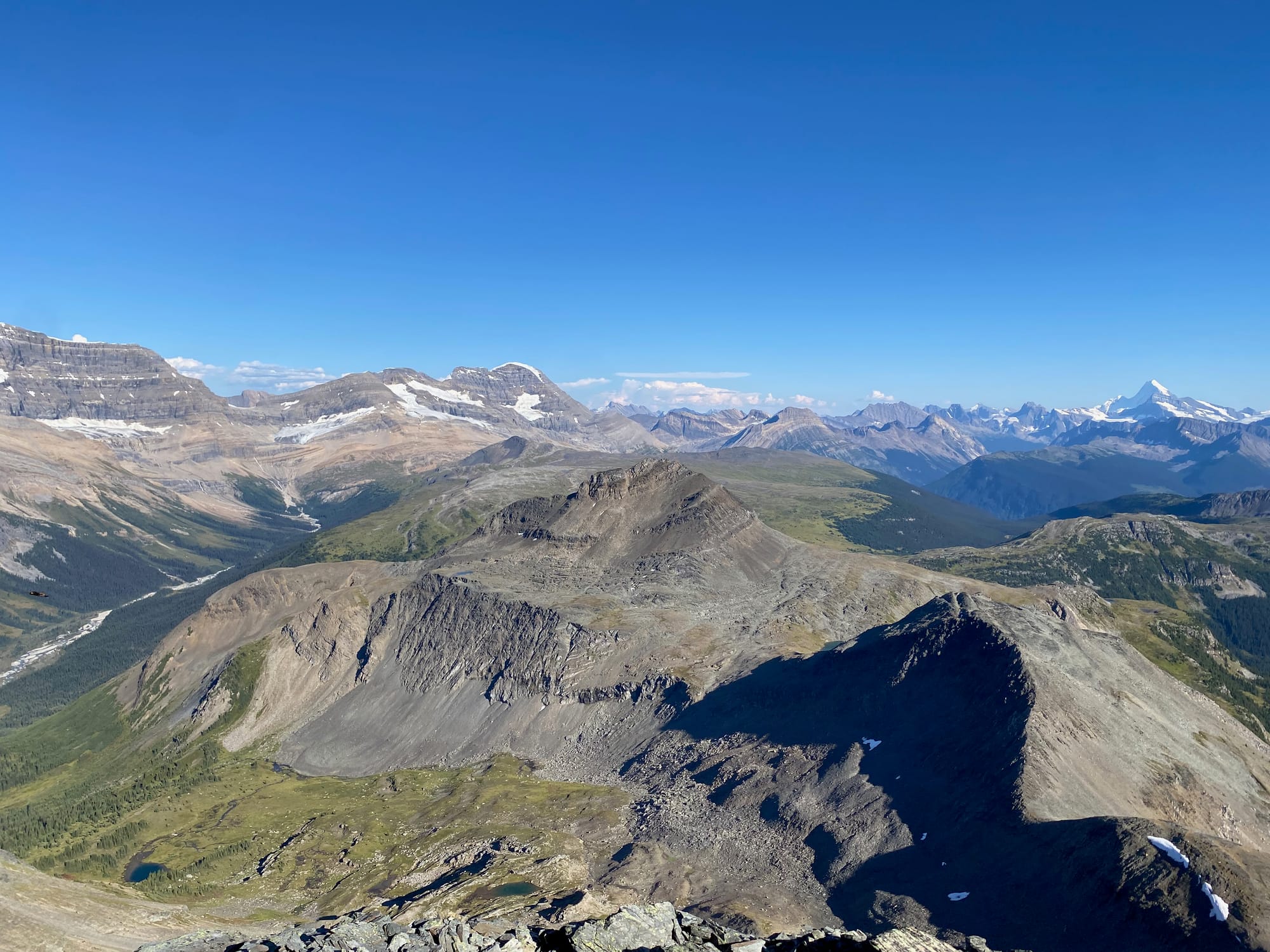
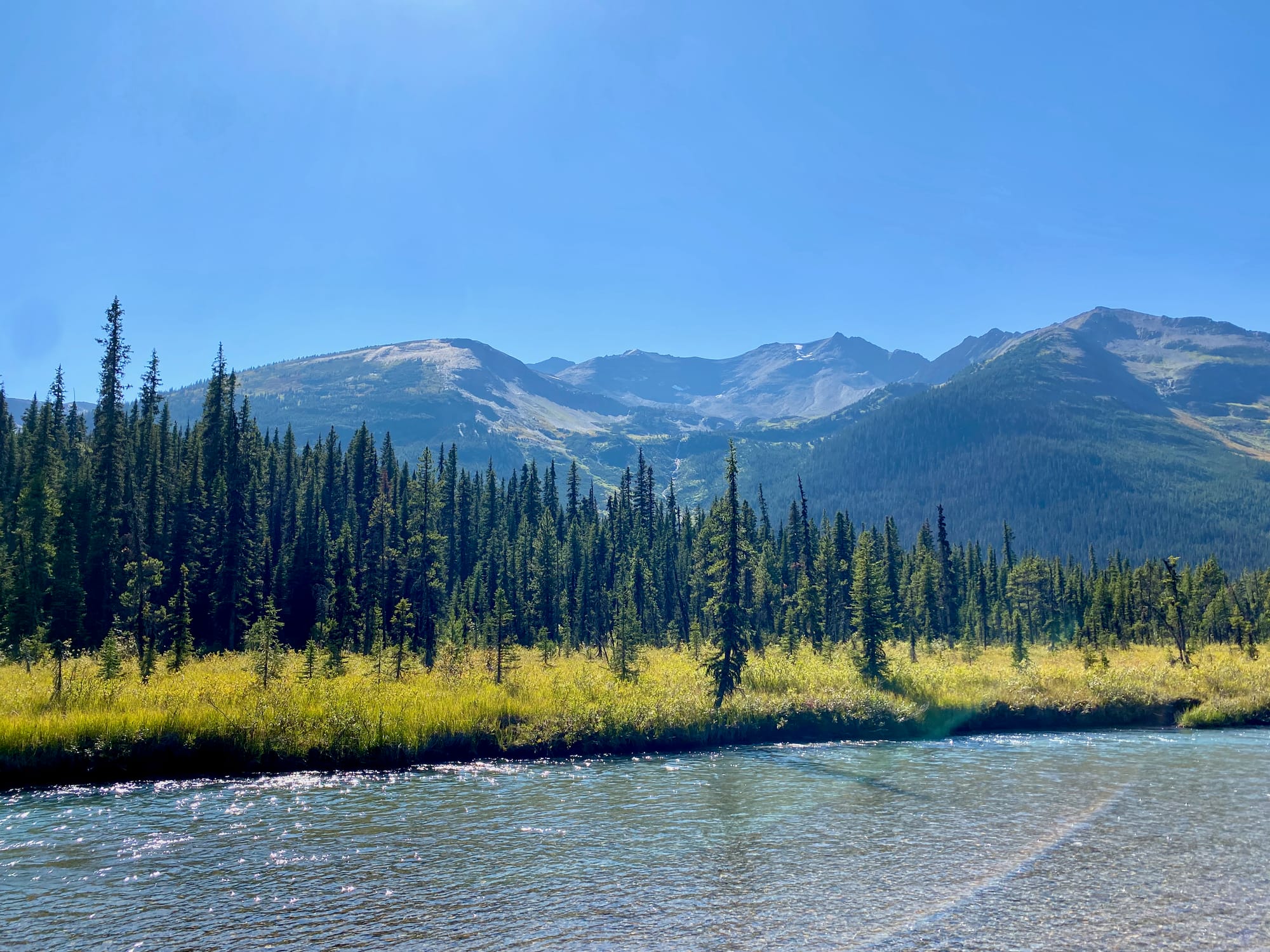
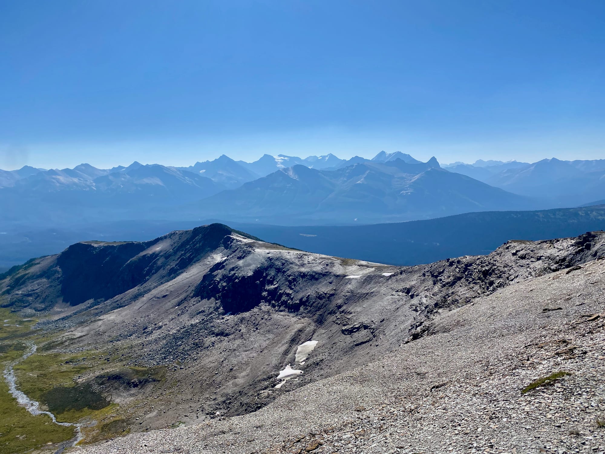
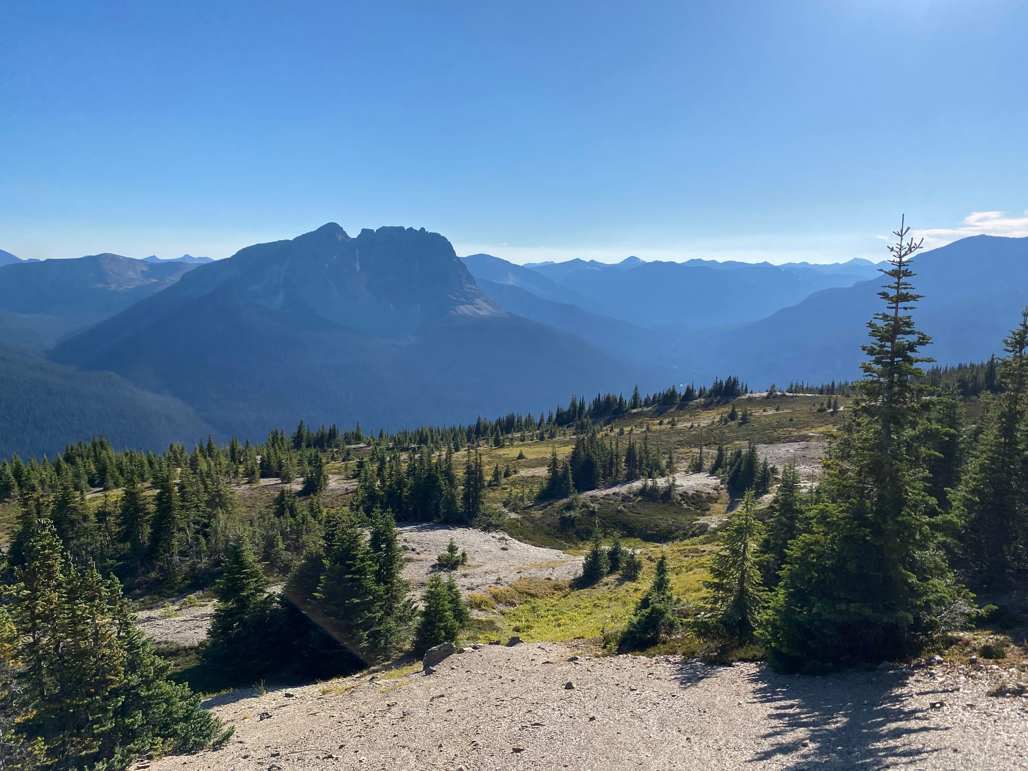
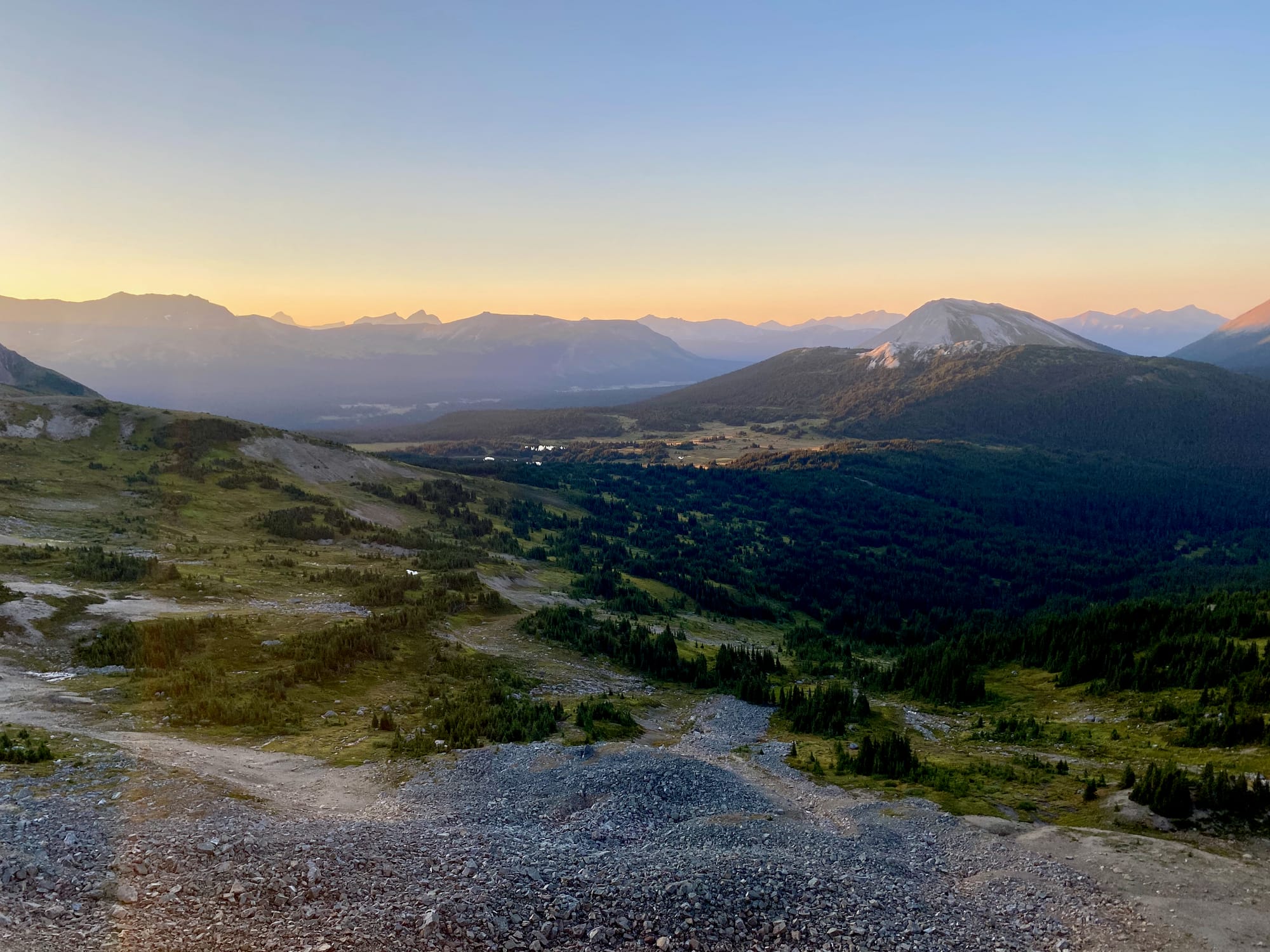
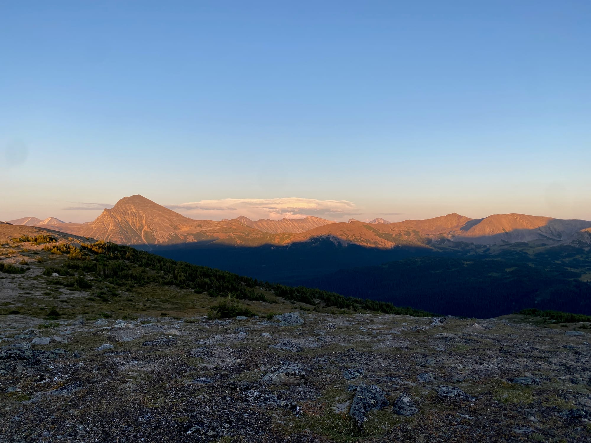
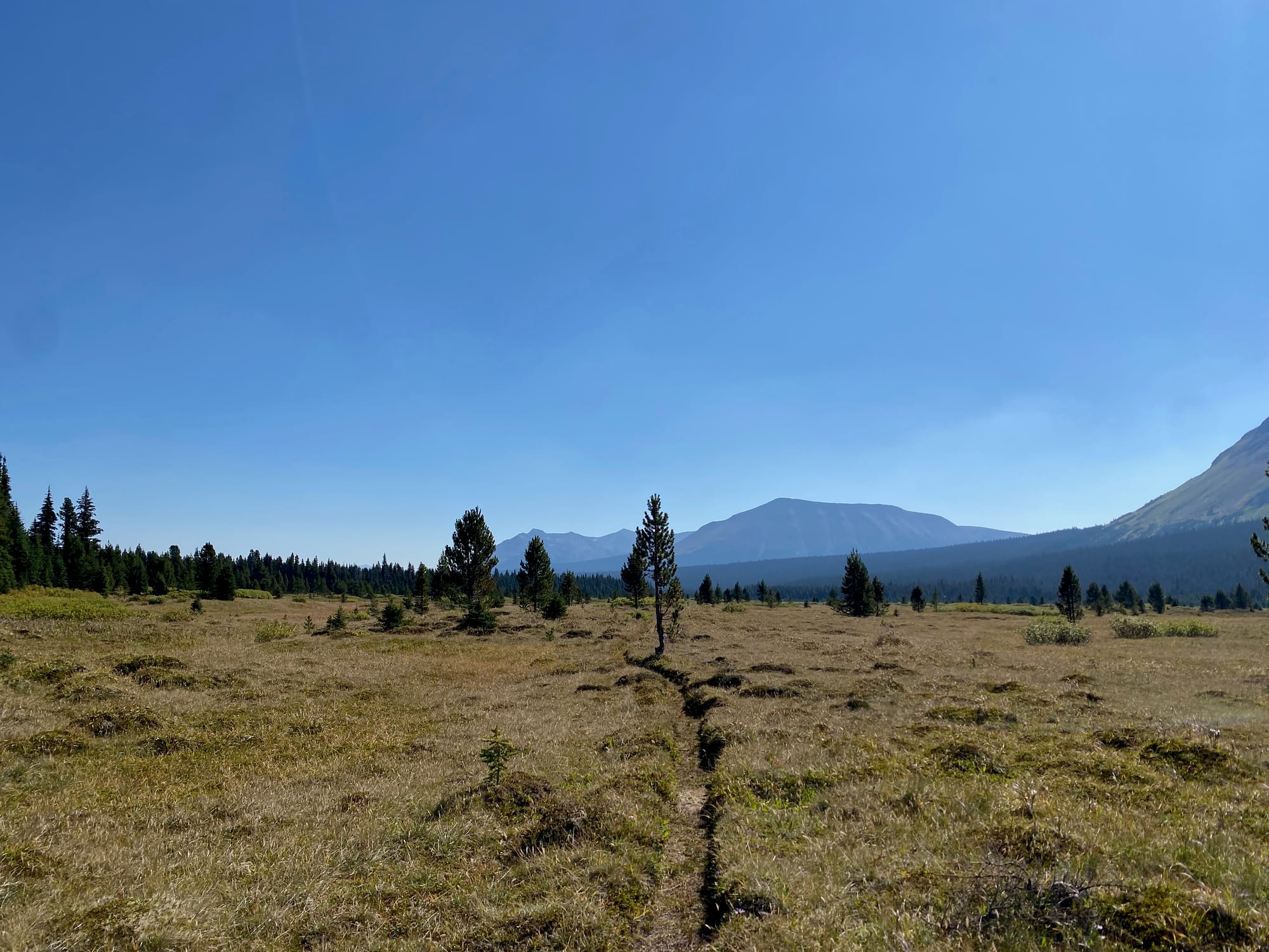
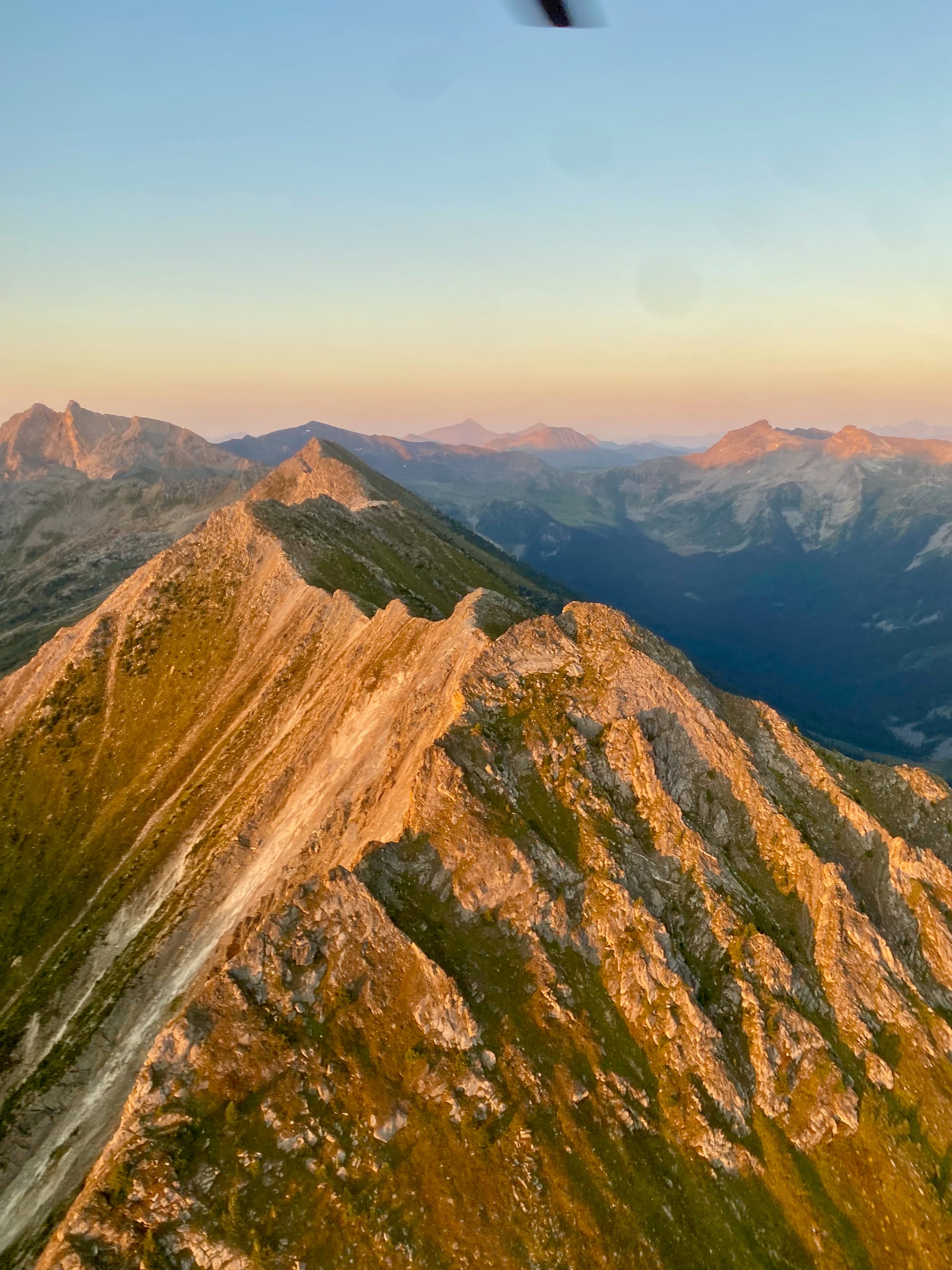
The second climb was to the ridgecrest of Big Shale Hill. This is one of the finest views on the GDT. The perfect weather continued, and the sky was clear on the peak. All around me were endless mountain ranges. Peaceful. I had one last look back at the Jackpine valley: beyond it, Mount Robson was just barely visible. In the distance were the peaks around my intended destination, Kakwa Lake.
The trail descended to Shale Pass, then climbed along the side of Mount Talbot to Morkill Pass. At first, the trail was well-marked, so I picked up the pace. Closer to the pass, the trail crossed a large flat area, and I kept briefly losing the trail in boggy meadows.
It didn’t help that somewhere around this section, my feet started to hurt. I had a long lunch break at the Morkill Pass horse camp. There was a small rash on the most painful parts of my feet, so I bandaged it, but that had limited effect. I’d met other hikers who’d contracted trench foot, but I thought I had avoided it. Getting to Kakwa quickly became an even bigger priority.
There was another long climb up the slopes of Mount Morkill to the mountain’s SW Col, then another descent, then another ascent to Fetherstonhaugh Pass. Once again the terrain was quite boggy and the route was difficult to follow. Sunset was approaching and the pain was getting worse.
There were two more descents and one more ascent ahead of me. Some bushwhacking was needed to reach the Mount Fetherstonhaugh ridgecrest, and I often found myself walking in a way that put pressure on the rolled ankle. By the time I reached the ridgecrest, the sun was setting and it felt like I was walking on sandpaper. Casket Creek was still seven kilometres away, on the other side of what was rumoured to be a difficult willow thrash.
Thankfully, some absolute heroes from the GDTA had done some trail maintenance, and the willow thrash was now a wide pathway. The sun set, light faded, and every step felt like I was walking on broken glass, but Casket Creek was getting closer and closer.
I arrived at the campsite to find Solène, Carlie, and Summer with a nice warm campfire. What a perfect end to an otherwise painful day.
The next morning was quite cold, with frost covering the trees and rocks. I pondered the changes in the landscape since I’d started hiking in Field, almost one month ago. I’d gone from summertime among giant mountains to the much harsher climate of the more worn-down northern Rockies, where the season was already fading away and the leaves were starting to turn. This gradual but noticeable change was something I’d never really appreciated on previous, shorter trips. I’d come a long way and so many things were very different now.
Once again I had to cover a decent amount of ground to make the Walker Creek shuttle. I planned to push myself to get out on time, then immediately seek medical attention in McBride. I said goodbye to Solene, Carlie, and Summer, but we ended up passing each other a few times on the trail.
The first few kilometres were painful but manageable. Recent trail clearing made things easier and I limped along.
A few kilometres past the Copper Kettle campsite, I took a wrong turn and ended up having to climb over deadfall to reach the main trail.
As I approached Surprise Pass, the pain worsened and I started moving very slowly. I took a few breaks on the ascent but they did not help. Every step was quite painful. I slowed to a crawl as I walked up the valley to the pass, moving at less than 1 km/hr.
This was a terrible surprise.
I took a longer rest at the pass and took some painkillers, but they didn't help. Somehow, walking was even more painful. I’d made it 15 kilometres that day: at my pace I would not reach the shuttle on time, and the trench foot situation would just get worse from here. After a brief discussion with my family through inreach, I decided to call SAR.
(I should have called SAR much, much earlier, as soon as I realized how quickly things were worsening. This would have given them more time to plan a response.)
The RCMP got back to me very quickly. Within a couple hours I was in a helicopter on my way to McBride. Much of section G flew past me, then we dropped out of the mountains to the airport, scaring away some deer on the runway.
The town ambulance was needed elsewhere, so I caught a ride in the back of a police car - hopefully the only time I will ever be there - and soon reached the hospital. Over the next two days, my dad drove me back to Vancouver (thanks!), and then the adventure was over.
(I’m incredibly grateful to Robson Valley SAR, the RCMP, and the McBride hospital staff for the rescue. Experiencing it firsthand made me realize how easy it is to take our search and rescue system for granted, especially its ability to respond quickly in some of the most remote terrain imaginable.)
It took a while for the injuries to heal, but as I write this three months later, I’ve recovered. Apparently, with this year’s especially rainy conditions, around half of GDT hikers contracted some degree of trench foot, and other evacuations took place (Source: https://trailsmag.net/en-ca/blogs/hiker-box/in-the-trenches-this-foot-injury-is-more-common-than-backpackers-expect )
I hope to return to section G someday to finish what I started, but with a more cautious approach and a more waterproof pair of boots.

Member discussion