Great Divide Trail Section F
Jasper -> Mount Robson Welcome Centre
August 18-21, 2025
100km
GDTA Link: https://greatdividetrail.com/go-hiking/section-hiking/section-f/
Side trips: Miette Pass North Peak
North of Jasper, the already remote GDT gets even further from civilization, and crowds disappear. Most of this section follows officially decommissioned trails and roughly defined routes. It's common for the trail to completely disappear in boggy areas. River crossings become more common here, such as the often dangerous Smoky River. The reward: some of the best passes on the Great Divide Trail. This section reaches its apex as it passes directly below Mount Robson, the highest point in the Canadian Rockies. Most hikers will exit through the spectacular Berg Lake trail, recently re-opened after a devastating flood. In my case, I hiked the Berg Lake trail to the highway, picked up a resupply package, then walked all the way back past Berg Lake to begin section G.
I left Jasper with a heavier pack and a much lighter wallet, ready to take on the next section. This starts with a 23km walk along the Yellowhead Highway, which many people skip, myself included. I had booked a hard-to-find campsite on the popular Berg Lake trail, making my schedule a bit tight for this section, so I took a taxi to the Miette River trailhead, which ended up being more expensive than expected (Rocky Mountain Cabs; $60; cash only).
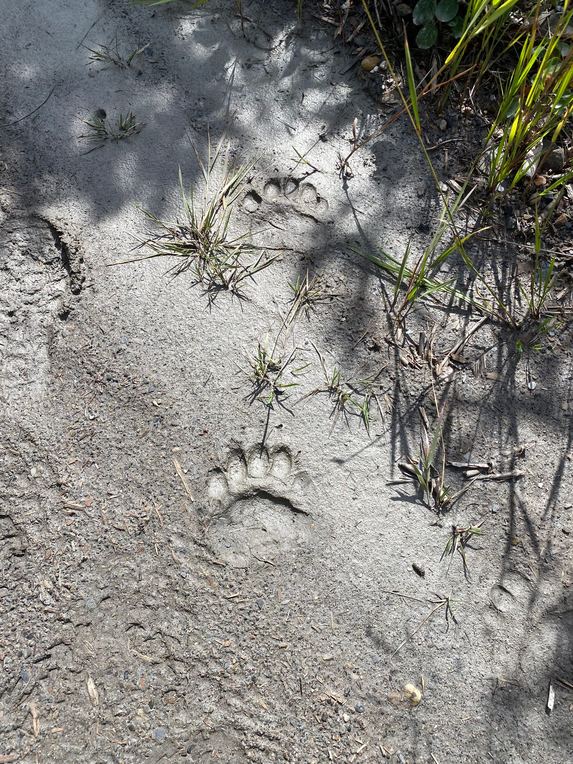
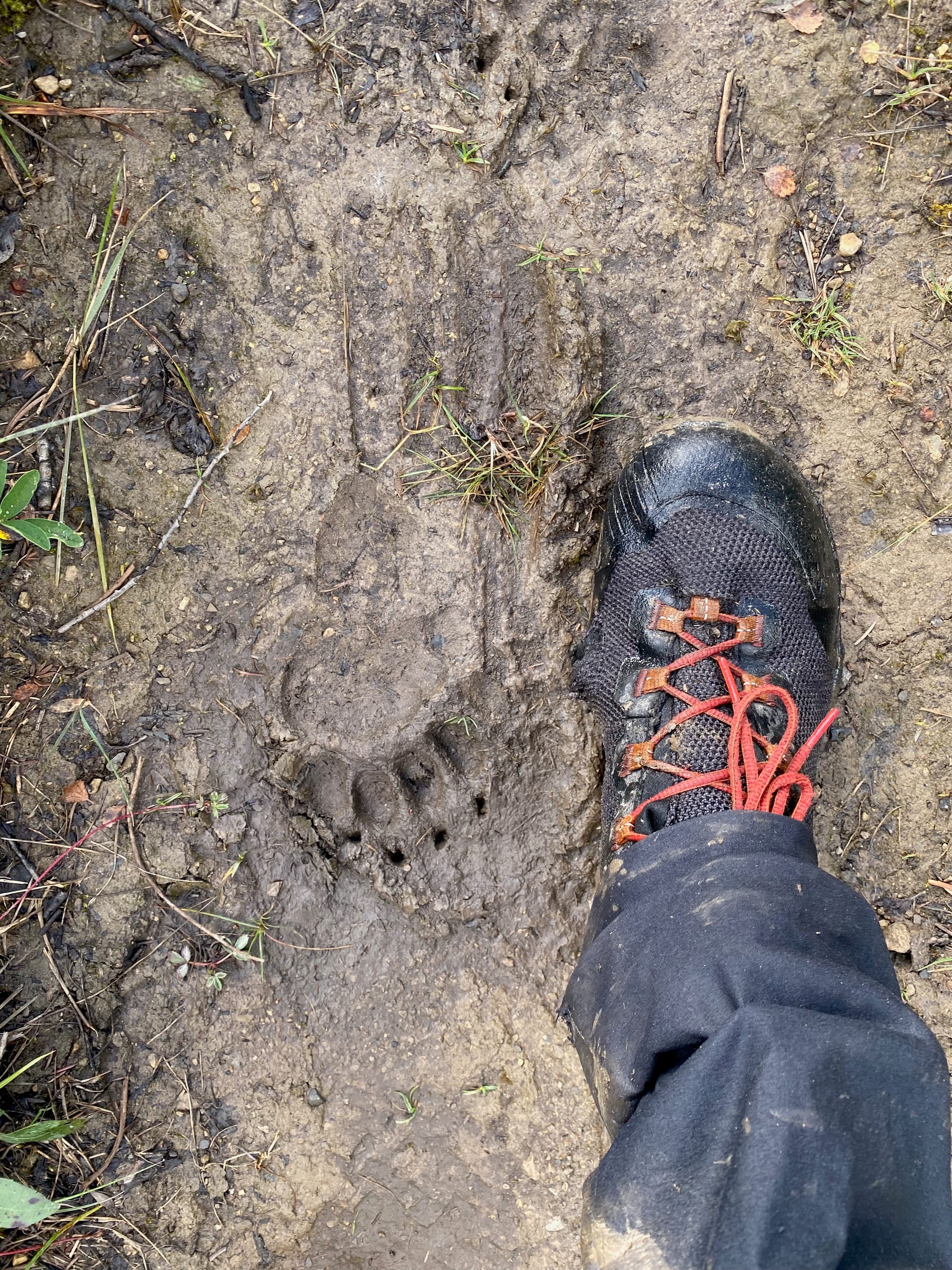
The first few kilometres are along a FSR that follows an abandoned railway line. The road sees more animal traffic than hiker traffic, as shown by the prints in the mud: mostly deer and moose, but there are plenty of bear and cougar tracks as well.
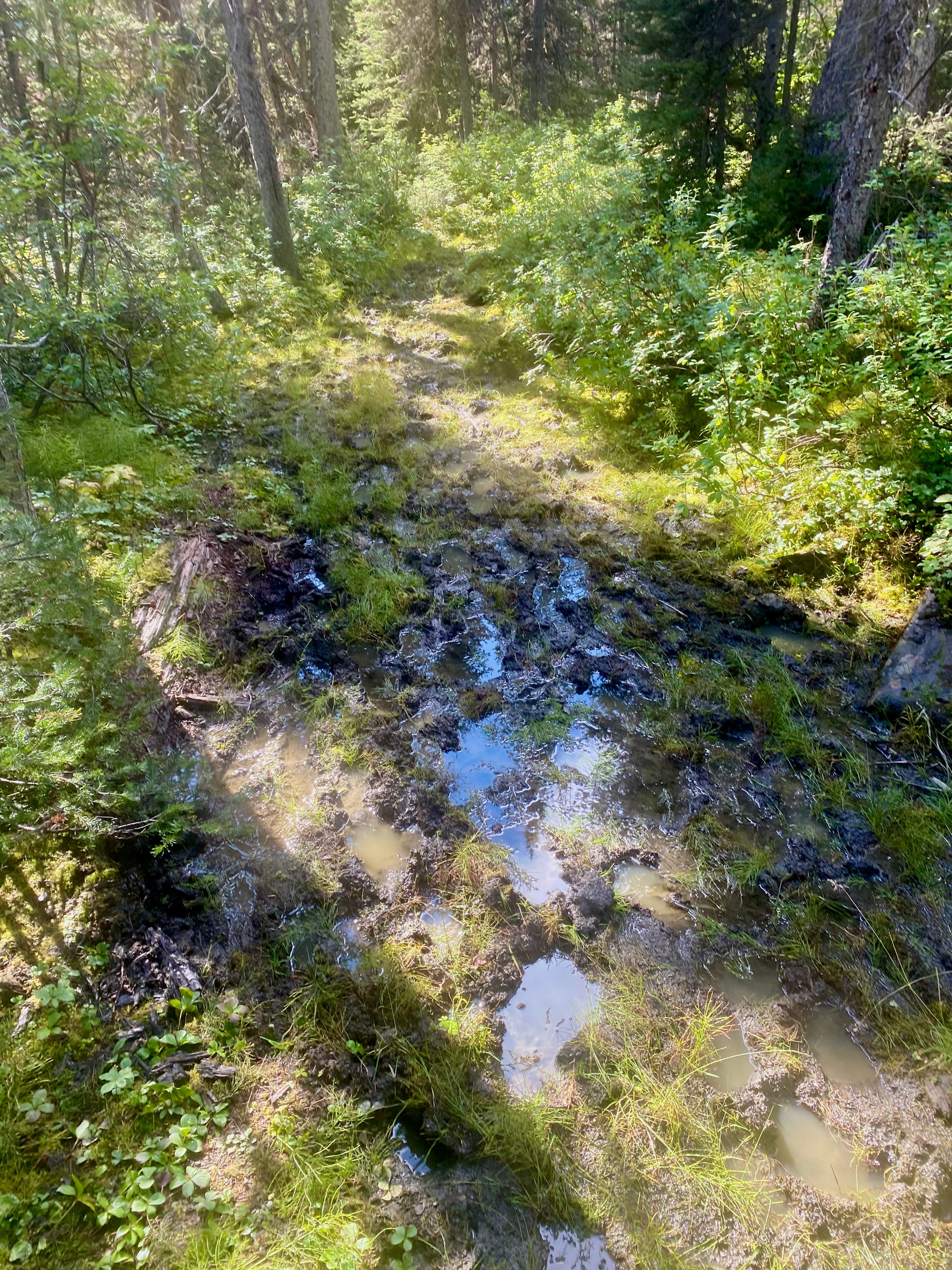
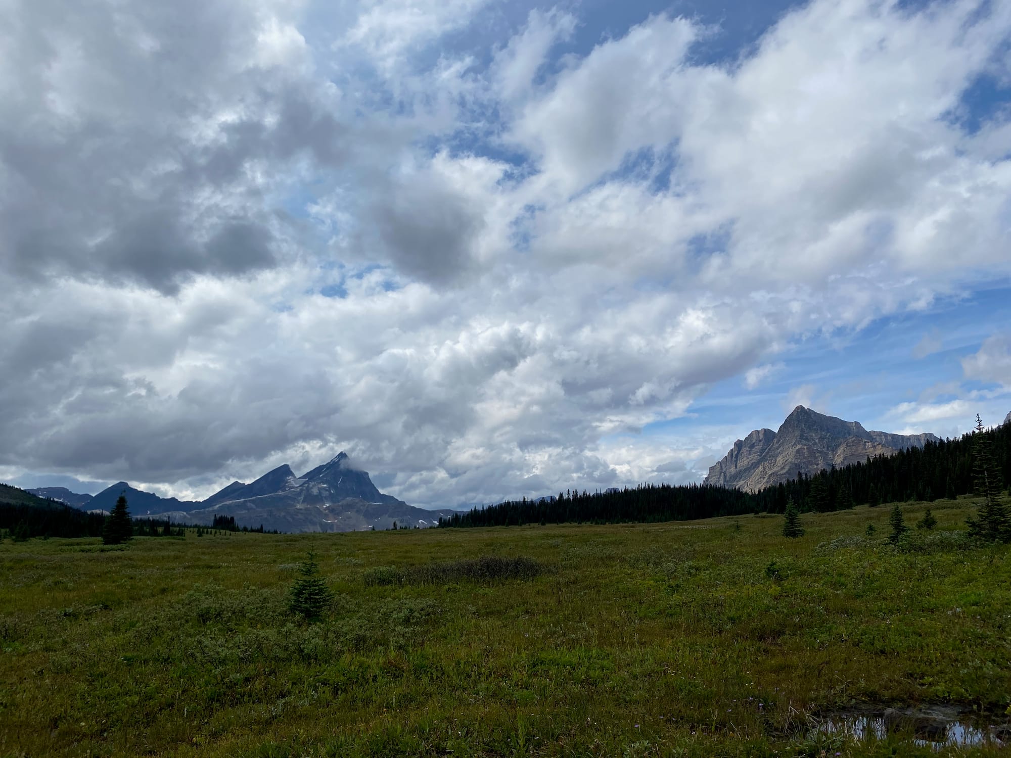
The trail then left the road along a very overgrown FSR, the Miette River trail. This section was notorious for deadfall, but Parks Canada had recently cleared it, making the grind much easier. It’s also notorious for mud, which isn’t going away anytime soon. I’d hoped to last a full day with dry boots, but they succumbed to the mud after about an hour on the Miette River trail. About halfway up, a brief thunderstorm struck, soaking the blueberry bushes along the trail. Soon I was completely soaked. On the bright side, at times the green tunnel parted to reveal the mountains across the valley to the south.
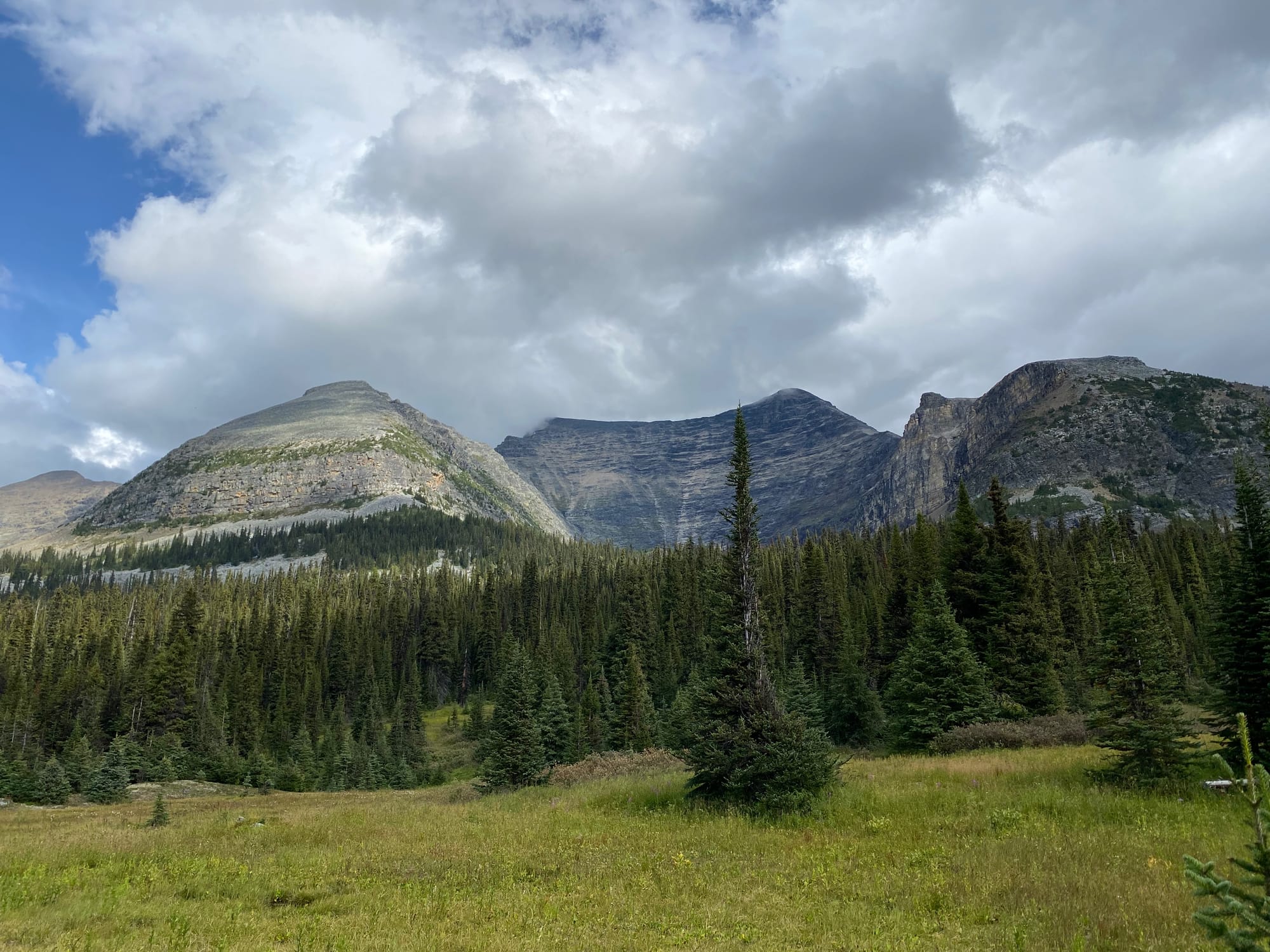
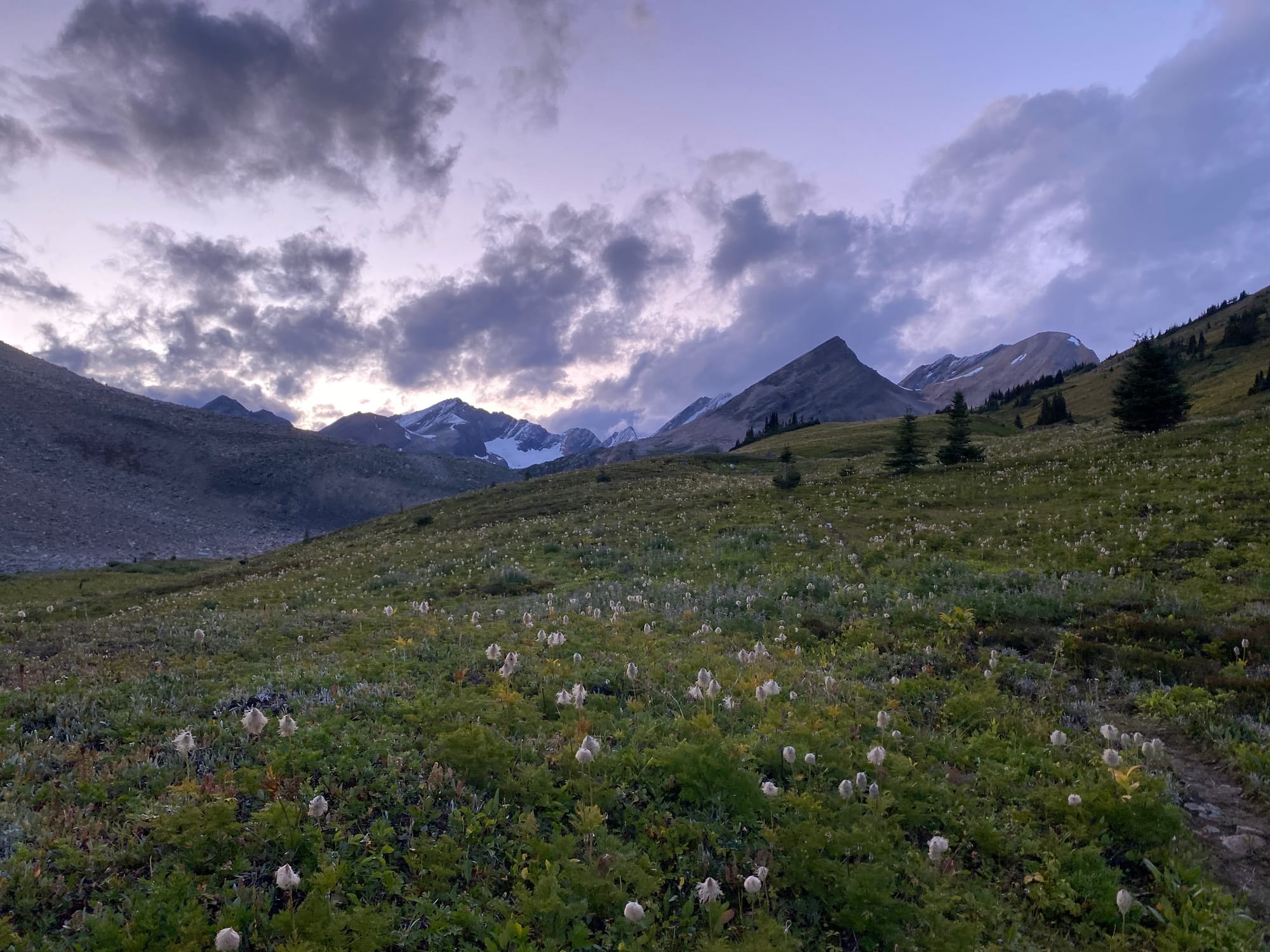
This section was annoying, but in true GDT fashion, the views made it worth it. The trail led through some meadows, which were of course flooded. Past the meadows, the trail climbed to Miette/Centre Pass, a massive expanse of meadow surrounded by jagged mountains. At one point, a very freshly cleared trail leads north of the red line on the FarOut app.
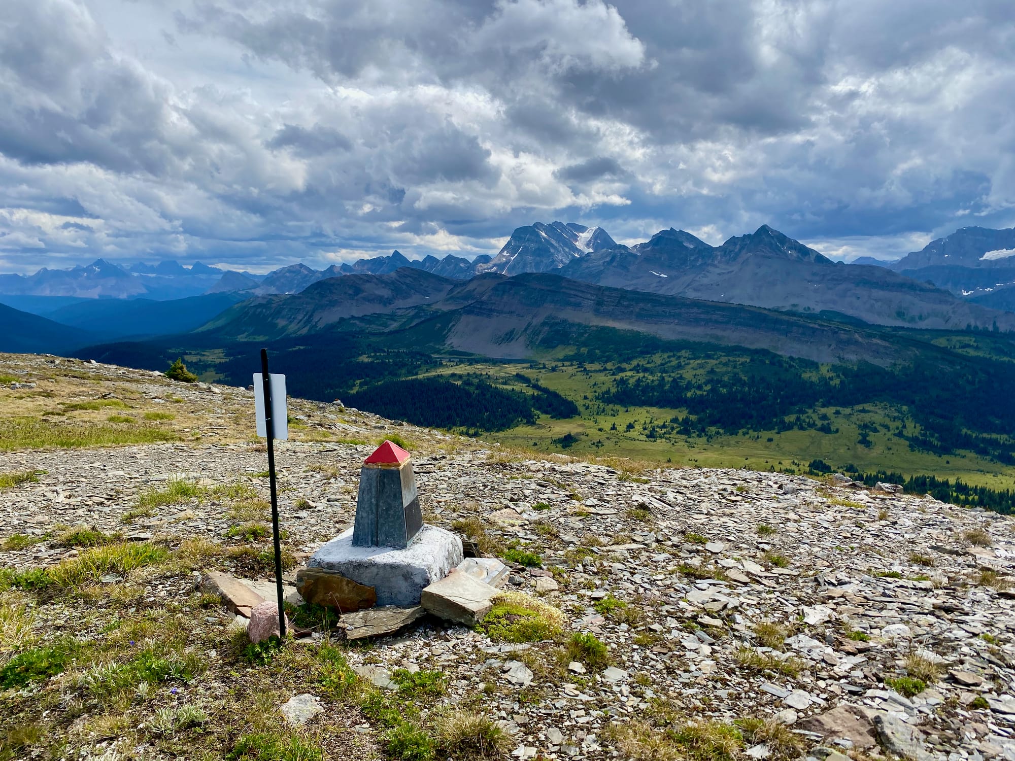
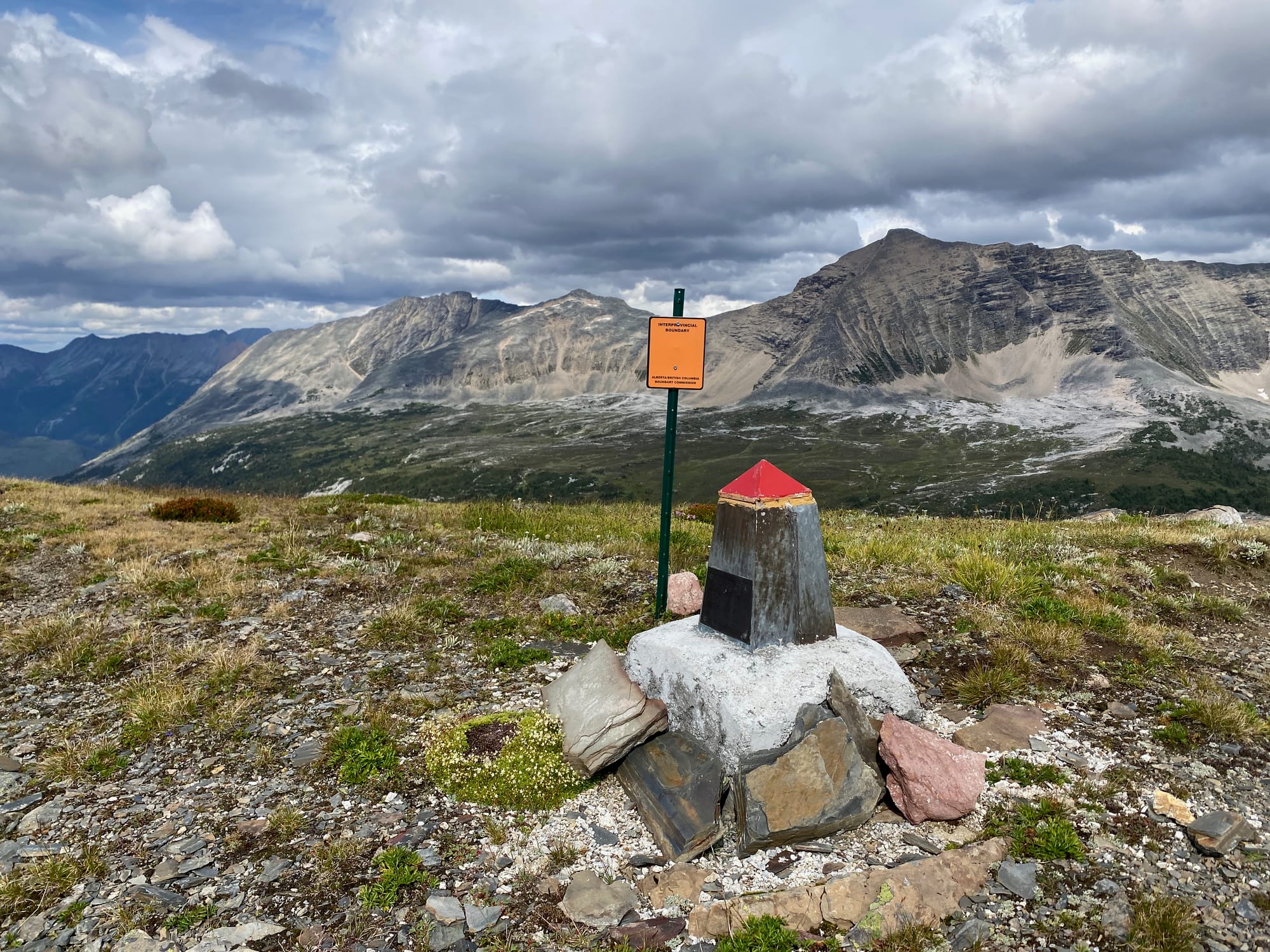
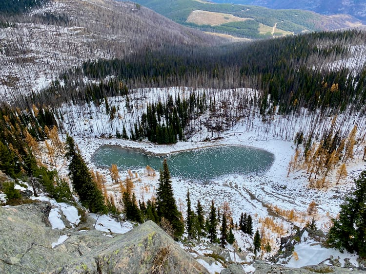
For even better views, I walked up the peak to the north of Miette Pass. This was a short detour (1.22km one way, 275m elevation gain) and very much worth the trip, with a bird’s eye view of the expansive meadows on the pass and more remote peaks and valley further beyond. This should be a more popular GDT side trip.
There is an interesting provincial boundary marker on the summit. Miette Pass marks the first time the trail crosses the Divide - and the provincial boundary - since Howse Pass in section D. I was finally back in BC.
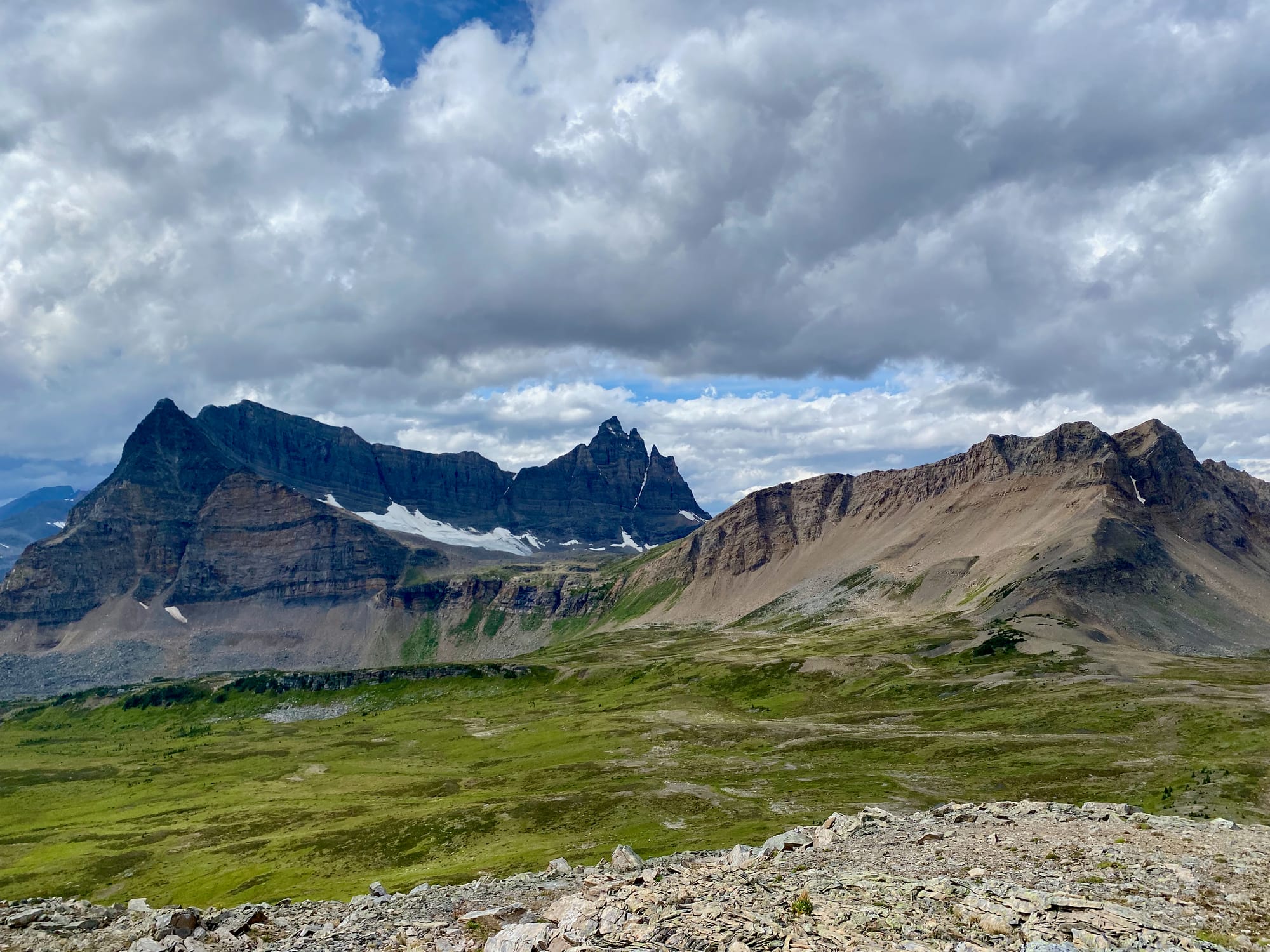
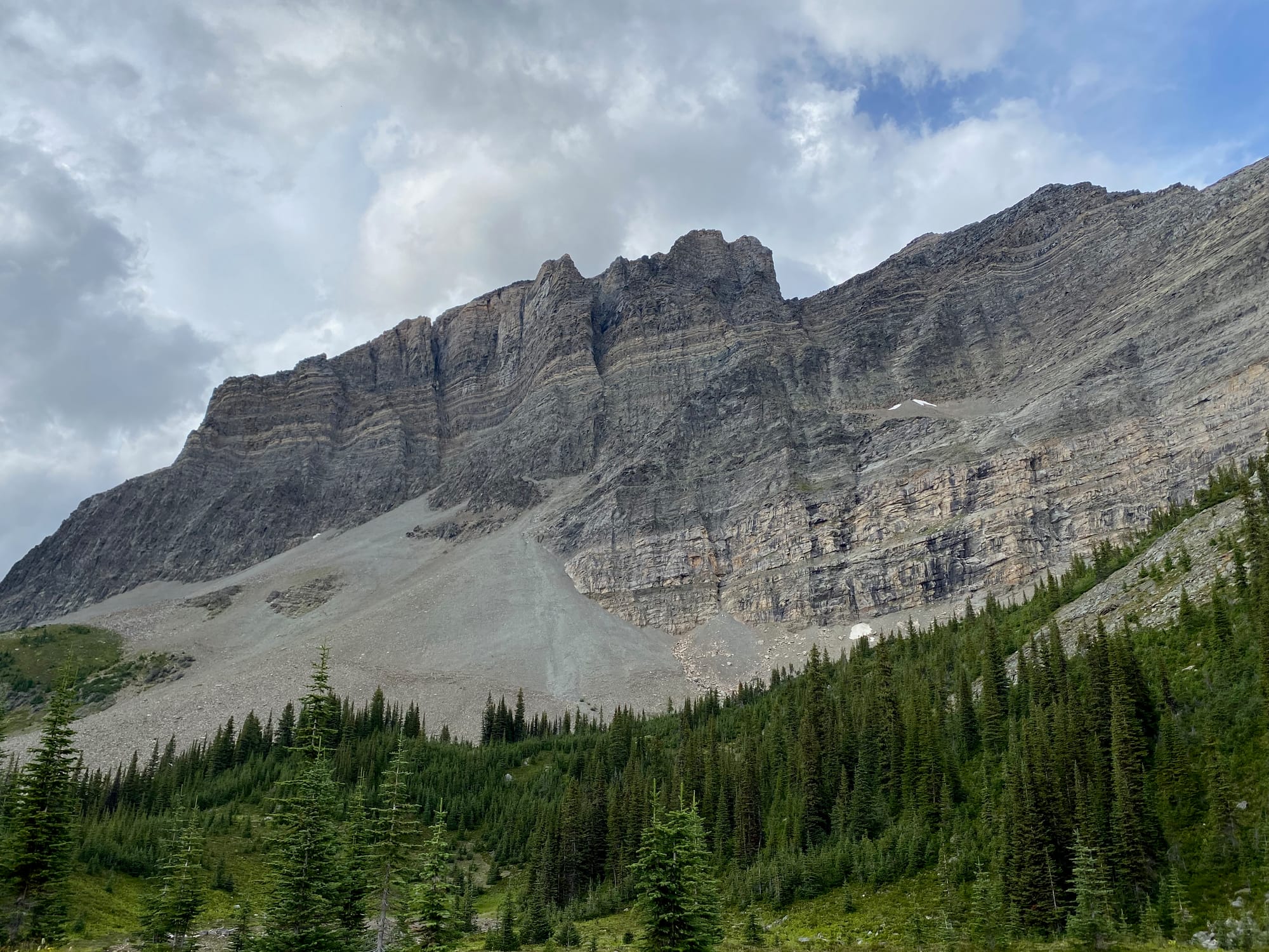
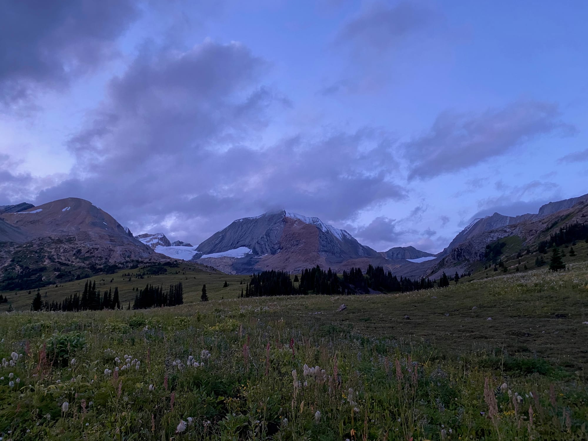
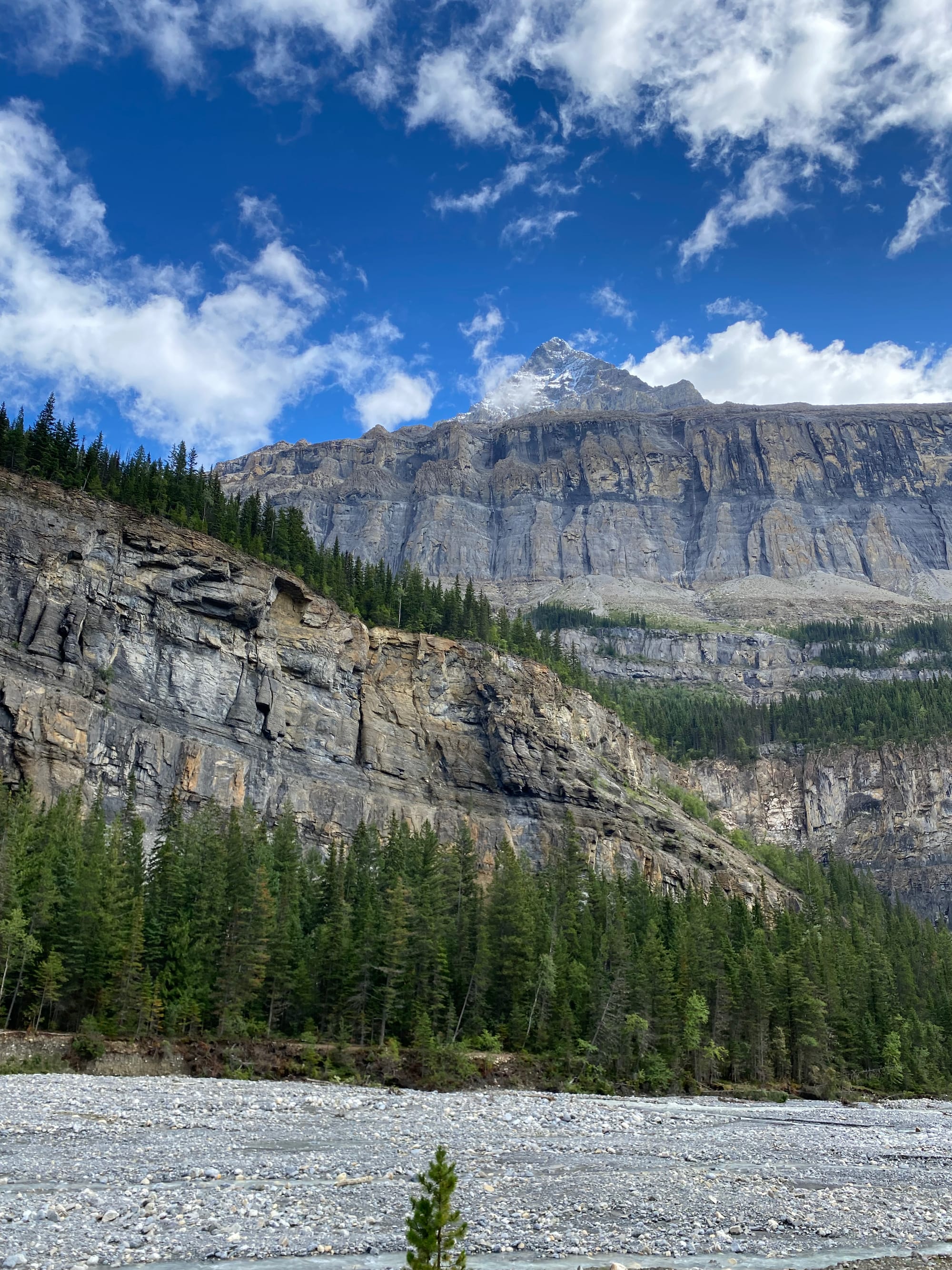
After crossing Miette Pass, the trail circled around the massive wall of Salient Peak. It really reminded me of Burgess Pass in section D.
At one point there was a massive rockfall above me! I sprinted along the path as large rocks tumbled down the boulder field, but luckily none of them reached the trail.
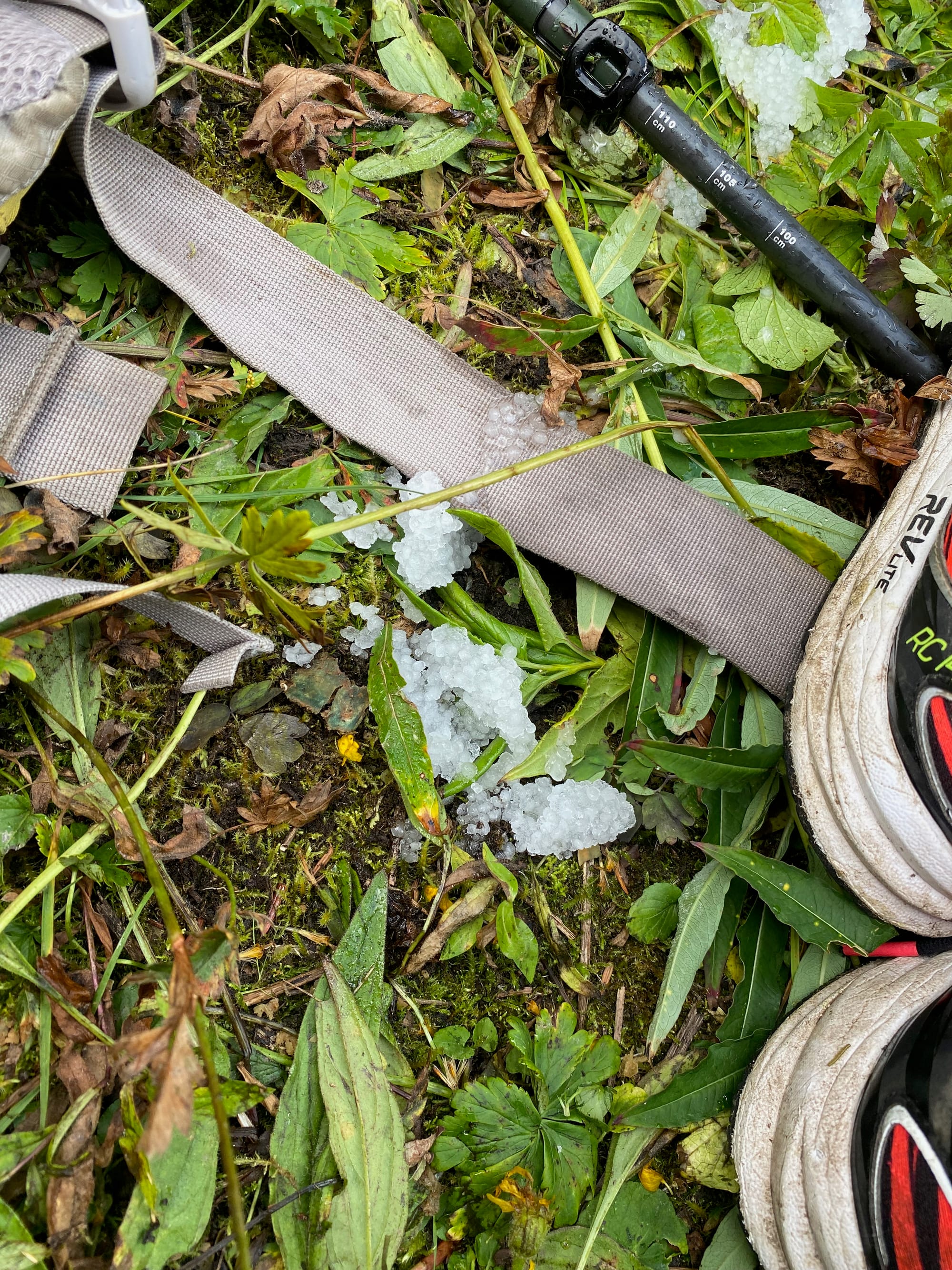
The next day, I’d planned to get an early start and cover a lot of ground. I woke up in the middle of a thunderstorm. Hail pelted my tent as thunder and lightning raged around me. I went back to sleep for another couple hours, then cleared the layer of hail off the tent and packed up. As I was about to leave, another thunderstorm hit, forcing me to wait under a (mostly) dry tree for a while. Happy birthday to me…
Eventually I left camp. Most of the deadfall in the next section had been cleared, but some hadn’t. At one point my pack was caught on a branch and the side pocket completely ripped open. I had to use the last of my zip ties to fix it. Immediately after this, the same thing happened to my pants. Luckily I had another pair.
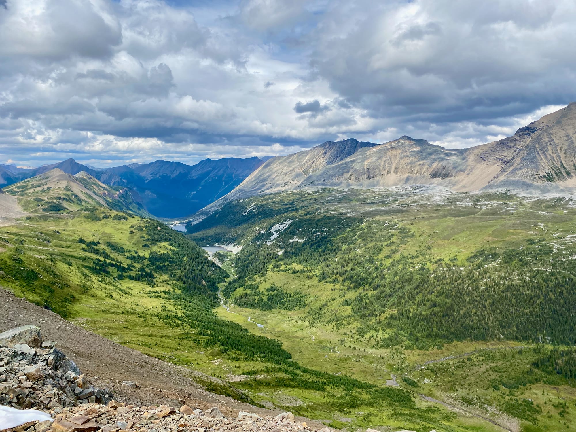
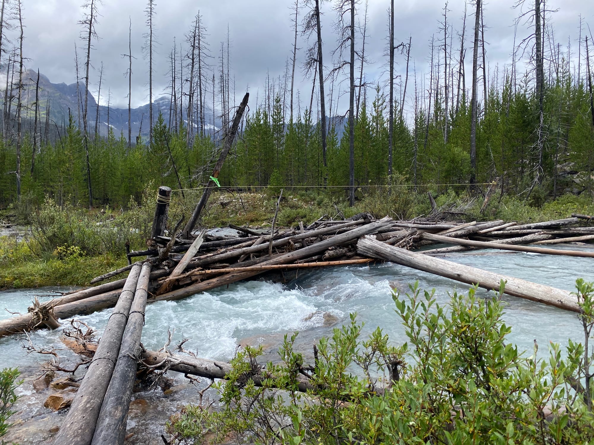
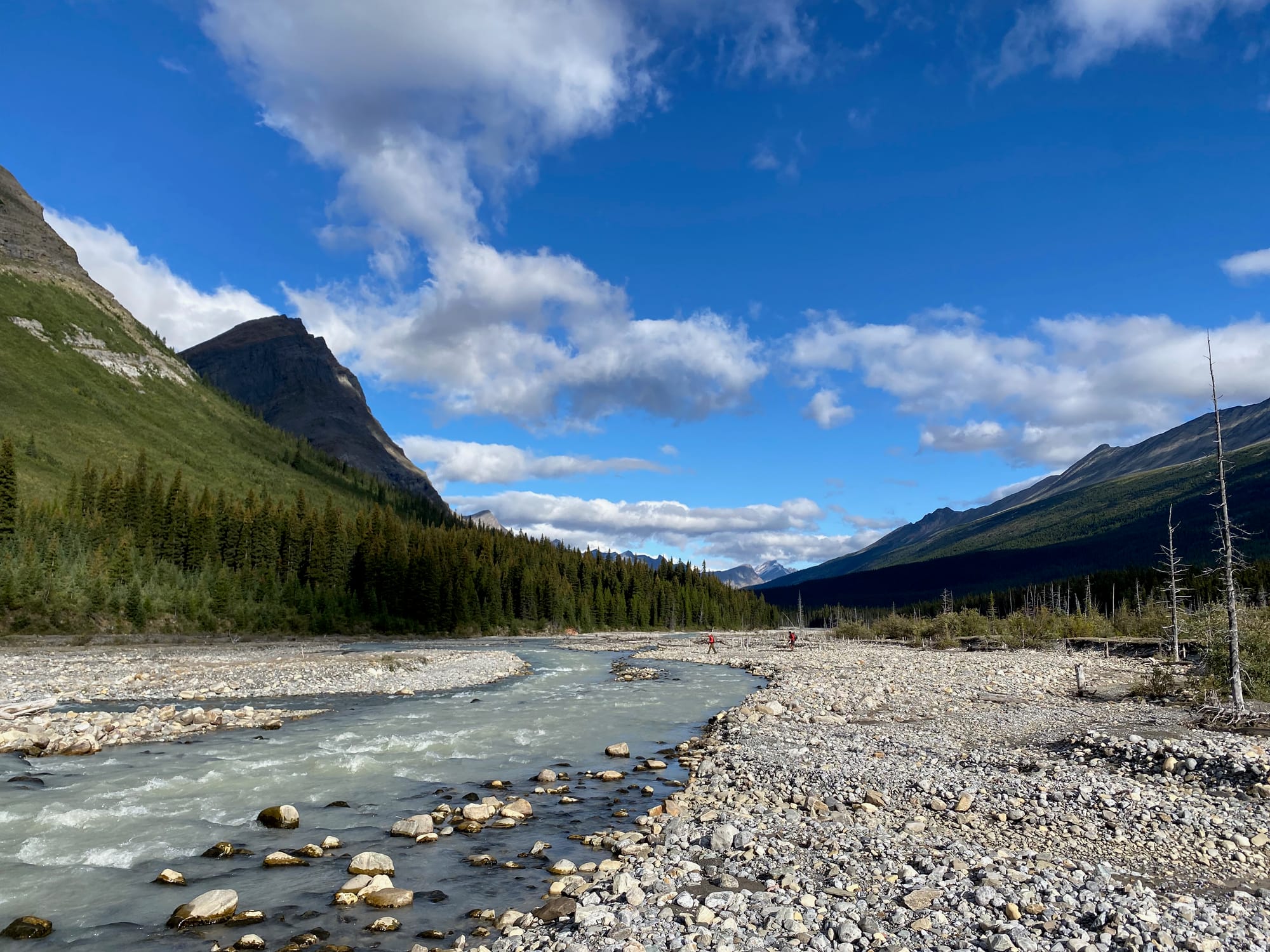
The trail descends into the Moose River valley, following an old horse trail. Being a horse trail, it fords the river about 6-8 times, although the GDTA has rerouted the trail to avoid even more fords. The river was thigh deep at most, even after the rain. This was deeper than expected, making me even more worried about the Smoky River on the other side of the pass.
Along the way I met Nathan, the first southbound hiker I’d met. He had some helpful tips about the route ahead, especially about the difficult crossing of the Carcajou river.
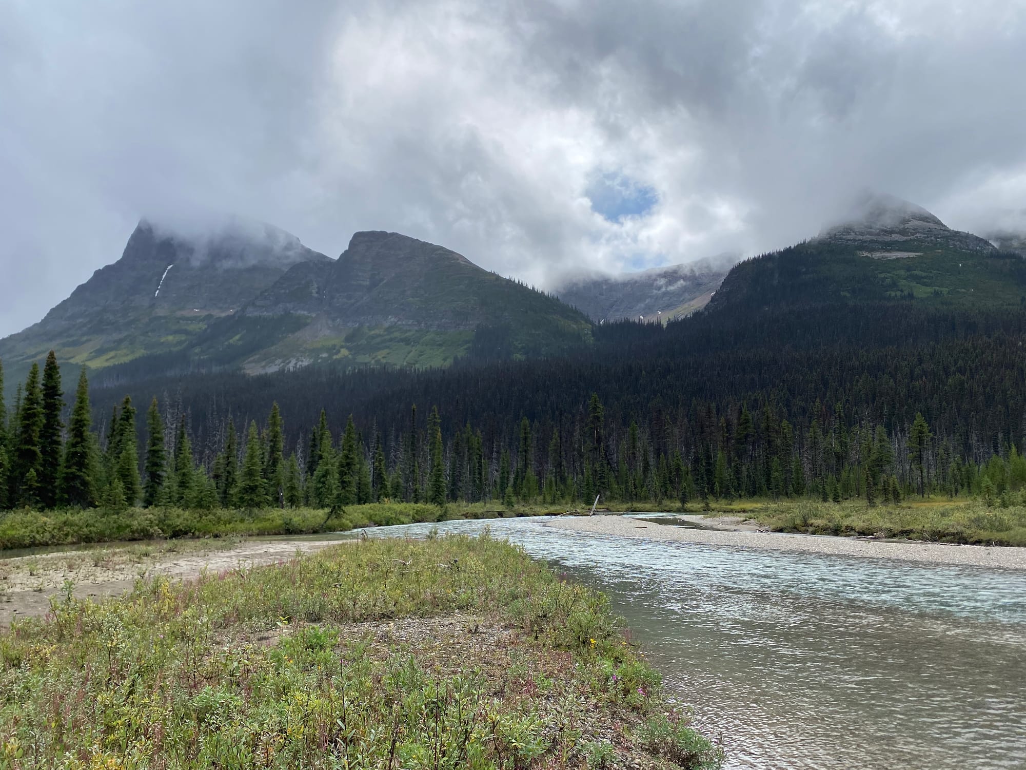
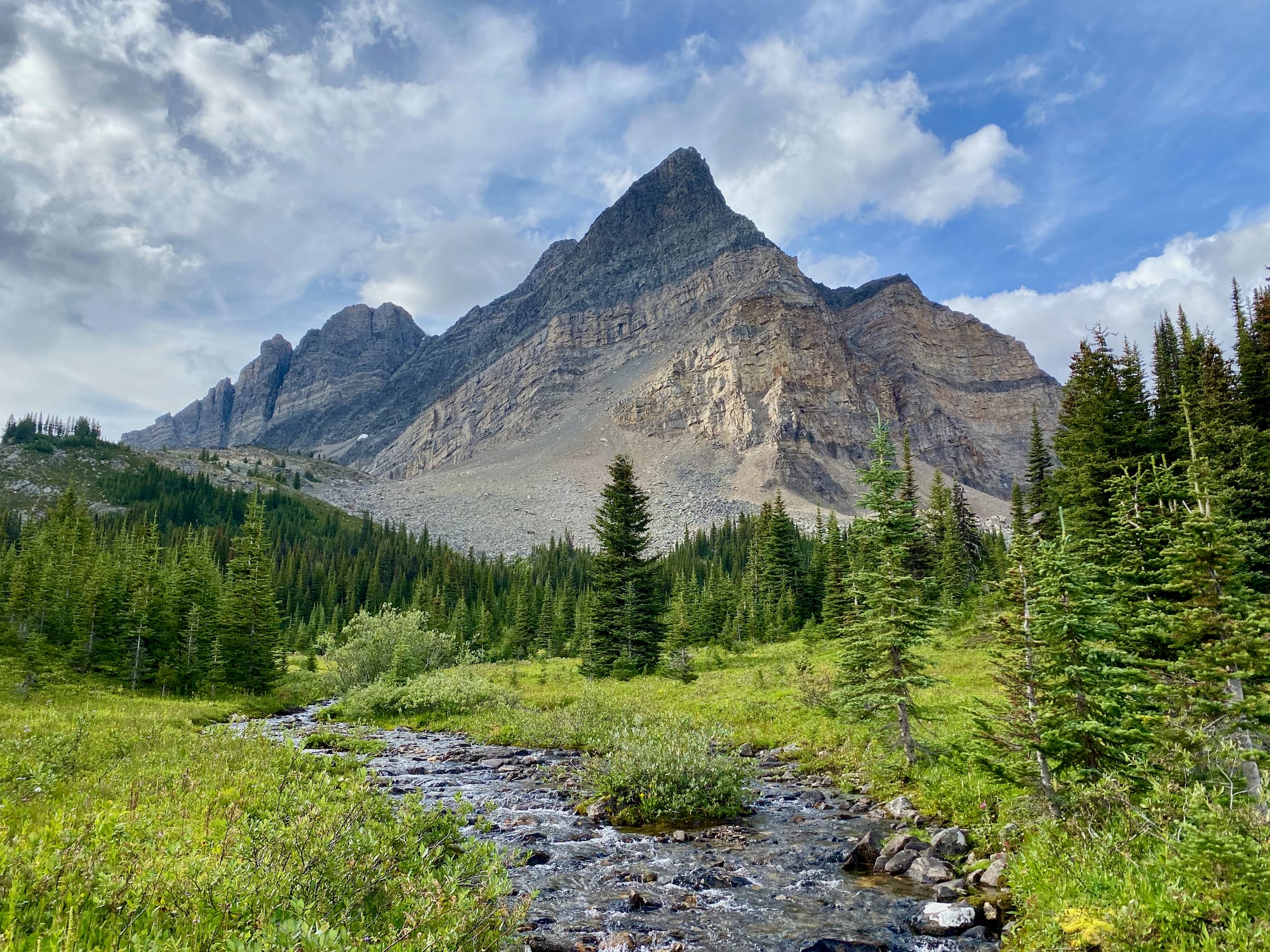
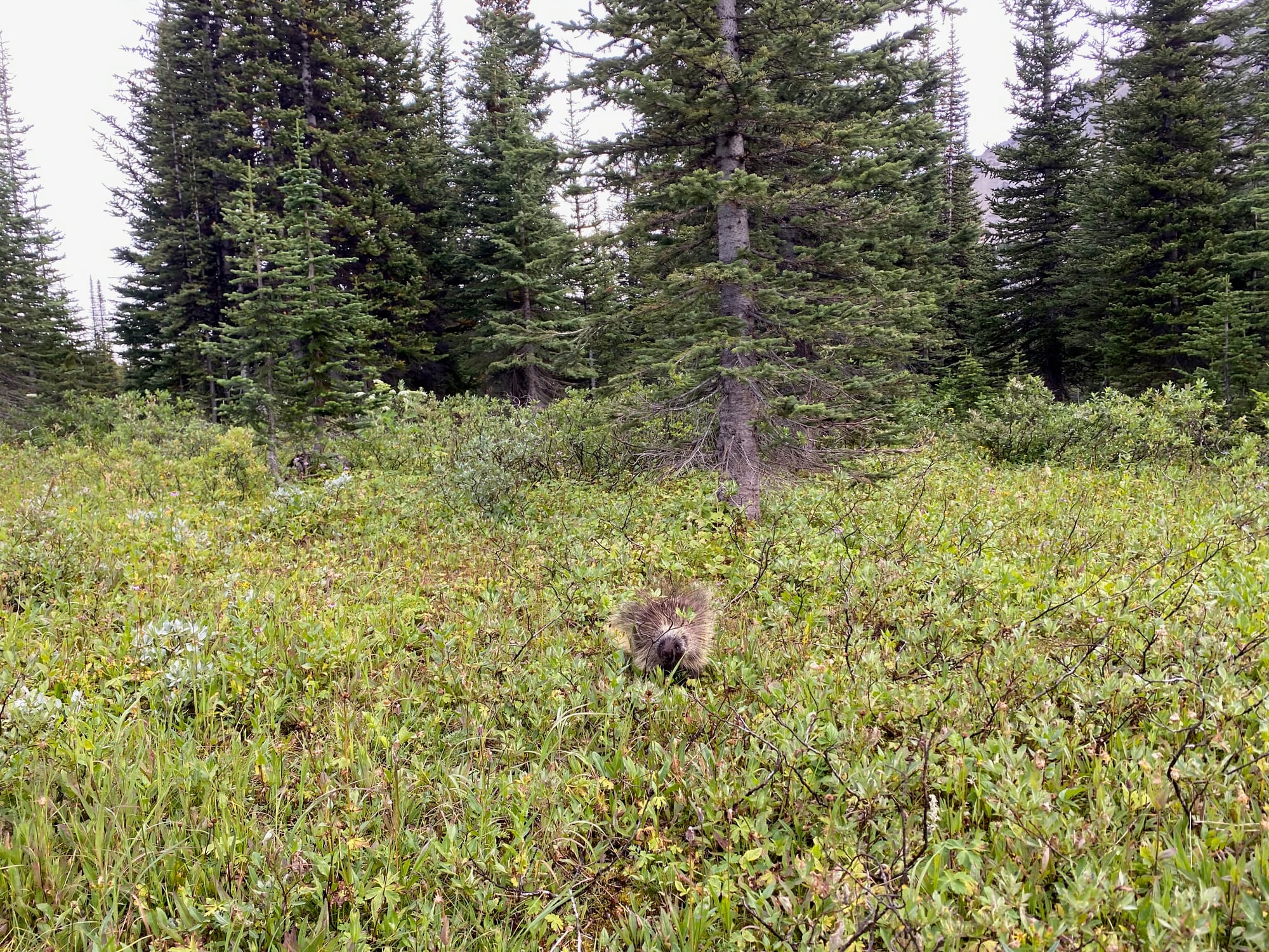
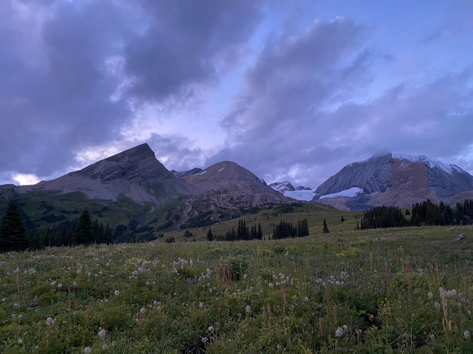
The Moose River valley reminded me of a smaller version of the Howse, with mountains towering above the floodplain. I followed the Moose River to its headwaters at Moose Pass. This meant passing the Slide campsite, known for its resident porcupine which enjoys eating hikers’ belongings. I stopped here for a snack break but didn’t stay long.
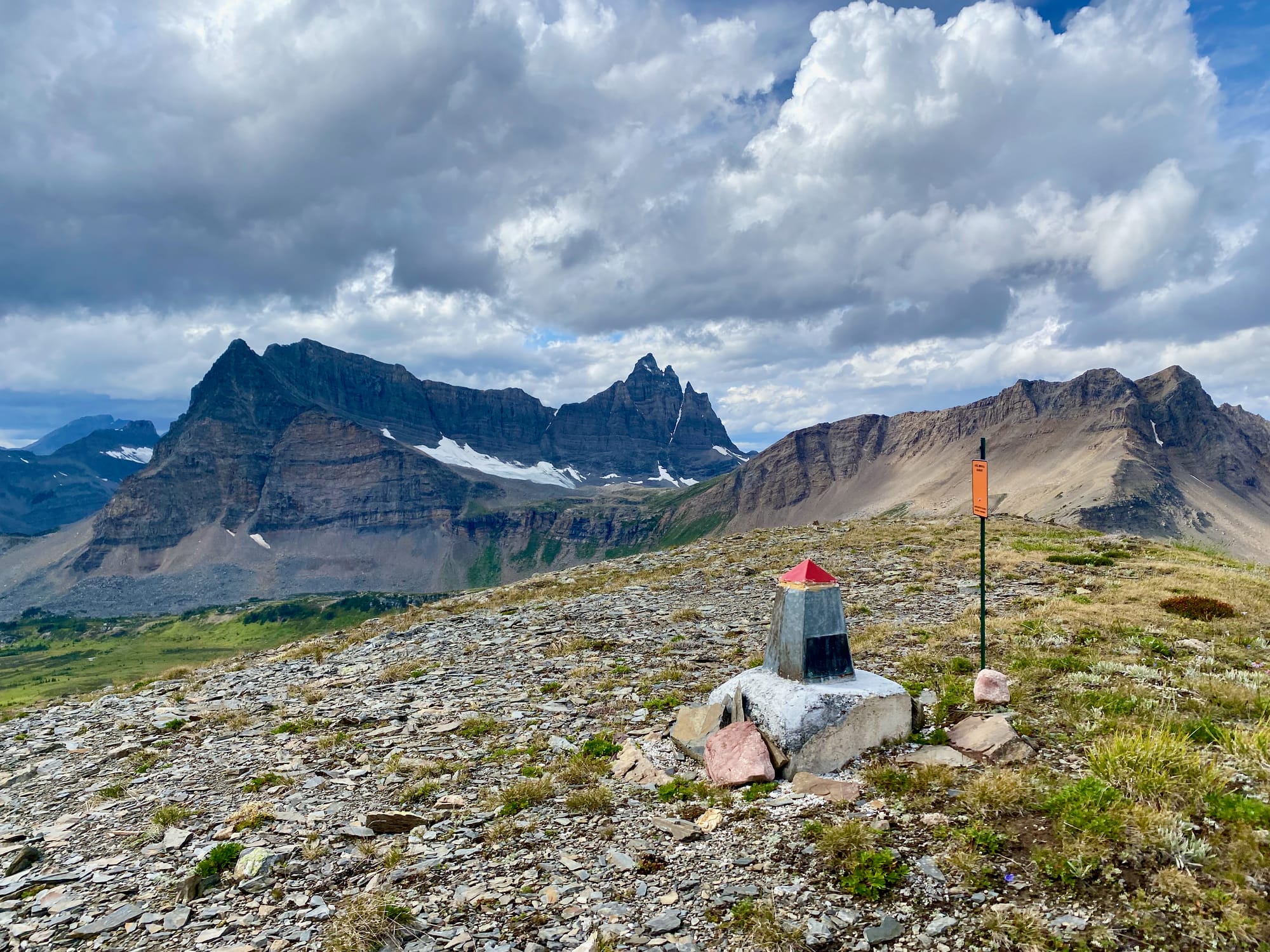
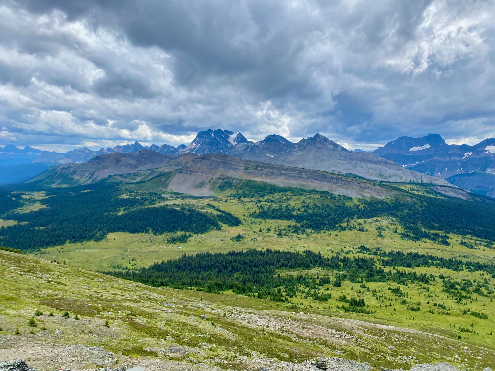
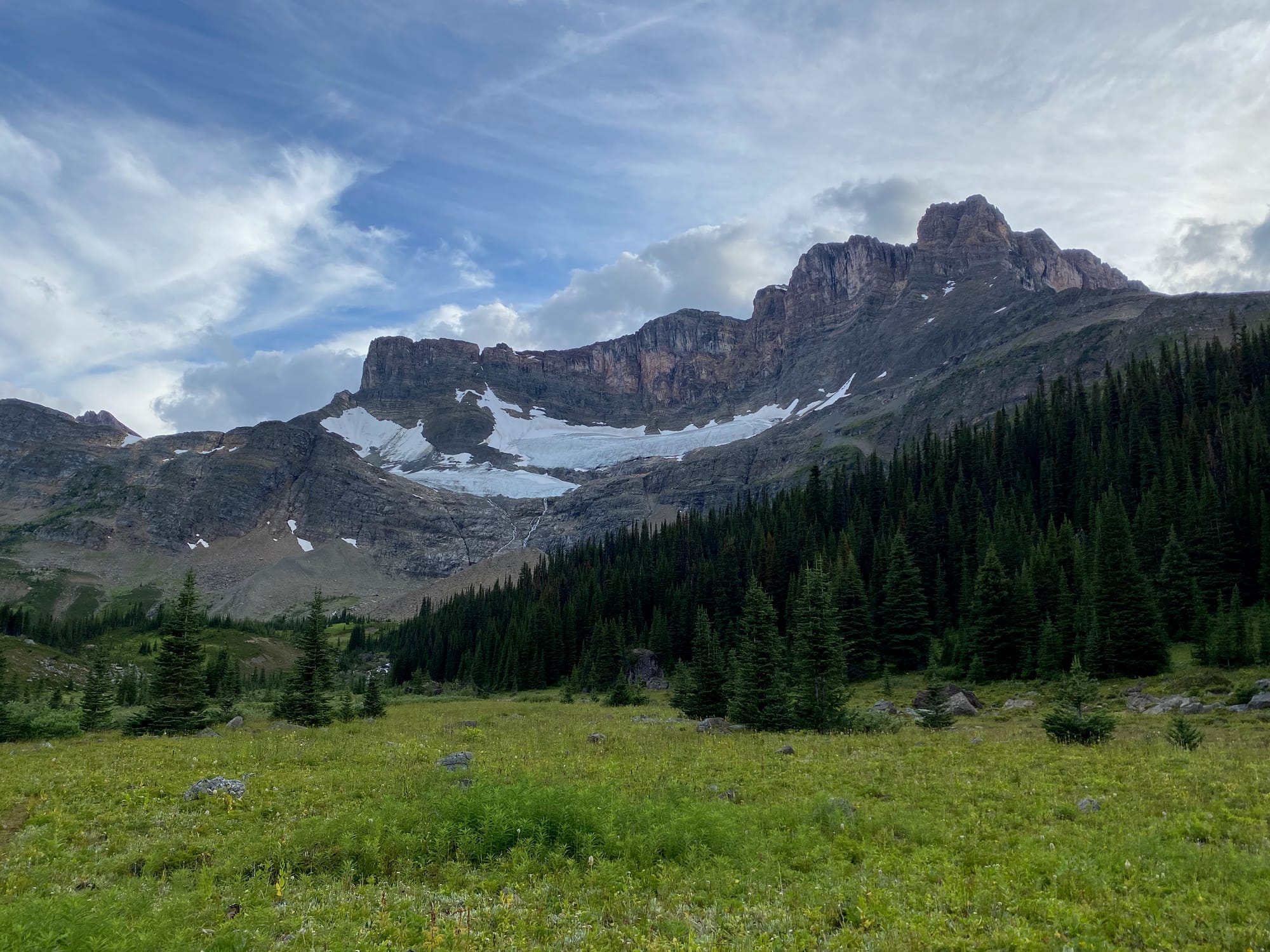
Moose Pass is another expansive alpine meadow surrounded by towering mountains and glaciers. I’d arrived early enough in the year to see some of the wildflowers the pass is known for.
Due to a time zone mishap, sunset was an hour earlier than expected. I reached the pass just in time to see the sun disappear behind the peaks to the west. (You might want to manually set your phone to BC time after leaving Jasper; most trailheads and resupply services are on that side.) I crossed below treeline as the last usable light disappeared, navigating through the dark to reach the Calumet Creek campsite.
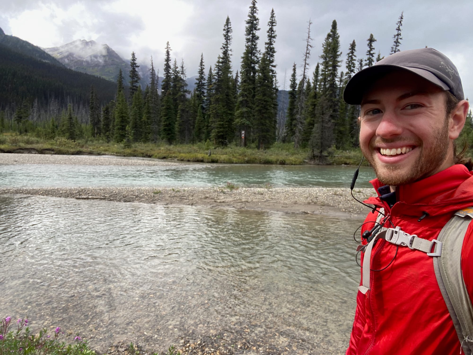
The next day was going to be a long one. After an early wake-up and a nice breakfast with the other group at Calumet Creek, I began walking south. Luckily, the weather was significantly better, with only a few clouds. The biggest challenge of the day was the Smoky River ford, which many resources say is the most dangerous ford in section F, and one of the most difficult on the whole trail…
With the morning’s dry but cold weather, the ford was almost disappointingly easy, only coming up to my knees. It was kind of anticlimactic.
Soon after the ford was the junction with the Mount Robson Trail, marking the beginning of section G. Before I could go there, I had a resupply package to collect at the Robson visitor centre, 28km away, so I headed south on the Robson trail.
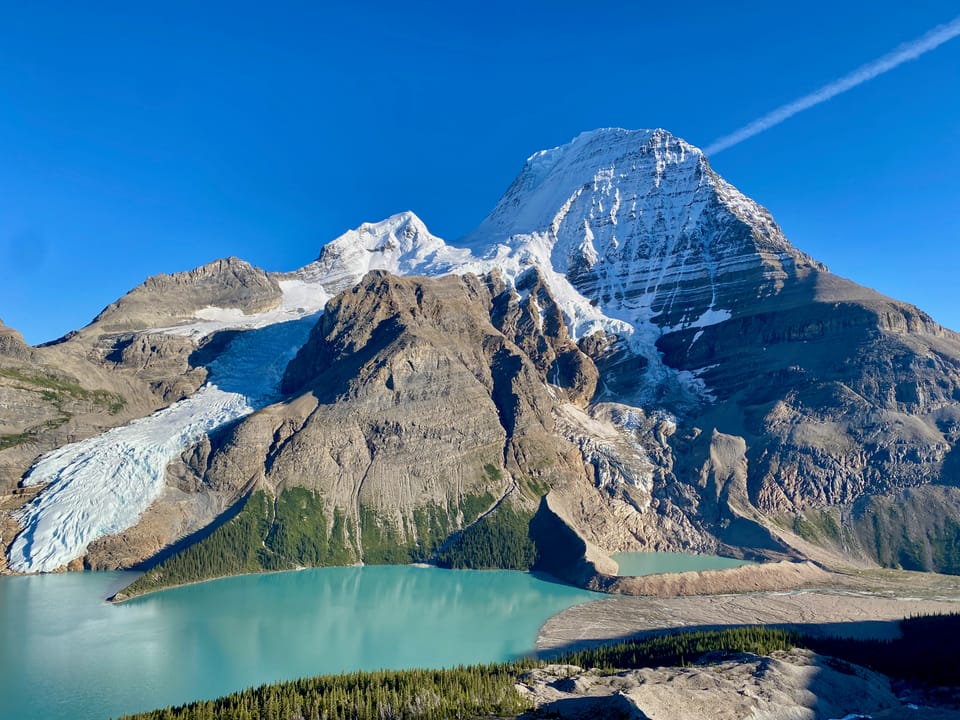
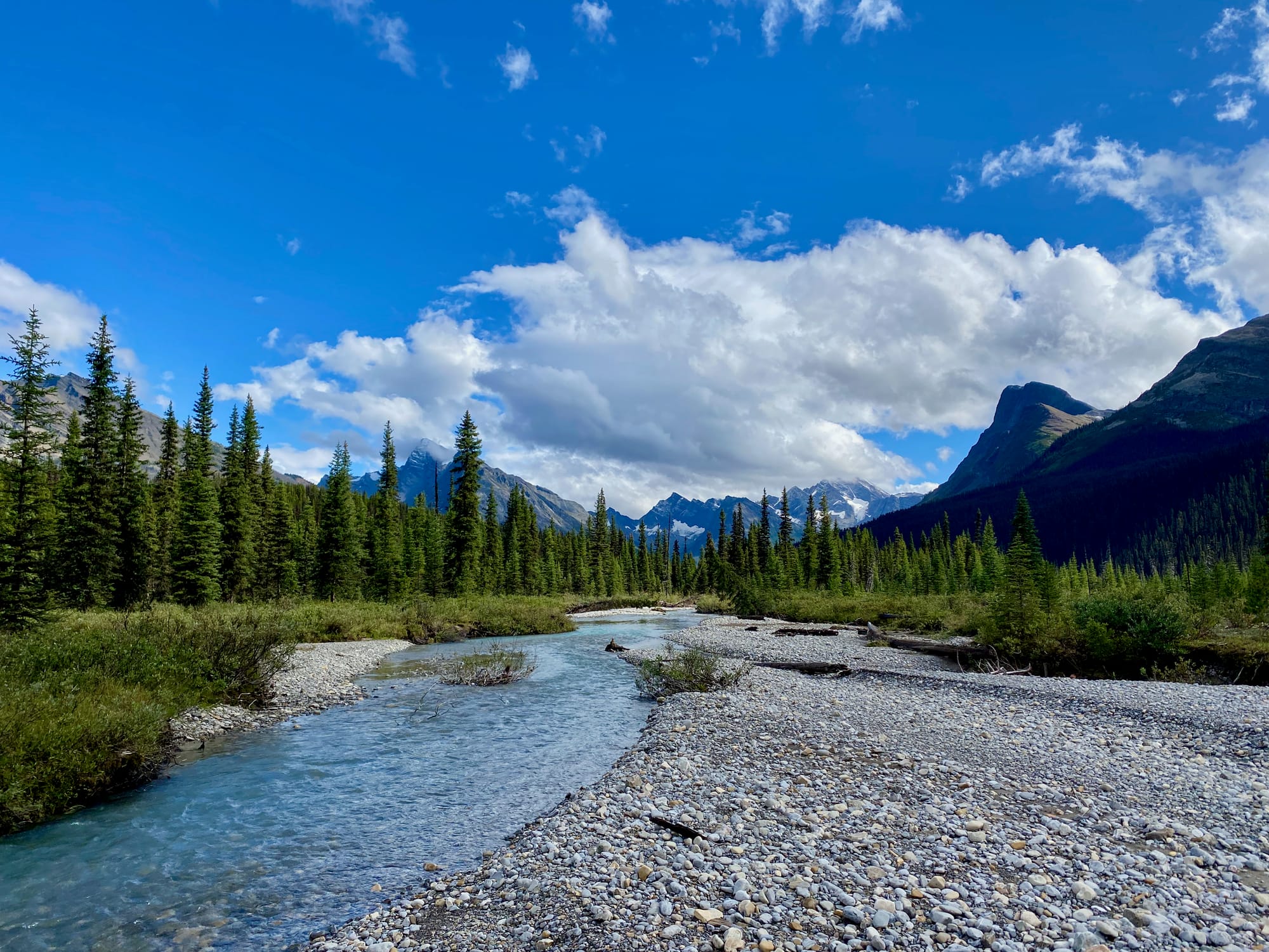
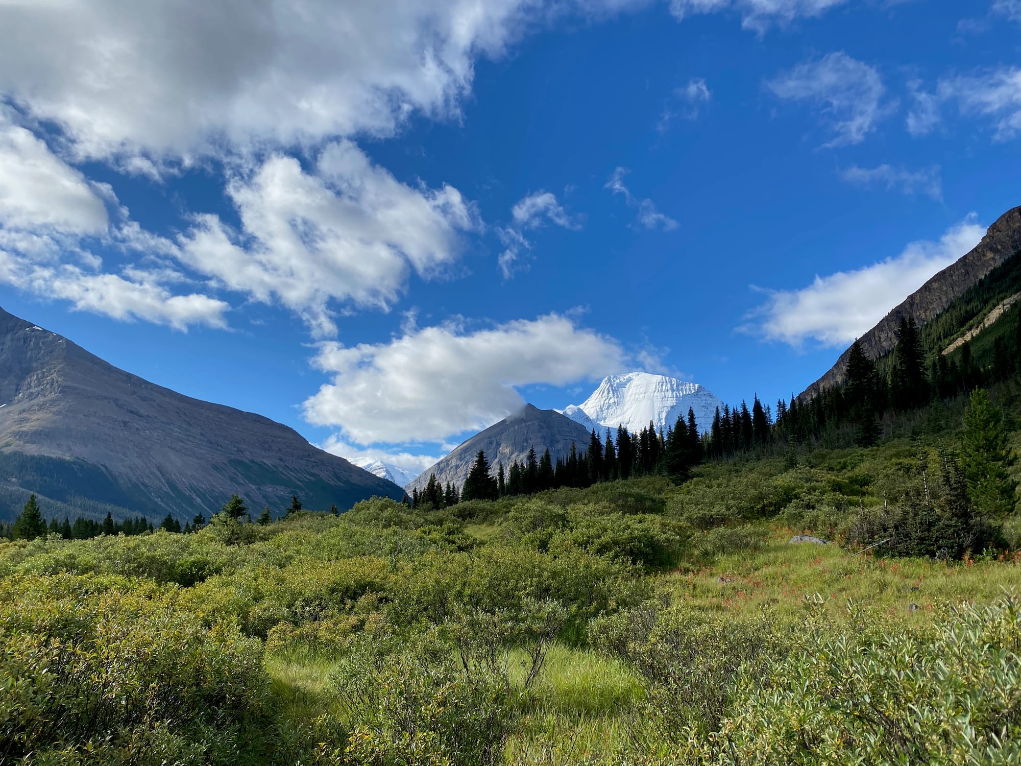
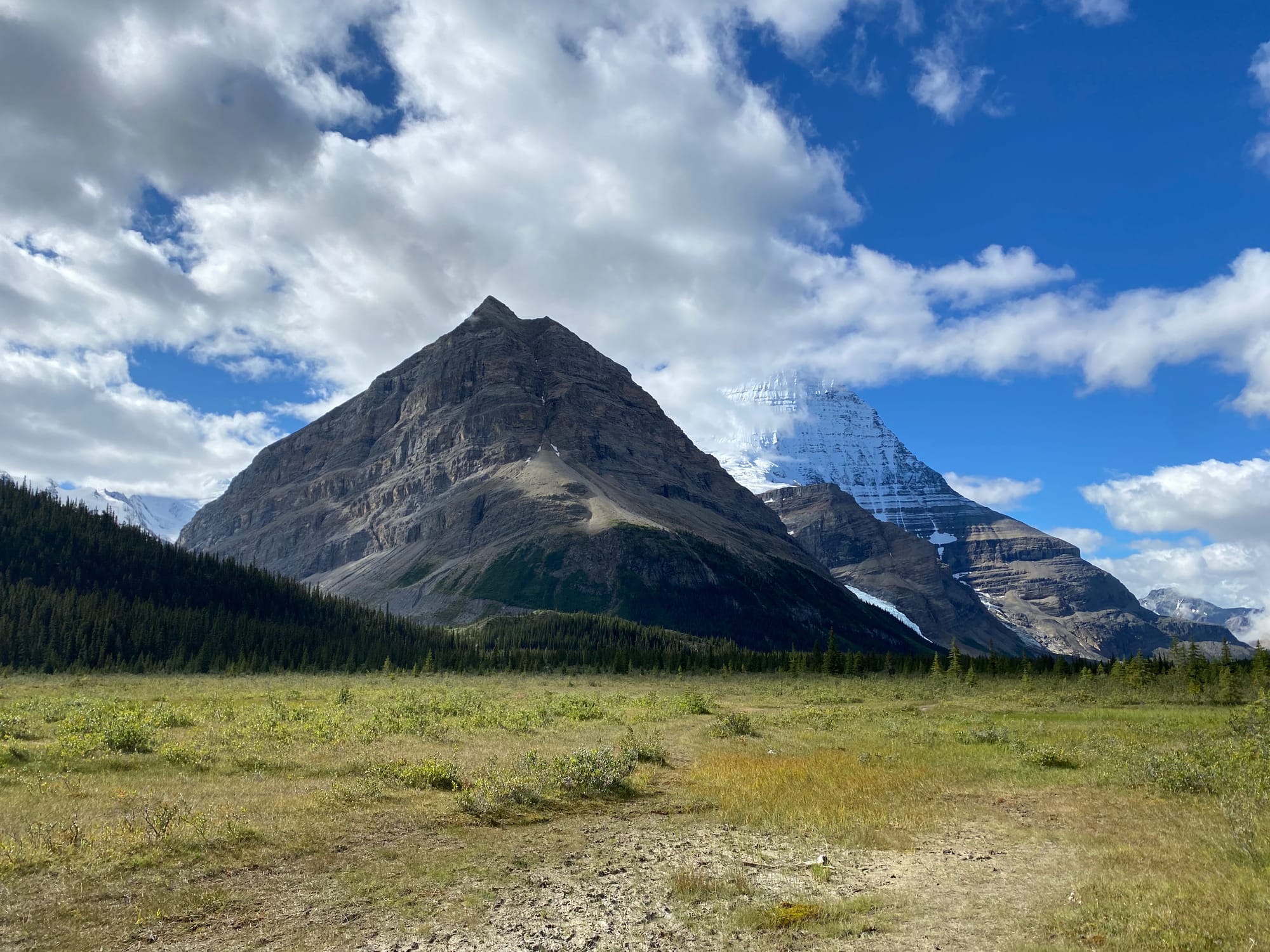
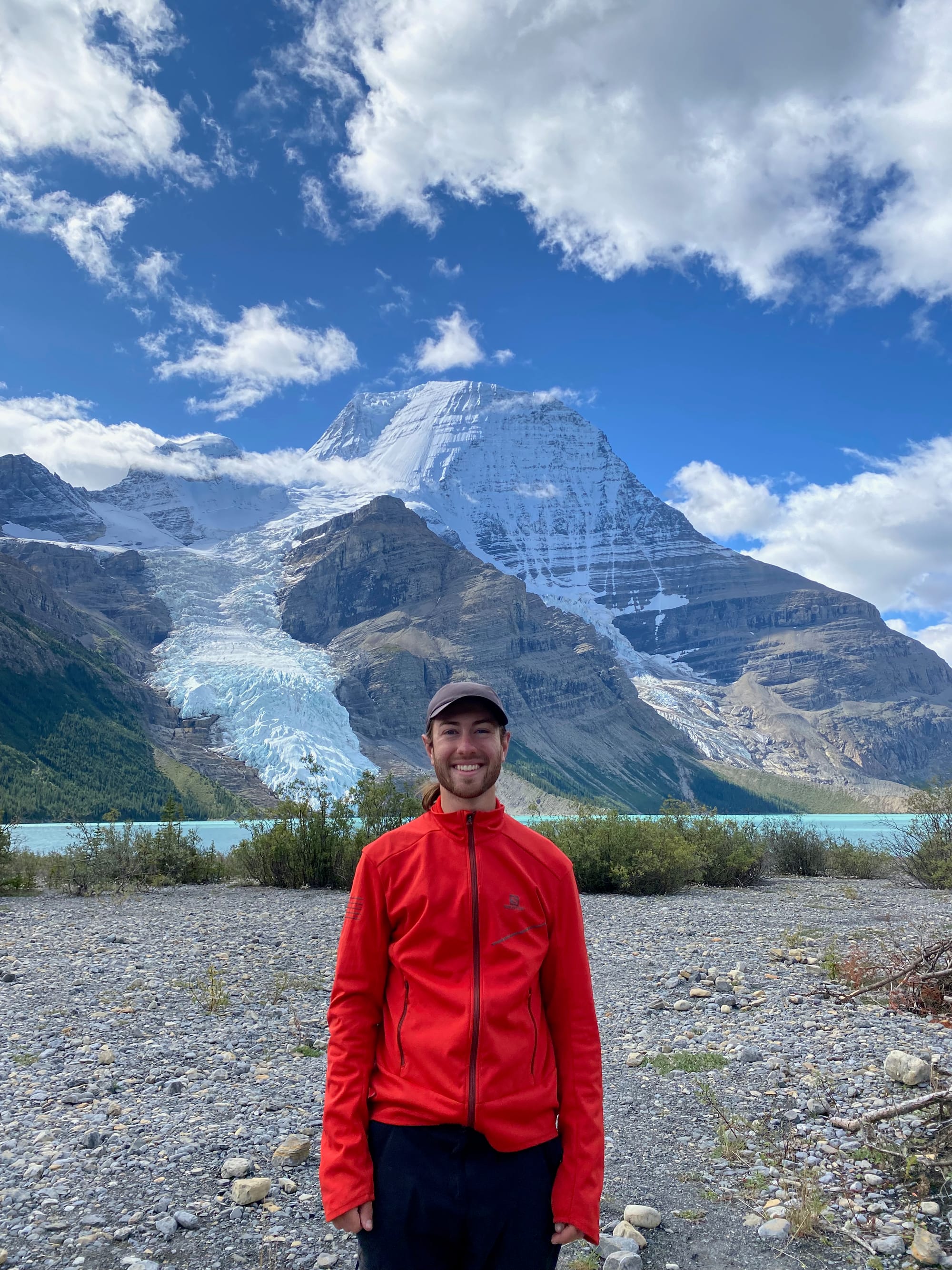
In a few kilometres I turned around a corner and caught my first view of Mount Robson. Even on such a stunning trail, this view stopped me in my tracks. Mount Robson is almost four thousand metres tall and towers almost one kilometre over its neighbours. It feels like a Himalayan or Pamir peak suddenly transported to the Rockies.
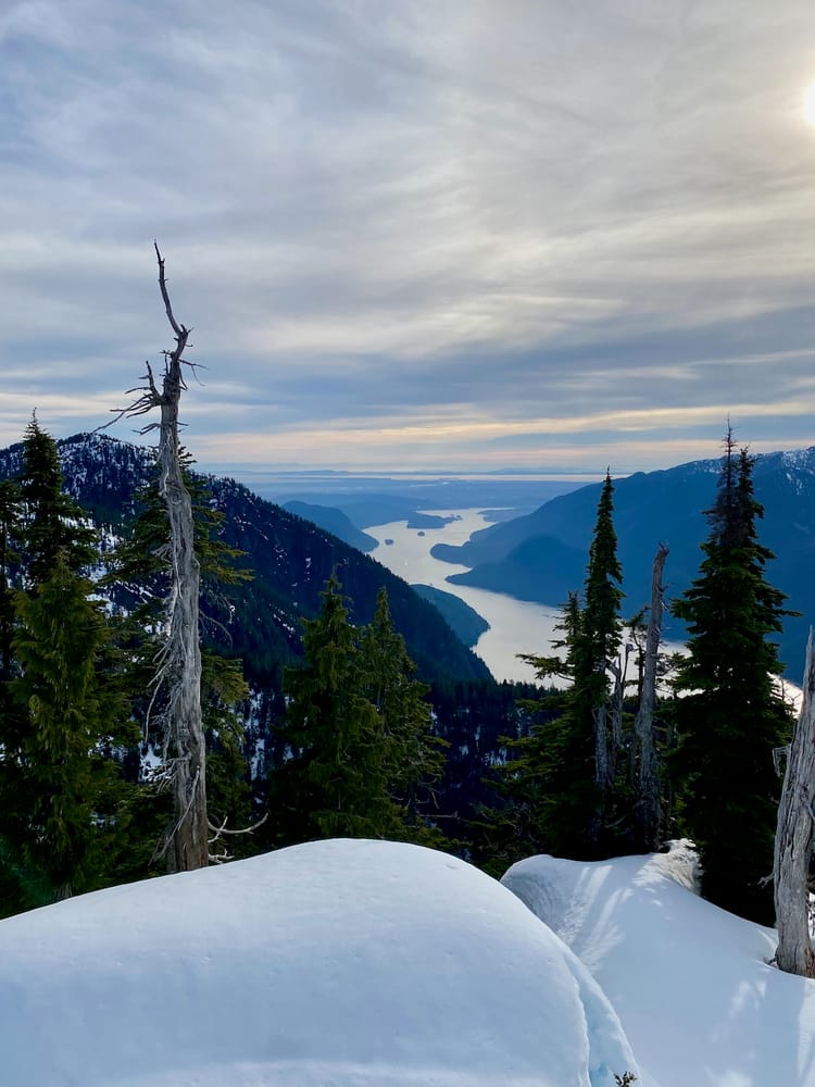
As I walked south, the trail got better and better, as did the view of Robson in the distance. After reaching Robson Pass, the provincial border and boundary of the Berg Lake provincial park, the trail was quite crowded.
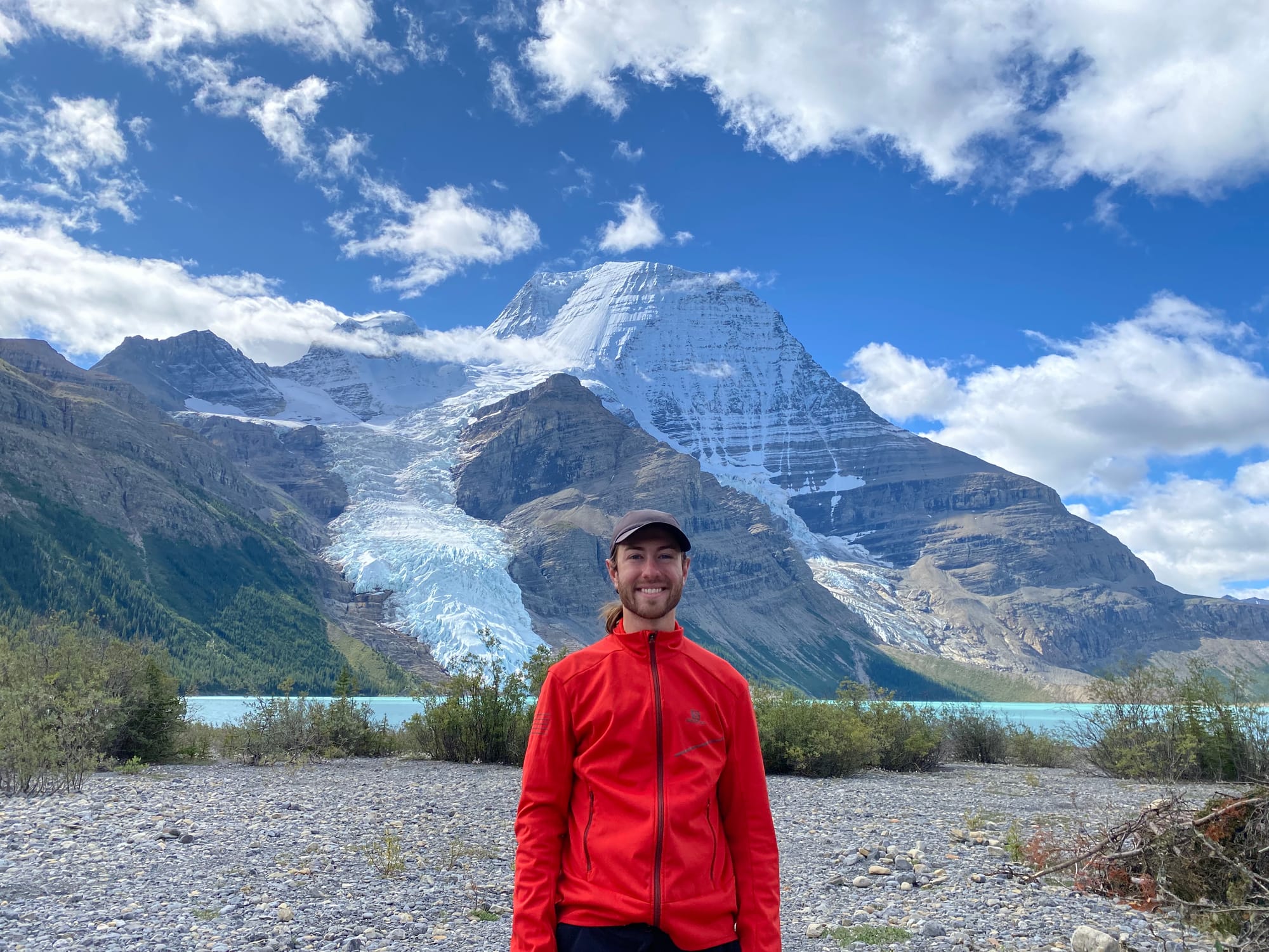
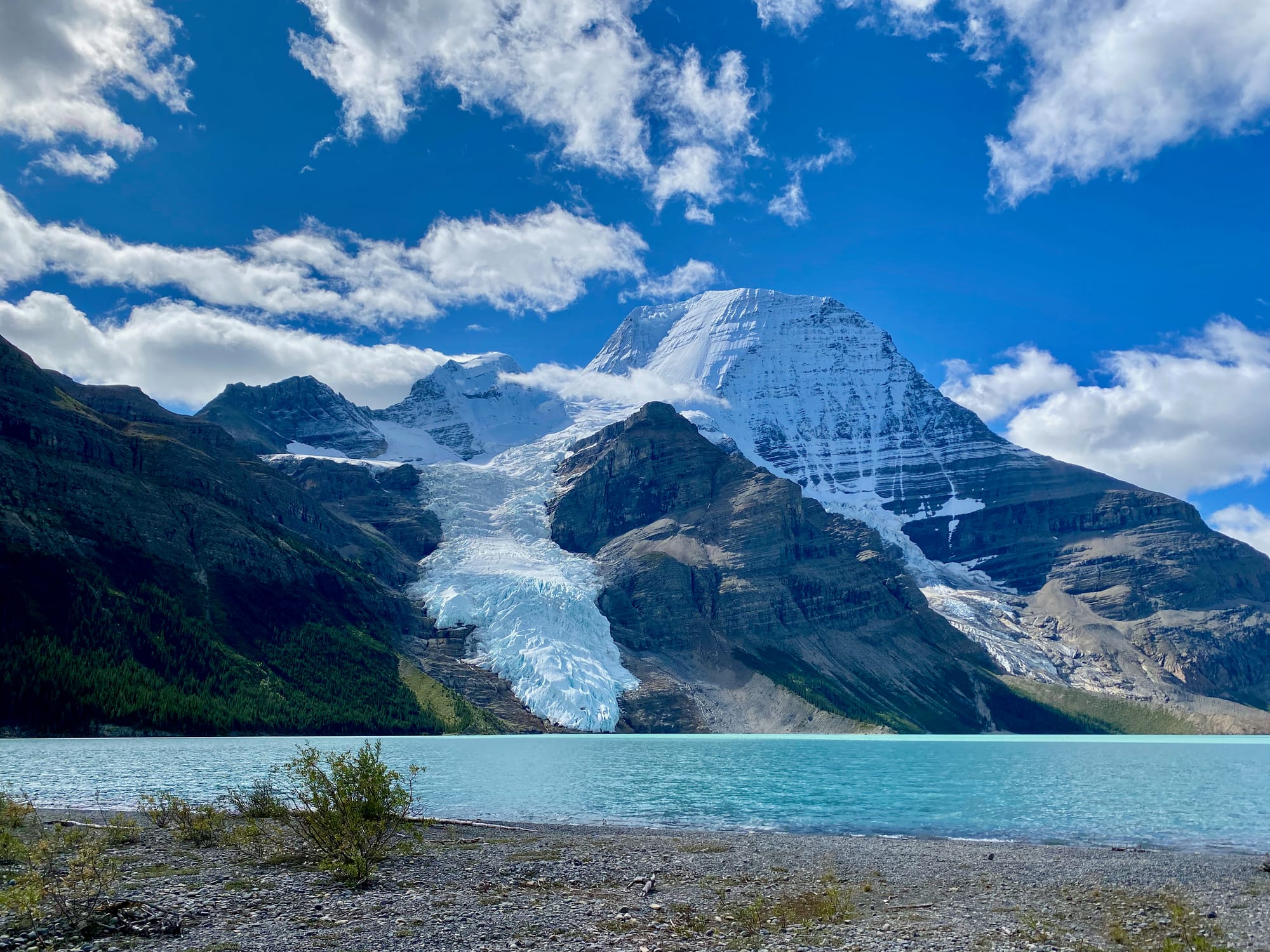
I took a long lunch break at Berg Lake, directly below Robson’s north face, where a glacier cascades down from the peak. Climate change is evident everywhere along this trail, but this was one of the more powerful reminders. The glacier no longer reaches the lake; a very recent development, given how close it still is. There are no bergs in Berg Lake anymore.
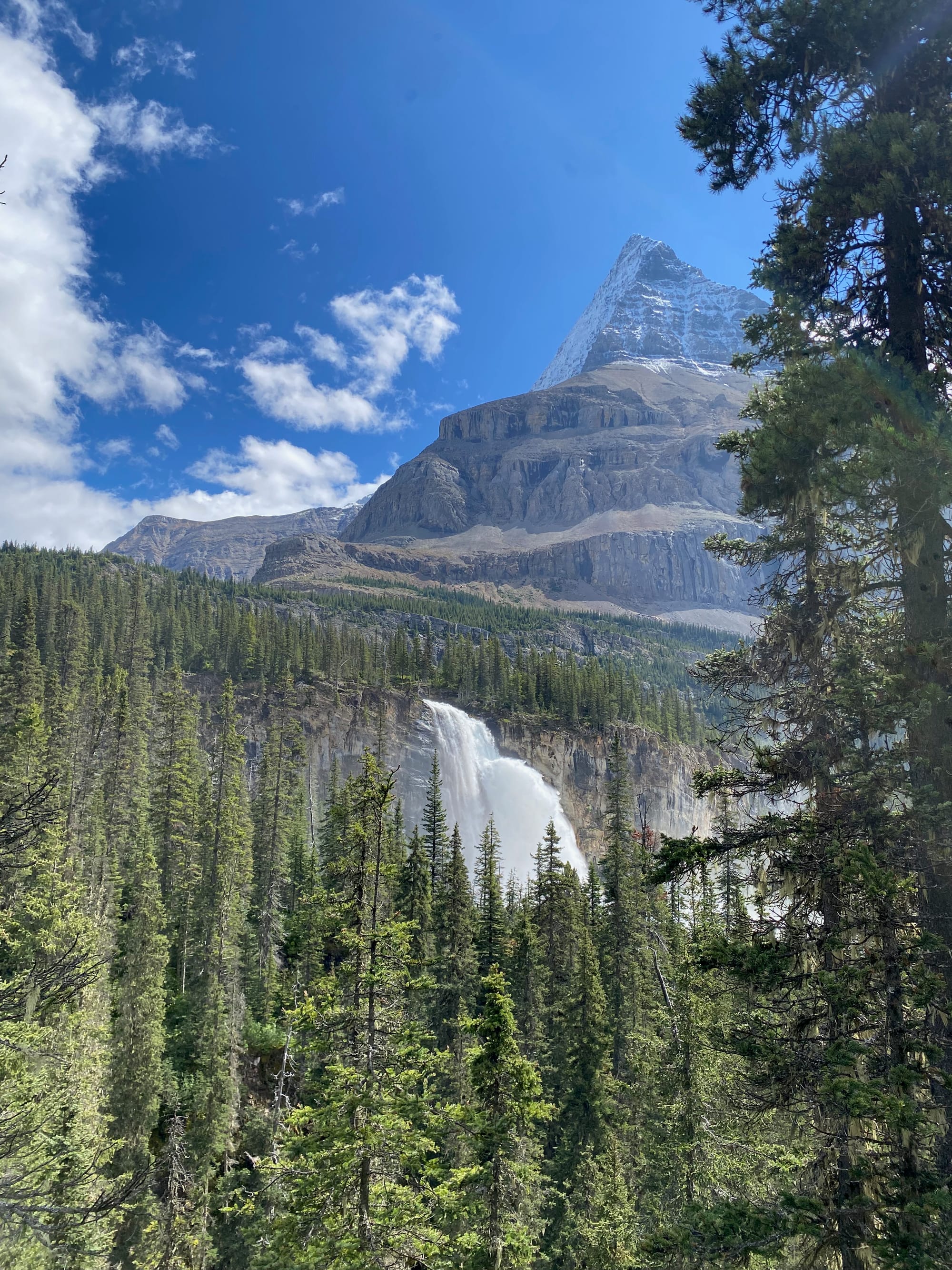
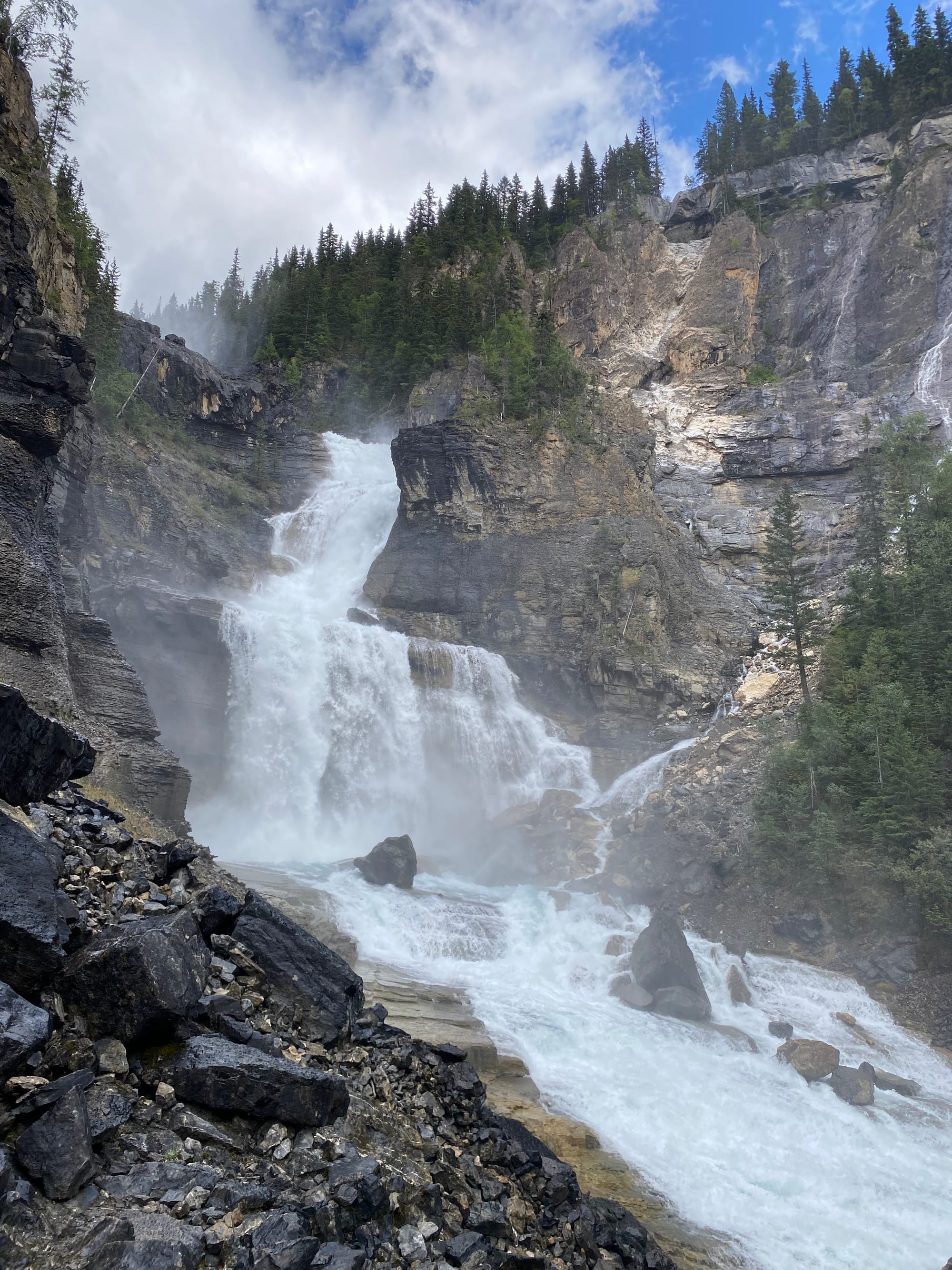
From the lake, the trail continued along a floodplain for a while, then began its long descent into a canyon carved by the Robson River. There were many side trips and viewpoints of waterfalls. I started passing many, many tourists, for the last time on this adventure.
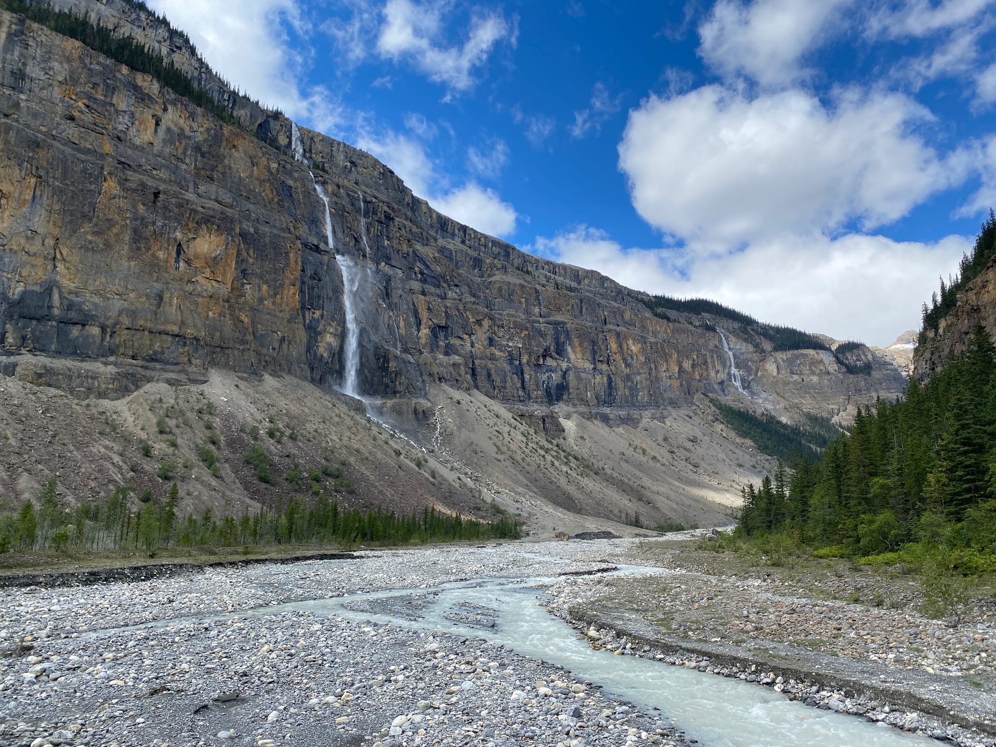
Past Kinney Lake, the trail passes through an extremely rare inland rainforest. Mountains and humid air create enough precipitation to sustain a rainforest hundreds of kilometres from the coast. The temperature became noticeably cooler. As a Vancouverite, the climate, combined with the wide, well-maintained trail, gave me a weird feeling of deja vu: I could’ve been in Lynn Canyon Park or Lighthouse Park or any other popular park near my house.
There are kilometre markers along the trail, but GDT hikers will have to add an extra two kilometres of road walking to these numbers to get to the visitor centre. Any resupply packages will be sent to the visitor centre, which was open from 8pm to 4pm (not 8pm to 7pm as listed elsewhere). I arrived at 4:30 and had to track down a park ranger who could get into the locked building (thanks!) This is best avoided.
I filled my now-very-heavy pack with 8 days’ worth of food from the resupply box, got a surprisingly good meal at the cafe, and took advantage of the last internet access for a while to check in with family and friends and sort some stuff out for the upcoming school year. Across the field, the summit of Mount Robson was hidden in clouds. Many - if not most - people will end their thru-hike here.

Member discussion