Great Divide Trail Section E
Saskatchewan River Crossing -> Jasper
August 9-16, 2025
190km
GDTA Link: https://greatdividetrail.com/go-hiking/section-hiking/section-e/
Side trips: Michele Lakes Peak, Replica Peak
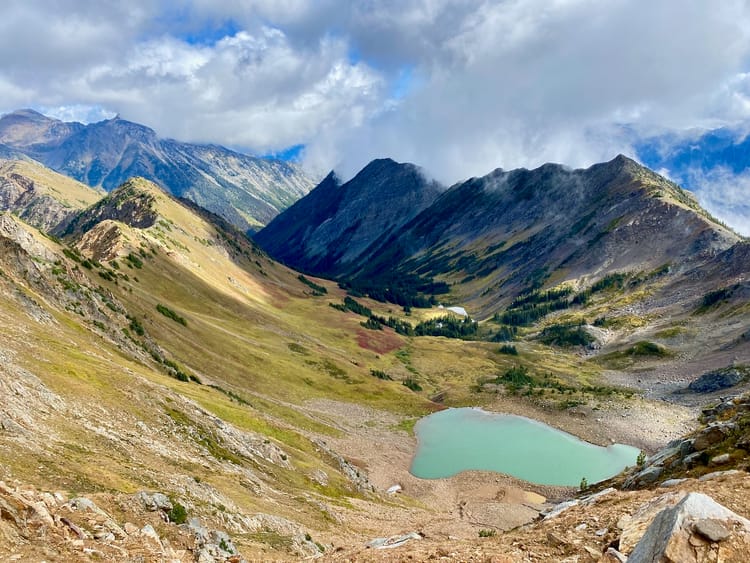
Out of all the GDT sections I completed, section E was the most stunning. After a steep climb beside a slot canyon, it follows a series of valleys and passes, mostly above treeline: Owen Pass, Cataract Pass, Maligne Pass, and so on. Some of my favourite GDT memories involved reaching the next pass to see surreal mountain scenery unfold in front of me. The trails are a mix of well-groomed, popular superhighways, such as the Skyline trail, and more remote herd paths in obscure places like the White Goat wilderness, where trail maintenance isn’t even allowed. I’d never heard of the White Goat Wilderness before this trip, but it became one of my favourite sections of the trail. Side trips to Mt. Stewart and Replica Peak were also highlights. The section wraps up on the popular Skyline trail, which I did in a freezing rainstorm, then descends to the town of Jasper where warm meals and rest awaited.
This section has an inauspicious beginning, with the first few kilometres being a bit of a slog along an abandoned logging road with industrial debris and some of the worst mosquitoes I encountered on this trip. I was aiming to camp at the boundary cutline, the closest official campsite to the trail (it’s just outside the Banff National Park boundary) but spent too much time doomscrolling at The Crossing resort, which forced me to set up camp in the middle of the logging road as darkness fell.
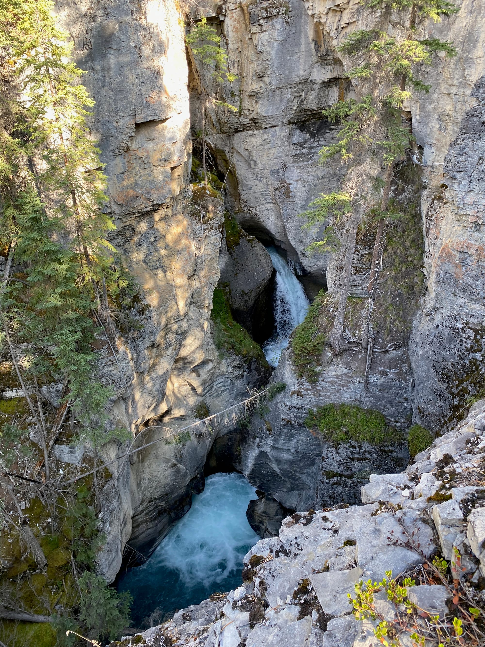
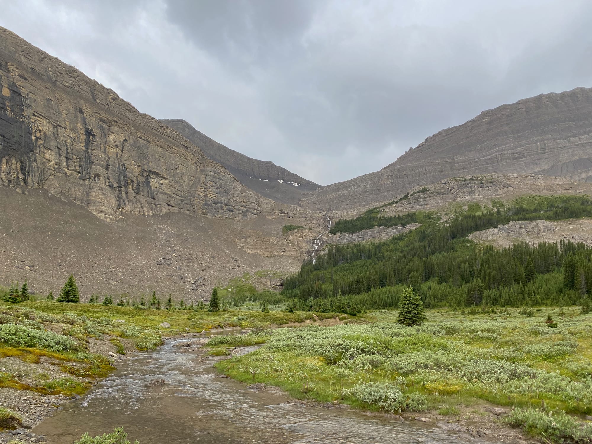
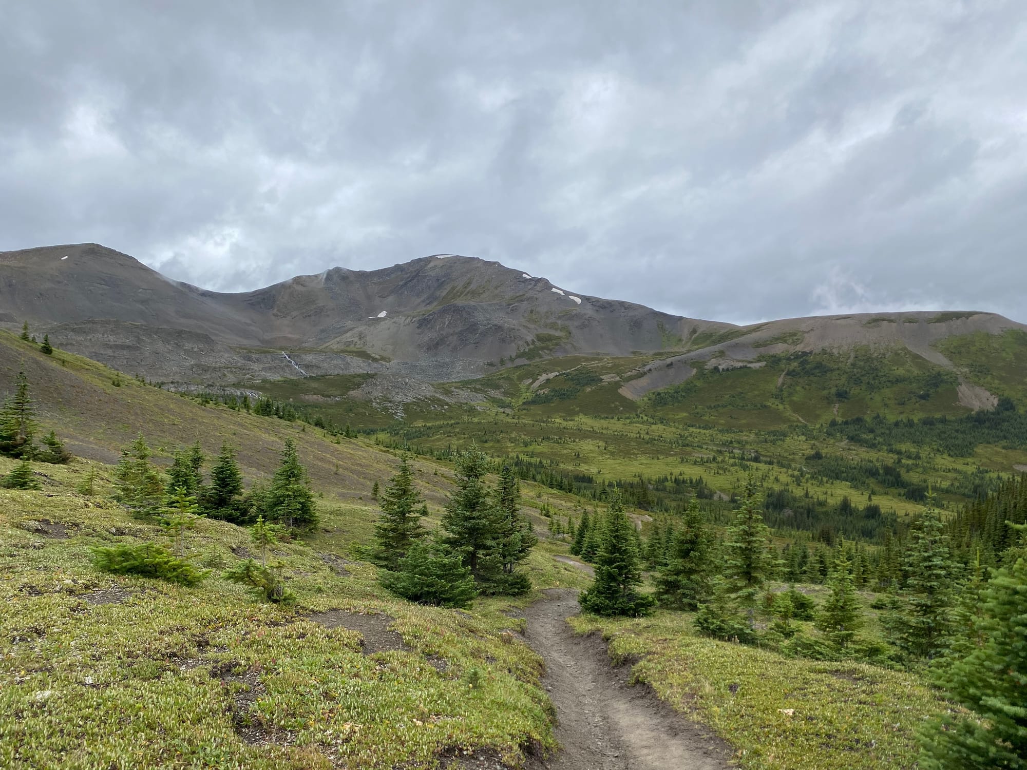
Things improved the next day when I reached the Owen Creek trailhead. This trail follows the creek up and up and up, traversing the rim of a dizzyingly deep slot canyon. Recent trail maintenance made this action easier than it used to be, but there was still plenty of deadfall in places. I continued upward as the forest thinned out, then vanished entirely. I would spend most of the next few days in the alpine.
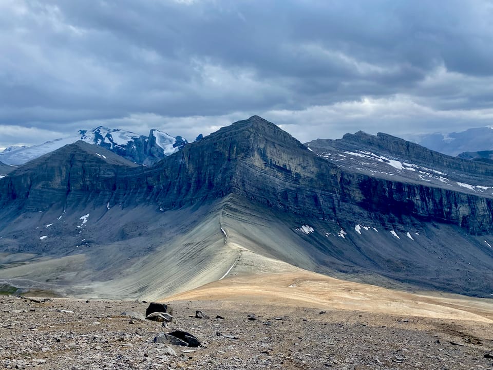
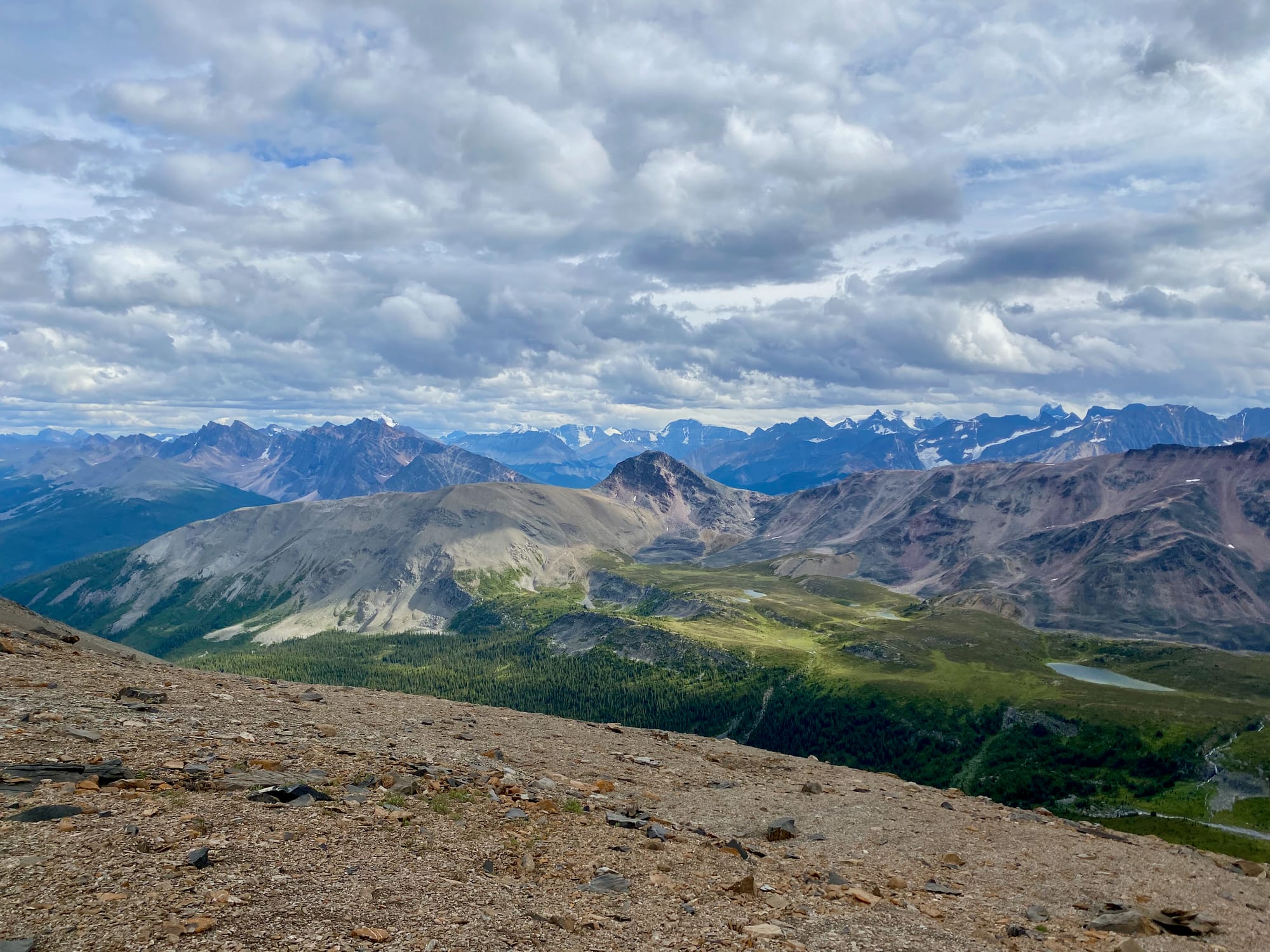
The trail led to Owen Pass, the first of many mountain passes. To my left was a massive rock wall, with an icefield further beyond. Ahead lay another valley and pass. Further down this valley are the beautiful glacial blue Michele Lakes. I took a long break at the upper lake, almost mustering the courage to go for a swim, but incoming clouds and rain put a stop to that.
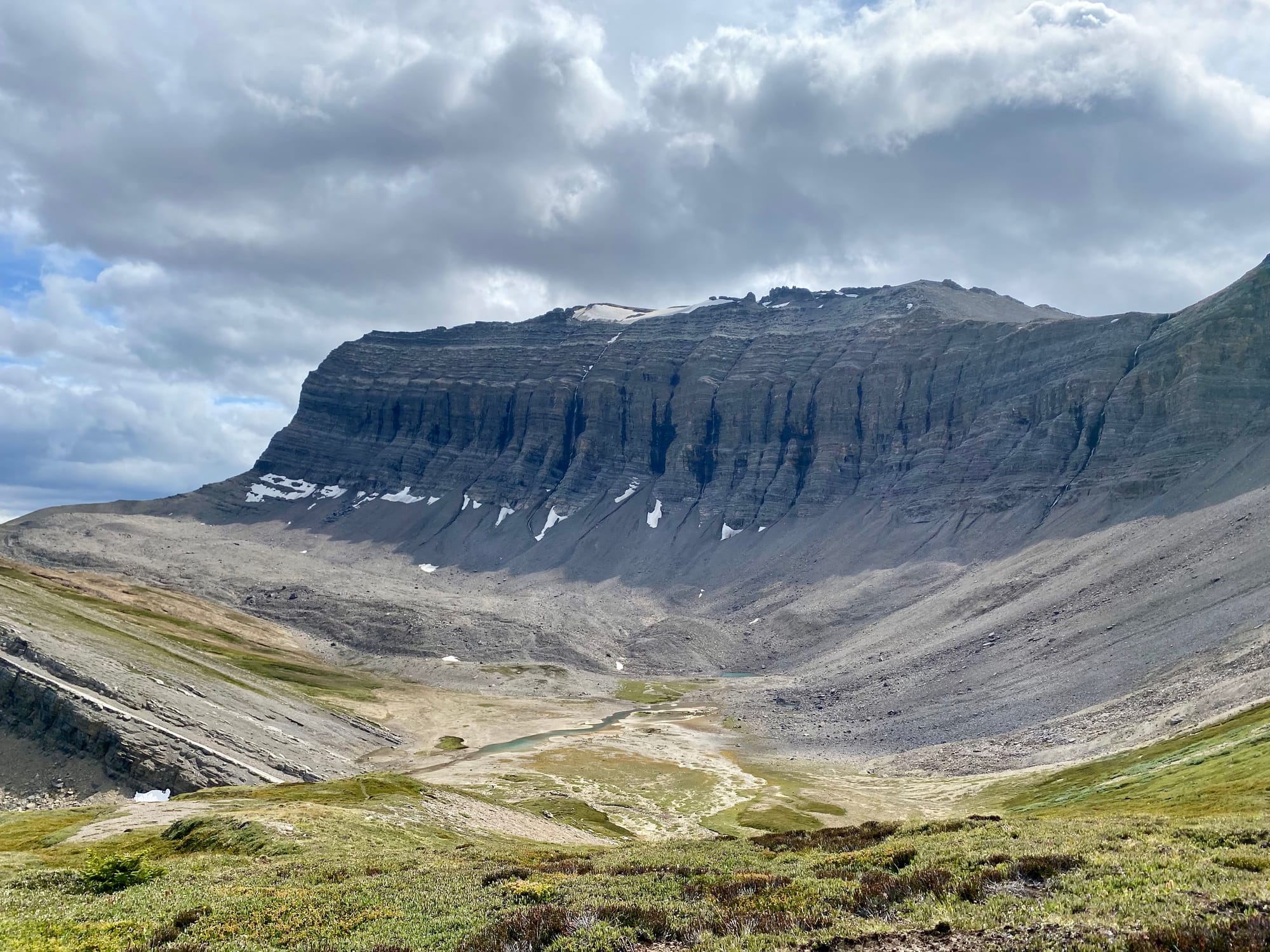
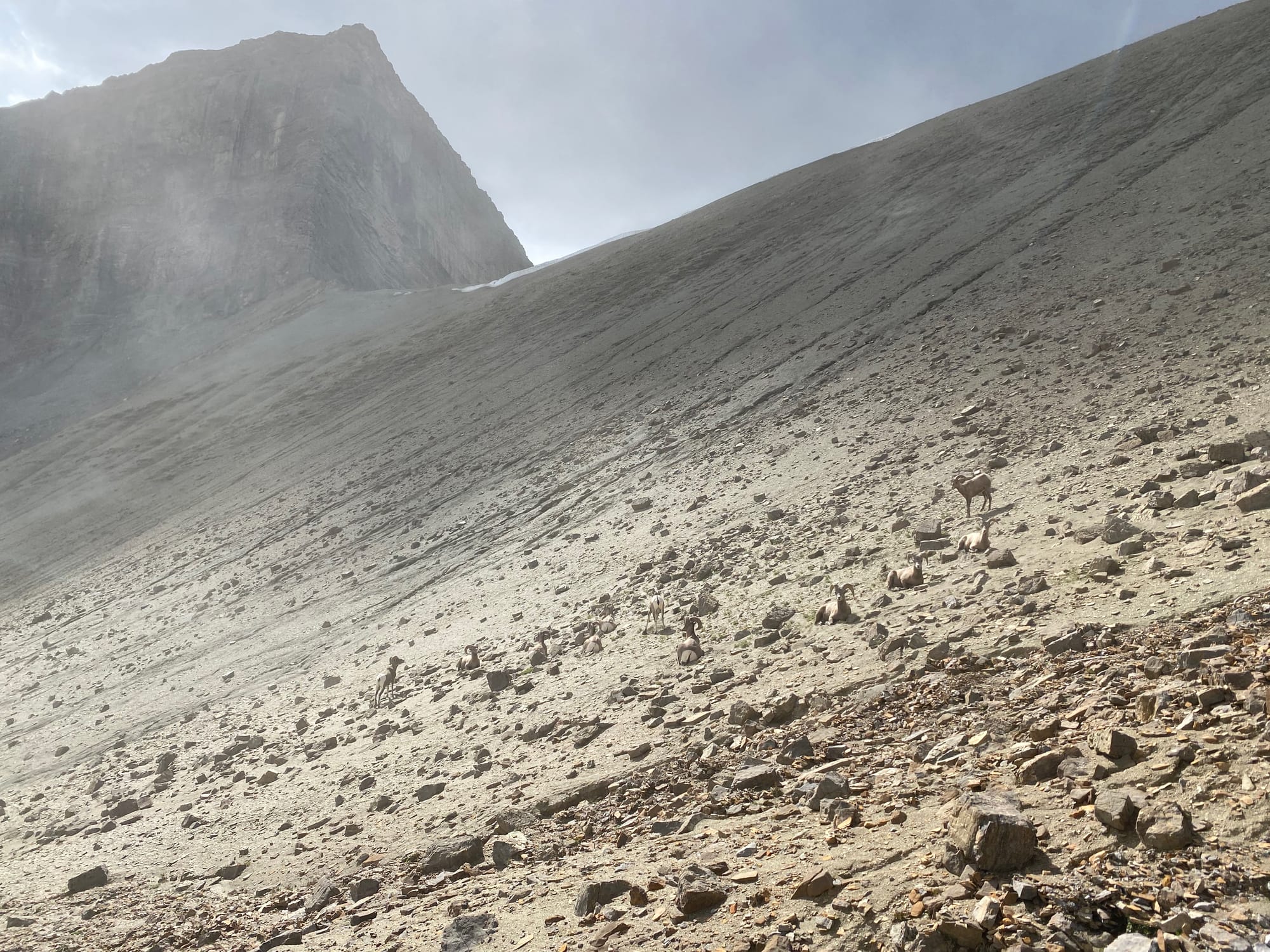
The next pass (unnamed) is the highest point of the GDT, at 2578 metres above sea level. As I climbed, the meadows gave way to rocky slopes. In the distance, some of the rocks seemed to move. It was a pack of bighorn sheep crossing the pass!
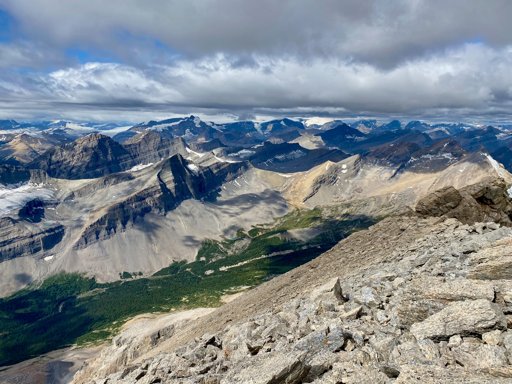
As expected, the pass had stunning views. The unnamed hill on the eastern side of the pass is an easy ascent, and many people will hike there as a side trip. If the weather allows, I would highly recommend it! The summit had even better views, with the next segment of the GDT laid out before me. In the distance were the jagged peaks of the Whitegoat Wilderness, including Mount Stewart, which I hoped to climb. Immediately to my north, yet another massive cliff gave way to the alpine meadows at the head of the Waterfalls Creek valley, my next destination. There was a summit register with encouraging notes from other GDT hikers, and some… interesting stuff in the log box (not pictured).
Eventually, some clouds rolled in and it started hailing. It was time to get off the mountain. I quickly made my way down to the Waterfall Creek horse camp, unintentionally disrupting the sheep once again on the descent.
The camp is surprisingly well-hidden, located in the middle of a grove of trees. I didn’t see it until I walked into the grove. I’d planned to go further that day, but the wind was picking up and I didn’t want to risk going over another hgh pass, so I stayed at Waterfall Creek, hanging out with Alex who I’d met on section D and Solène, Carlie, and Summer from Calgary who were thru-hiking.
The next day started with the long climb over Pinto Pass I’d avoided, then a long descent towards Pinto Lake. Along the way I met a large group of about 30 air cadets all the way from the UK. Even the relatively remote parts of this section see more traffic than section D.
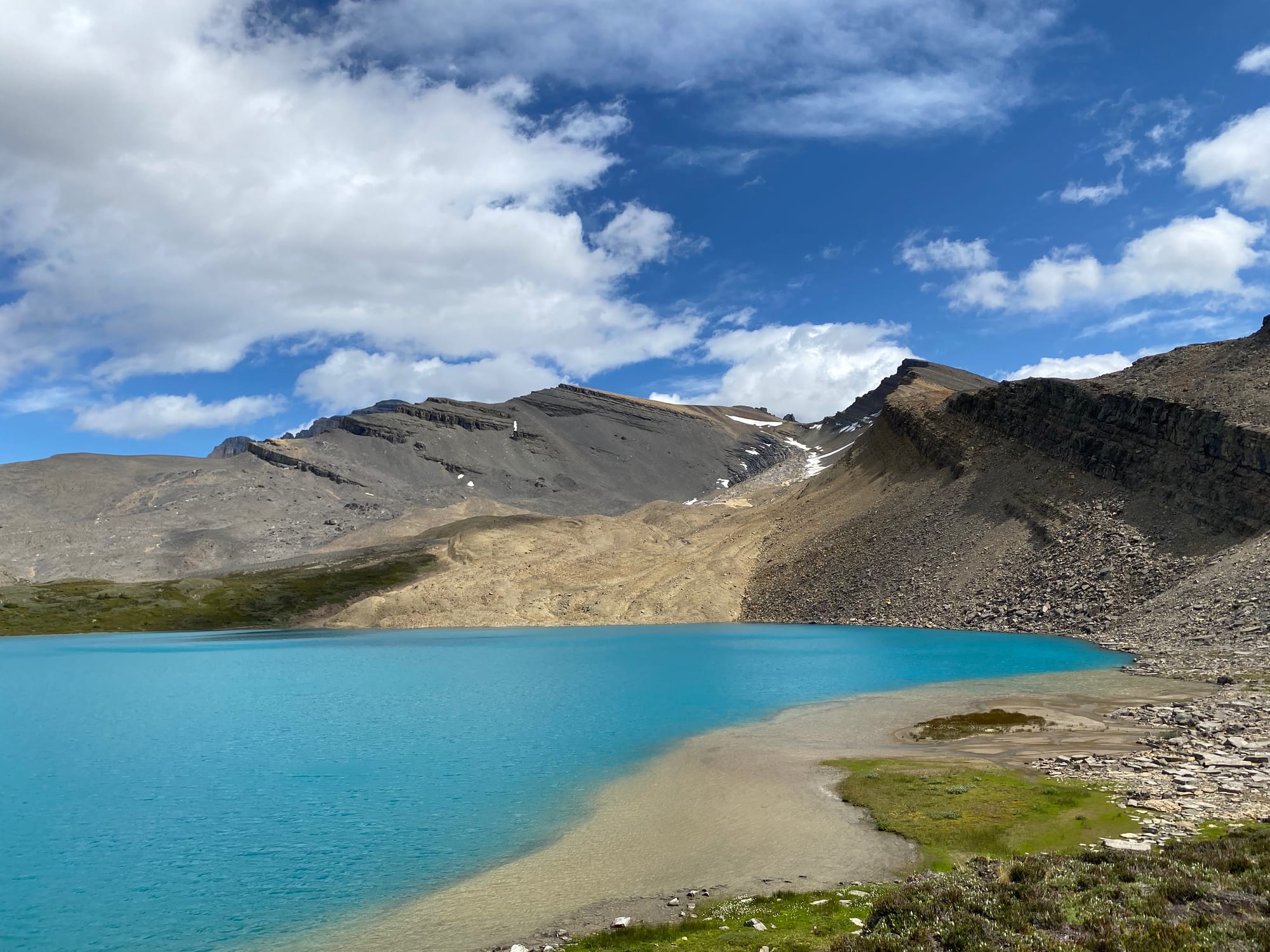
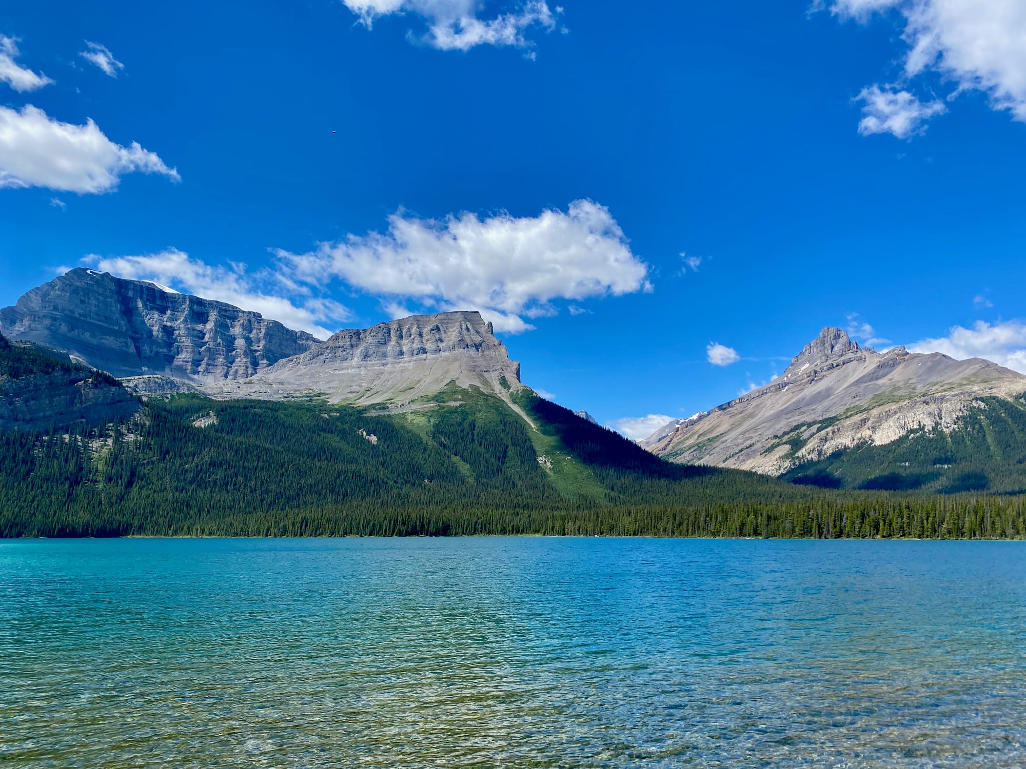
Pinto Lake is beautiful: high enough to be pristine, but low enough for the temperatures to be reasonable. Some say it has the best swimming on the entire GDT. I enjoyed a long, relaxing swim here.
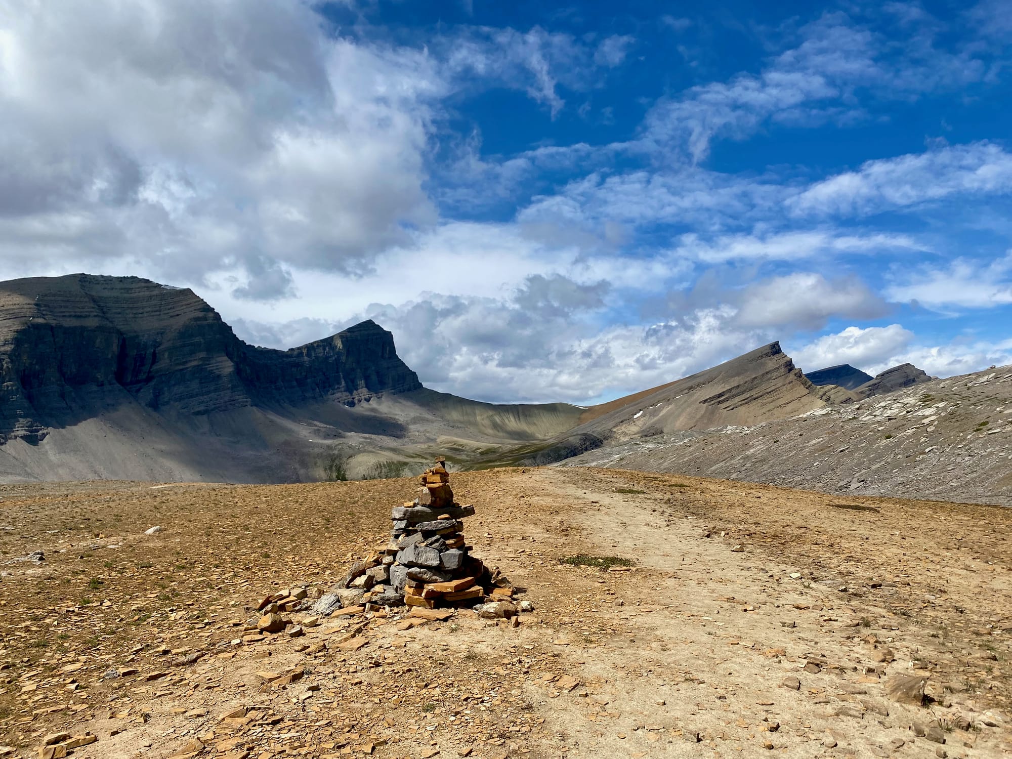
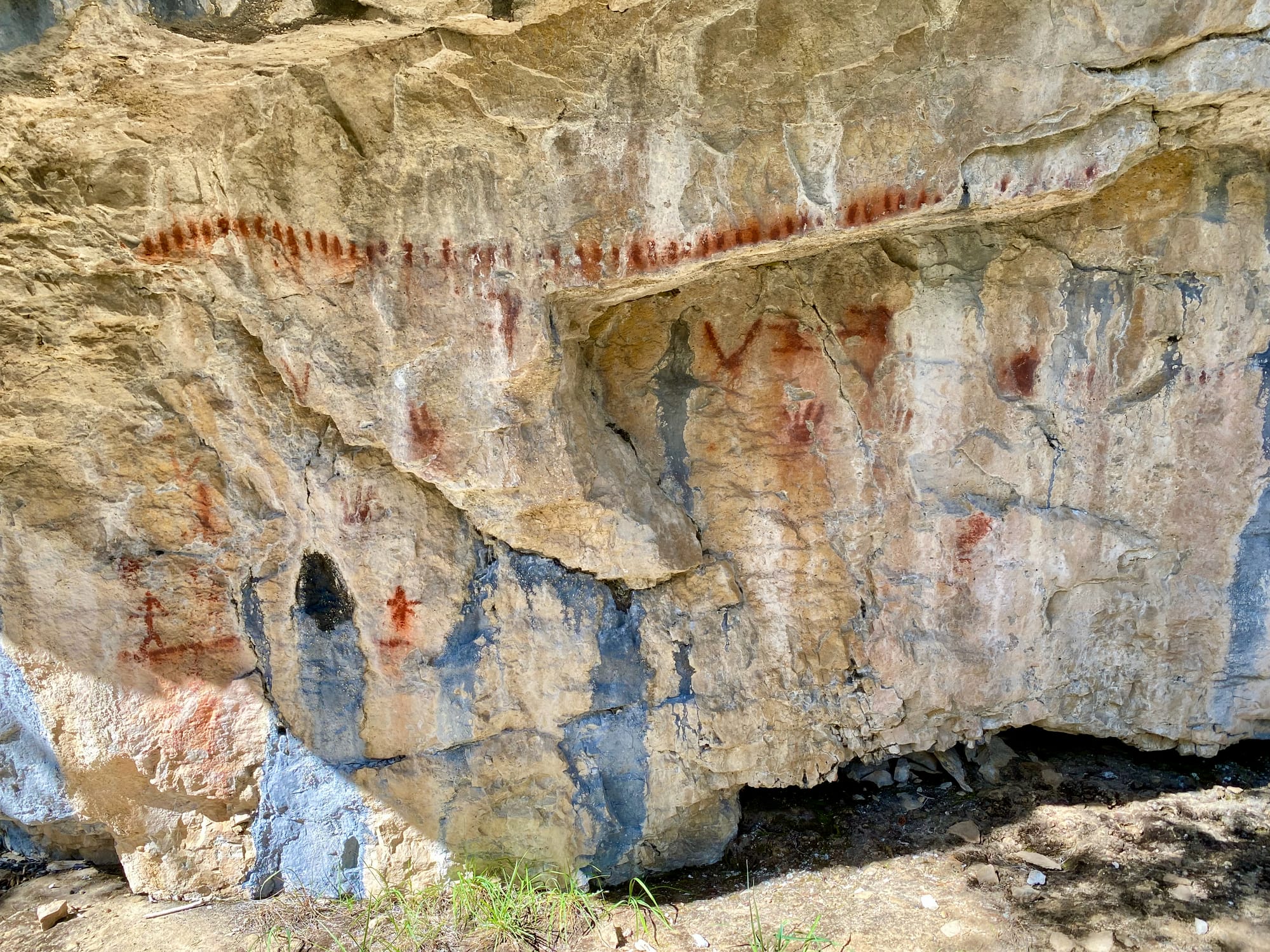
Past Pinto Lake, the trail leaves Banff National Park, entering the much more remote White Goat Wilderness. Motorized access and even trail maintenance are strictly forbidden here, although the GDT sees enough use that a herd path has formed. A trail register marks the boundary, and past it, the trail fades away. Luckily, there is enough flagging that it is difficult to get lost. After crossing Cataract Creek, the route turns west, leading you up the valley to Cataract Creek’s source at Cataract Pass. A boulder along the way is marked with ancient First Nations pictographs. I pondered the many generations that have used this valley as a transport corridor before me. This area may have seen more visitors pre-contact and during the fur trade era than it does now.
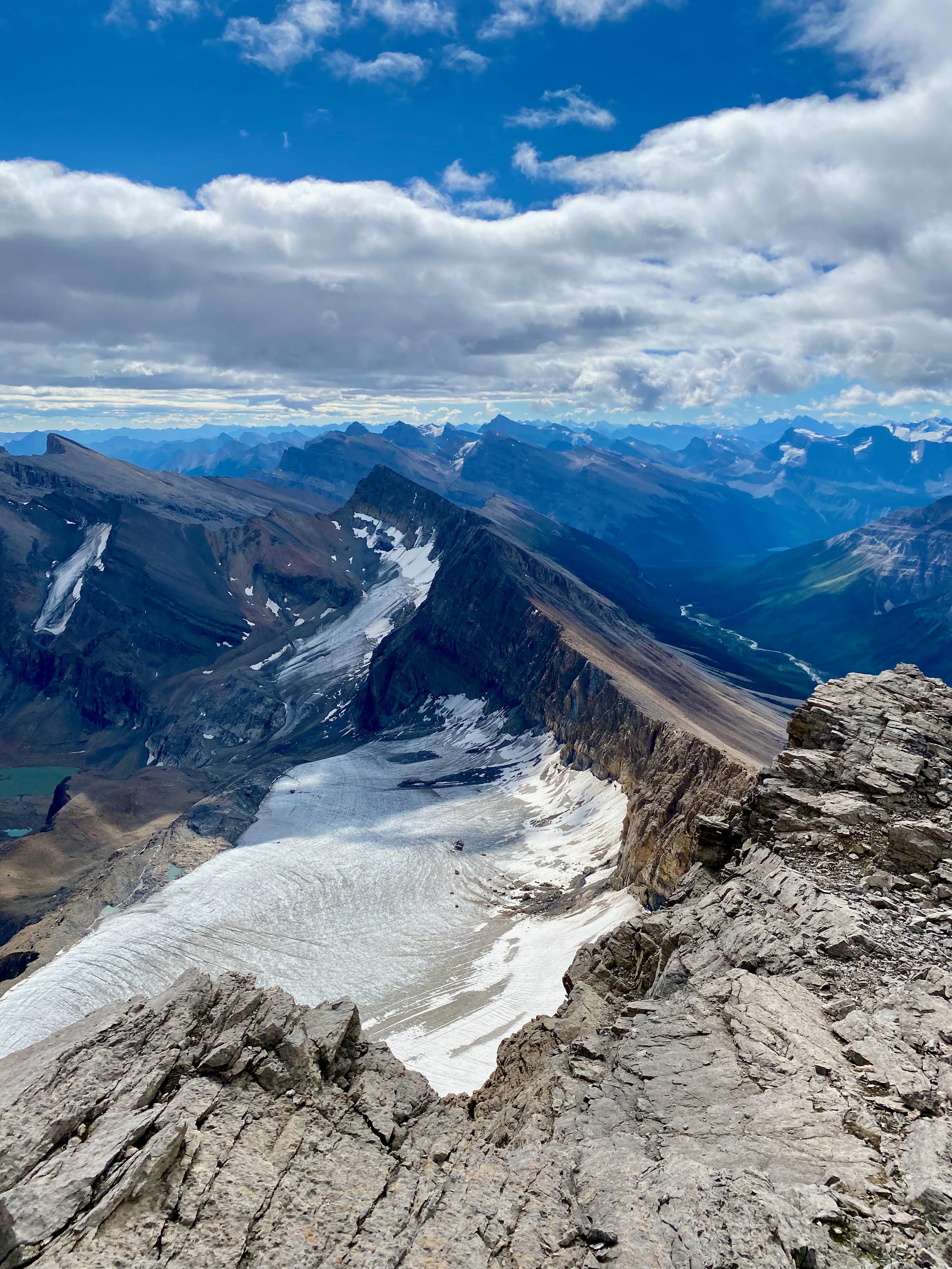
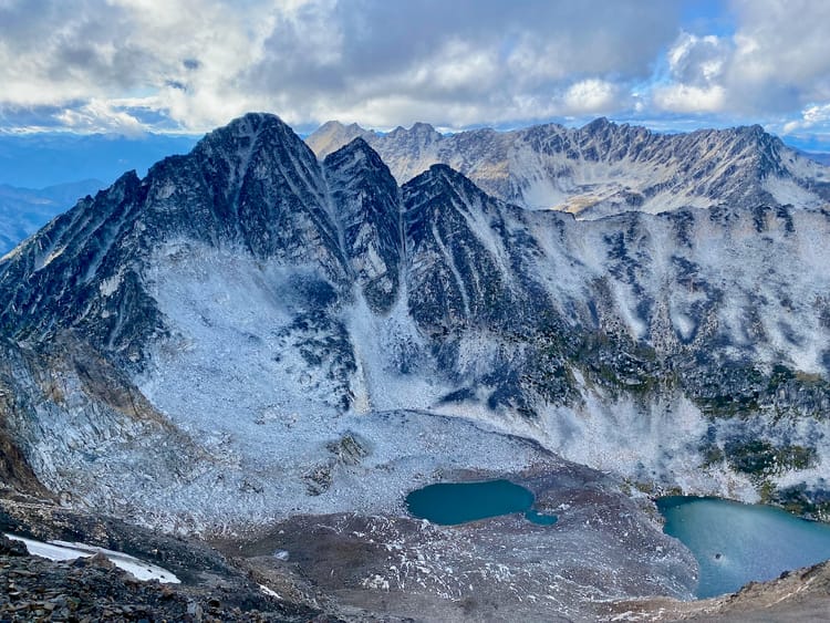
I camped at a clearing along the Cataract Pass trail, immediately below Mount Stewart, with the sound of rockfall echoing in the distance. My plan was to wake up very early the next day and scramble to the peak. That adventure is detailed here.
This day stands out, and that’s saying something on this trail, where almost every day was a world-class hike. It was the first truly sunny day of the trip. From Mount Stewart, I had an excellent perspective of everything I’d done so far, and much of the ground that was left to cover. In the afternoon I would traverse this terrain on foot, reaching the awe-inspiring Cataract Pass.
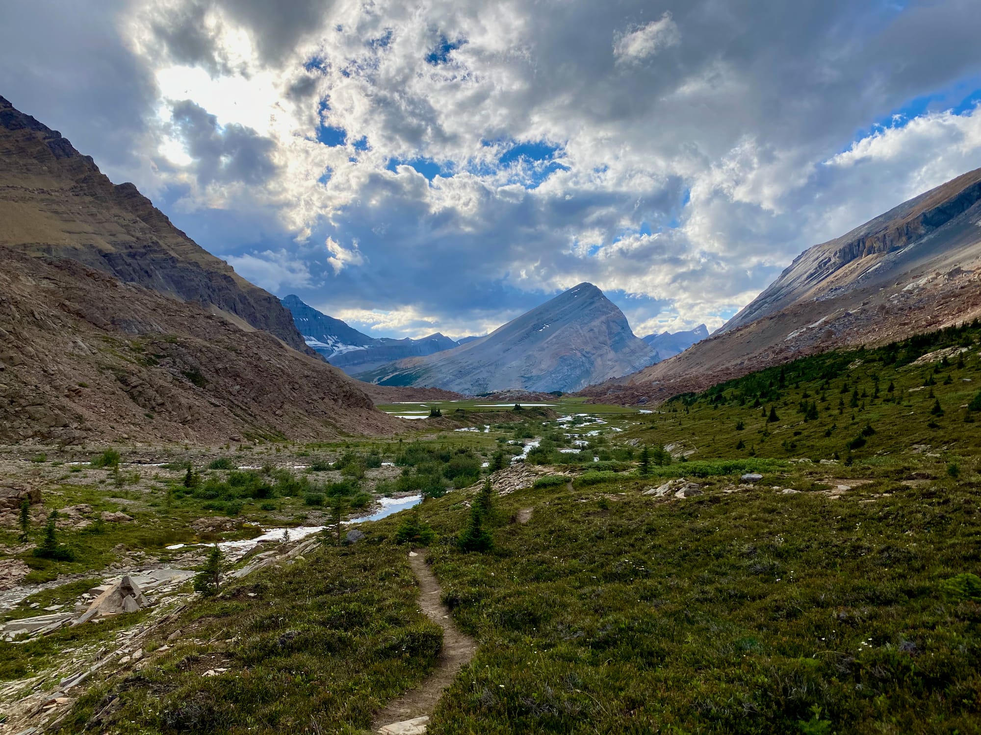
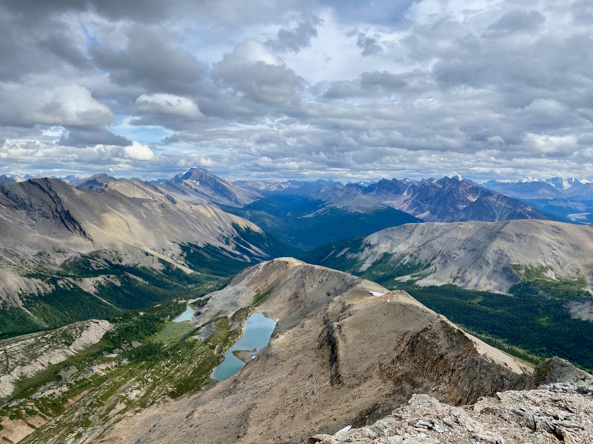
After rejoining the trail, I continued uphill. Forests gave way to alpine meadows surrounded by mountains. I passed the indistinct turnoff to Cline Pass, which is apparently worth visiting despite the bushwhacking needed to get there. Still, I wouldn’t miss Cataract Pass if this is your first time here, it is stunning.
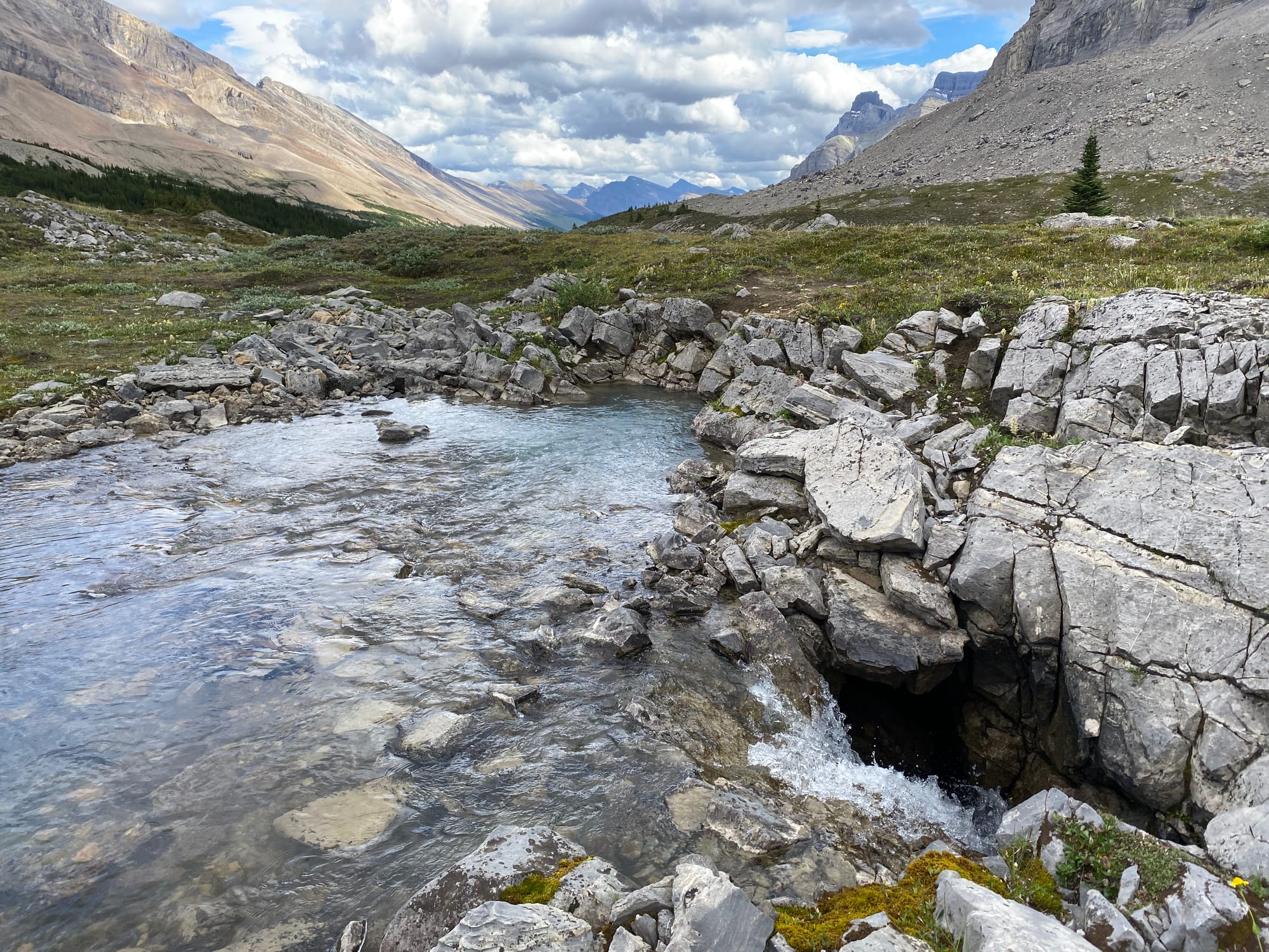
Above treeline, several karst features can be seen, including a stream that disappears into the ground. The meadows nearby would make an incredible campsite.
Eventually even the meadows vanish as the route reaches the pass. After the 1300-metre climb up Mount Stewart, I was definitely feeling the elevation gain here.
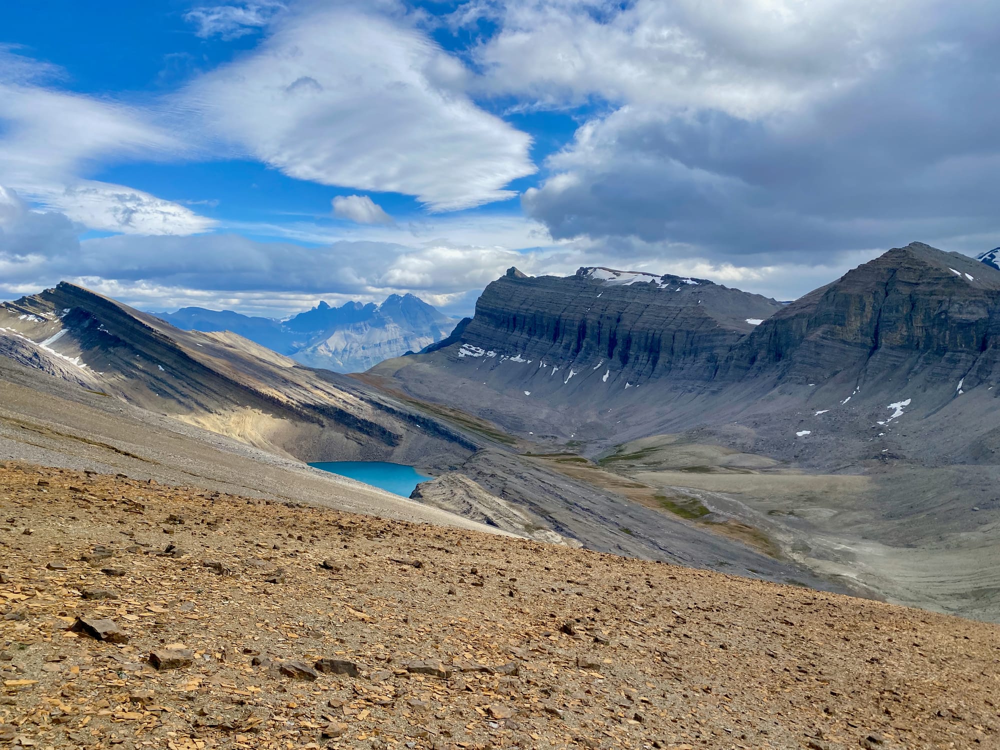
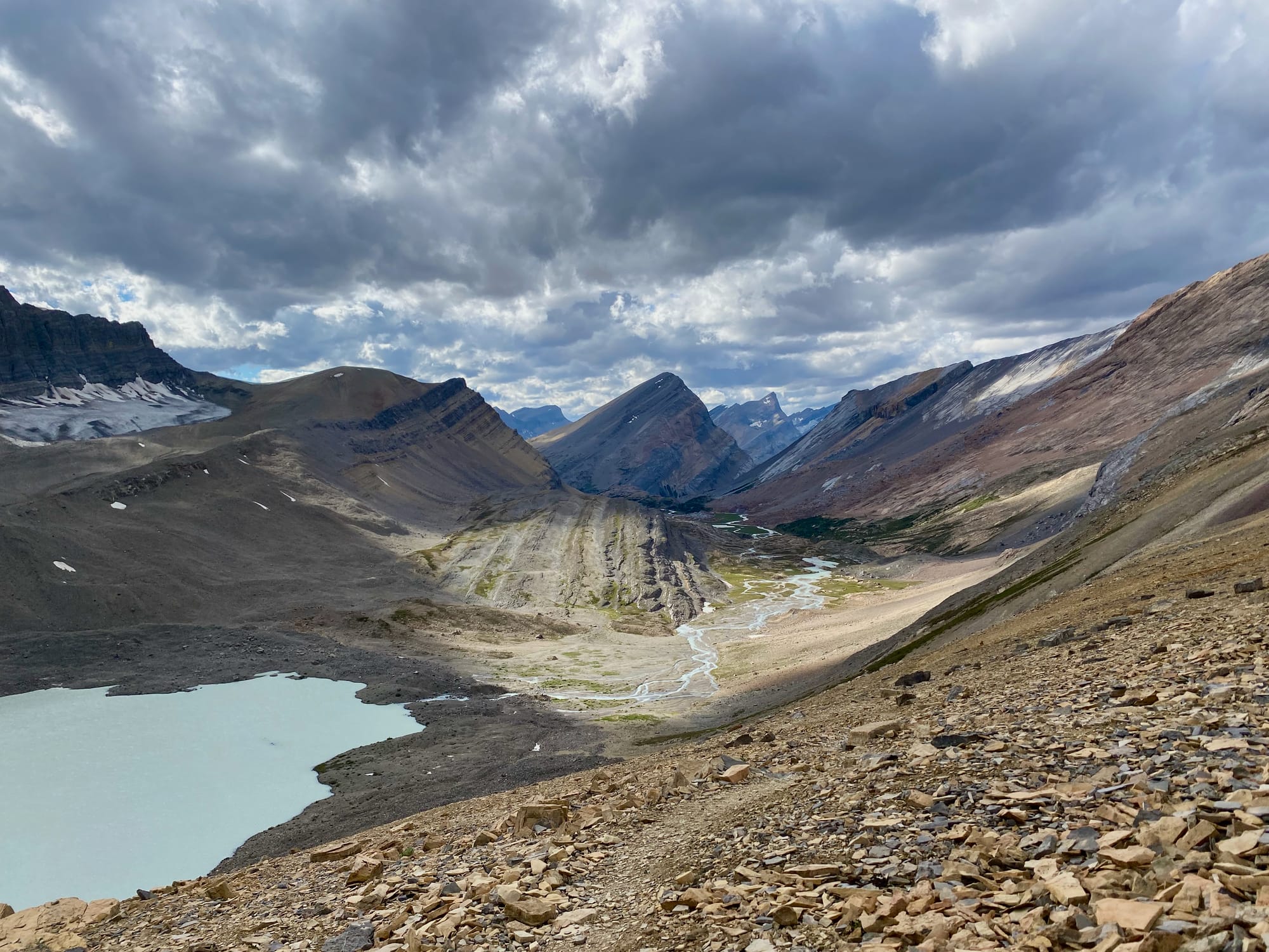
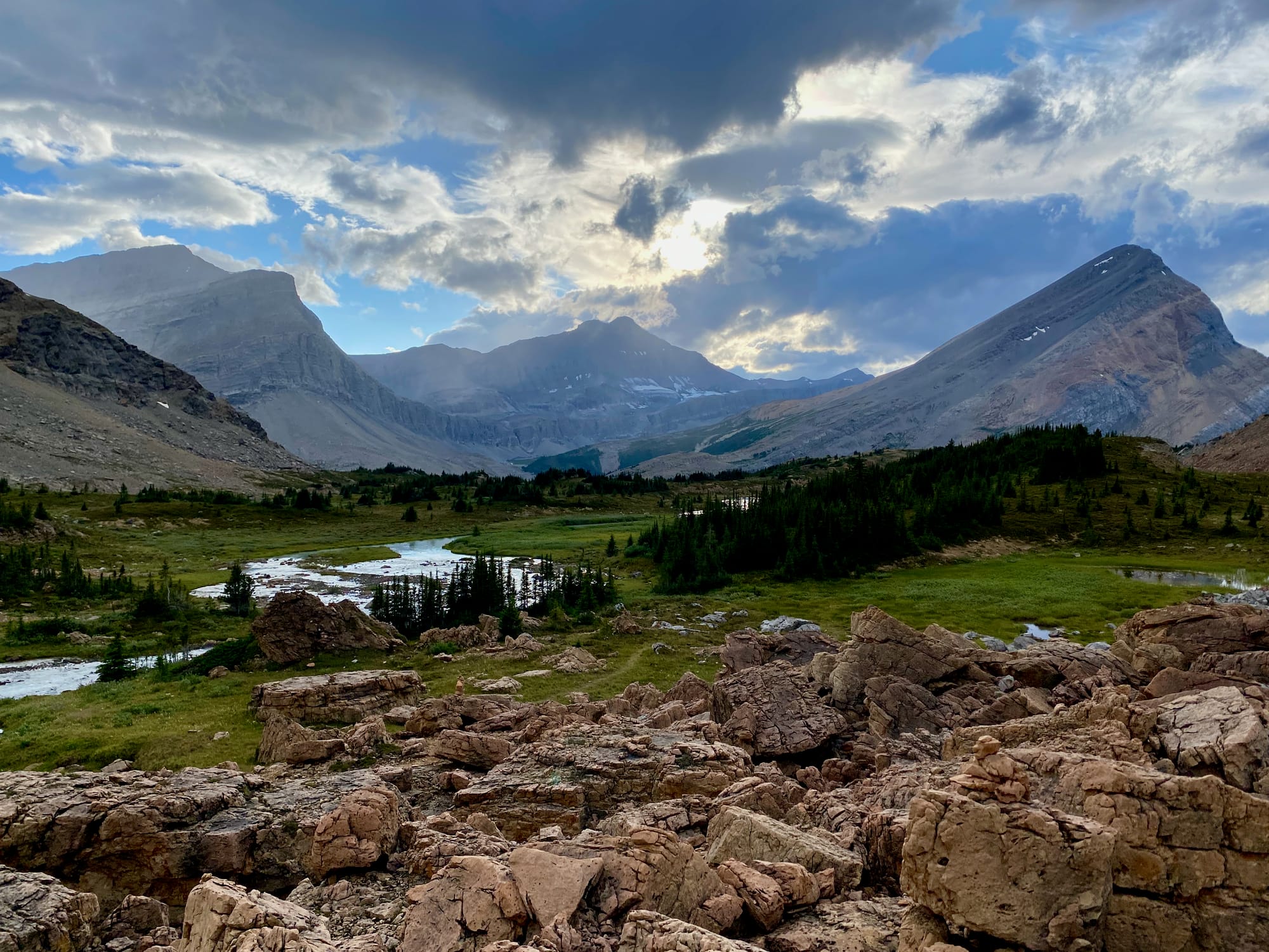
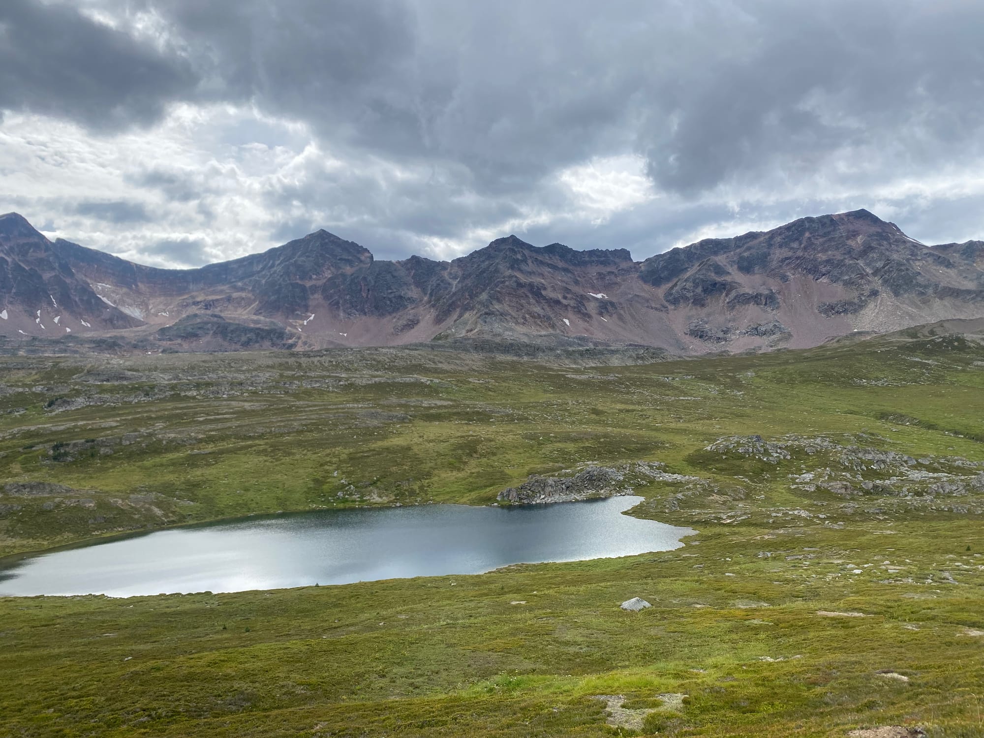
The pass was the best view I’d seen so far, and that’s saying something. It felt like a scene from Lord of the Rings, with majestic glaciers and mountains all around me. In the distance, a ray of light shone through the clouds, illuminating the next part of the route.
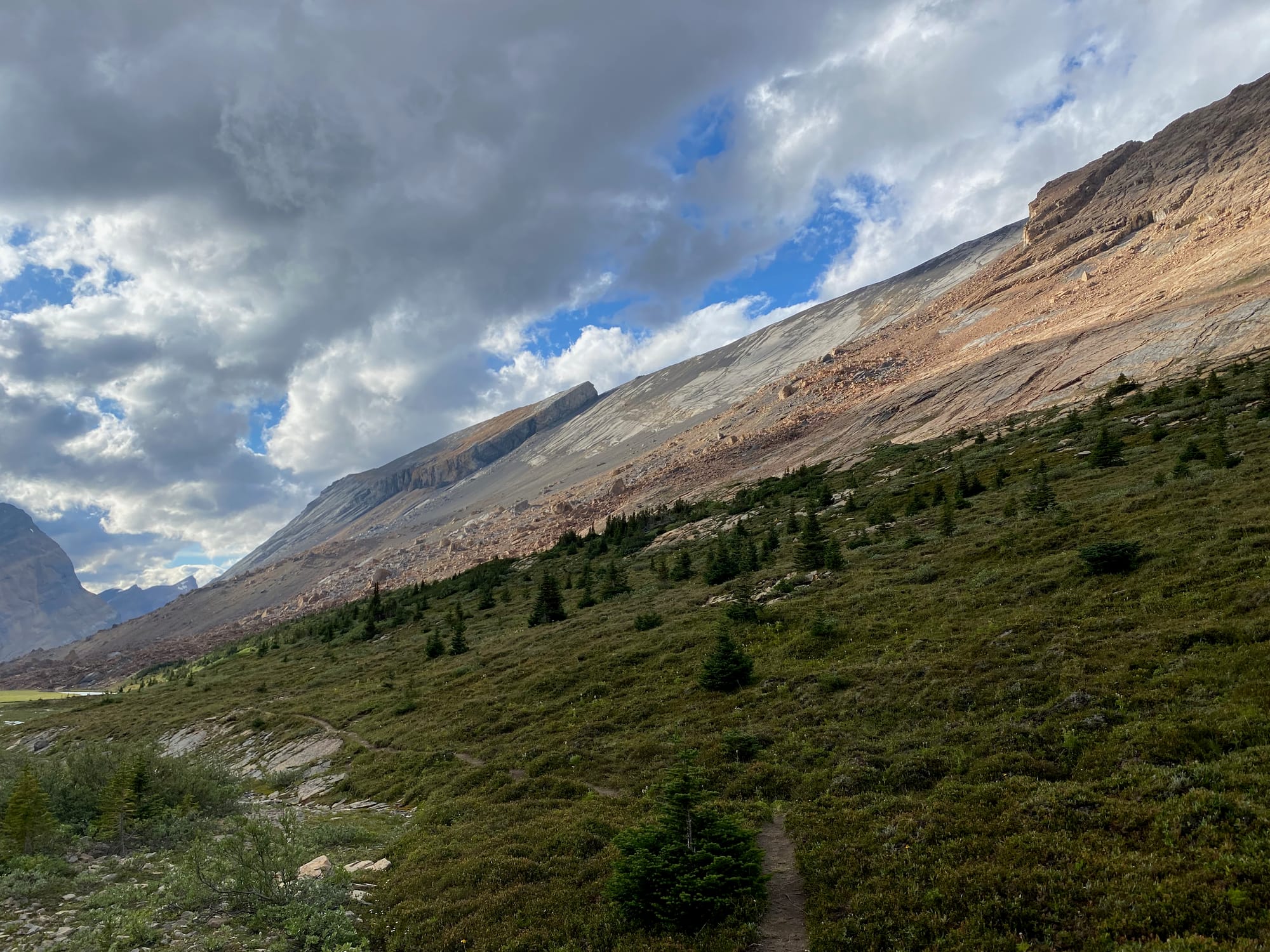
After a nice rest I continued downhill, meeting a group of hikers who generously shared some of their food. I soon reached a meadow surrounded by rockfall. Looking to the east, I realized the scale of the landslide that created this terrain. A massive slab, easily the size of a small town, slid off the side of the adjacent mountain. It was a powerful reminder of the geological forces that create and shape this land.
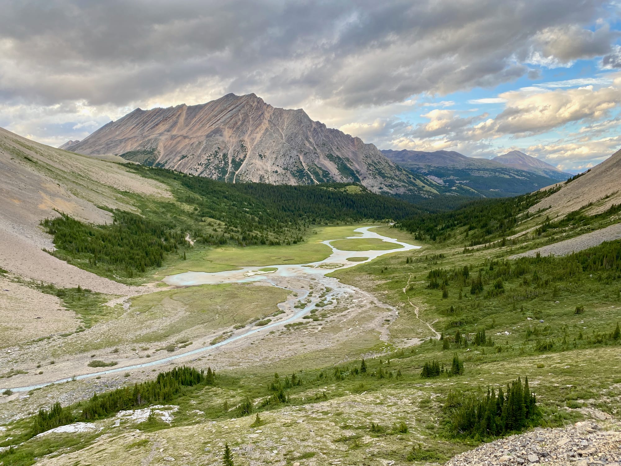
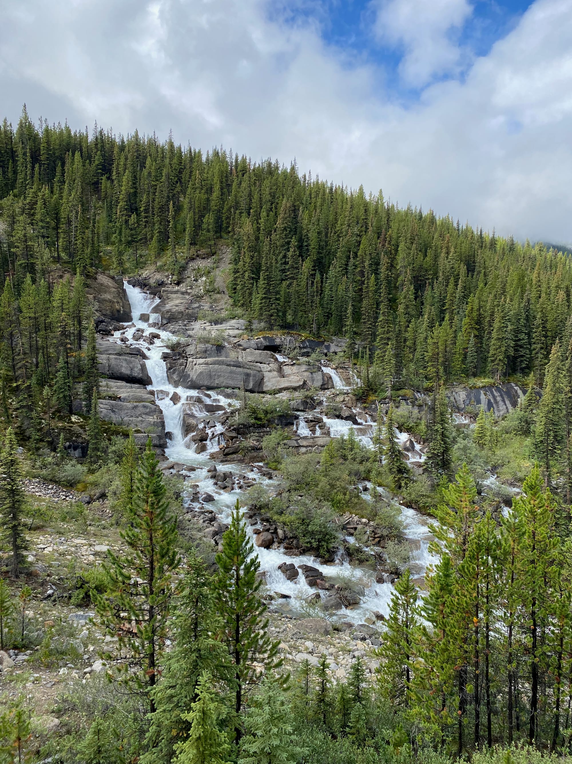
The day ended with a walk through some more alpine meadows, past the waterfalls of the Brazeau River - a perfect end to a perfect day.
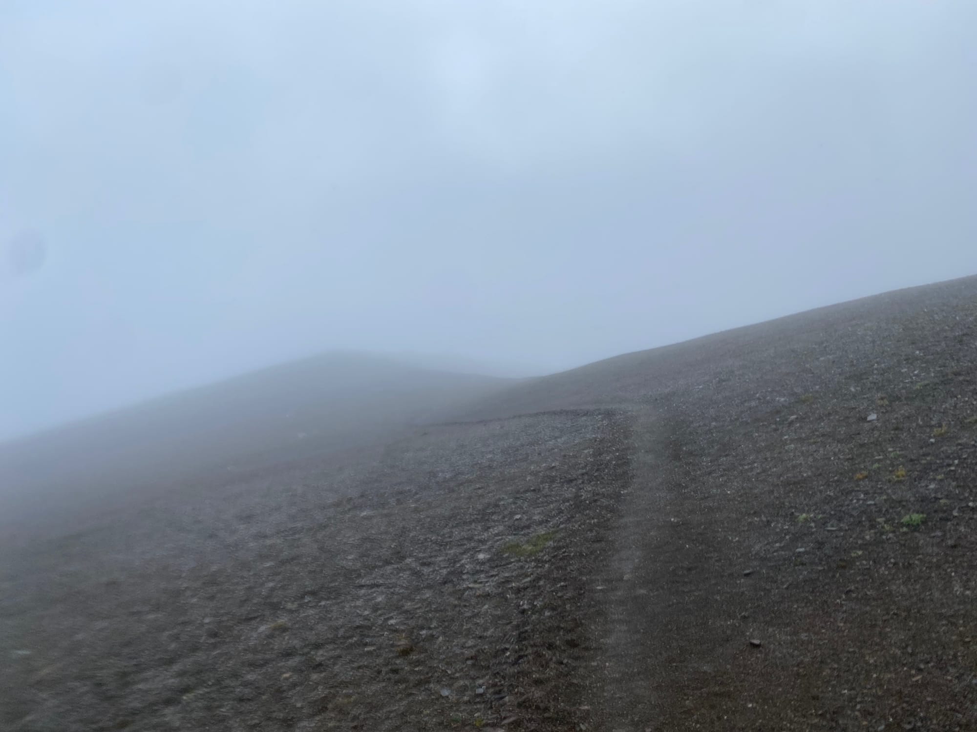
I’d had so much fun that the weather gods had to intervene. The next day’s journal entry starts with “Cold, wet, and miserable”. As I reached Jonas Pass, fog quickly descended. It soon started raining heavily, and the wind did not help matters. I had several cold, wet kilometres to go before reaching the safety of the treeline and the merciful campsite. I made it to the campsite just before hypothermia set in.
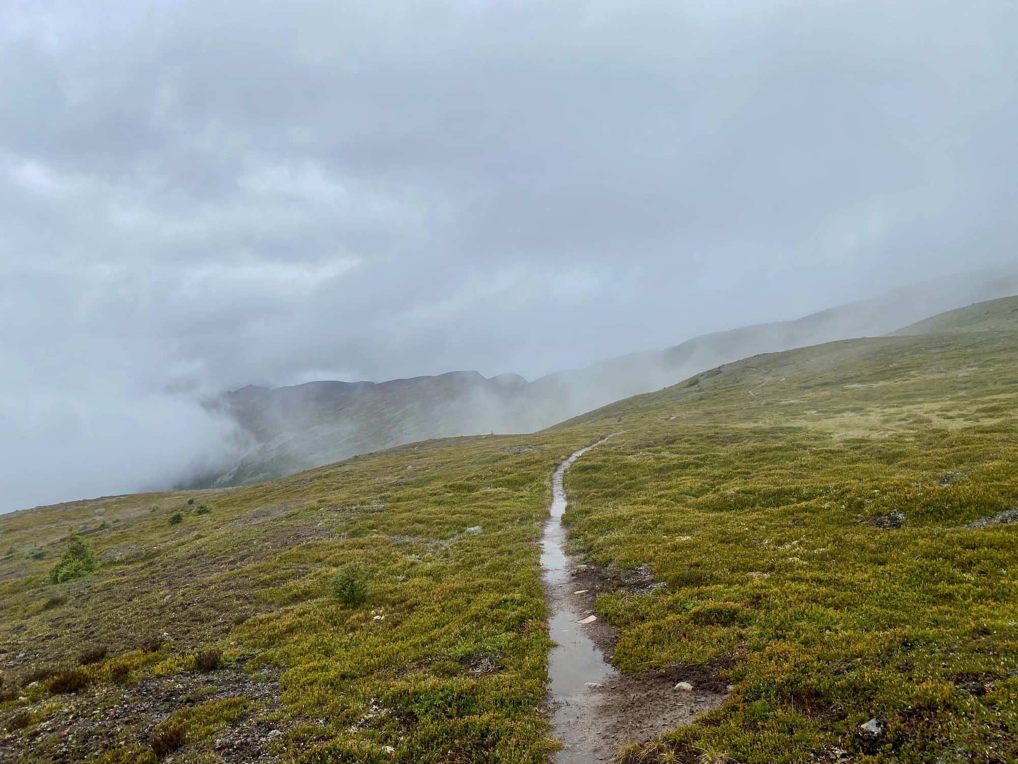
The next day, I’d planned an early start, but the warm and dry sleeping bag was hard to leave! I eventually made my way towards Maligne Pass. Like other trails in Jasper National Park, this trail has officially been decommissioned, but it is still used by GDT hikers. All the bridges have washed out, requiring ford after ford, often up to knee-deep. Luckily, it was a relatively warm day.
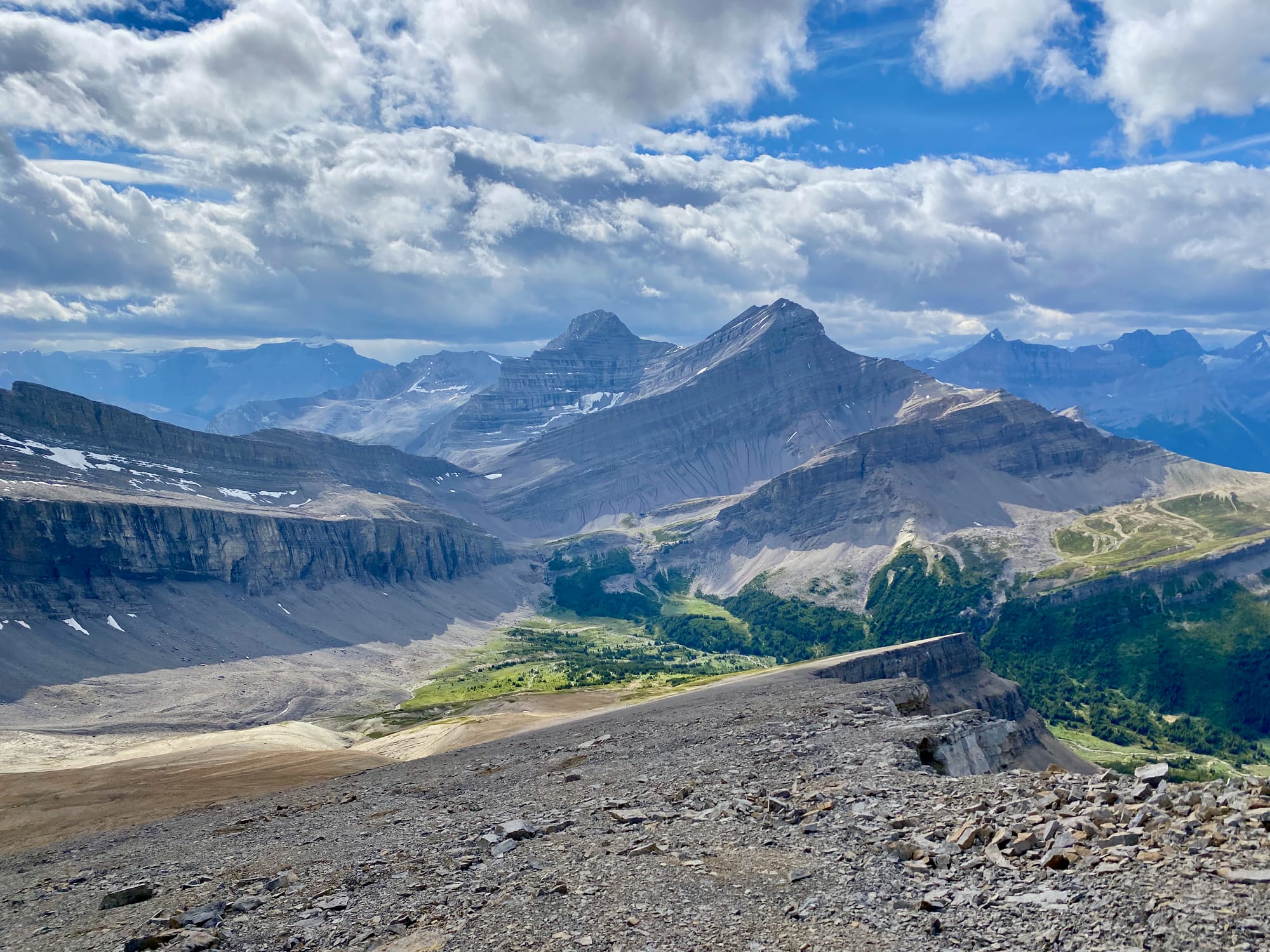
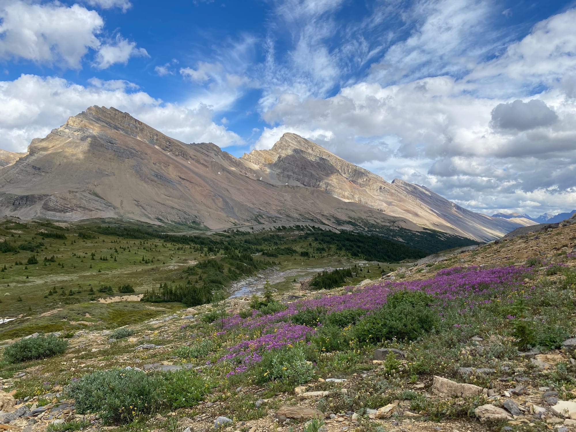
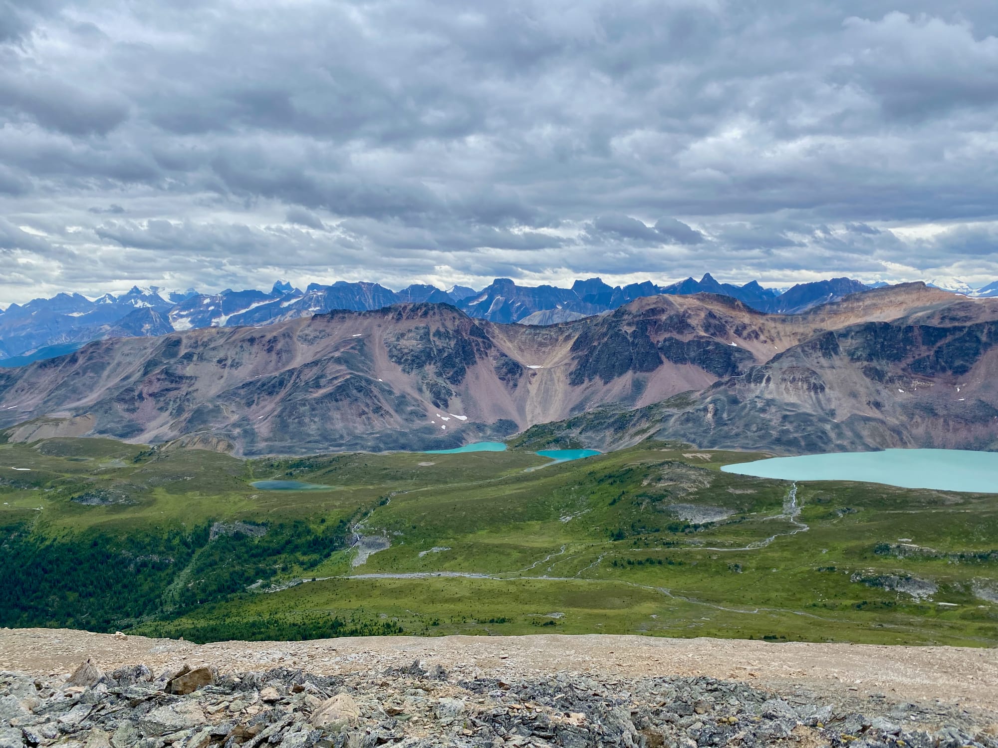
Maligne Pass reminded me of Scotland, with heather everywhere and craggy peaks on either side. The mountains to the west are known as the Endless Chain.
I took a side trip to the unusually-named Replica Peak. It was a bit of a grind up a series of scree slopes, but as I ascended, hidden views revealed themselves. There is a chain of glacial lakes below the Endless Chain that cannot be seen from the pass itself. Beyond the Endless Chain, higher mountains came into view, such as Mt. Columbia, the highest point in Alberta. The summit had panoramic views and I could see almost all the way to Jasper. I would highly recommend this side trip. It was about 1.8km one way with 550m elevation gain.
I returned to the pass and spent the night at the abandoned but usable Mary Vaux campsite.
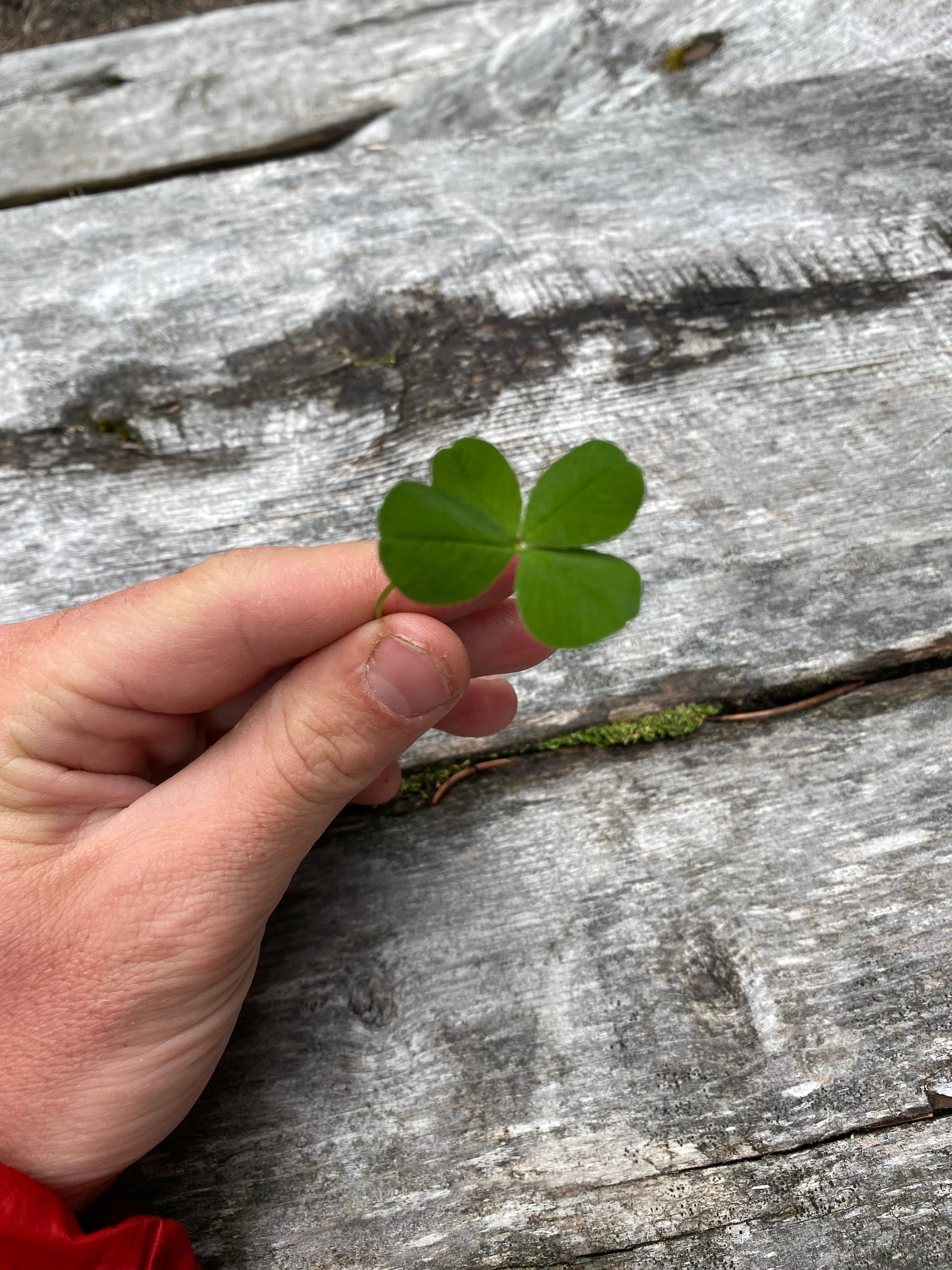
Thanks to my permit schedule, the next day ended up being my longest, at 44.2km. The first 26km of this was along the decommissioned and overgrown Maligne Pass Trail. Rain collected in the trail bed and my feet were underwater for most of the trail. At one point I met two hikers from Edmonton who gave me a four-leafed clover. It worked well enough until section G…
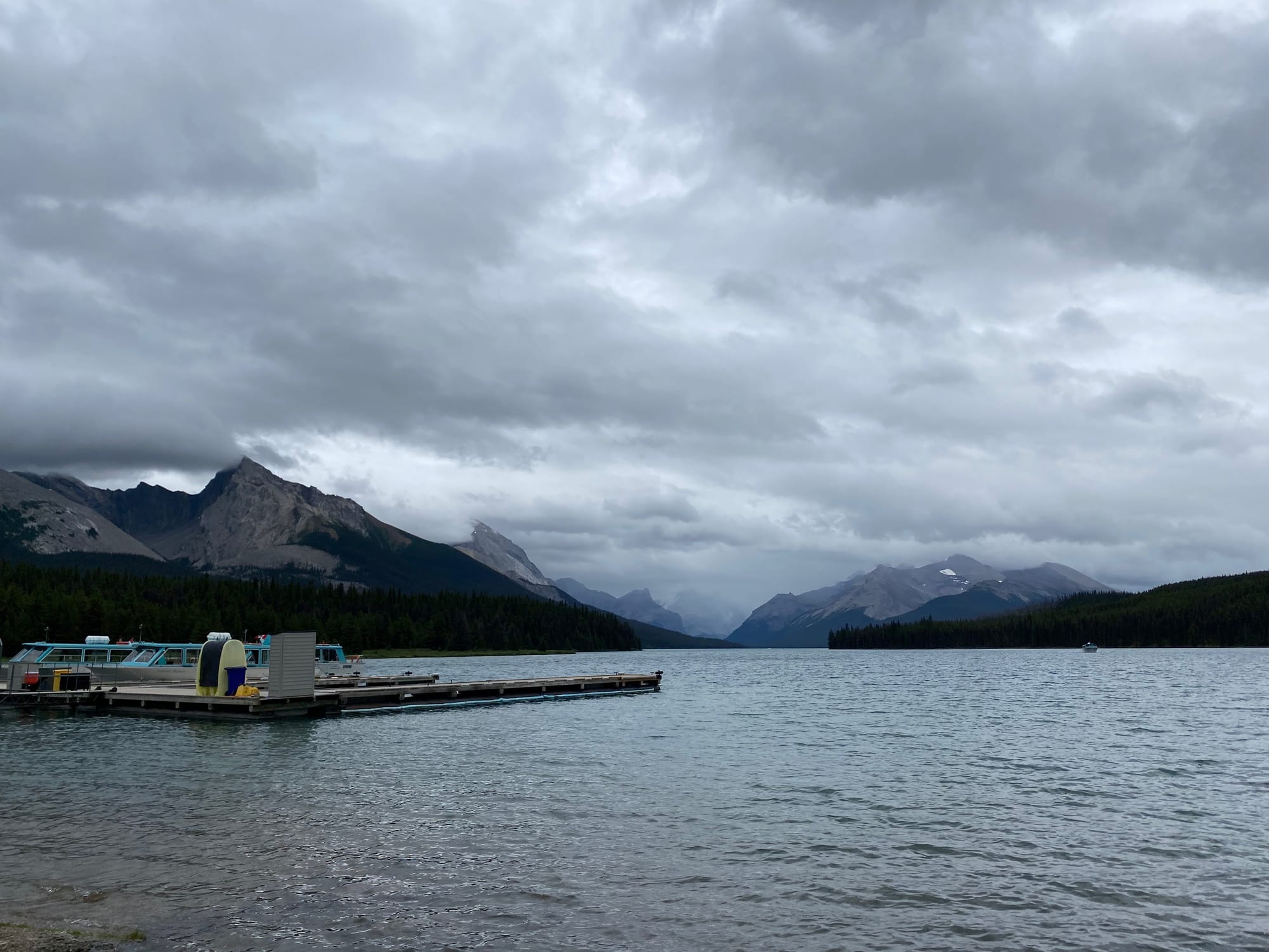
The Maligne Pass Trail connects to the popular tourist trails around Maligne Lake. Other hikers started appearing, and before long I had to dodge hordes of day hikers. I arrived at the Maligne Lake chalet, bothering a large Korean tour group in the process.
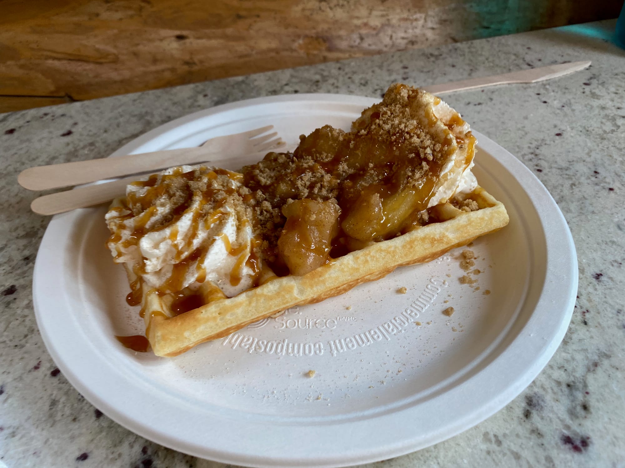
I spent some time at the waffle hut to charge some devices. It felt very weird to drink expensive coffee and eat a fancy waffle at a nice coffee shop in the middle of a 44km backcountry hike.
The rest of the day would be spent on the very popular Skyline trail. I left the chalet late enough that most hikers were setting up camp, avoiding the crowds. The Skyline is very well-maintained and the remaining 20 kilometres went by quickly. Annoyingly, the only campsite I was able to book was the Watchtower campsite, which added several kilometres. One long day of hiking remained until I reached civilization, warm beds, hot meals, etc. at Jasper.
It’s interesting that on my first few days on the trail, I was mostly craving high-calorie food like burgers and pizza, but after a week or so this shifted to fresh fruits and vegetables. I spent much of the Skyline trail dreaming about salads, of all things…
It was a cold and rainy morning, and it got even colder and rainier as I reached the Skyline trail’s highest point, a long traverse along an exposed mountain ridge. Snow and hail made my hands go numb. The Skyline is apparently famous for its views: I can’t confirm.
Once I got off the ridge, the weather improved and feeling returned.
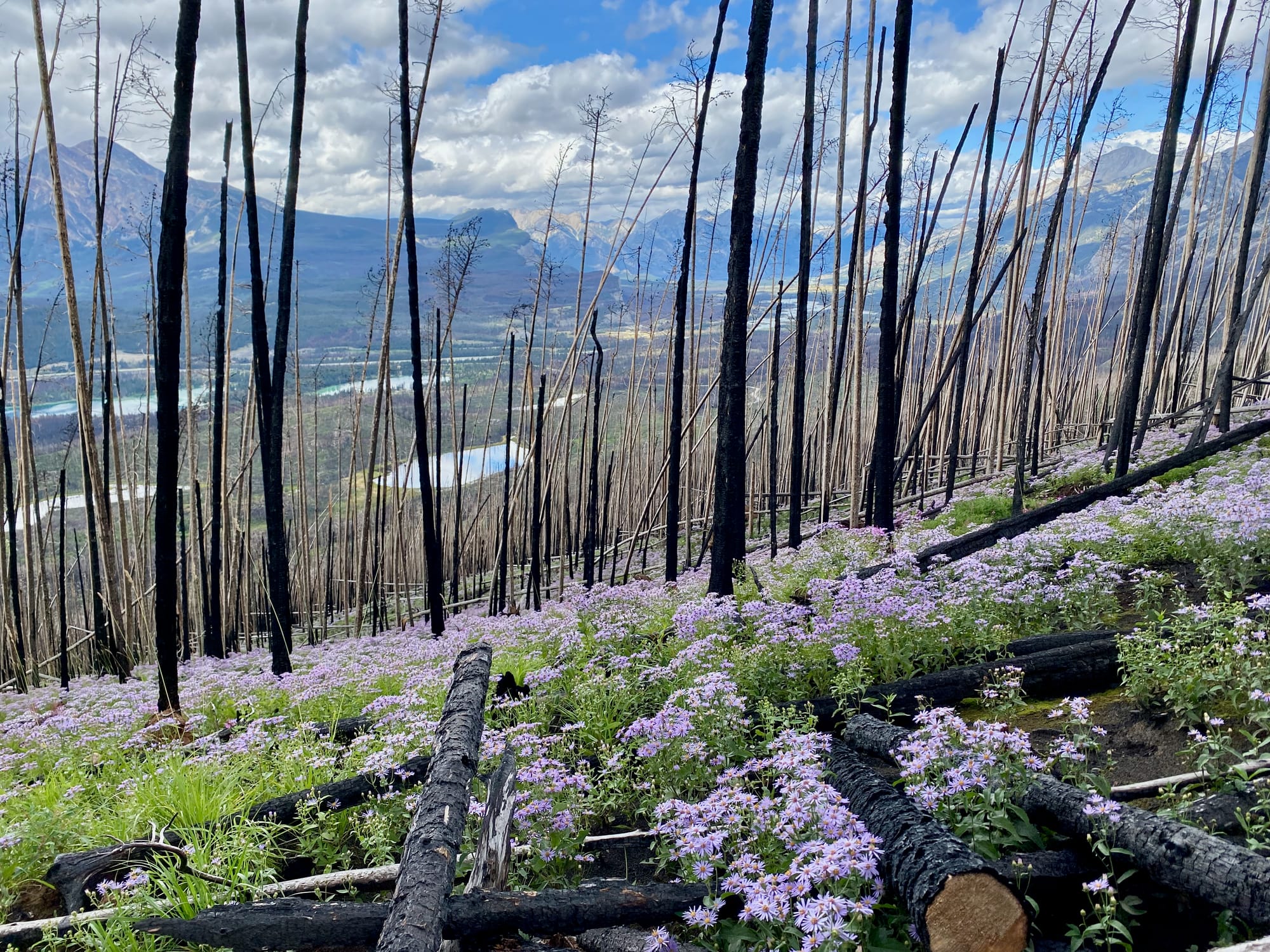
The Skyline ends with a long descent along the old Signal Mountain fire road. This area was completely devastated in the 2024 wildfire: every tree along the road was burned. It’s impossible to ignore the impacts of climate change on the GDT, from glaciers that are clearly a shadow of their former selves to fields of endless charred snags. Nowhere is this more apparent than here. It was comforting to see the fields of wildflowers that have emerged beneath the dead trees. It feels like a sign of recovery.
The trail connects to Jasper’s local trail system, which leads into the town. “Welcome back to civilization,” said a passing biker.
I spent almost two days in Jasper. On the surface, the town seems to be recovering well, but the burned trees, empty areas, and wildfire recovery signs show the extent of the damage.
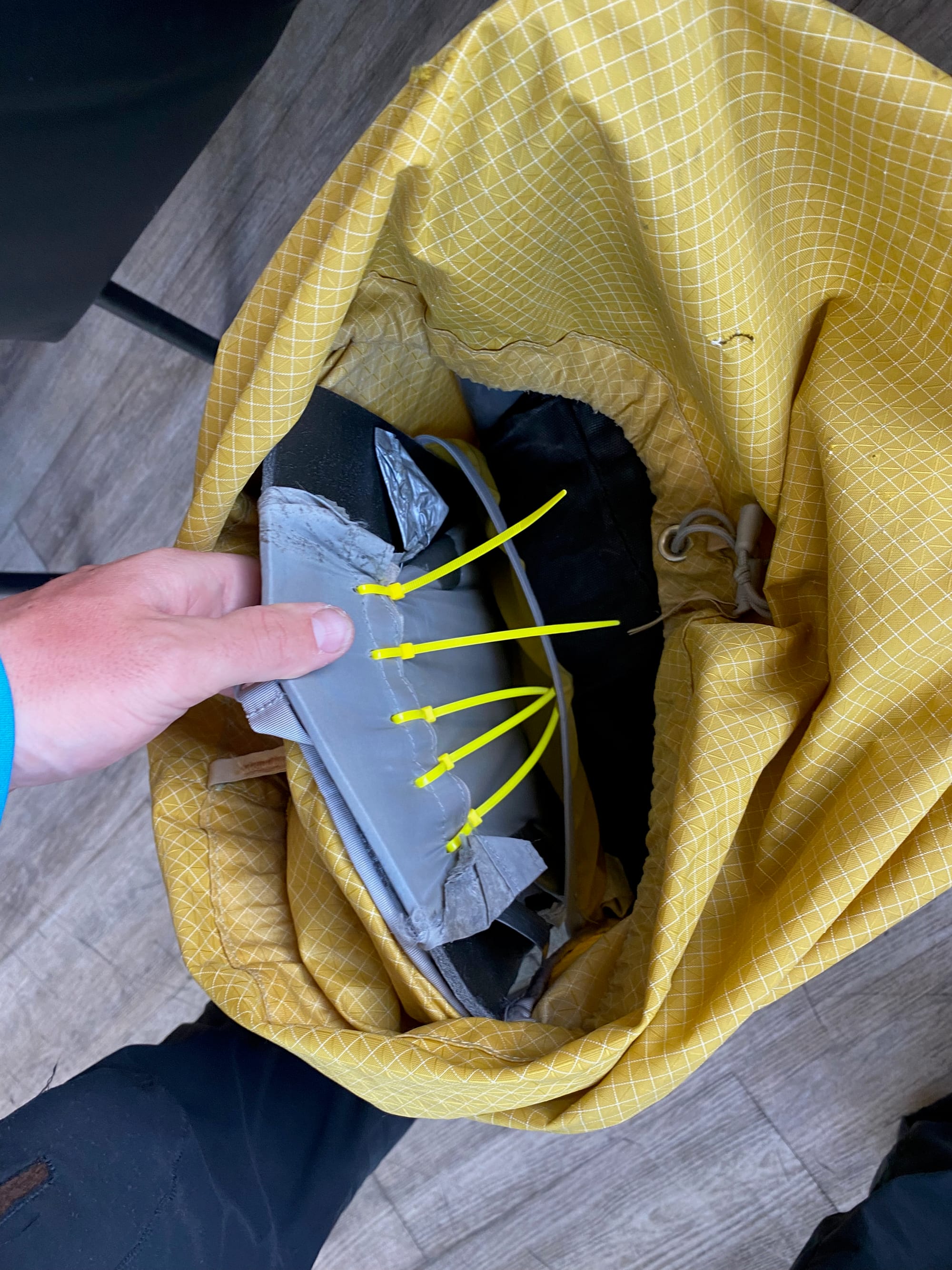
I spent most of my time relaxing, finally drying my boots, and replacing and repairing broken and lost gear. The frame of my pack had broken but I managed to hold things together with some zip ties.
I stayed at the Jasper Downtown Hostel, which is the main hub for GDT hikers in town. Over the next 2 days, I ran into a lot of the hikers I’d met on the trail.
Jasper has a number of good but expensive restaurants offering a variety of cuisines: after two weeks of dehydrated food and ramen, this created a dangerous situation for my bank account.
I really enjoyed my visit to Jasper, but eventually I had to move on to section F.
Member discussion