Great Divide Trail (Sections D, E, F, G)
The Great Divide Trail follows the spine of the Canadian Rockies from the Montana border to Kakwa Lake near McBride, almost 1100 kilometres later. Almost every day on the trail brings a new pass, river, or valley, through some of the most magnificent scenery I have ever seen. The route ranges from well-groomed national park trails to long stretches with no trail at all. The GDT’s official website lists its many hazards: “hiking conditions are often strenuous and potentially hazardous, difficult mountain navigation, glacial stream crossings, deceptively short hiking season, harsh weather including potential summer snowstorms, grizzly bears, mosquitoes, and remote trail exit points for resupply or potential emergency access.” At the same time, hiking the GDT is a very different experience now than it was ten or even five years ago. Although the trail dates back to 1966, interest has surged lately as people look for alternatives to the Pacific Crest Trail/Continental Divide Trail/Appalachian Trail. Extensive work has been done by the Great Divide Trail Association (GDTA) to create a more coherent route, as was very apparent on my hike. It’s an exciting time to hike the GDT!
In the summer of 2025, I found myself between life stages, with a month of free time between work and the start of a new degree. I had just finished a physically demanding job near the Rockies, so I decided to take advantage of this by section hiking the GDT. I didn’t have enough time to do the whole thing, so I chose the northern portion, starting in Field, BC and hiking over half the trail. All in all, I walked over 550 kilometres, comprising sections D, E, F, and most of G. This summer turned out to be especially cold and rainy, making things much more challenging, but the scenery and the sense of accomplishment made the trip worth it. I’d spent lots of time backpacking before, mostly on trips of a week or less. A full month on trail felt both familiar and different: in an odd way, it was more peaceful and less stressful than I expected, until the end. Unfortunately, section G was cut short by an injury on my second-to-last day.
I’ve done a lot of hikes throughout BC, the rest of Canada, and internationally, something I feel very grateful for. It says a lot about this trail that even considering how it ended, it was one of the highlights of my hiking career. I hope to finish the rest of it someday.
Stats
Days: 24 (Aug 4-28, 2025)
Kilometres: Around 550 (out of 1095)
Average kilometres per day: Around 23 (not counting the zero day)
Highest daily step count: 72,333 (Death march to Casket Creek in section G) (Runners-up: 68,158 Mary Vaux -> Maligne Lake -> Watchtower, Section E, and 64,522 on the Berg Lake Trail, Section F)
Zero days: 1 full zero day + several half-days on-trail
Elevation gain (Approximate): +32400 m / - 31600 m (not counting side trips)
Highest point on-trail: 2590 m at “Michele Lakes Pass”
Highest point off the trail: 3312 m on the summit of Mount Stewart (side quest)
Lowest point: SAR call
National parks: 3 (Yoho, Banff, Jasper)
Provincial parks: 2 (Mt. Robson, Kakwa)
Side trips: 7 (Mt. Field, Michele Lakes Peak, Mount Stewart, Replica Peak, Miette Pass Peak, Peak 2689/Devout Peak, Jackpine Mountain)
Favourite section: E
Packets of Indomie eaten: Too many
Thru-hikers met: 4
Bears seen: 0 (somehow)
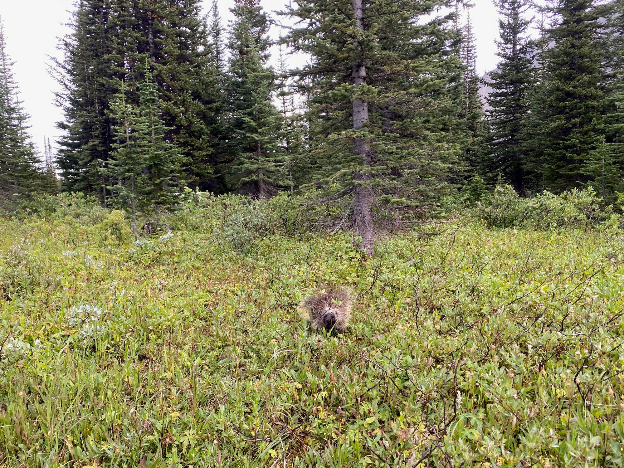
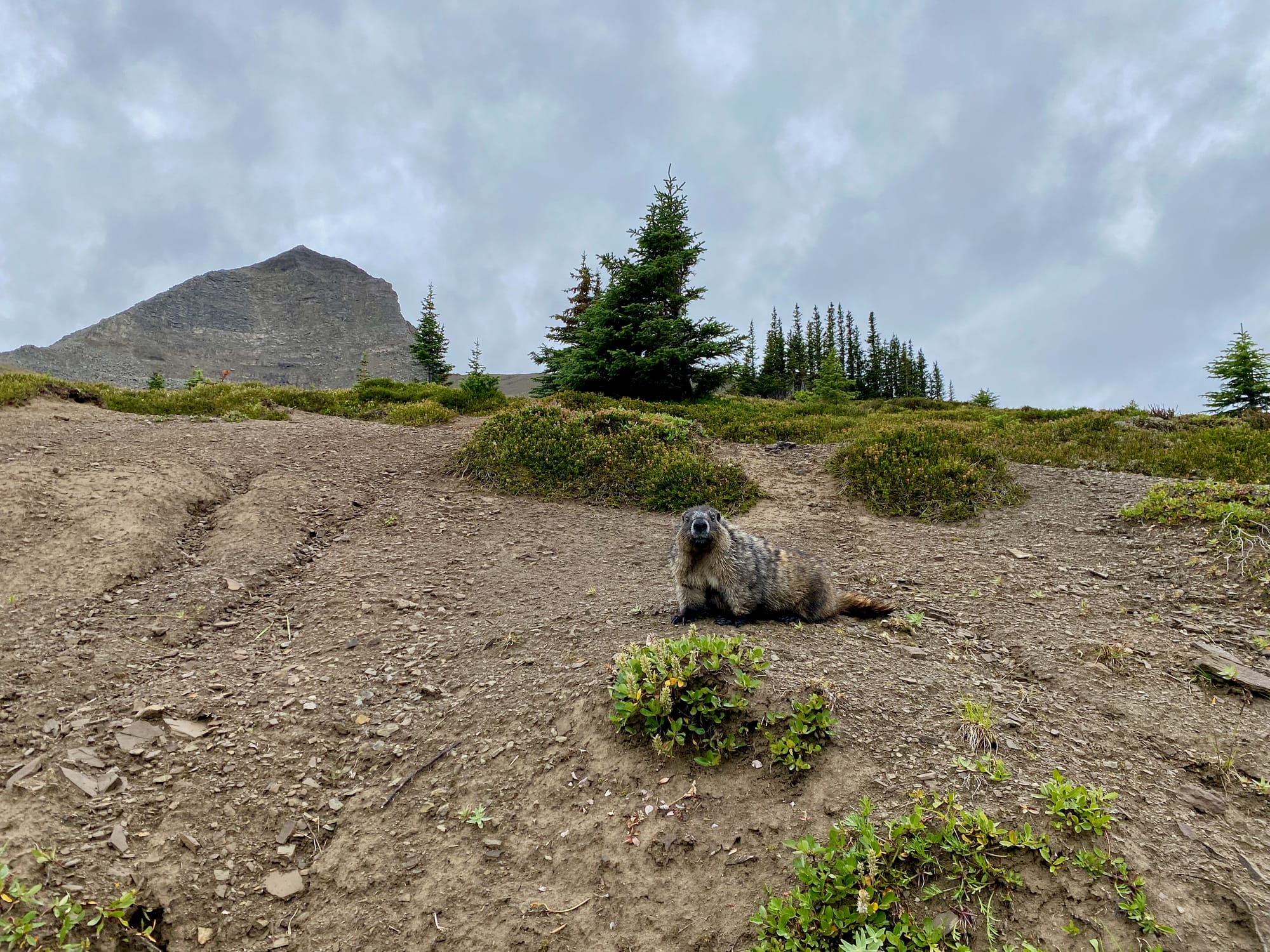
Porcupines seen: too many
Hiking poles nibbled by porcupines: 1
Rainy days: too many to count
Days without seeing another person: 3 (one in section D, two in section G. For most of sections D, F, and G, I saw only one group per day.)
Full days with dry boots: 1/24
Resupplies: 2 (Jasper, Mount Robson)
Destroyed or lost pieces of gear: around 10 (backpack, boots, pants, pole, several pairs of hiking socks, 2 cans of bear spray)
Lifelong memories: so many.
Sections Completed
Section D: August 4-9, 2025
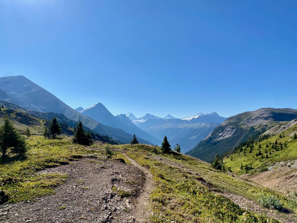
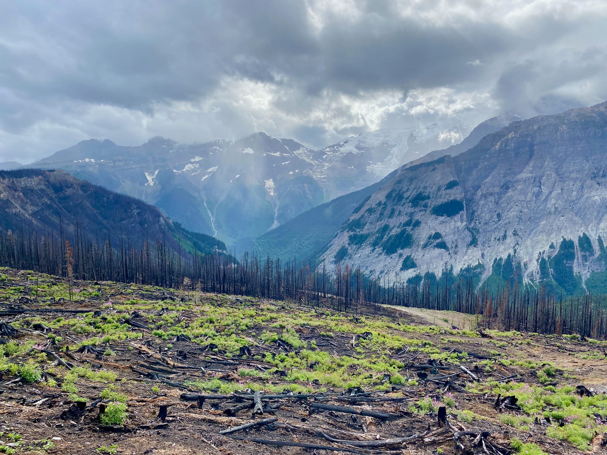
Formerly the “black sheep” of the GDT, recent trail maintenance has significantly improved things. Most hikers start this section with the Kiwetinok alternate, which climbs steeply to the famous Burgess pass and Iceline trail, offering views of Takkakaw Falls, the highest waterfall in the Rockies. Past the Iceline trail, the route drops 500 metres into a valley through the worst bushwhack I encountered on the GDT, then climbs almost 400 metres out of that same valley in the steepest section of the GDT (there are cliffs preventing a more direct route). All this in the first two days. From here, the trail follows the Amiskwi and Blaeberry rivers to their sources, eventually reaching Howse Pass, notable as the site where David Thompson first crossed the Great Divide in 1807. This section culminates in the Howse Floodplain, a wide valley carved by the glacial Howse River and surrounded by jagged peaks. This leads to Saskatchewan Crossing Resort, with resupply and transport options.
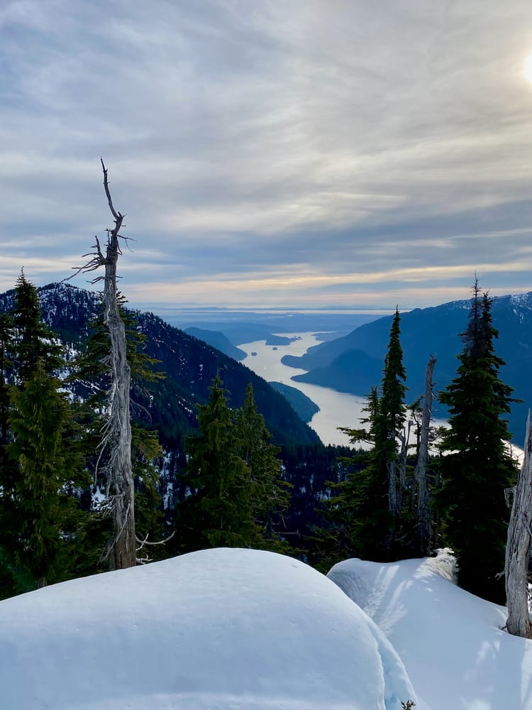
Section E: August 9-16, 2025
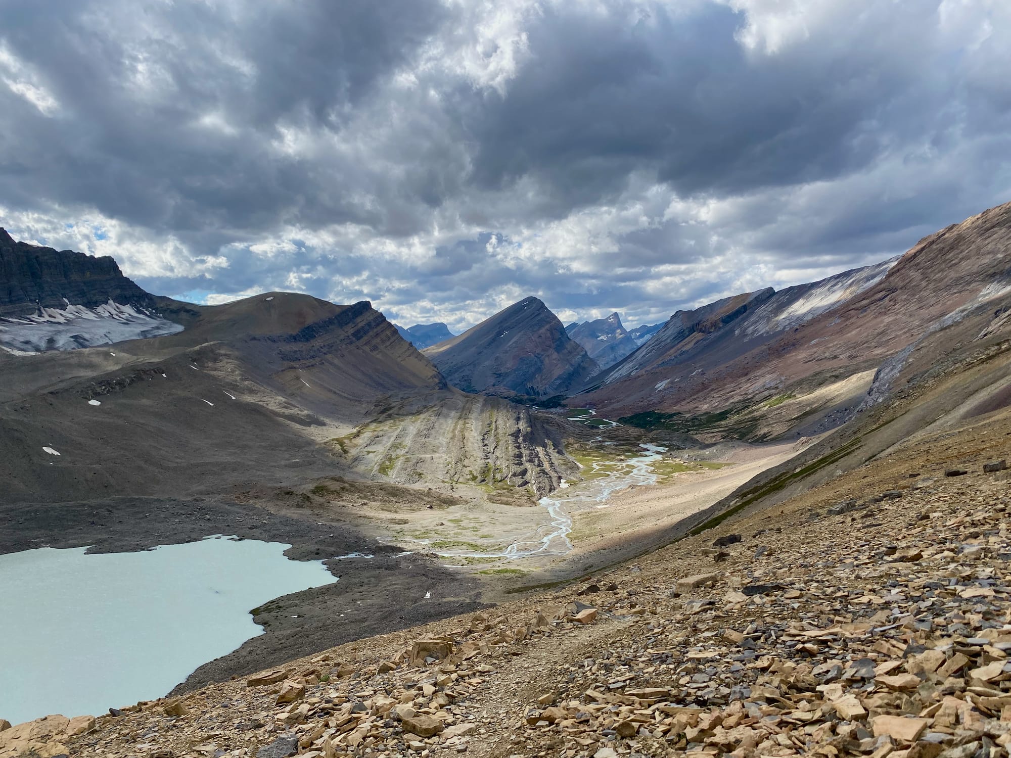
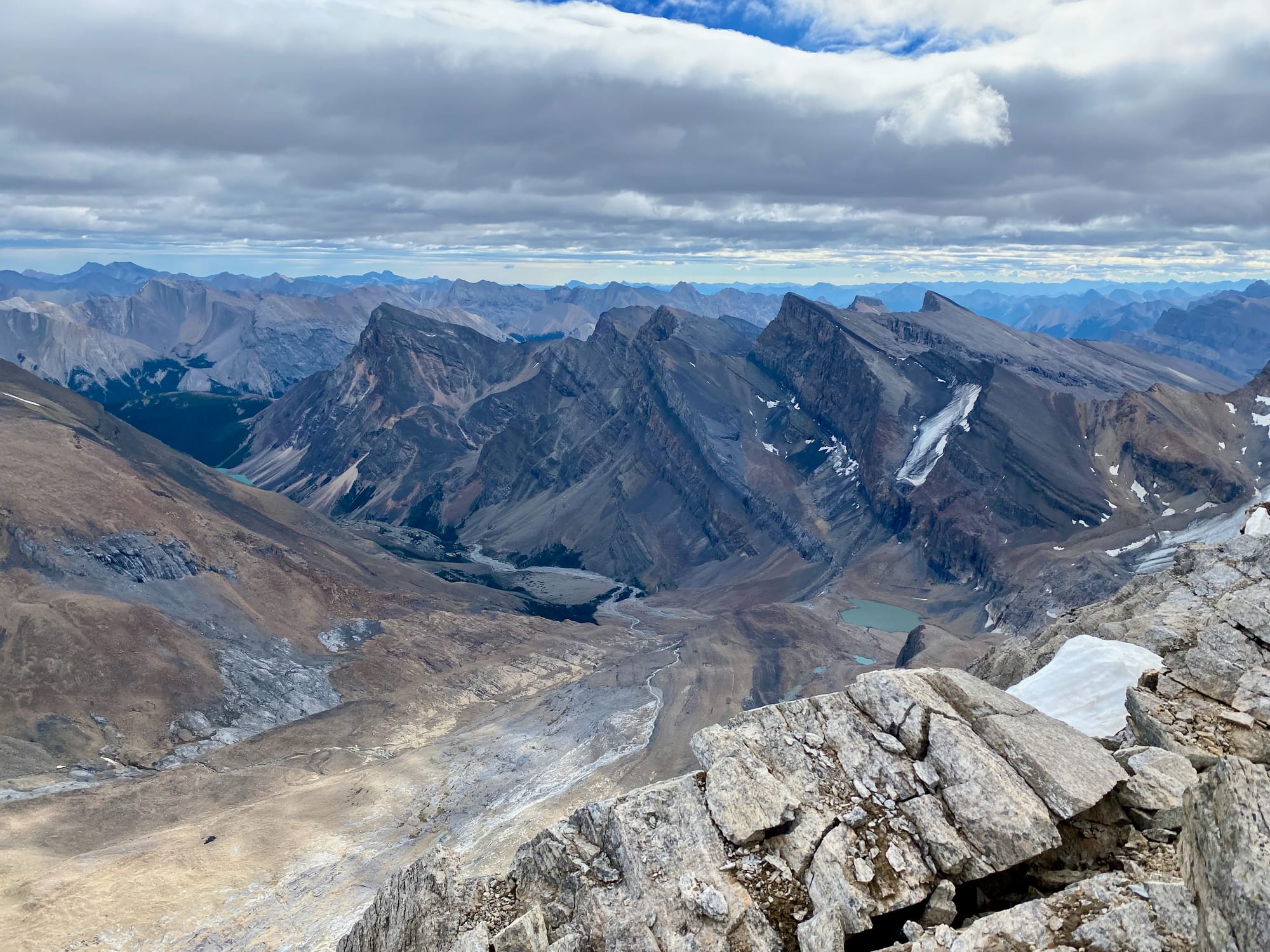
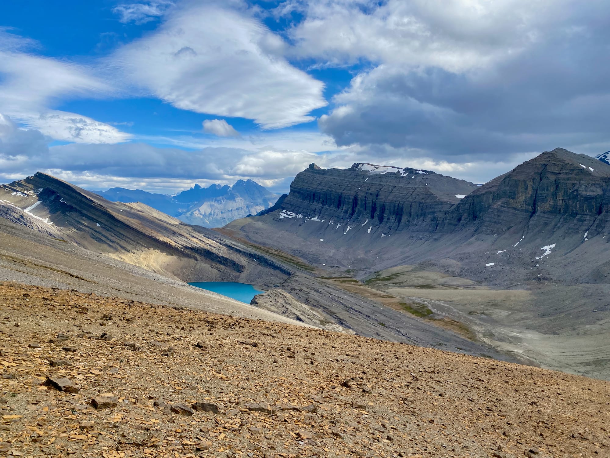
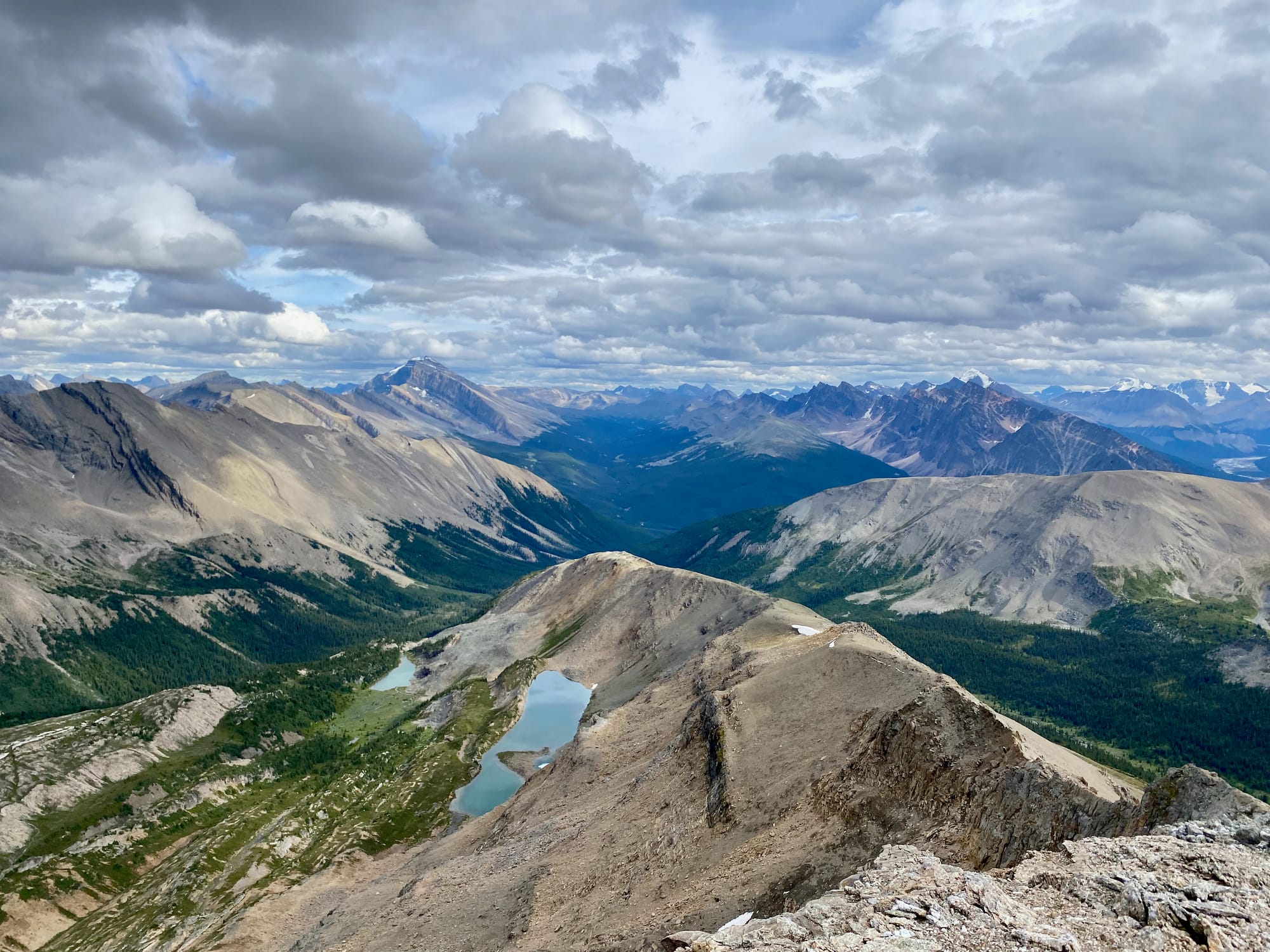
Out of all the GDT sections I completed, section E was the most stunning. After a steep climb beside a slot canyon, it follows a series of valleys and passes, mostly above treeline: Owen Pass, Cataract Pass, Maligne Pass, and so on. Some of my favourite GDT memories involved reaching the next pass to see surreal mountain scenery unfold in front of me. The trails are a mix of well-groomed, popular superhighways, such as the Skyline trail, and more remote herd paths in obscure places like the White Goat wilderness, where trail maintenance isn’t even allowed. I’d never heard of the White Goat Wilderness before this trip, but it became one of my favourite sections of the trail. Side trips to Mt. Stewart and Replica Peak were also highlights. The section wraps up on the popular Skyline trail, which I did in a freezing rainstorm, then descends to the town of Jasper where warm meals and rest awaited me.
Section F: August 18-21, 2025
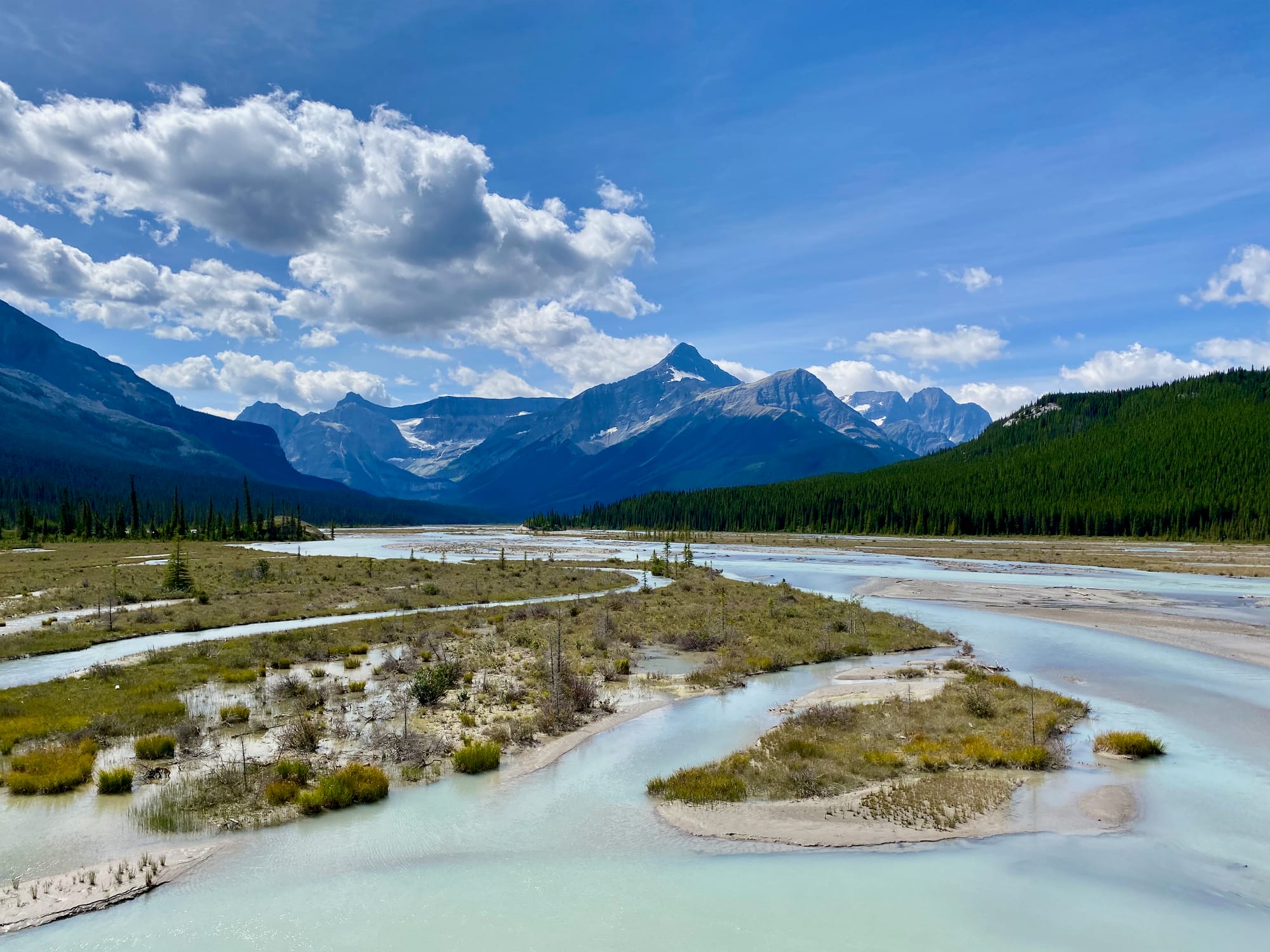
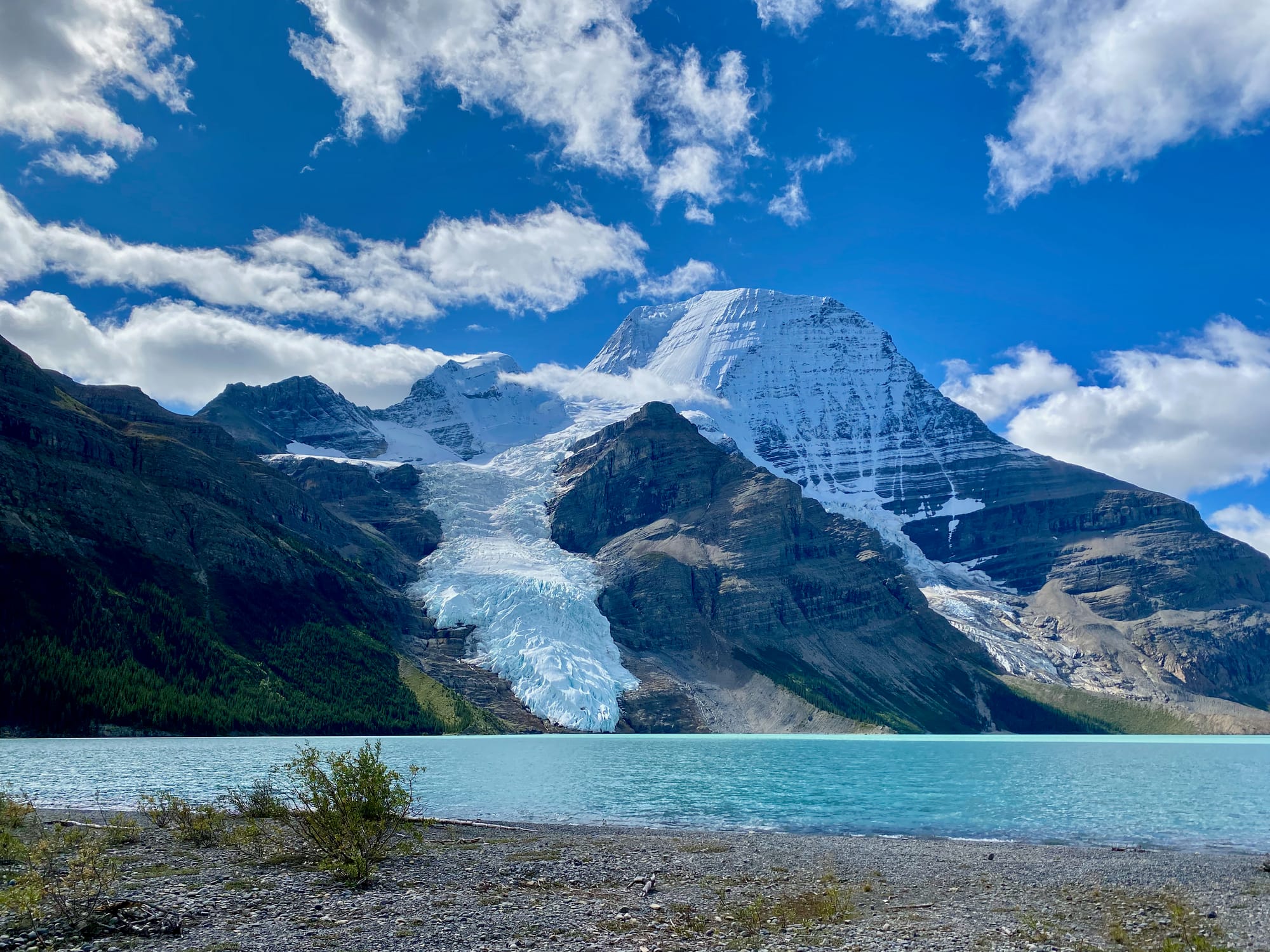
North of Jasper, the already remote GDT gets even further from civilization, and crowds disappear. Most of this section follows officially decommissioned trails and roughly defined routes. It's common for the trail to completely disappear in boggy areas. River crossings become more common here, such as the often dangerous Smoky River. The reward: some of the best passes on the Great Divide Trail. This section reaches its peak as it passes directly below Mount Robson, the highest point in the Canadian Rockies. Most hikers will exit through the spectacular Berg Lake trail, recently re-opened after a devastating flood. In my case, I hiked the Berg Lake trail to the highway, picked up a resupply package, then walked all the way back past Berg Lake to begin section G.
Section G (Mostly): August 22-28, 2025
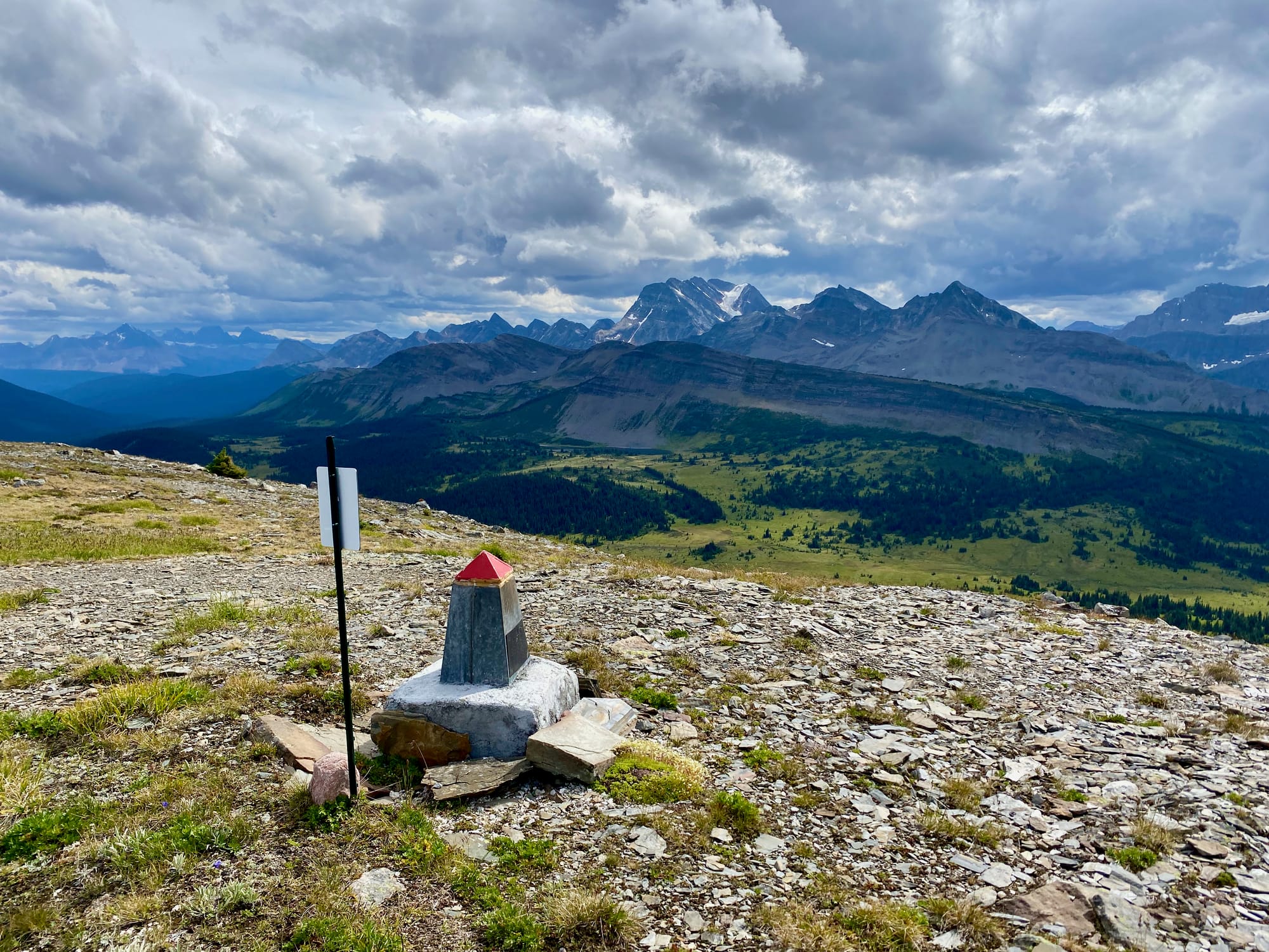
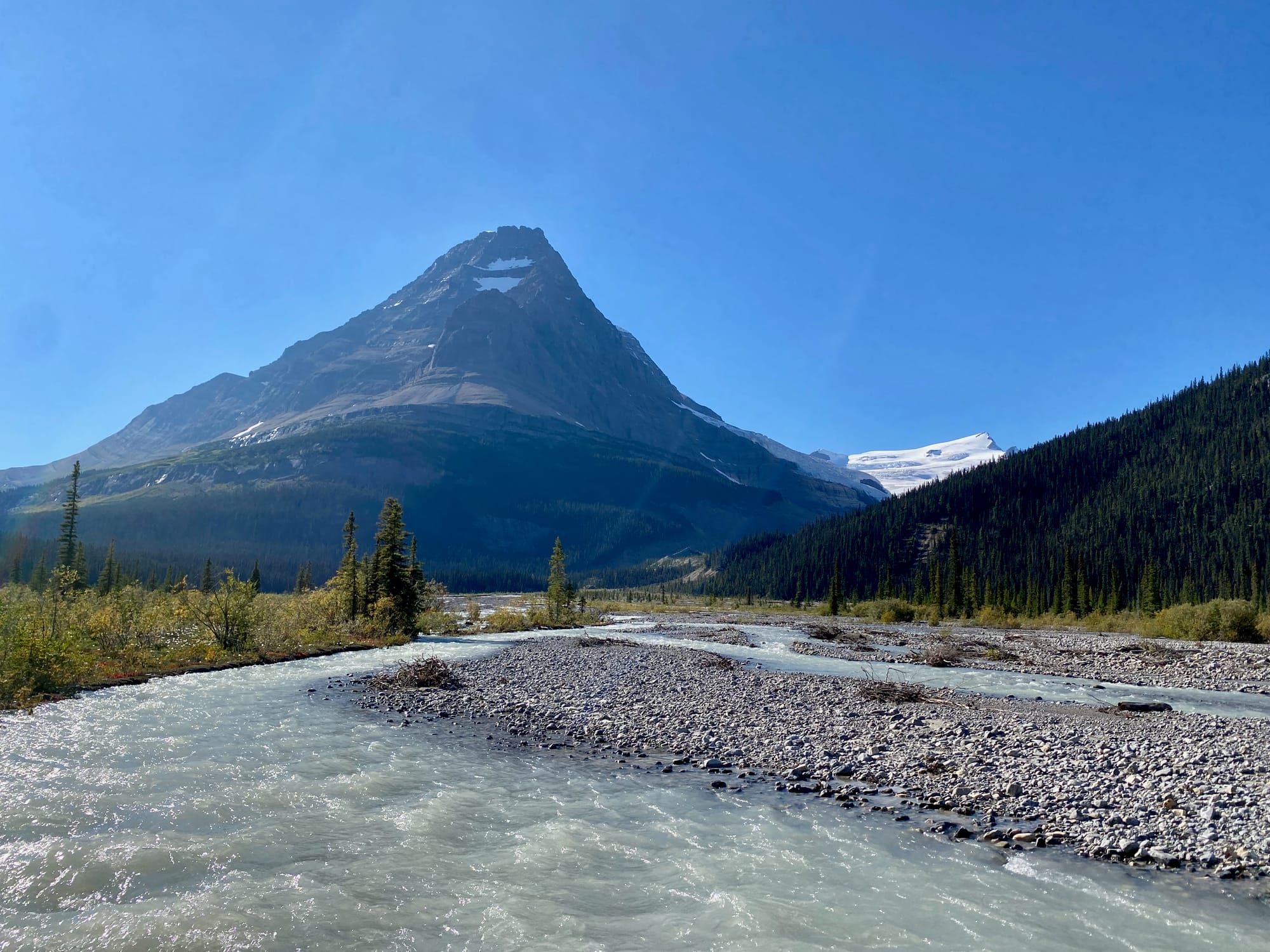
In many ways, Section G exemplifies what the GDT is all about. It is the wildest and most remote section of an already wild and remote trail. Hikers cross countless deep rivers, wrestle through seemingly endless fields of willows and mud, and sometimes spend days walking through bogs and floodplains. The reward is some of the most spectacular scenery the trail has to offer. In contrast to the southern sections, the mountains here are more worn down by the harsher climate, and after Mount Robson they never rose as high to begin with. As a result, the GDT spends more time on ridges and alpine plateaus than in previous sections, and numerous alternate routes lead to mountain summits, offering hikers stupendous views of peaks and valleys almost no one has visited. It must be said that the GDTA’s excellent work in this area has made the section less intimidating than in years past, with some of the worst bushwhacks now cleared. The weather seemed to flip a switch, and I was treated to a full week of sunshine after the endless rain of earlier sections. Things were going well until I injured my foot near the end of the trail, leading to an evacuation.
Side Quests
There are infinitely many side trip opportunities here. Most of the sections I did (with the exception of section G) follow valleys to passes, and avoid summits. I wanted to reach some peaks and see a different perspective of the Rockies, so I hiked up a few mountains. All of these had unbelievable 360 degree views, some more hard-won than others. I would recommend most of them to GDT hikers with the time and stamina. It’s very satisfying to stand at a high point and see all the ground you’ve covered, and the trail you’ve yet to hike. Note: all distances and elevation gains below are one way.
- Mt. Field (D): 0.9km, 396m elevation gain from the trail. Scree slope with one short class 2 scramble. Offers extensive views, including the Kicking Horse valley almost 1.5km below you.
- Michele Lakes Peak (E): 0.75km, 243m elevation gain. This is the most commonly done GDT side trip, since it offers a relatively accessible viewpoint above the GDT’s highest point.
- Mount Stewart (E): 3.45km, 1232m elevation gain. Without question, this was one of my favourite parts of the whole adventure. Cataract Pass is stunning and this mountain is a vertical kilometre above it. The downside is the 1232m of scree slogging required to get there. I only did it because my permit schedule locked me into what would otherwise have been a very short day, but I’m so happy I did.
- Replica Peak (E): 1.8km, 550m elevation gain. If you only do one of these side trips, do this one! Maligne Pass is one of the GDT’s highlights, but much of its beauty is hidden from the trail. From this peak, I could see the glacial lakes not visible from the pass and the mountains behind the Endless Chain range. Note that there are steep scree sections.
- Miette Pass North Peak (F): 0.6km, 275m elevation gain. Short and non-technical walk to a summit above the Miette Pass meadows. Good effort/reward ratio. Highly recommended.
- Peak 2689/Devout Peak (F): I tried to climb this very obscure peak but had to bail 150m below the summit when the ridge became too technical. Stunning scenery, but it was difficult to get there. Not sure if this was worth the effort.
- Jackpine Mountain (G): About 3km and 500m elevation gain. Fun class 2 scramble with some easier class 3 sections. I’m not sure if I would recommend this one: the views are epic but you get similar views from the actual GDT along the Jackpine High Route, unlike the other peaks here. I rolled my ankle in a boulder field on the descent, putting an end to future side trips.
Other side trips I considered but didn’t do were Mount Willis and Cline Pass (E), Poboktan Mountain (E), Mount Mary Vaux (E), Curator Mountain (E), Snowbird Pass/Titkana Mountain (F), the Perseverance Alternate and Adventist Peak (G), Mount Ruth (G), and Mount Ian Monroe (G). From the limited information available, these seem like class 2 or 3 scrambles, some much longer than others.
Resources
My go-to source for trip planning was the Great Divide Trail Association’s website: https://greatdividetrail.com/discover-the-gdt/ It includes section descriptions, sample itineraries, maps, and much more. If you’re hiking the trail, I would strongly recommend becoming a GDTA member: it’s good to support all the great work they do to make this trail what it is. The membership also paid for itself in hostel discounts alone.
The FarOut app will be your best friend on the trail (except possibly any hiking companions). It includes GPS tracks of the trail and notes campsites, water sources, and other features. Users can leave comments at each location, providing the most up-to-date information you’ll find anywhere. The comments were invaluable and I left plenty of my own. Note that FarOut is supposed to include lines overlaid on the map (red lines mark the trail, blue are alternates, and yellow are access/bailout routes). These weren’t appearing for section D; I had to uninstall and reinstall the app at Sask Crossing to fix this. Additionally, some other hikers mentioned not being able to see the comments.
The GDTA website includes an assortment of blogs, videos, and online guides. They were all helpful but Jupiter Hikes’s guide was especially useful: https://jupiterhikes.com/how-to-thru-hike-the-1200km-great-divide-trail/
The “Great Divide Trail Hikers” Facebook group also contains a wealth of information. It’s a good way to trade/obtain permits as well.
The trail has one definitive guidebook: “Hiking Canada’s Great Divide Trail” by Dustin Lynx. It contains extensive information and was helpful for trip planning.
Resupplying
Towns are few and far between on the GDT, but there are several places where hikers can resupply. See https://greatdividetrail.com/go-hiking/trip-planning-resources/resupplying/ for the full list. I bought meals in Jasper and mailed a resupply box to the Mount Robson visitor centre (check with them for their hours first, there’s lots of inaccurate info online). For section D, I could have made my pack much lighter by resupplying at The Crossing resort but I decided to just carry more food for that stretch. This may or may not be worth it.
Permits
Note: Every GDT hiker should have all the correct permits. The GDTA has worked hard to build relationships with the various land managers along the way, and breaking the rules could lead to increased restrictions on GDT hikers and the GDT itself.
The most difficult part of this trail, other than the actual hike, is acquiring the necessary permits. Work is being done by the GDTA to improve this situation, but at the moment, the process is quite frustrating. The trail passes through many different provincial parks, national parks, and wildernesses across 2 provinces, each with their own permit system. Some permits sell out almost instantly (especially in sections C and E), and some are only available in-person or by phone call. I could try to list everything but I would probably miss something. Check https://greatdividetrail.com/go-hiking/trip-planning-resources/permits/ for the full list.
Ideally, you would snag the most competitive permits as soon as they become available in January. For various logistical reasons, I wasn’t sure I would be able to go on this hike until mid-June, which meant a lot of last-minute planning, mostly from a treeplanting camp with limited internet access. This was not ideal.
The Schnerp app was invaluable in this situation. You can sign up for specific campsites and it will notify you when space becomes available. It helped me reduce a 57km day in Jasper National Park to a more manageable 44.2km day less than a week before my hike started. Even then, there were some annoyingly short and annoyingly long days.
Another invaluable resource was Dylan Ivens’s article (https://www.mountainsandme.ca/post/the-late-notice-gdt-guide-a-hiking-itinerary-for-permit-struggles-on-the-great-divide-trail ), which describes several itineraries for each section that avoid the most difficult permits. I ended up following his sample itinerary for much of section E, making the planning process much easier.
Full trip reports
Section A: TBD
Section B: TBD
Section C: TBD
Section F (August 18-21, 2025)
Section G (Most of it)(August 22-28, 2025)
“Section H” and beyond: Maybe someday…

Member discussion