Barkley Horseshoe part 2: Billy to Elliot
Date: September 20-22, 2025
Distance: 18.9km (Barkley Valley loop + Hurley detour); 2.39km (out and back to Crystal from Twin Lakes)
Elevation gain: 1993m (Barkley Valley loop + Hurley detour); 236m (out and back to Crystal from Twin Lakes
This is part 2 of a traverse of the ridgeline around the Barkley Valley north of Pemberton. The previous day, I had hiked from the trailhead to the cirque below “Billy Peak”, with a detour to visit the Hurley silver mine peaks. My goal for the rest of the trip was to travel counterclockwise from Billy Peak to Twin Lakes, with some peakbagging and scrambling along the way. This was accomplished with some detours.
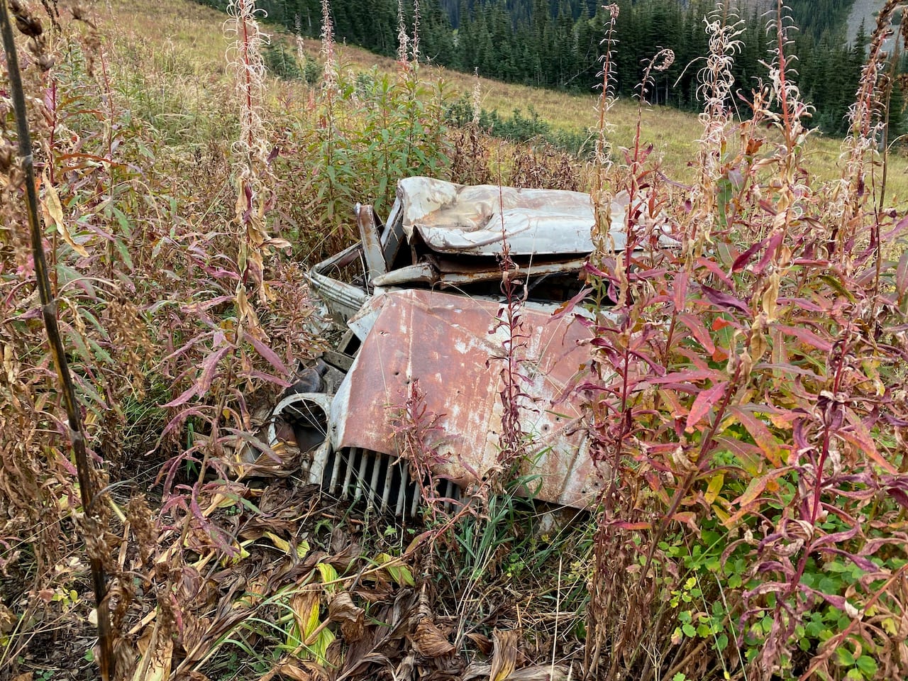
The Barkley Valley has a fascinating history. The N’Quatqua people called it “Lawlaton”, meaning “Paradise”, for its plentiful game. The valley was considered a place of spiritual significance. In the early 1960s, prospector Tom Barkley built a cabin, mine workings, and a road; only the road remains now. In the late 1960s, a religious group set up a community near the site of Barkley’s cabin and prepared to wait out the apocalypse. After a few years, they moved on, but their ruined cabins and abandoned cars can still be found in the valley. My sources for this information were the interpretive signs along the trail, and this fascinating Pique magazine article, which includes an interview with Lloyd Forman, founder of the religious community.
I woke up to pouring rain, which luckily stopped as I was leaving my tent. Some time was spent faffing around; it turns out that a buried Ursack is difficult to spot in a field of Ursack-sized boulders. Eventually I was ready to head out.
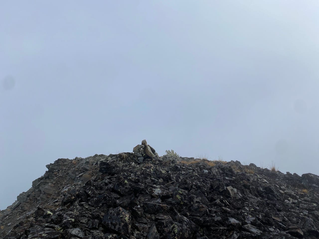
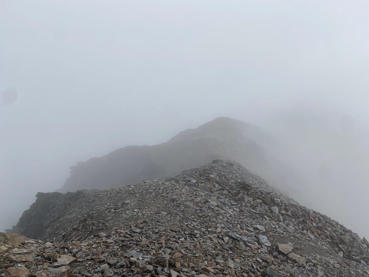
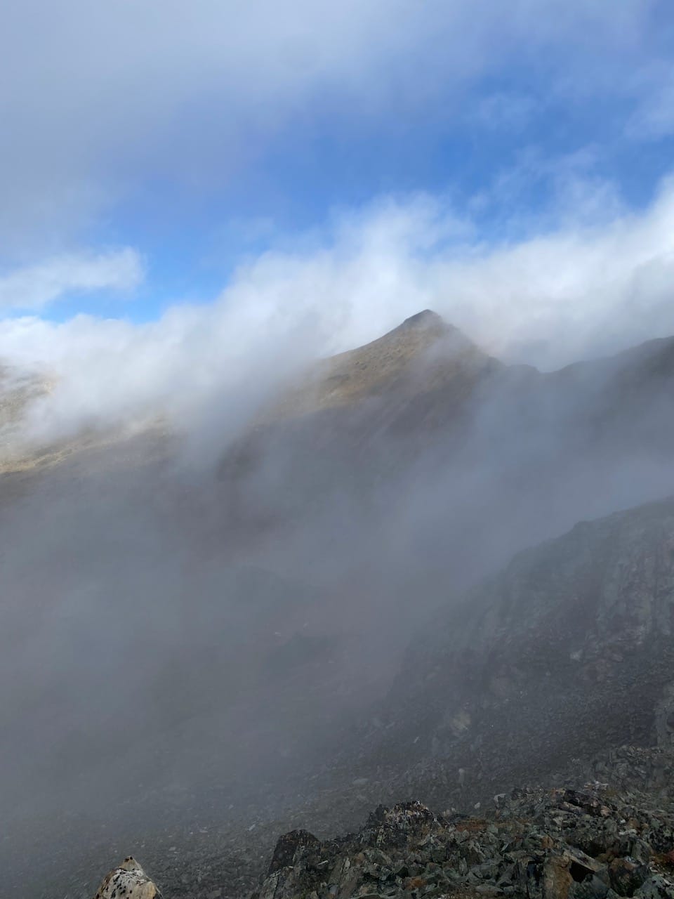
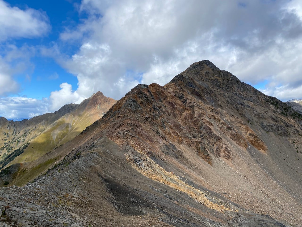
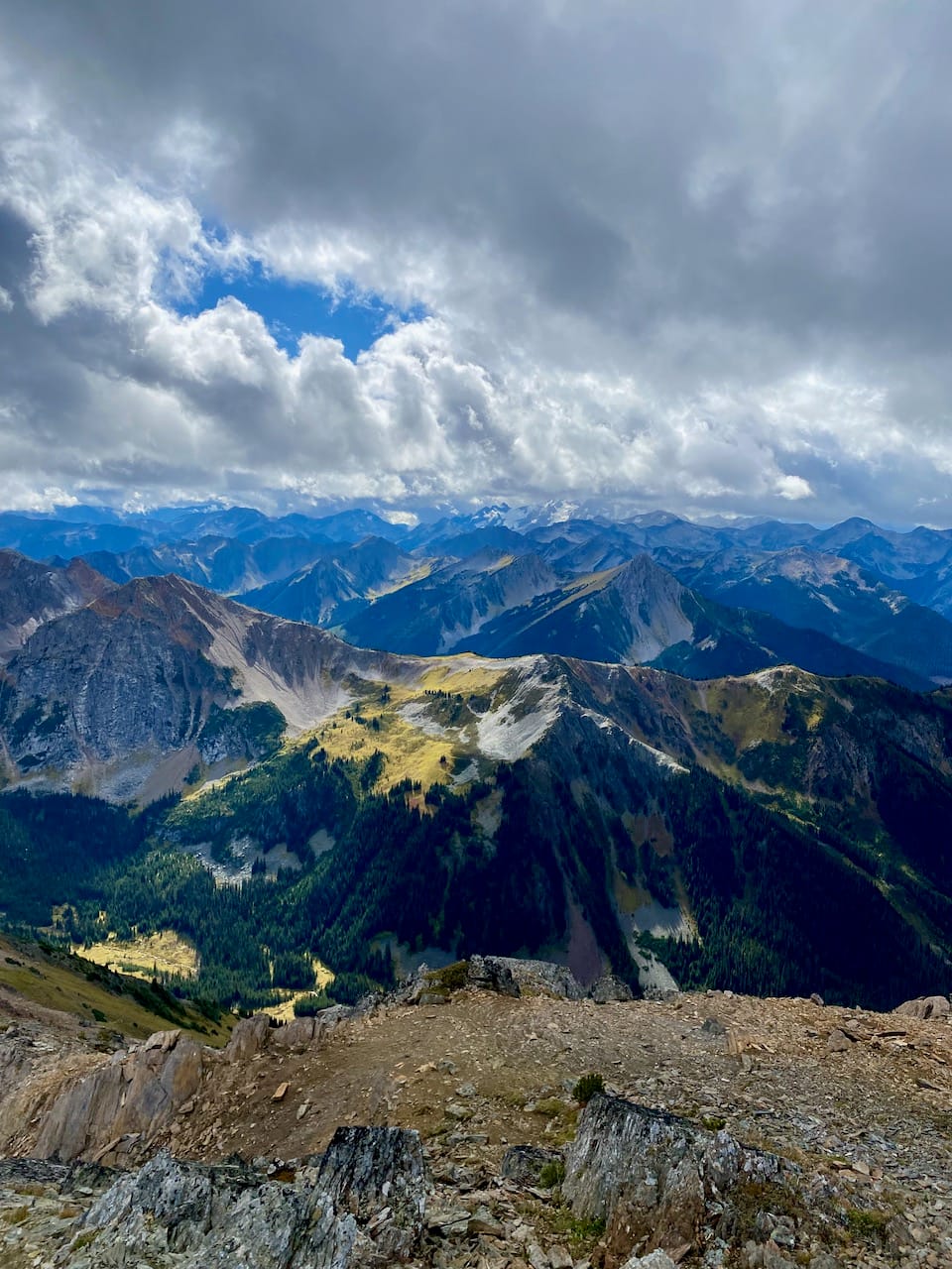
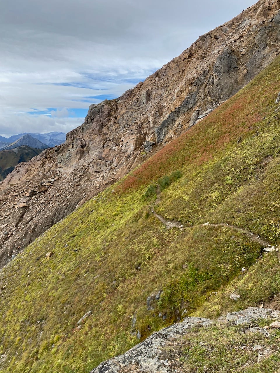
The weather cleared up for a while, but clouds immediately rolled in as I left camp. By the time I reached the summit of “Billy Peak”, nothing could be seen through the fog. I was hoping the weather would clear, so I continued. This part of the ridge was mostly easy walking, with some steep sections and scree descents, but nothing exceeded class 2.
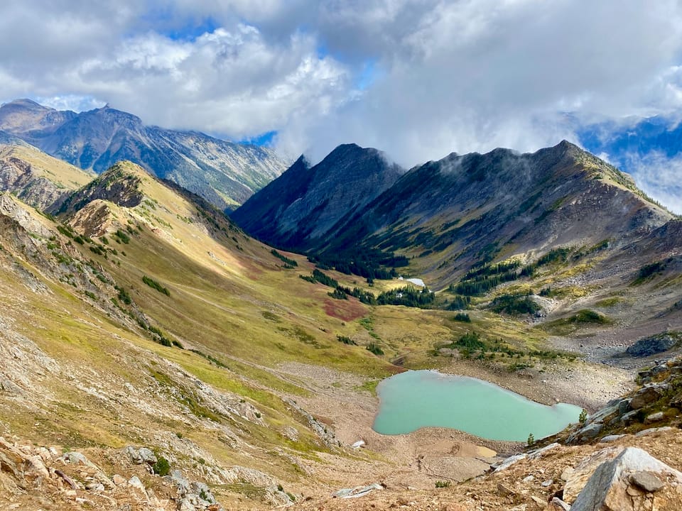
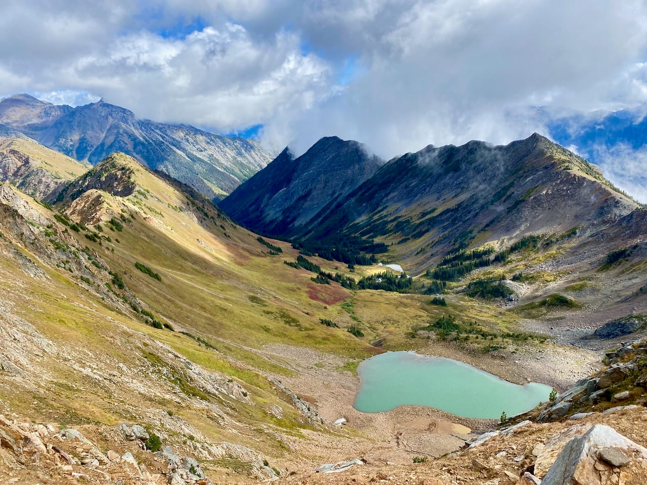
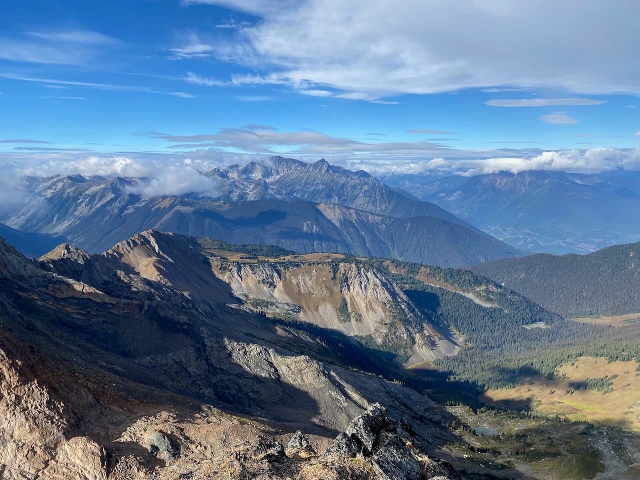
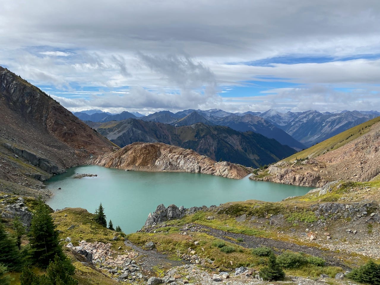
Once at the col between “Billy Peak” and Peak 2345, the clouds began to clear, and I was treated to some great views of the entire Barkley valley.
I stopped to drink some water, but my Nalgene slipped out of my hand and fell 50m into the Cayoosh Creek drainage basin. I scrambled down to retrieve it. Somehow it hadn’t broken.
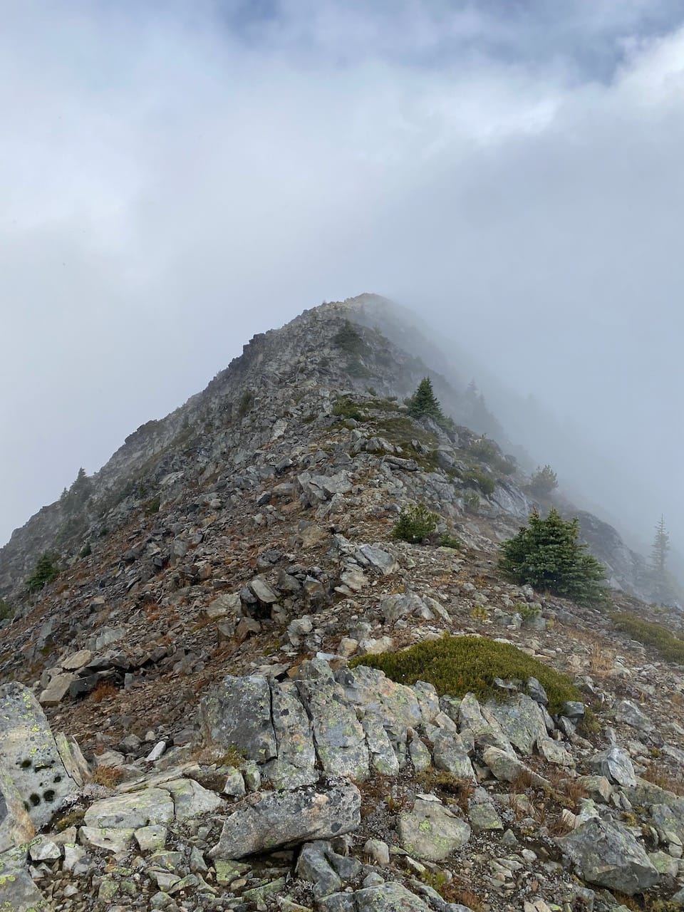
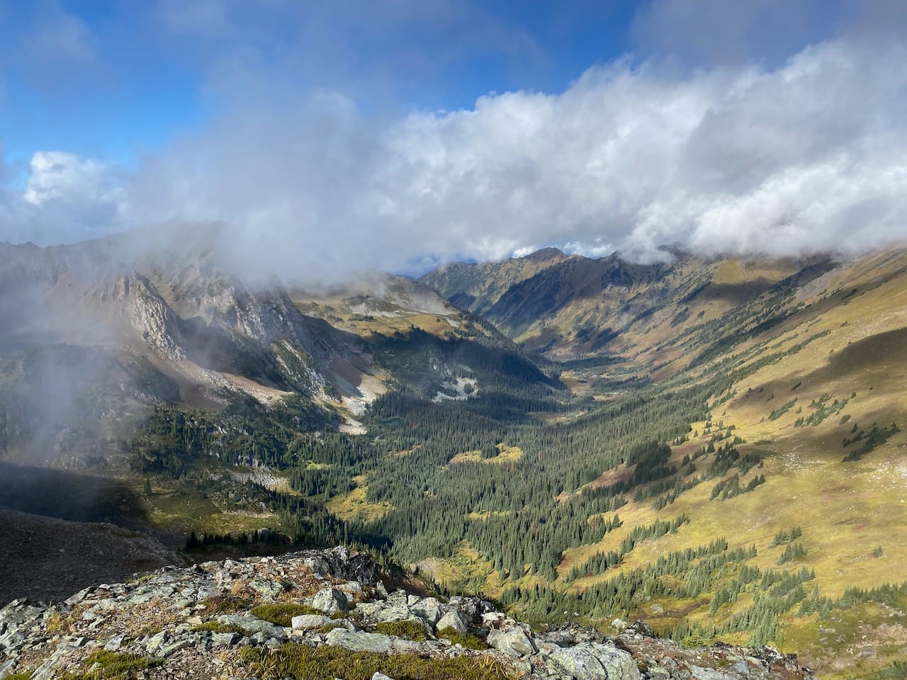
By the time I returned to the ridge, the cloud ceiling was above the mountains and the views were basically unobstructed.
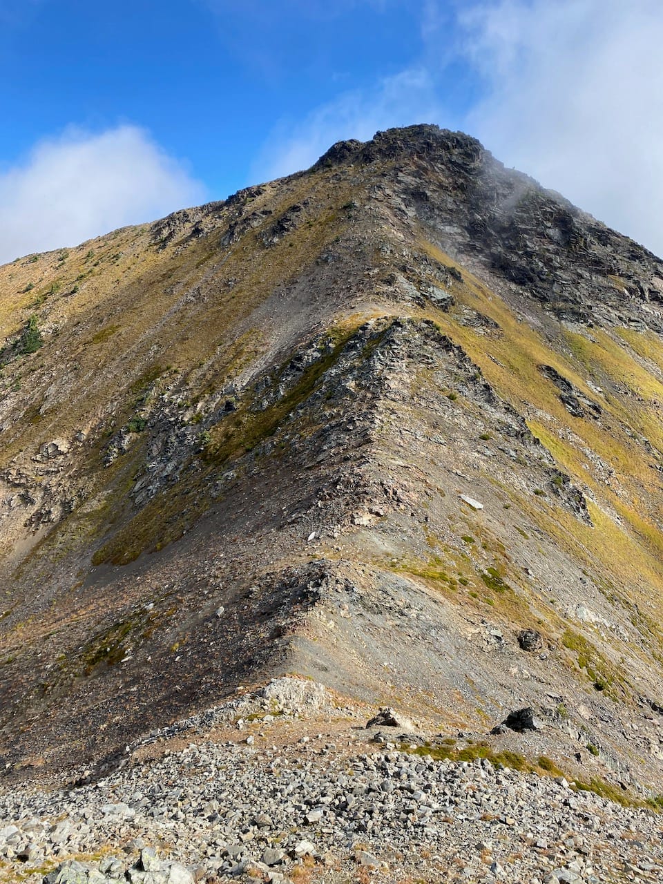
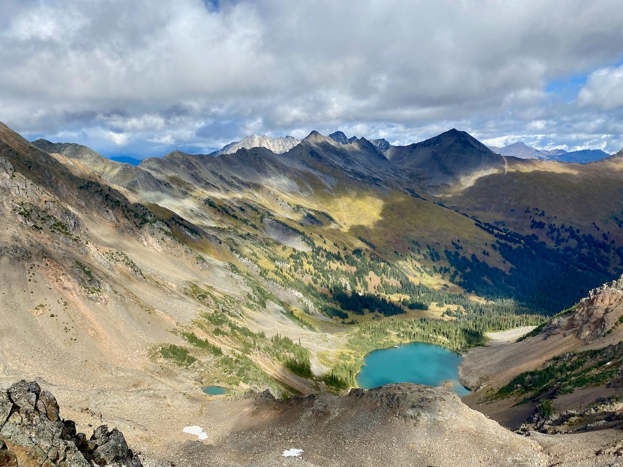
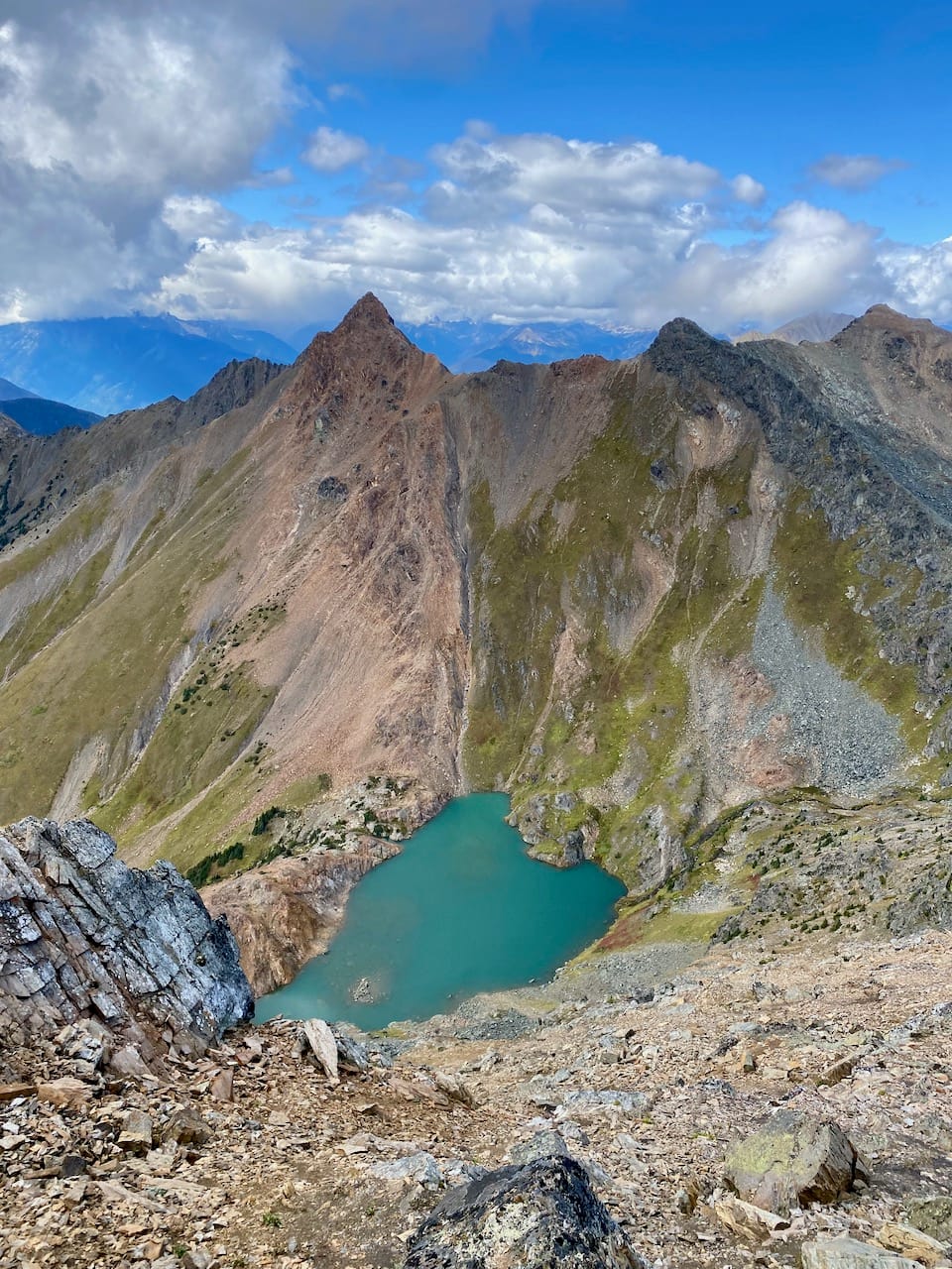
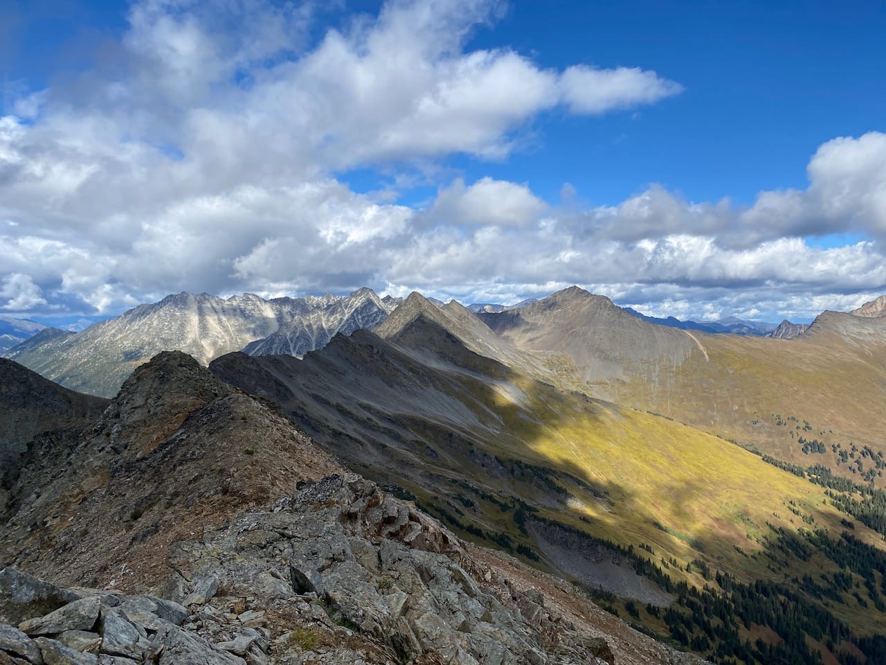
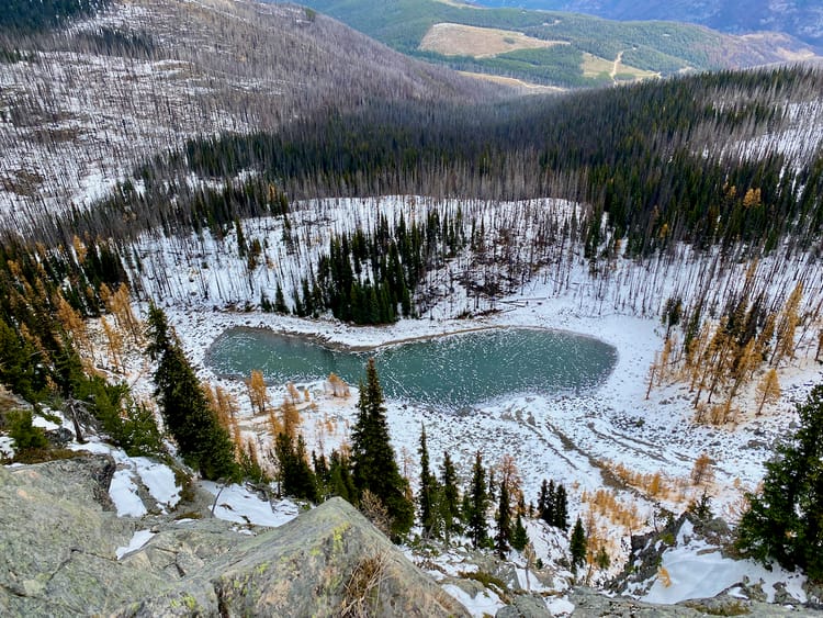
There are two peaks between the col and Elliot Peak, marked as “Peak 2380” and “Peak 2394” on Peakbagger. Each one has a glacial cirque to its north with a beautiful glacial lake within. Peak 2380 was a walk up but Peak 2394 had some easy class 3 scrambling along a broken ridge, which could probably be bypassed.
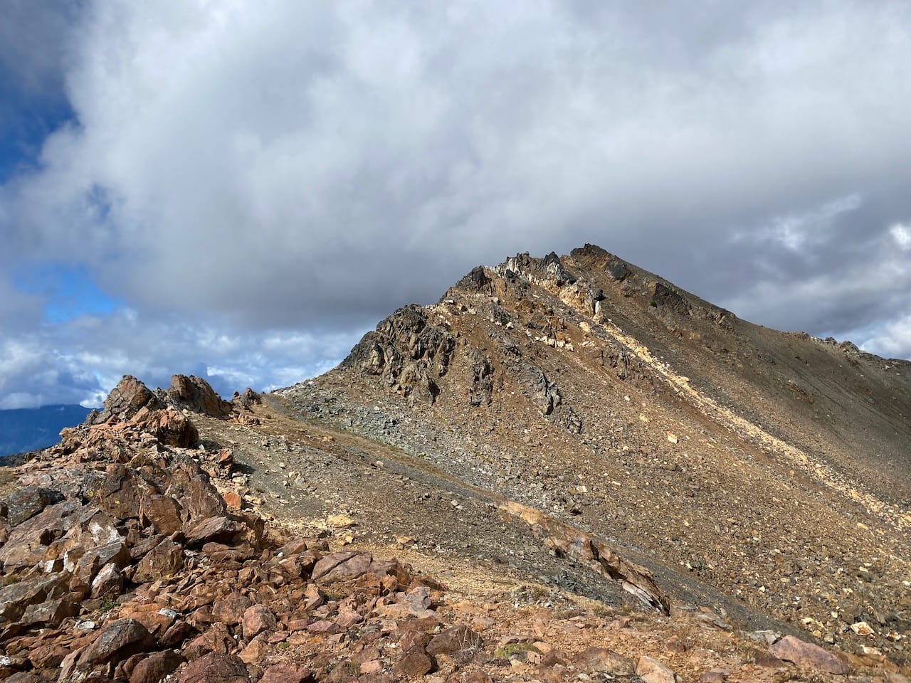
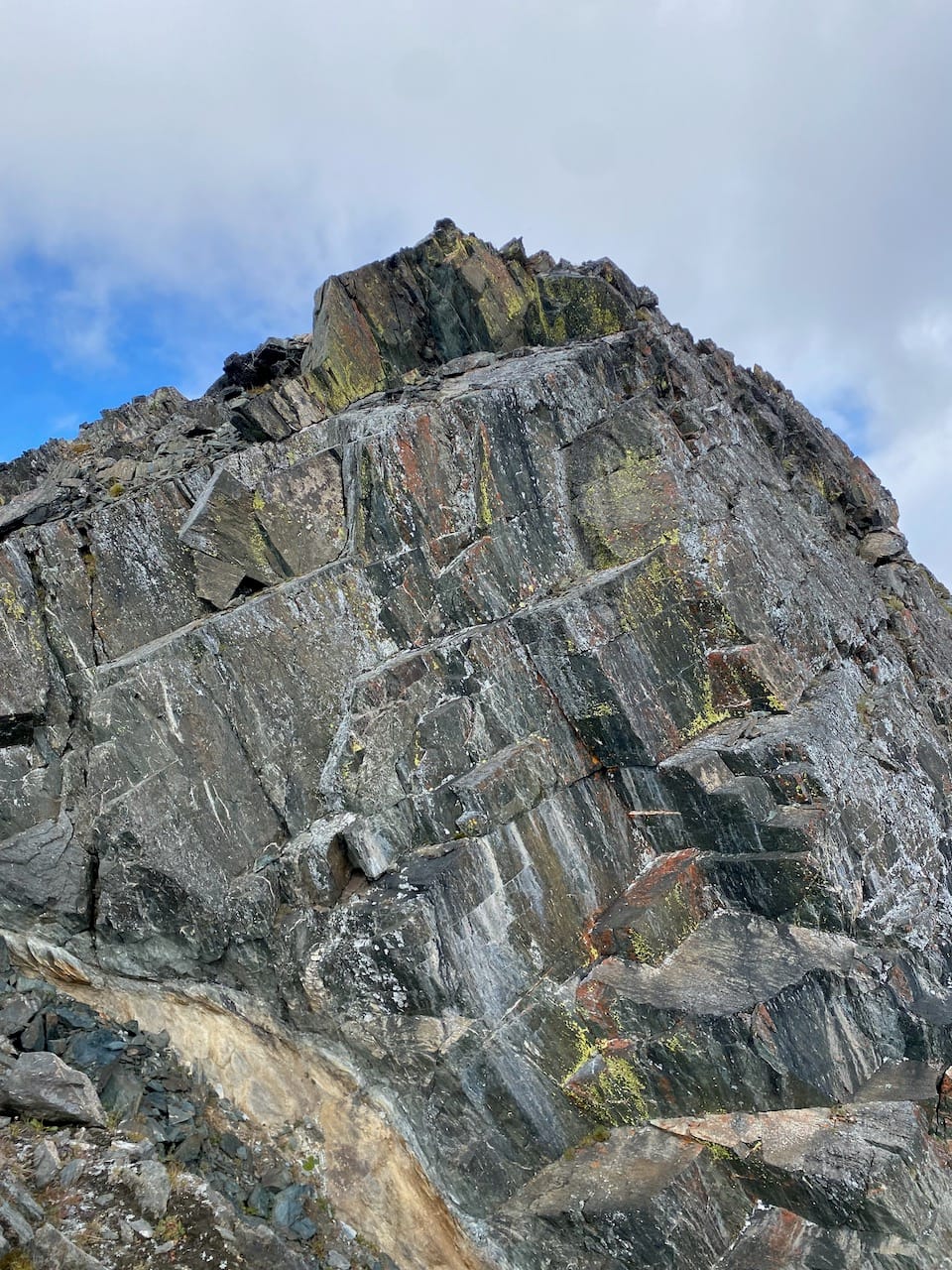
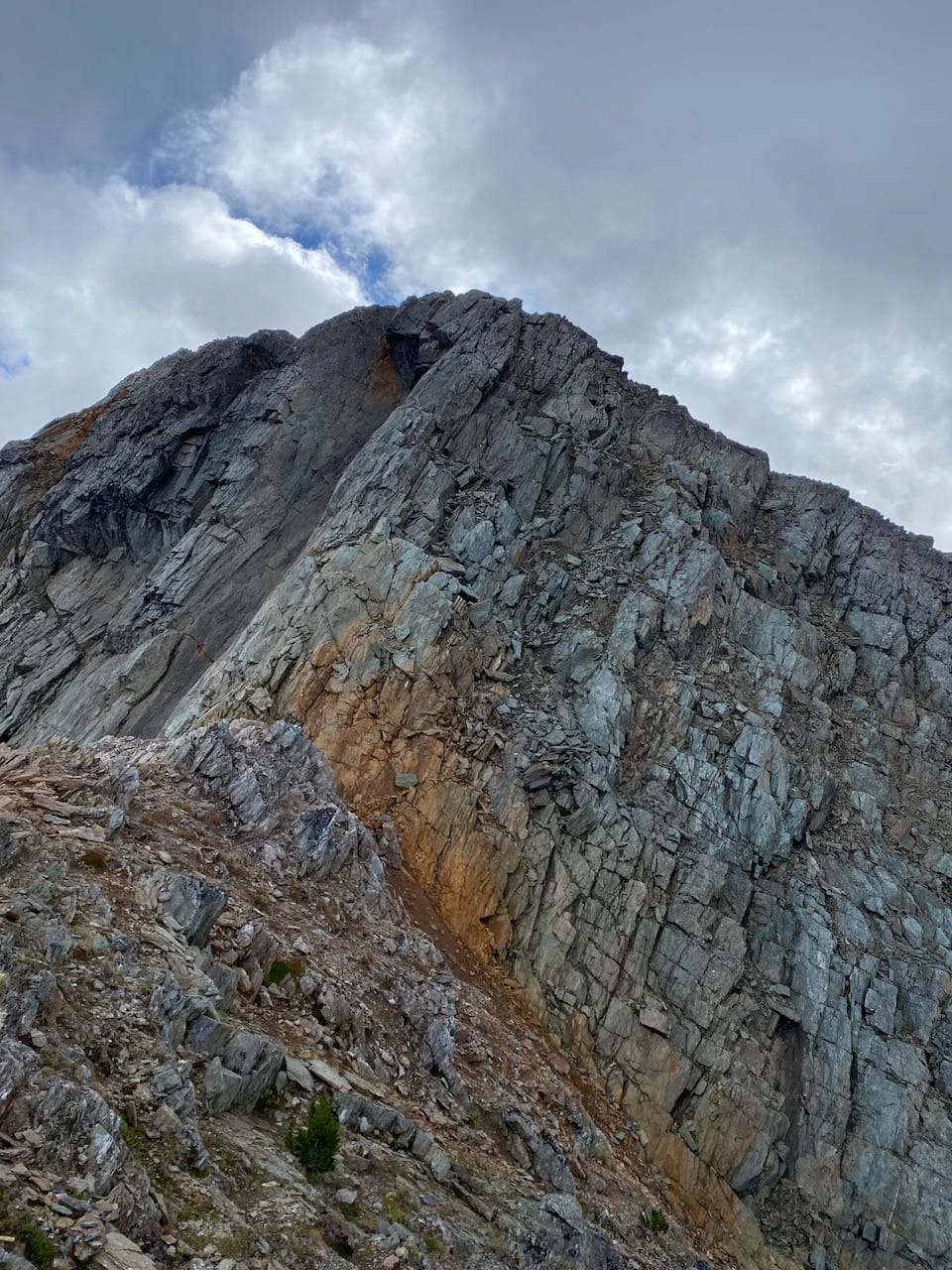
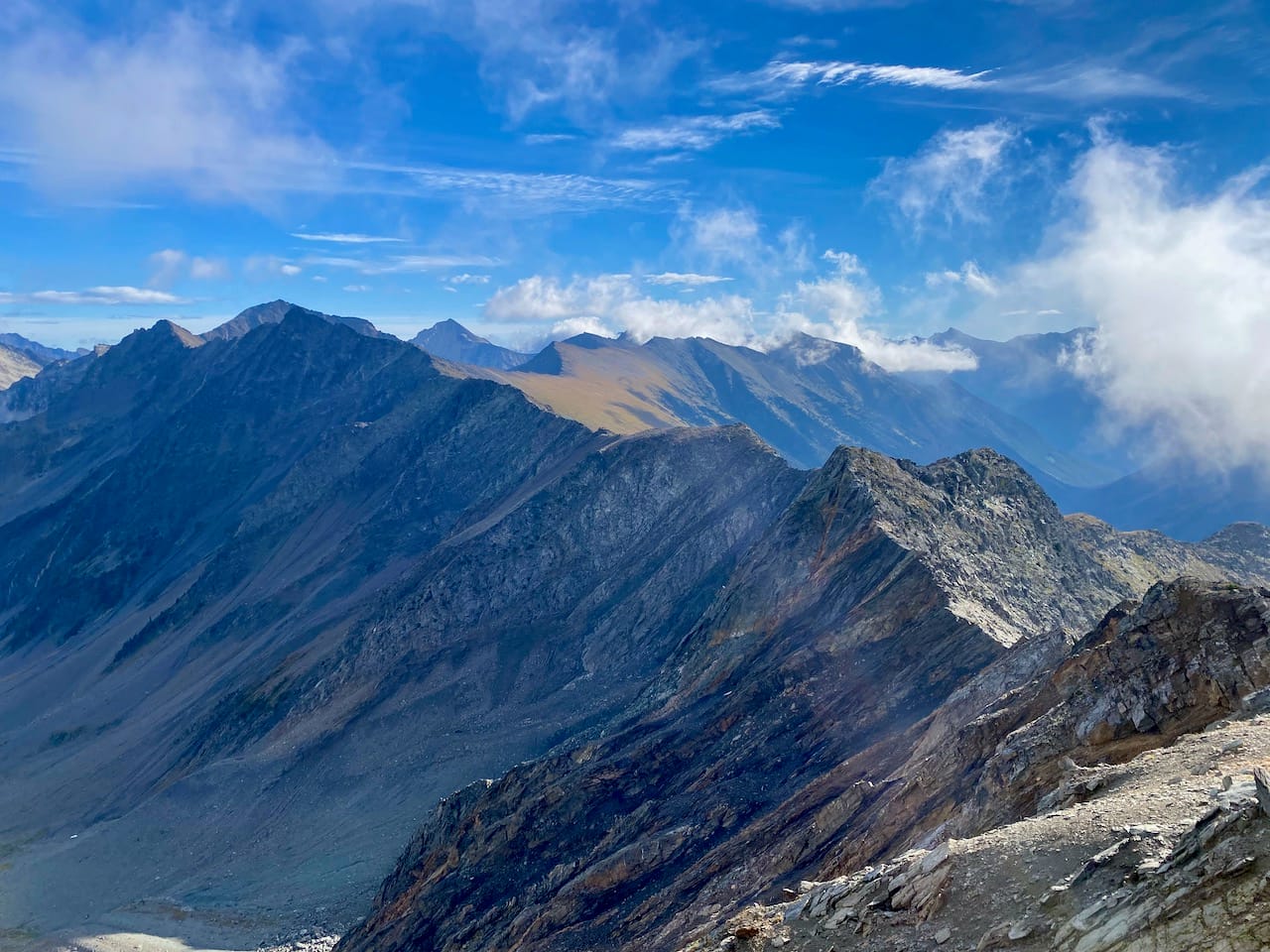
Elliot Peak was the most technical part of the day. At the 2394/Elliott col, I stayed on the southern face of the ridge to avoid a steep wall, then scrambled up a small gully (class 3) to regain the ridge. Alternate routes could easily be found here. The rest of the ascent was class 2 at most.
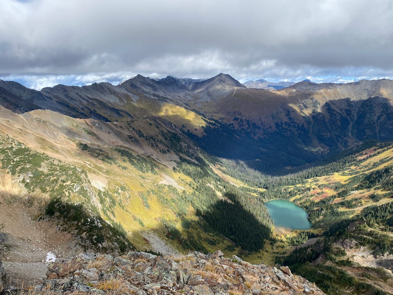
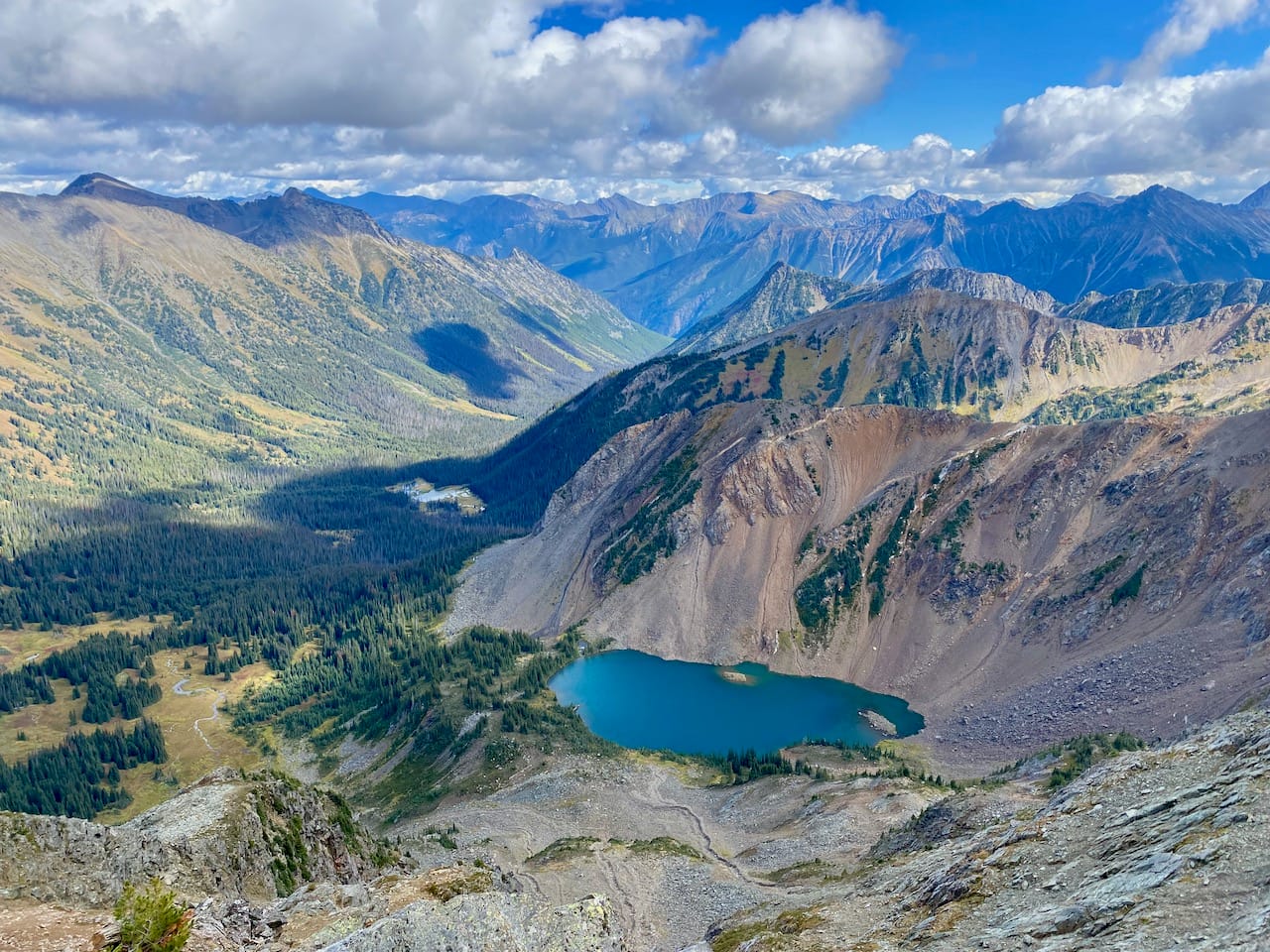
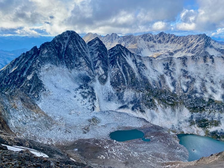
Elliot Peak had the best views of the day.
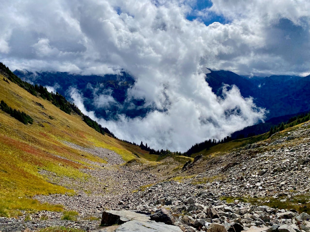
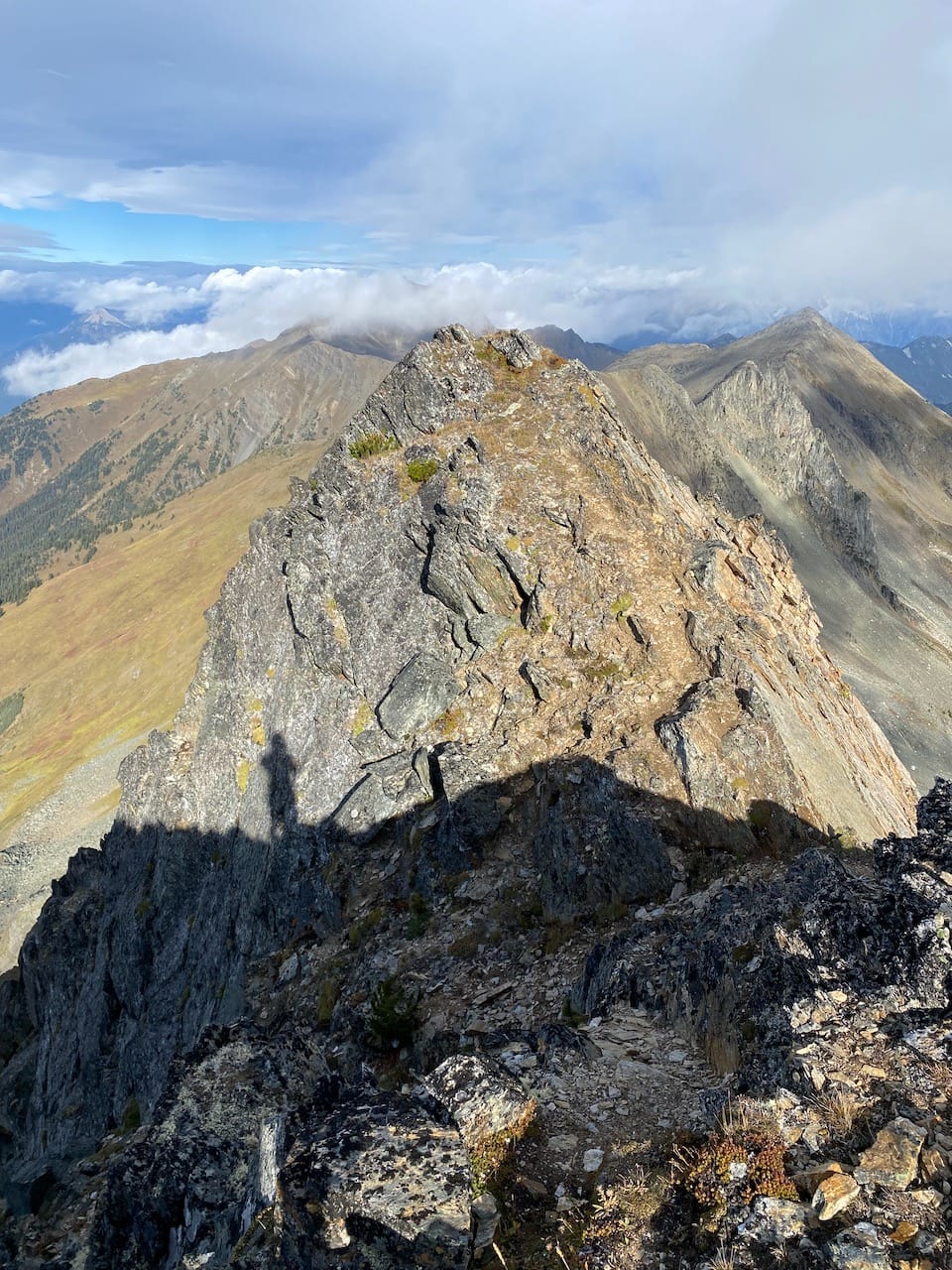
The cruxes of the day were the scrambling sections when getting off the summit. I was nervous about this section, especially since I didn't climb up here, but it turned out better than expected. There was a short section along the ridge that was somewhat exposed, but not difficult to traverse. The second, more extensive scramble involved a steep slope with several class 3 descent options, then a short traverse across a gully, but both were manageable. After getting past the scramble, I turned around; the slope I’d descended looks like a sheer cliff from this angle, much scarier than it actually is.
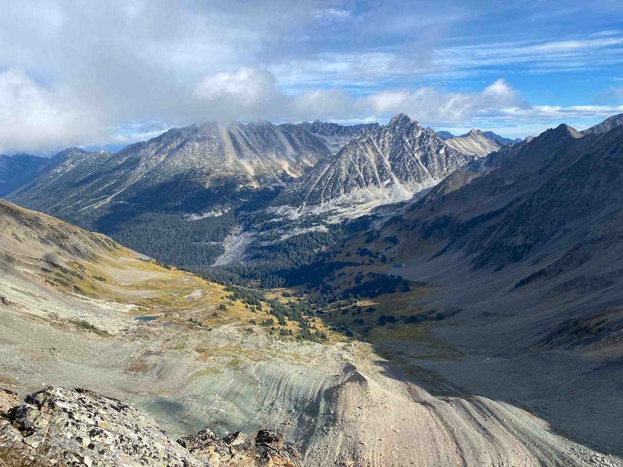
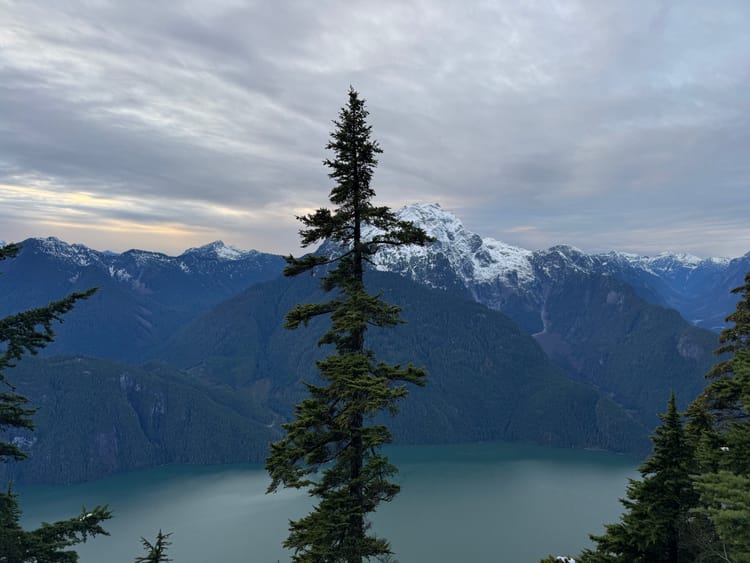
From there, a surprisingly easy talus descent brought me to the upper of the Twin Lakes. I’d arrived earlier than expected, so I took a side trip northward, towards Downton Peak. I returned to the lake early the next morning.
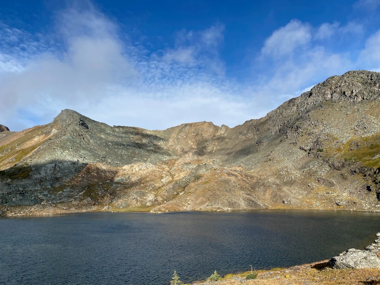
My last destination was Crystal Peak, to the west of the lake, which is listed in the Scrambles guide. The pointy-looking peak west of Elliot is actually a subpeak; the true summit is less intimidating. Crystal was a straightforward class 2 ascent on talus, marked by the occasional cairn. The summit had great views, including an interesting perspective on the Lost Creek valley that was hidden from view from the rest of the peaks on this trip. The west side of the Twin Lakes-Downton ridge looked quite steep and imposing. There is a small pinnacle a few metres away which might be the true summit, accessed by an exposed but relatively wide ridge.
I returned to the upper lake and made my way along the trail to the lower lake. This was surprisingly faint and difficult to follow in places. Marmots whistled all around me. The western side of the lower lake is basically marmot city; I saw 5 of them at one point, and heard many more.
Past the lower lake, the trail connects to an old mining road, then returns to the cabin, where I retrieved my bike. The return was uneventful and I made it home by mid-afternoon.
Member discussion